INFRASTRUCTURE
The LCZO infrastructure, sampling strategy, and integrated data management system are designed to provide a platform whereby collaborators can put geochemical and biogeochemical studies into a geomorphic and hydrologic perspective. The basic infrastructure of the LCZO is an integrated set of sampling sites that are built upon existing study sites that have long-term and ongoing records of rainfall, throughfall, litterfall, and streamflow.
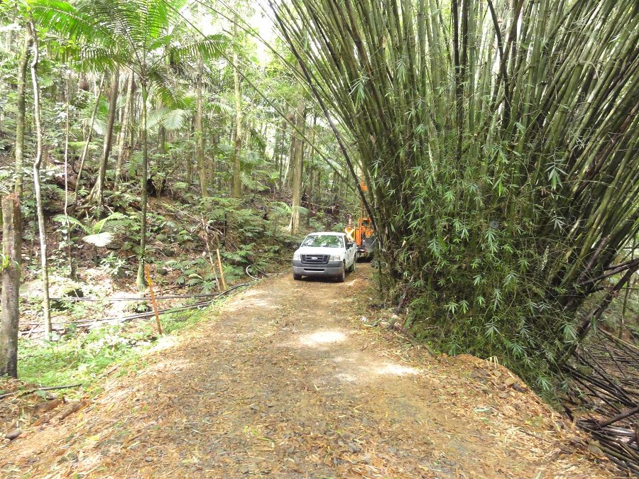
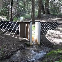
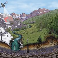
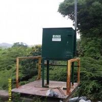
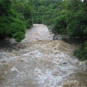
The LCZO infrastructure, sampling strategy, and integrated data management system are designed to provide a platform whereby collaborators can put geochemical and biogeochemical studies into a geomorphic and hydrologic perspective. The basic infrastructure of the LCZO is an integrated set of sampling sites that are built upon existing study sites that have long-term and ongoing records of rainfall, throughfall, litterfall, and streamflow (Schellekens et al 2004, Peters et al 2006, Heartsill et al 2007, Wei et al 2007). The atmospheric sampling nodes consist of 8 weather stations and an additional 8 rain gages that monitor climatic and geochemical inputs to the different lithologies and forest types across a precipitation gradient that ranges from 1000 mm/yr to 5000 mm/yr. Soil and deep weathering nodes consist of a sampled network of soils on the various lithologies and forest types and monitored hillslope catena’s that are underlain by VC and GD lithologies (Table 2). Soil and regolith water and gas samples are sampled using suction samplers installed according to our previous studies and CZEN standards. Aquatic nodes of the observatory focus on quantifying the fluxes of water, sediment, and solutes from the basin and how they are transformed as they move from pore spaces in the lithologic matrix to the coastal zone. These nodes include 8 stream gages and numerous georeferenced cross-sections and riparian sampling sites. A major limitation to previous studies has been the ability to monitor storm events and temporal variations in exports. To overcome this limitation, the LCZO is adding sensors to the existing stream gages to obtain continuous records of conductivity, and temperature.
Water chemistry is sampled weekly and on a campaign basis and will be processed at the USGS WEBB laboratories and at the University of New Hampshire. While the water chemistry at most of the proposed aquatic sampling nodes has been sampled before, sampling frequency has been erratic and the actual data is stored in different ways and at different institutions. The LCZO is ameliorating this situation by developing a centralized data management archive where researchers can access existing data and share the new data they collect.
Infrastructure News
FEATURED
CZ colleagues: Please contact us about proposals for NSF’s CZ Collaborative Network, due 02 Dec 2019
08 Jul 2019 - CZO will end Nov 2020, succeeded by the “CZ Collaborative Network”. Let’s explore how the CZ community can build upon the CZOs via new NSF proposals.
Ravaged El Yunque viewed as storm-recovery lab
17 Nov 2017 - Over the millennia, the tropical woodland known today as El Yunque National Forest has been pummeled by rains and rocked by hurricanes. But the...
Water Resources Research Special Collection: Concentration-discharge relations in the critical zone
30 Oct 2017 - Water Resources Research published a new special collection in September 2017 featuring concentration-discharge research from multiple CZOs.
Hurricane Maria decimated the nation’s only tropical rain forest outside Hawaii
05 Oct 2017 - Hurricane Maria ravaged Puerto Rico. The Category 4 storm destroyed thousands of homes, businesses, bridges, communication towers, the entire...
Researchers Set a Rainforest to Bake
05 Oct 2017 - The world’s rainforests absorb 30 percent of human-produced carbon dioxide. Plants take up the CO2 through photosynthesis and release it...
2017 CZO Webinar Series: Critical Zone and Society
06 Apr 2017 - 2017 CZO Webinar Series: Critical Zone and Society.
Field Areas:
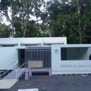
El Verde Field Station
1.05 km2,
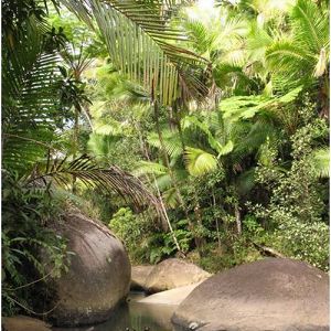
We are located within El Yunque National Forest in Puerto Rico, surrounded by tropical rainforests representative of many Caribbean island ecosystems. Research at El Verde focuses on forest dynamics, stream ecology and hydrology, and ecosystem processes. Most research is conducted by the Luquillo Long-Term Ecological Research (LTER) program, LCZO and by scientists from the University of Puerto Rico and universities in mainland US.
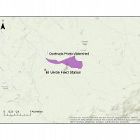
Quebrada Prieta
0.3077 km2,
Quebrada Sonadora
2.6159 km2,
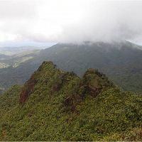
Northeastern Puerto Rico and the Luquillo Mountains
0-1075 m elevation, 1000-5000 mm/yr
The Luquillo Critical Zone Observatory (LCZO) is located in Luquillo Mountains of northeastern Puerto Rico. This Includes El Yunque National Forest, Rio Mameyes and Rio Blanco watersheds, surrounding coastal plains and nearby urbanized areas such as the San Juan metro area, Luquillo and Fajardo.
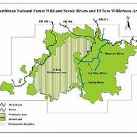
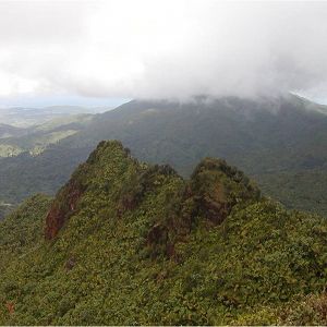
El Toro Wilderness Area
40.5 km2,
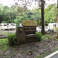
Sabana Field Station
10.26 km2,
Rio Blanco
3.26338502 km2, 0-1043 m elevation, 3080 mm/yr
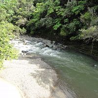
Large Instrumented river drains the majority of the south side of the Luquillo Mountains, underline with a granodirite bedrock. Sandy river bed with large boulders. Instrumentation includes multiple gagued streams, lysimeter fields, climate stations, water chemistry sampling as well as other event based and field campaign sampling.
East Peak
-1028 m elevation,
Rio Blanco nr Florida
Lago Icacos
Rio Icacos
618-775 m elevation,
Rio Mameyes
17.8191 km2,
The Rio Mameyes flows in a northerly direction and has outstanding scenic, biological, recreation and historic values. The Rio Mameyes watershed covers 6.88 square miles within the forest, or 10.4% of the forest. Water quality is optimum within the study area of the upper segment, since the entire corridor is located in the Baño de Oro Natural Area and no development exist. Due to steep slopes, no significant flood plains occur. There are approximately 73 acres of riparian wetlands along the Rio Mameyes designated segments.
Bisley
265-460 m elevation,
Puente Roto
17.8191 km2,
Explore Further
