INFRASTRUCTURE
Catalina-Jemez CZO internal and external interactions. NSF provides project oversight, with input from the National CZO Steering Committee. Strong collaborations are ongoing with other CZOs across the national program, as well with the CZO Data Management Team. A Catalina-Jemez CZO advisory board is being assembled during year 1, as are new collaborations with the Flandrau science center for education and public outreach.
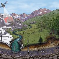
The Catalina-Jemez CZO infrastructure is comprised of people, models, a range of analytical tools, and a sensor/sampler array established in our field site. Our people include faculty, staff and scientists working across the fields of earth and ecosystem sciences, conducting observational, experimental, and modeling research. By maintaining consistent dialogue among observation, experiment, and modeling components, we seek to develop a progressively-evolved understanding of CZ processes. Our infrastructure has to include, therefore, the range of disciplinary tools and approaches that can contribute to unraveling the coupled physics, chemistry and biology leading to CZ change.
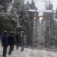
In respect to the sensor/sampler array, initial Catalina-Jemez CZO instrumentation efforts have focused on supporting our capacity to measure concurrently on a given tectonic template (i) climate-driven forcing and (ii) CZ response. Specifically, we seek to measure in real-time and model-space quantitative relations among ecohydrologic partitioning (EHP), subsurface biogeochemistry (SSB), surface water dynamics (SWD), and landscape evolution (LSE).
A broader impact of our real-time and model-space landscape research is to help inform federal, state and local managers of public and private land. In the southwestern US, management agencies, resource managers, and private land owners are facing new challenges arising from climate and disturbance-induced threshold changes in ecosystem structure (e.g., see Williams et al., 2012, Nature Climate Change). Our CZO seeks to generate scientific data on the couplings among biological, chemical and physical CZ processes that can also provide a scientific foundation for land and water management decisions. To do so, we combine a conceptual modeling framework with a hypothesis-driven multi-component CZO sensor/sampler array, and strategically executed measurement/sampling campaigns.
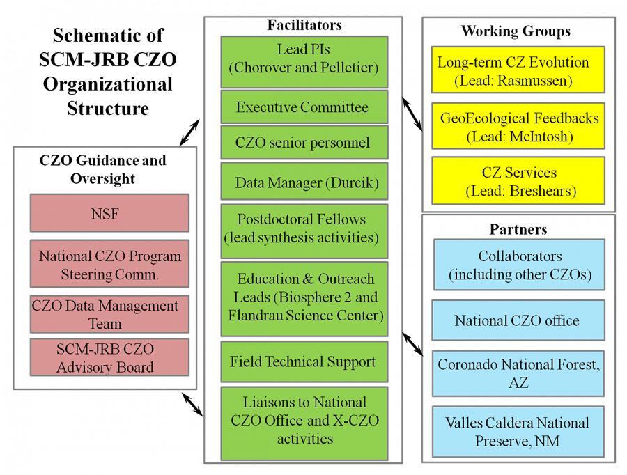
The schematic emphasizes SCM-JRB CZO-internal and
-external interactions. NSF provides project oversight, with input from the National CZO Steering Committee. Strong collaborations are ongoing with other CZOs across the national program, as well with the CZO Data Management Team (Anthony Aufdenkampe, PI). An SCM-JRB CZO advisory board is being assembled during year 1, as are new collaborations with the Flandrau science center for education and public outreach.
Infrastructure News
FEATURED
CZ colleagues: Please contact us about proposals for NSF’s CZ Collaborative Network, due 02 Dec 2019
08 Jul 2019 - CZO will end Nov 2020, succeeded by the “CZ Collaborative Network”. Let’s explore how the CZ community can build upon the CZOs via new NSF proposals.
Water Resources Research Special Collection: Concentration-discharge relations in the critical zone
30 Oct 2017 - Water Resources Research published a new special collection in September 2017 featuring concentration-discharge research from multiple CZOs.
2017 CZO Webinar Series: Critical Zone and Society
06 Apr 2017 - 2017 CZO Webinar Series: Critical Zone and Society.
Critical Zone Q&A with researcher Adrian Harpold
19 Oct 2016 - University of Nevada Reno's Adrian Harpold reflects on his past and present time researching at Critical Zone Observatories.
EOS: Taking the Pulse of the Earth’s Surface Systems
04 Dec 2015 - Taking the Pulse of the Earth's Surface Systems In September of 2014, Laurel Larsen (UC Berkley), Elizabeth Hajek (Penn State), and others...
Video: CZ graduate students reflect on experience at University of Western Australia Summer School
13 May 2015 - Students from around the Worldwide Universities Network (WUN) gathered in Perth for two weeks in Feb. 2015 for the Inaugural WUN Summer School.
Field Areas:
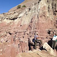
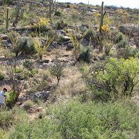
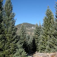
Santa Catalina Mountains
1022-2780 m elevation, 10-18 °C, 420-940 mm/yr
The Santa Catalina Mountains (Catalina) are located northeast of Tucson in southern Arizona. This location includes three sites: one in the Sonoran desert on the mountain foothill; the second in the mid elevation and the third - high elevation in the Marshall Gulch Creek catchment and Bigelow site which includes zero order basin (ZOB) and flux tower.
B2 Desert Site (Low-Elevation)
1022-1161 m elevation, 18.2 °C, 420 mm/yr
Oracle Ridge (Mid-Elevation)
1.09 km2, 2064-2388 m elevation, 11.9 °C, 840 mm/yr
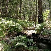
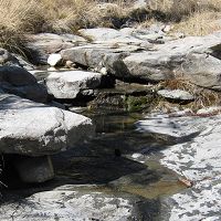
Marshall Gulch (High-Elevation)
1.54 km2, 2284-2634 m elevation, 10.4 °C, 940 mm/yr
Bigelow Site (High-Elevation)
0.016 km2, 2532-2574 m elevation, 9.2 °C, 609 mm/yr
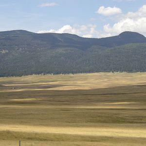
Jemez River Basin
2060-3433 m elevation, 3 - 9 °C, 480-850 mm/yr
The Jemez River Basin is located in the transition zone between the southwestern desert and the Rocky Mountains.
Jemez Unburned Site
0.01 km2, 2751-2753 m elevation,
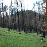
Jemez 2011 Burned ZOB
0.13 km2, 2664-2934 m elevation, 5.1 °C, 670 mm/yr
Jemez 2013 Burned ZOB
0.14 km2, 2986-3103 m elevation, 4.1 °C, 770 mm/yr
Explore Further
