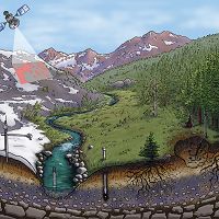
INFRASTRUCTURE
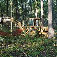
The Calhoun CZO features long-term plot and watershed experiments. Data from sensor networks; gas, water, and solid samples; geophysical measurements; and models will be used to evaluate CZ evolution following severe erosion and land degradation. Observational data sets are being developed via three major infrastructure projects: 1) Re- and up-instrumentation of three historic experimental catchments; 2) Inverted tower installation for atmospheric and deep-profile sampling; and 3) Sub-surface sensor installations in space-for-time land-use plots.
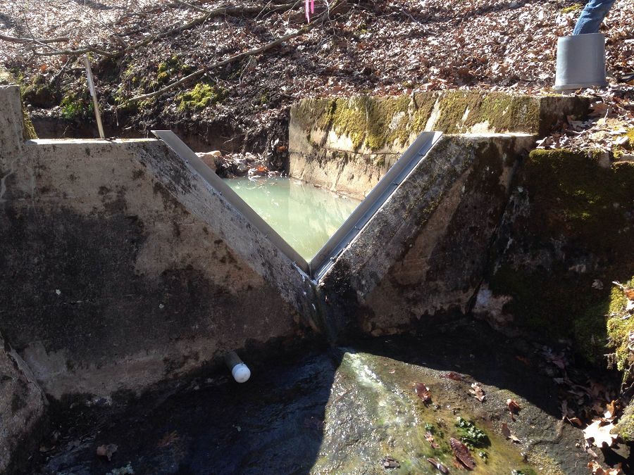
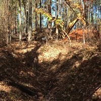
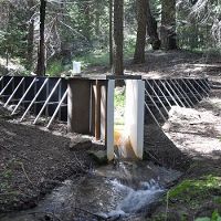
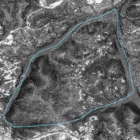
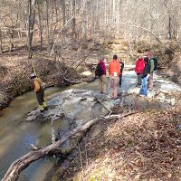
New weir blades, water level recorders, rain gauges (not seen), and monthly stream sampling will allow new records and historic records to be compared directly in certain catchments of Holcombe's Branch watershed.
Re- and Up-Instrumented Experimental Watersheds
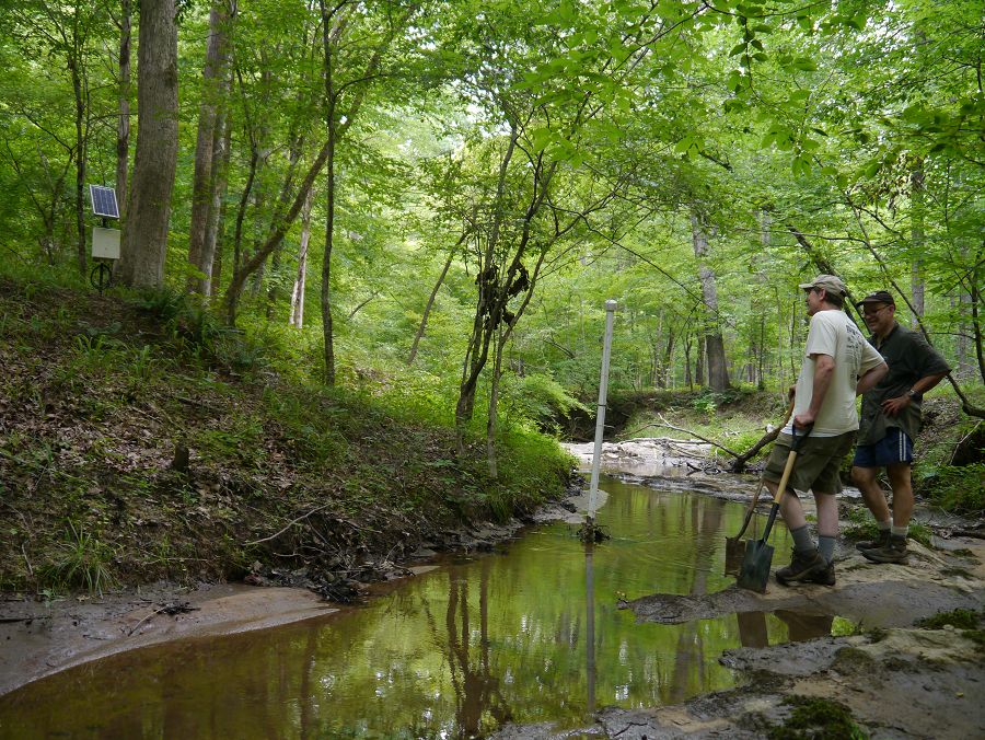
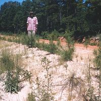
Three experimental watersheds that operated for more than ten years between 1947 and 1962 will be re-instrumented to test effects of 60-years of reforestation on severely eroded and gullied watersheds. Old strip charts from rain and stream gages are being digitized with help from USGS in Atlanta.

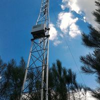
Atmosphere to Bedrock Instrumentation
A flux tower will be built to estimate forest-atmosphere dynamics of energy, water, and CO2 and forest-bedrock dynamics of water, CO2, and other gases. The instrumentation has three components: 1) an above-canopy eddy covariance (EC) system for direct measurement of above-canopy fluxes of energy, water and carbon (CO2), 2) a below-canopy radiation and meteorological sensor system which in conjunction with a Maximum Entropy Production (MEP) modeling will estimate tree-scale above- and under-canopy energy and water fluxes, and 3) co-located below-ground sensors and samplers for measurement of gases (CO2 and O2), soil moisture, and temperature at multiple depths as deeply as they can be installed.
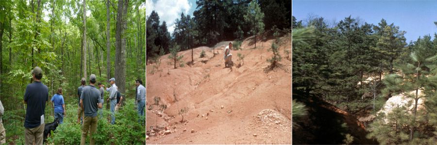
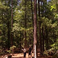
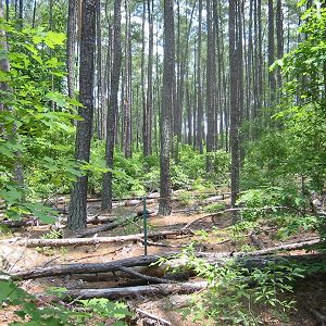
Old-field and Uncultivated Forest Comparisons
At four research areas, paired hardwood stands (uncultivated hillslopes to small watersheds) and old-fields will be instrumented with co-located below-ground sensors and samplers for measurement of gases (CO2 and O2), soil moisture, and temperature at multiple depths as deeply as they can be installed.
New weir blades, water level recorders, rain gauges (not seen), and monthly stream sampling will allow new records and historic records to be compared directly in certain catchments of Holcombe's Branch watershed.
Re- and Up-Instrumented Experimental Watersheds
Source: Allan Bacon, 2014.
Atmosphere to Bedrock Instrumentation
A flux tower will be built to estimate forest-atmosphere dynamics of energy, water, and CO2 and forest-bedrock dynamics of water, CO2, and other gases. The instrumentation has three components: 1) an above-canopy eddy covariance (EC) system for direct measurement of above-canopy fluxes of energy, water and carbon (CO2), 2) a below-canopy radiation and meteorological sensor system which in conjunction with a Maximum Entropy Production (MEP) modeling will estimate tree-scale above- and under-canopy energy and water fluxes, and 3) co-located below-ground sensors and samplers for measurement of gases (CO2 and O2), soil moisture, and temperature at multiple depths as deeply as they can be installed.
Old-field and Uncultivated Forest Comparisons
At four research areas, paired hardwood stands (uncultivated hillslopes to small watersheds) and old-fields will be instrumented with co-located below-ground sensors and samplers for measurement of gases (CO2 and O2), soil moisture, and temperature at multiple depths as deeply as they can be installed.
Infrastructure News
FEATURED
CZ colleagues: Please contact us about proposals for NSF’s CZ Collaborative Network, due 02 Dec 2019
08 Jul 2019 - CZO will end Nov 2020, succeeded by the “CZ Collaborative Network”. Let’s explore how the CZ community can build upon the CZOs via new NSF proposals.

FEATURED
Calhoun CZO featured in Duke Magazine
14 Nov 2018 - How critical zone science unearths secrets: The new cross-disciplinary field of study concerns itself with the living skin of the Earth.
FEATURED
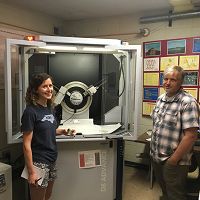
X-ray Diffraction for Clay Minerals at Calhoun
01 May 2017 - Anna Wade (visiting from Duke University) and Jay Austin (based at the University of Georgia) are collaborating by using X-ray Diffraction (XRD) to...
FEATURED
Four soil pits installed in new Research Area 8!
21 Nov 2016 - Four soil pits were installed in new Research Area 8 at the Calhoun CZO on 21-22 November 2016 for easy access for soil sampling down to 2 meters.

FEATURED
Eight new soil pits dug at the Calhoun!
17 Oct 2016 - Eight soil pits were installed at the Calhoun CZO on 17-18 October 2016 for easy access for soil sampling down to 2 meters. Photo: Will Cook.
FEATURED
USFS Photos from the Historic Archive of the Calhoun Experimental Forest
03 Oct 2016 - Just posted, thanks to efforts of Don Nelson, Kathy O'Neill, Mike Coughlan, Michael Lonneman, Zachary Meyers, and many other students, is an...

FEATURED
First flux tower erected at the Calhoun CZO
17 Aug 2016 - On August 17, 2016 a crew from Georgia Tech led by graduate student Yao Tang and professor Jingfeng Wang, with a little help from the folks at Duke,...
FEATURED
Going deep! Gas wells installed at 8.5 m
14 Jul 2016 - Another Calhoun CZO record - gas reservoirs installed at 8.5m depth! Jay Austin, Zach Brecheisen, and Dan Richter only stopped at 8.5m because they...
Water Resources Research Special Collection: Concentration-discharge relations in the critical zone
30 Oct 2017 - Water Resources Research published a new special collection in September 2017 featuring concentration-discharge research from multiple CZOs.
2017 CZO Webinar Series: Critical Zone and Society
06 Apr 2017 - 2017 CZO Webinar Series: Critical Zone and Society.
Calhoun CZO Headquarters!
15 Sep 2016 - At long last, a 900 sq ft house is now our headquarters at the Calhoun!!! We should all start to use it for multi-day, 2-day, & even 1-day...
TDR probes installed to monitor soil moisture
13 Jul 2016 - On July 13, 2016, Duke PhD candidate Zach Brecheisen, with assistance from his advisor Dan Richter and Jay Austin, installed TDR probes at 25-cm...
EOS: Taking the Pulse of the Earth’s Surface Systems
04 Dec 2015 - Taking the Pulse of the Earth's Surface Systems In September of 2014, Laurel Larsen (UC Berkley), Elizabeth Hajek (Penn State), and others...
Field Areas:
Calhoun Critical Zone Observatory
134-190 m elevation, 16 °C, 1250 mm/yr
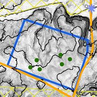
The Calhoun Critical Zone Observatory is comprised of eight research areas in the Calhoun Experimental Forest and surrounding areas in the Sumter National Forest in upstate South Carolina, including the Holcombe's Branch watershed, experimental catchments, and space-for-time (paired hardwood-pine-cultivated field) plots. The areas were chosen primarily for their wealth of historical data giving researchers an ideal platform for testing hypotheses on how critical zones evolve in response to human forcings at the landscape scale.
Calhoun CZO Research Area 8
0.77 km2,
Calhoun CZO Research Area 7
Calhoun CZO Research Area 6
0.30 km2,
Calhoun CZO Research Area 5
Calhoun CZO Research Area 3
6.5 km2, 108-195 m elevation, 16 °C, 1250 mm/yr
Calhoun CZO Research Area 2
.16 km2,
Calhoun CZO Research Area 4
0.42 km2,

Calhoun CZO Research Area 1
0.40 km2, 180-190 m elevation, 16 °C, 1250 mm/yr
Calhoun Pine Flux Tower
16 °C, 1250 mm/yr
Calhoun Long-Term Soil-Ecosystem Plots and Reference Areas
180-190 m elevation, 16 °C, 1250 mm/yr
Calhoun Experimental Forest and Eco-hydrology Experiments
134-157 m elevation, 16 °C, 1250 mm/yr
Explore Further
