ARCHIVED CONTENT: In December 2020, the CZO program was succeeded by the Critical Zone Collaborative Network (CZ Net)
×
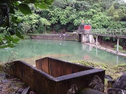
Lago Icacos
Data available for reservoir level, discharge and precipitation.
Parent Field Area:
Rio Blanco ▲
Lago Icacos
Lithology
igneous-ultramafic extrusive, meta-igneous
Soil Order
Inceptisol
Biome
rainforest
Land Use
forest land
-
Setting & Research
The Lago Icacos damsite is a USGS station which monitors reservoir level, discharge and precipitation. Lago Icacos is a small reservoir built in 1930 and owned by the Puerto Rico Electric Power Authority, is part of the Río Blanco Hydroelectric Power System. The reservoir is located in Naguabo, within the El Yunque National Forest in eastern Puerto Rico.
-
Data
No datasets for this field area have been entered yet
-
Partner Organizations
Explore Further
