INFRASTRUCTURE
_900_469_80auto.jpg)
Southern Sierra Critical Zone Observatory infrastructure consists of several instrumented field sites, datasets, and other resources for carrrying out field research, data analysis, and modeling.
For questions about our field infrastructure or visiting field sites for research purposes, contact our Field Manager, Erin Stacy, or Outreach Manager, Michelle Gilmore. Data can be browsed and accessed through our dataset listings; please direct data questions to our Data Manager, Xiande Meng.
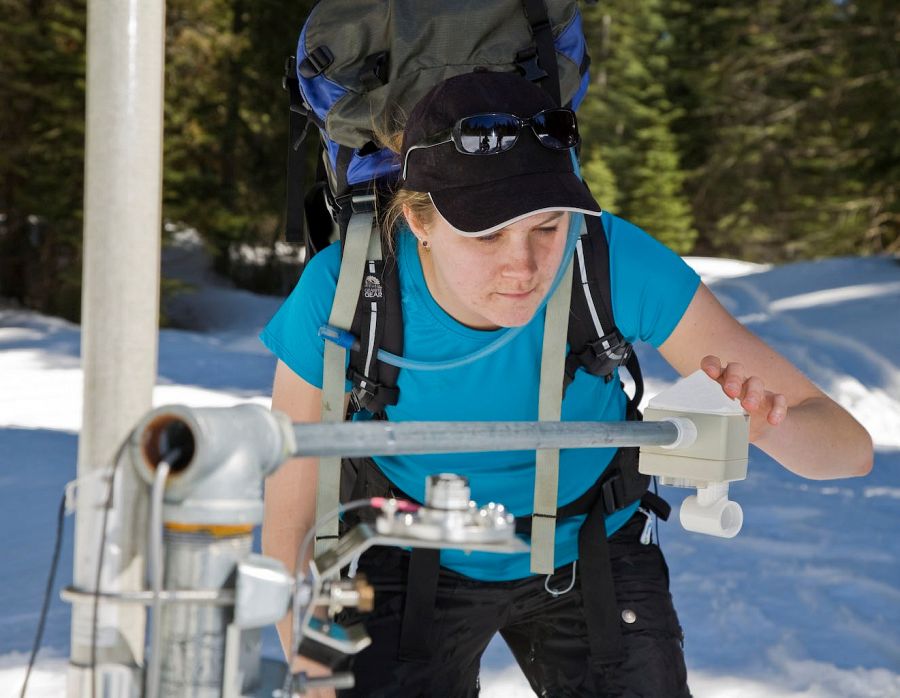
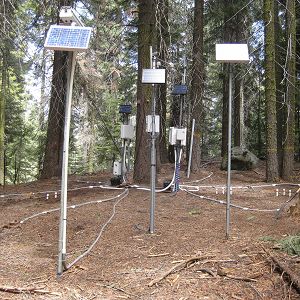
Water-cycling instrumentation around Critical Zone Tree 1
CZO infrastructure creates an extensive and informed research platform
Tightly-linked, multidisciplinary research carried out by our investigators, collaborators, and other researchers have resulted in intensively studied field areas with multi-year measurement records, many of which are available online in our Data Listings. Learn more about our five research areas in the Field Areas section of our website. Our CZO also offers sample collection resources and logistical support for researchers who want to conduct studies at our sites.
A selection of ongoing instrument-based and manual measurement initiatives are described below. Additional information about field areas, sensors, and other infrastructure and resources are available in the subpages of this Infrastructure section.
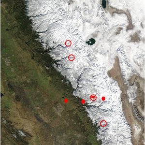
Interactive Map of Research at SSCZO Field Sites
Click here to view a larger version of this map (recommended).
The map above was developed in 2018 by undergraduate assistant Madeline Castro under supervision of Michelle Gilmore and Erin Stacy in collaboration with the UC Merced Spatial Analysis & Research Center. In 2019, we plan to expand map layers to include our work in Sequoia National Park and more locations of previous sample collection efforts. If you have feedback about the map or suggestions for improvements, please contact Michelle Gilmore.
Evapotranspiration Studies
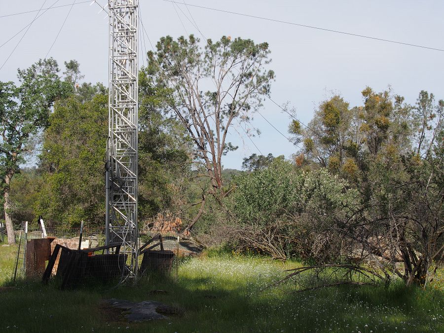
There are currently four eddy covariance gas flux towers in operation at along a west-to-east transect of the southern Sierra Nevada, including San Joaquin Experimental Range (405 m), Soaproot Saddle (1160 m), Providence Creek Catchment P301 (2015 m), and Shorthair Creek (2700 m). The change in climate along the flux tower transect allows for investigations on interactions between climate, soil development, species distribution, biotic production, and hydrological balance.
Flux towers provide individual measurements of water, energy and carbon exchange with the atmosphere. This data is then extended outward using the meteorological, snow/soil, remotely sensed and other spatial data to understand broader interactions at different scales. Tower instruments also provide an measure of evapotranspiration and net ecosystem productivity by measuring 3-dimensional windspeeds, gaseous carbon dioxide, and water vapor. Additional instrumentation has been added over several years, such as multi-wavelength panning cameras.
Two Cosmic-ray Soil Moisture Observing Systems (COSMOS) were co-located with the P301 and Shorthair towers in June 2011. COSMOS is an advanced technology used to measure soil water content over large areas; this is a collaboration with the University of Arizona. Additionally, the Providence Creek flux tower is used as the main data transmission hub for the site's embedded wireless sensor network.
See other webpages for more information about the towers' instruments and locations. For additional information, contact: Michael Goulden.
Critical Zone Tree Experiments
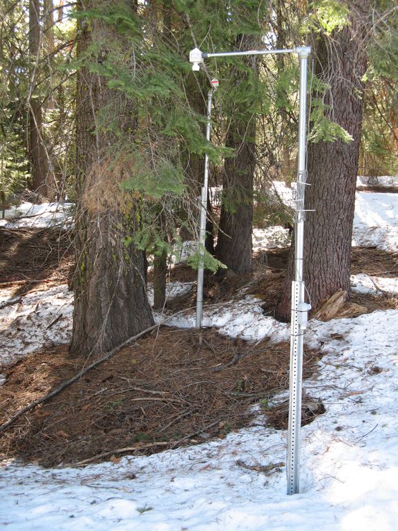
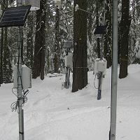
In August 2008 we instrumented a mature white fir (Abies concolor) and the surrounding soil to better define the water balance in a single tree; we call this tree CZT-1. In July 2010, we instrumented a second tree, a Ponderosa pine (Pinus ponderosa) in shallower soils on a drier, exposed slope. Sap-flow measurements in the trunk and stem-water-potential measurements in the canopy capture the seasonal cycles of soil wetting and drying. See time lapse photos of snow around the tree in 2008-09. Between 2010 and the present, six other Critical Zone Trees were established for shorter term monitoring projects. Today CZT-1 is still actively instrumented.
The objectives of this study are to 1) monitor surface and subsurface water budgets in remote landscapes, with specific attention to moisture and temperature variability in near surface soils and 2) study the interactions between soil hydrology and tree functioning in a forested catchment, as part of a wider effort to analyze changing ecosystem response to changing environmental inputs.
In September 2010 a root excavation was conducted on a white fir adjacent to the first Critical Zone tree. Excavation was performed to map the root structure and location in response to new questions regarding moisture deficit in the soil profile. Excavation allows us to confirm the lateral and vertical extent of the root system and provide a better estimate of the area of influence of moisture removal for the tree.
See other webpages for more information about Critical Zone Tree instruments and site location. For additional information, contact Peter Hartsough.
Biogeochemistry
Some of the biogeochemical studies conducted at the Southern Sierra Critical Zone Observatory include:
- Using snow melt plots to determine which soil biogeochemical processes are most likely to be impacted by climate change across the rain-snow transition zone.
- Researching carbon cycling and organic matter stabilization as affected by erosion.
- Estimating the response of gaseous fluxes to climate change using an N isotope mass-balance model in order to determine how the rain-snow transition zone affects N cycling in the plant-soil system.
- Investigatiing nutrient hotspots and O horizon runoff in soils.
For additional information, contact Asmeret Asefaw Berhe or Stephen Hart.
Surface-Groundwater Interactions
The objective of this experiment is to determine variations in diel temperature change, inflow and outflow of groundwater into the stream, quantify interactions between vegetation and water, and understand the water balance and hydrologic processes. Experiments are being conducted in both the P301 meadow complex and at Long Meadow in Sequoia National Park.
Groundwater exchange in P301 meadow includes the installation of 24 wells and piezometers, 2 stilling wells, and 3 three sap rock piezometers to a depth of 205 to 500 cm. Evapotranspiration chamber measurements commenced in June 2010, continuing in Fall 2011 in order to understand ET throughout the growing season. Salt dilutions have commenced at the installed stilling wells to measure flow and establish a rating curve.
Activities in Long meadow, Sequoia NP began in 2007. Long Meadow is within the Wolverton area of the park. Research has focused on exploiting temperature as a hydrologic tracer using a distributed temperature sensor (DTS) and Tidbit temperature sensors, plus data from piezometers and observation wells. The DTS system includes a computer, two 1-km long fiber optic cables and a power source. The DTS deployment led to the observations of polymictic pool behavior in the meadow pools. This daily thermal stratification and nightly was further assessed in 2008 and 2009 using Hobo Tidbit temperature loggers, for vertical temperature profiles, and Radon-222 analysis.
In addition to temperature and geochemical tracer activities, evapotranspiration, ground water level, and pressure head measurements have been collected since 2008.
For additional information, contact Martha Conklin.
Geochemical and Geophysical Weathering Investigations
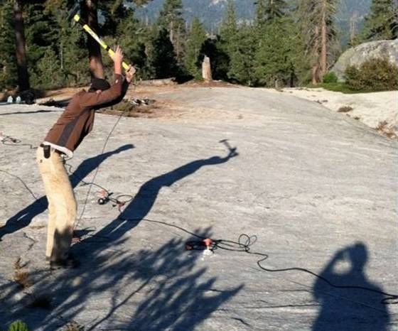
Spearheaded by colleagues at the University of Wyoming, researchers have been participating in a number of weathering studies using geochemical and geophysical approaches. Projects investigate long-term versus short-term rates of erosion (sediment basins and solute fluxes versus cosmogenic nuclides and regolith geochemistry), landscape evolution, “stepped topography” and the role of bare rock in shaping landscapes, the role of dust in pedogenesis and nutrient supply to the forests in and around the CZO (from isotopic tracers), and the origins of coarse sediment in streams (also from isotopic tracers).
Geophysical imaging of weathered layers at SSCZO has been studied over the past two summers to provide 2D and 3D knowledge of the subsurface. Methods of geophysical investigation include seismic refraction and resistivity. Tests on hypotheses include what controls the thickness of the subsurface (weathering and erosion), and how much water is stored in the subsurface (porosity versus depth).
Future studies focus on cosmogenic nuclide method development (10Be in magnetite), drilling and coring in partnership with DOSECC (Drilling, Observation and Sampling of the Earths Continental Crust).
For additional information, contact Clifford Riebe.
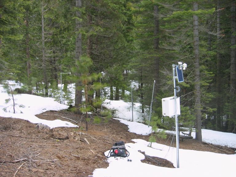
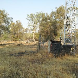
Wireless Sensor Networks
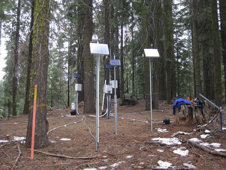
In the Fall of 2007 a 28-node network of sensors was deployed around the upper and lower met stations in Providence Creek Catchment P300 to capture spatial and temporal variations of snow depth, soil temperature and soil volumetric water content. On N-S aspects sensors were placed and under canopy, at the canopy drip edge, and in the open. In the Fall of 2008 a 50-node wireless embedded sensor network was deployed across varying aspects, elevations, and canopy covers in the P301 headwaters of Providence Creek. Over 300 sensors are now included in this deployment. For more information on the wireless sensor networks, see our Instruments section.
For additional information, contact Erin Stacy.
© Southern Sierra Critical Zone Observatory
© Southern Sierra Critical Zone Observatory
© Southern Sierra Critical Zone Observatory
© Southern Sierra Critical Zone Observatory
© Southern Sierra Critical Zone Observatory
Gallery
SSCZO - Critical Zone Trees
© Southern Sierra Critical Zone Observatory
The primary Critical Zone Tree in the Southern Sierra CZO is a White Fir (Abies concolor) that has been intensely instrumented with soil moisture, temperature, and matric potential sensors, snow depth, solar radiation, and sap flow sensors, resin nutrient collectors, tension lysimeters and time lapse photography. The Southern Sierra CZO currently has three instrumented trees.
A photo gallery of the Critical Zone Trees can be found here.
SSCZO - Flux Towers
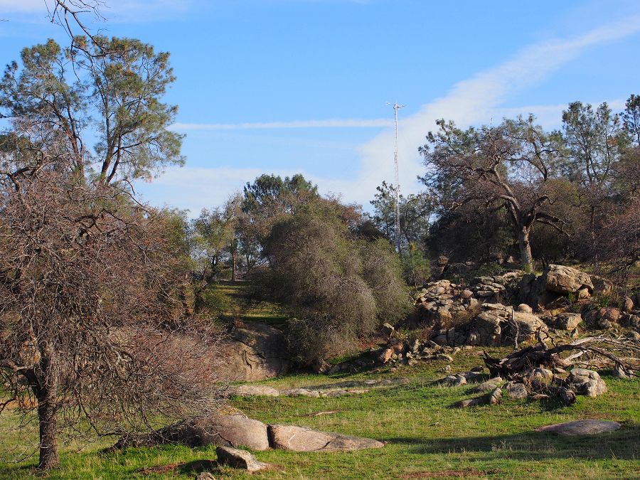
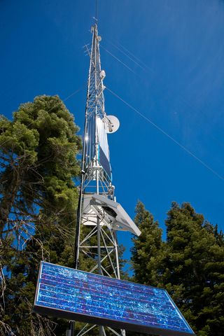
At the San Joaquin Experimental Range (SJER), the SSCZO flux tower sits on a small rise in the oak-pine woodland. This is the lowest site of the flux-tower transect, with the tower installed at 405 m in elevation.
Fully erected, the SJER tower stands about 29 m tall (~95 ft).
However, the tower also telescopes down for maintenance.
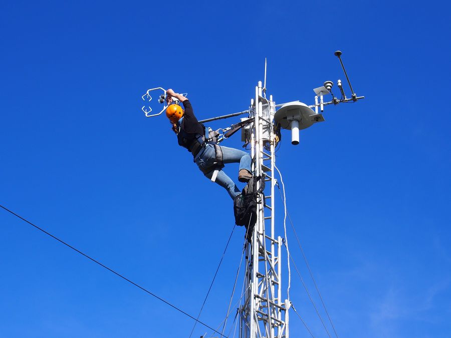
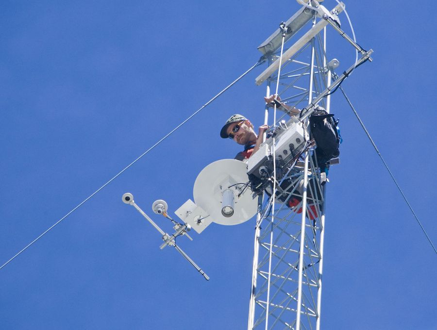
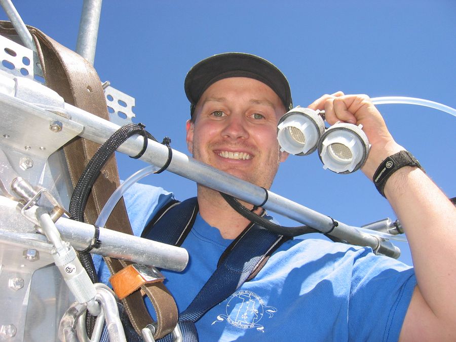
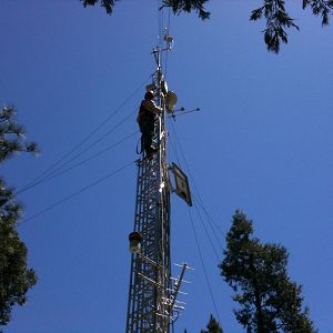
Erin Stacy (UC Merced) exchanges the filters on the gas intake.
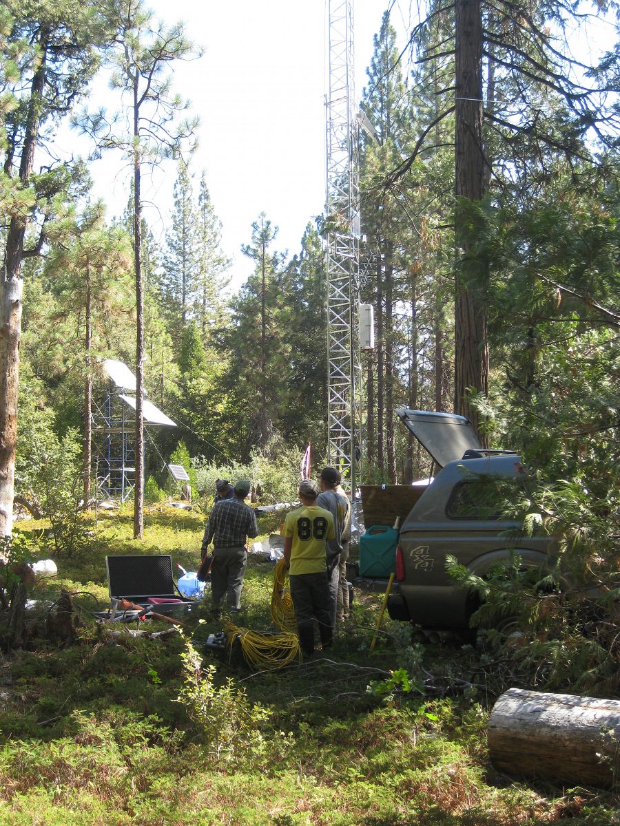
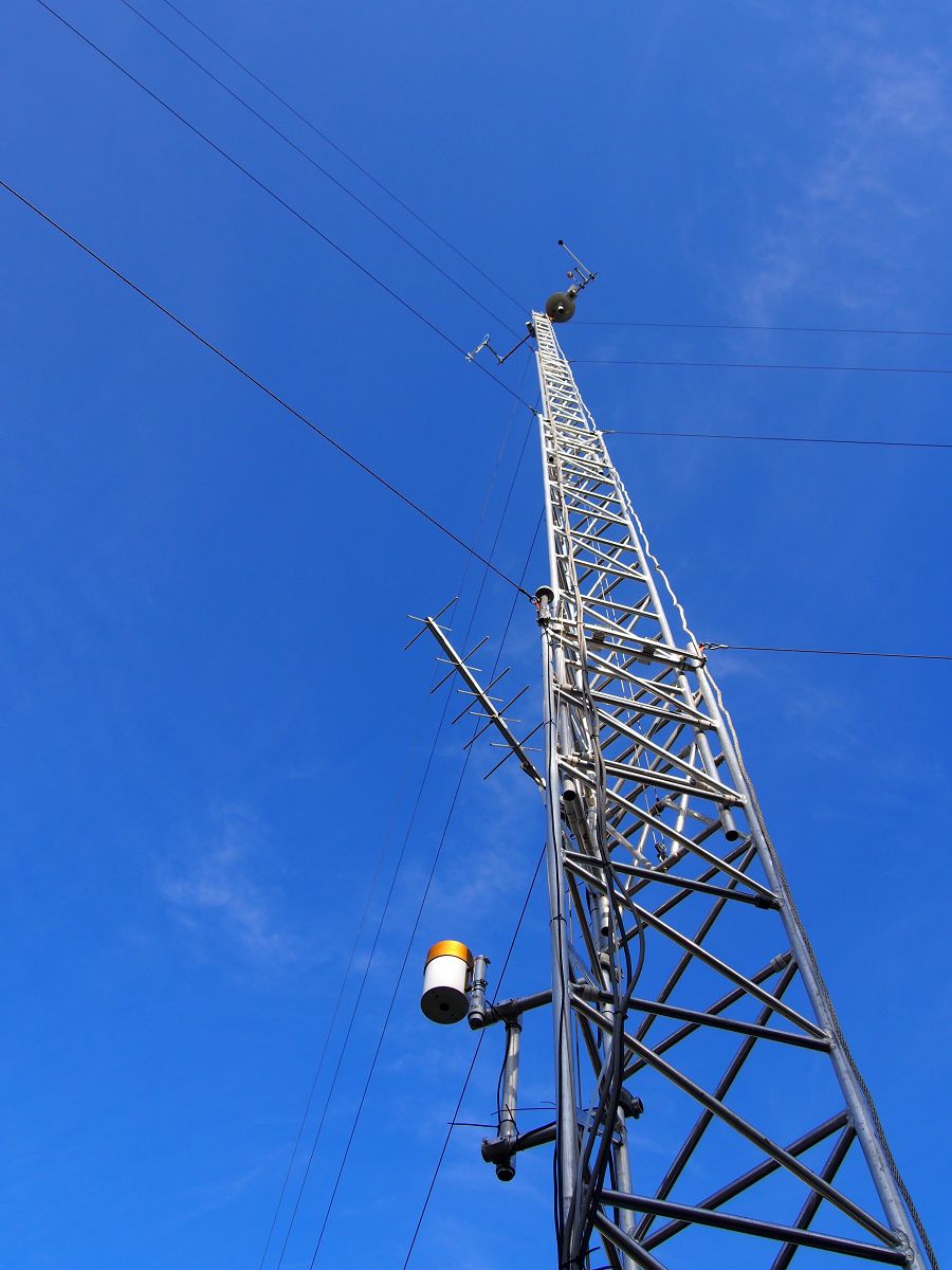
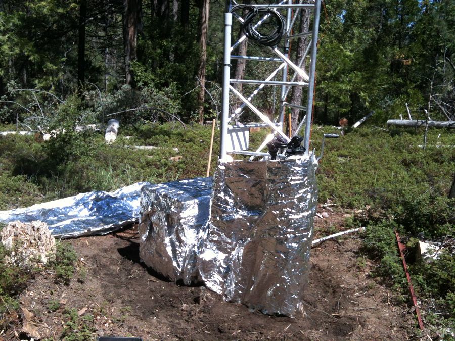
The flux tower at Soaproot Saddle stands in a small forest clearing. The tower, approximately 39 m tall (125-130 ft), is surrounded by a mix of Ponderosa pine and oak. Here the WyCEHG (Wyoming) sets out equipment to conduct geophysical surveys in the tower footprint.
Defensive measures were taken for the Soaproot Saddle tower in advance of a prescribed burn. The Clarence Burn burned up to a nearby firebreak in January 2014, but did not burn the area immediately around the tower
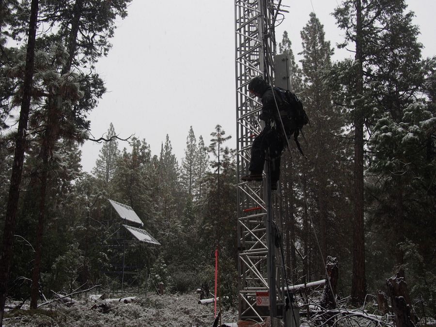
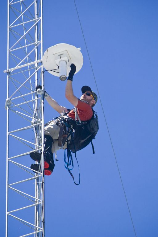
Matt Meadows (Field Manager, UC Merced) begins the climb for routine tower maintenance in a late January storm, 2014.
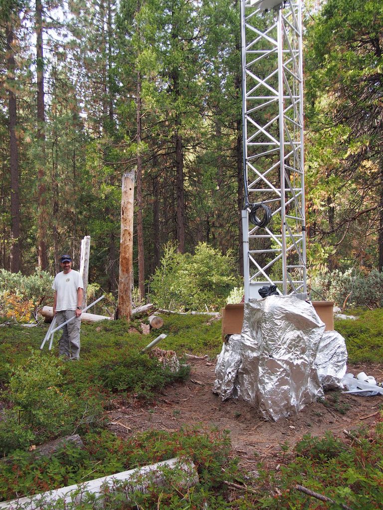
Pete Hartsough (collaborator, UC Davis) stands next to the Soaproot tower, September 2013, with core tubes in hand. A large drilling unit cored soil and saprolite to a depth of ~4 m on most attempts at this site.
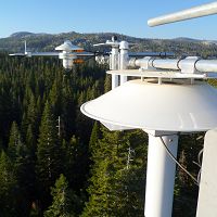
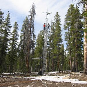
The P301 tower is the tallest of the four towers at 50 m (160 ft), plus a lightning rod. It stands near the top of the Providence catchments at 2015 m in elevation.
The P301 tower near the end of the 2014 winter.
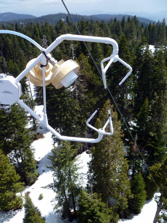
Matt Meadows (Field Manager, UC Merced) shows off the filter intakes at the top of the P301 tower.
An eddy covariance flux tower is located near the top of the P301 watershed. Instruments collect data on temperature, relative humidity, and fluxes of carbon dioxide and water vapor to determine the physiological responses of the site (for example, how photosynthesis increases with light) and summed over a year to determine the carbon balance of a site (how much carbon it is gaining or losing). Three other flux towers have been instrumented at different elevations with the Sierras including the San Joaquin River, Soaproot, and Short Hair Creek.
This west-east transect spans elevation gradient from 400 m to 2700 m. The change in elevation is accompanied by a slight increase in precipitation, but the main change is a shift from rain-dominated precipitation to snow-dominated precipitation. The climatic shift plays out in other ways as well. At lower elevations, high temperatures and low water availability limit evapotranspiration by vegetation. Meanwhile, forest activity (evapotranspiration) at higher elevations is limited by cold winter temperatures. There is a sweet spot at middle elevations of yera-round evapotranspiration and forest activity.
Photo galleries of each flux tower are available: San Joaquin Experimental Range; Soaproot Saddle; Providence subcatchment P301; and Short Hair Creek.
SSCZO - Instruments
Matt Meadows (Field Manager, UC Merced) checks on an instrument on the P301 flux tower.
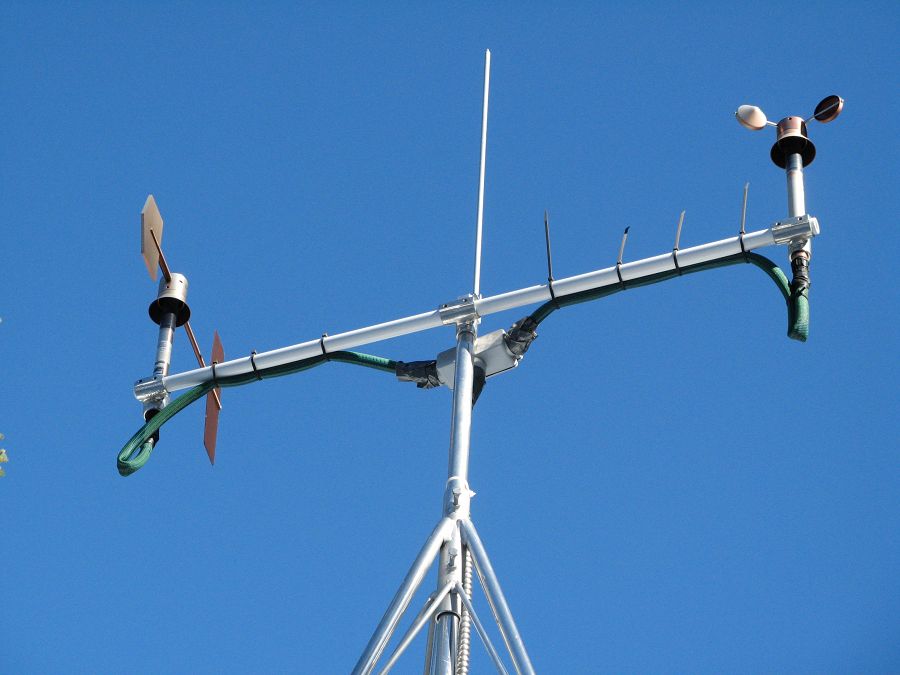
Anemometer measuring wind speed and direction.
Ultrasonic anemometer on the P301 flux tower measures wind speed and direction in 3 dimensions. Data is connected to gas samples taken every quarter second at the filters on the left (beige circles).
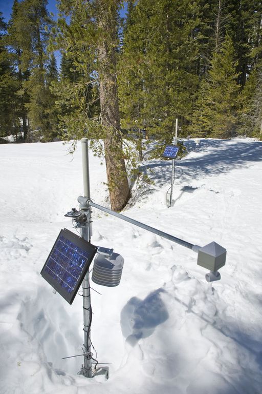
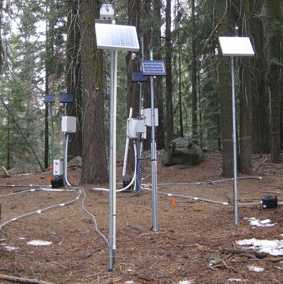
Instrument cluster featuring a relative humidity sensor, ultrasonic snow depth sensor, co-located soil moisture and temperature sensors at different depths, and a solar panel to power it all.
Instrument cluster at the P303 Upper Met site with ultrasonic snow depth sensor and co-located soil moisture and temperature sensors.
Instrument cluster at the P300 Lower Met site with ultrasonic snow depth sensor and co-located soil moisture and temperature sensors. The pole also psupports a solar panel, and an enclosure with a backup power supply and the data logger.
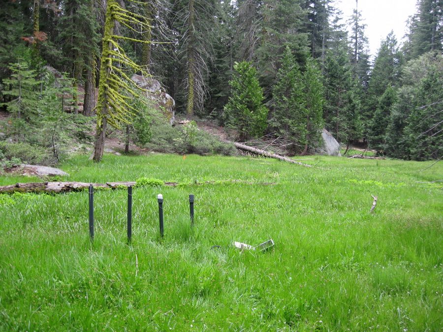
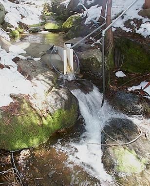
Instruments installed in the P301 meadows include wells and piezometers, at different locations to assess surface and groundwater flows.
Several clusters of instruments measure the water balance. These clusters each contain soil moisture and temperature sensors, an air temperature sensor, relative humidity sensor, and an ultrasonic snow depth sensor.
These water balance instruments are clustered at two different elevations, with north, flat, and south facing aspects. Conditions are measured under canopy, at drip edge, and at open canopy. Water balance measurements are also made in the wireless sensor network that stretches along the P301 meadow.
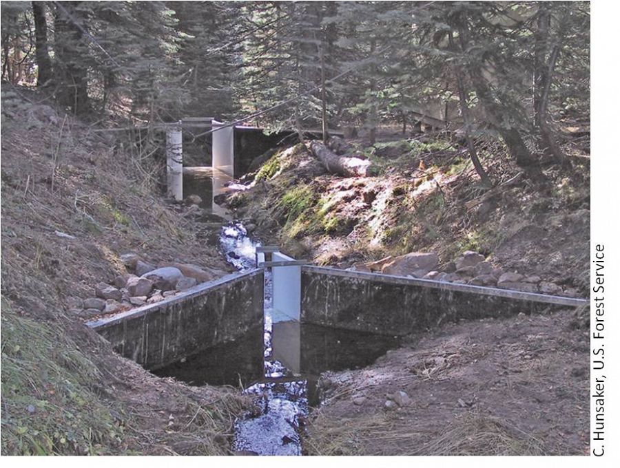
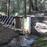
The eight subcatchments and two integrating catchments in the KREW project have flumes to measures discharge.
The large KREW flumes are complemented by small flumes for low flow.
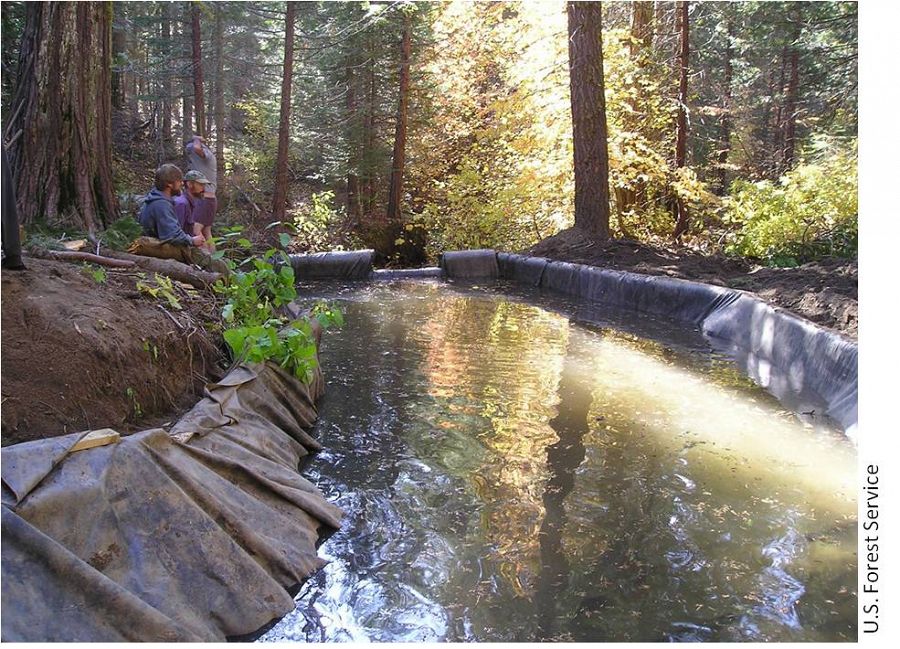
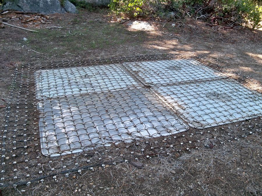
Each of those eight KREW subcatchments also has a plastic-lined settling basin to capture sediment.
There are two meteorological stations in the Providence catchment - one at the lower elevation range and one near the crest. Each meteorological station has a rain gauge.
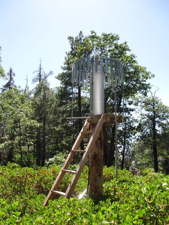
At the upper meteorological station, there is a snow pillow. This snow pillow tracks the weight of snow above it. Combined with the snow depth measurements, the two permit the calculation of amount of water in the snow pack.
Another view of the snow pillow.
Hundreds of instruments and sensors have been deployed in the primary SSCZO research site of the Providence Creek watershed as well as in Wolverton basin. Additional SSCZO flux towers and instruments have also been installed at the San Joaquin Experimental Range, Soaproot Saddle, and Short Hair Creek.
Explore more photos of the intstuments and sensors used by SSCZO.
SSCZO - Water Balance Transect
© Southern Sierra Critical Zone Observatory
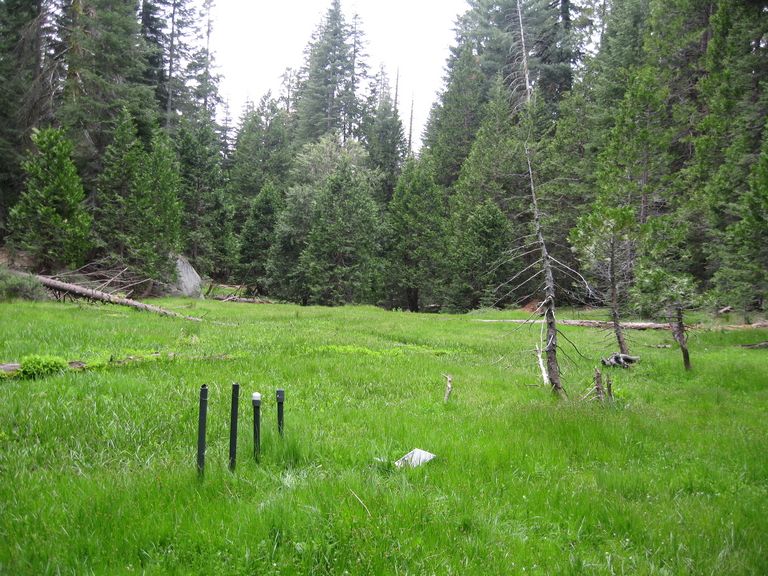
Within the headwaters of the P301 catchment is a series of montane meadows. The P301 water balance transect is comprised of monitoring wells, piezometers, soil sensors, and meteorological sensors.
A photo gallery of the P301 water balance transect can be found here.
Infrastructure News
FEATURED
More news about SSCZO on Center for Ecosystem Climate Solutions
24 Nov 2020 - More news about SSCZO on Center for Ecosystem Climate Solutions, which grew out of the SSCZO, also on Sustainable California
FEATURED
CZ colleagues: Please contact us about proposals for NSF’s CZ Collaborative Network, due 02 Dec 2019
08 Jul 2019 - CZO will end Nov 2020, succeeded by the “CZ Collaborative Network”. Let’s explore how the CZ community can build upon the CZOs via new NSF proposals.
Multiple postdoc and grad student opportunities at UC Merced
12 Sep 2018 - Two postdoctoral scholar positions and multiple MS or PhD research assistantships are currently available at the University of California, Merced....
Research Program Update: September 2018
07 Sep 2018 - Recent activities and findings, funding opportunities, upcoming events, and other updates
Research Program Update: July 2018
17 Jul 2018 - Recent activities and findings, funding opportunities, upcoming events, and other updates
Research Program Updates: May 2018
27 May 2018 - Recent activities and findings, funding opportunities, upcoming events, and other updates
_200_200_80auto_s_c1.jpg)
Research Program Updates: January 2018
17 Jan 2018 - Recent activities and findings, funding opportunities, upcoming events, and other updates
Field Areas:
San Joaquin Experimental Range (210-520 m elevation)
The San Joaquin Experimental Range (SJER) research site is in the oak woodland foothills of the southern Sierra Nevada.
Soaproot Saddle (1000-1500 m elevation)
The Soaproot Saddle site is located within Ponderosa Pine forest at 1100 meters in elevation within the Sierra National Forest.
Providence Creek Headwater Catchments (1660 - 2115 m elevation)
4.6 km2,
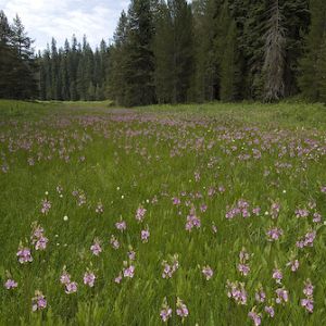
The most intensively studied research area of the Southern Sierra Critical Zone Observatory is the Providence Creek headwaters area, located along a tributary to the North Fork of the Kings River in the Sierra National Forest. Most of the long-term observations by SSCZO are located at this site. The P300 area includes forested hillslopes, some glacial erratics and areas of exposed bedrock, multiple meadows, and creeks draining the catchment.
Providence Creek Subcatchment P301
0.992 km2, 1790-2117 m elevation,
Providence Creek Subcatchment P303
1.323 km2, 1731-2025 m elevation,
Providence Creek Subcatchment P304
0.487 km2, 1768-1983 m elevation,
Short Hair (2670 m elevation)
The Short Hair field area is in the subalpine belt of the Sierra Nevada, located in the Sierra National Forest near Courtright Reservoir.
Wolverton Basin (2230 - 2700 m elevation)
8 km2,
Wolverton Basin site in Sequoia National Park comprises meadows and forested mountain slopes.
Other instrumented sites
Other instrumented sites have been established in the Southern Sierra Nevada and are suitable for comparative research, including: Kings River Experimental Watersheds, Sierra Nevada Adaptive Management Project, and the American River Hydrologic Observatory.
Explore Further
