INFRASTRUCTURE
The Boulder Creek Critical Zone Observatory (CZO), located in the Front Range of Colorado, is designed to examine the effect of erosion on the development and function of the Critical Zone. The Critical Zone is the near-surface region that supports terrestrial life, extending vertically from the base of groundwater to the upper reaches
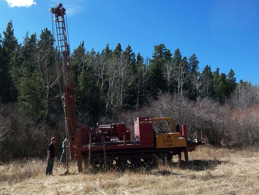
Drilling for groundwater wells at Gordon Gulch.
Overview:
At Boulder Creek CZO, we study how erosion and weathering control Critical Zone architecture and evolution, concentrating on slope, climate, ecosystems and rock properties.
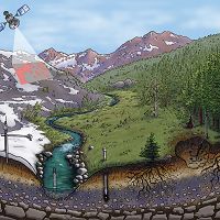
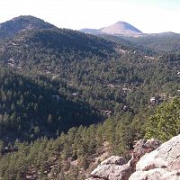
The Boulder Creek CZO lies within the Boulder Creek watershed, which drains the Front Range from the Continental Divide (4120m) to the eastern plains (1480m). This large elevation range within the watershed encompasses five climatic zones and three distinct erosion regimes. The three erosion regimes within the watershed are (1)Glacial Scouring (2) Slow post-Laramide denudation (3)Recent base level lowering. Each of our field areas is chosen to represent the three erosion regime ( see Figure 1).

Figure 1. Three Distinct Erosional Regime along Boulder Creek
Questions:
What is the legacy of climate and geologic history in critical zone architecture?
How are the dynamics of key interfaces within the criticzl zone governed?
What are the feedbacks between hydrologic and ecological processes and critical zone evolution?
How do landscape position, slope aspect, microclimate and rock properties control the evolution of the critical zone?
Research Topics and Field Sampling:
To better understand the critical zone and its processes, our research topics encompasses geomorphology, geophysics, meteorology, cosmic rays, hydrology, biology, stream chemistry, glaciers, soils & weathering, and GIS & remote Sensing. Data from field samplings can be categorized into
(1)Time Series Data - meteorological, discharge, soil temperature and moisture, snow depth, discharge, groundwater depths, precipitation, time-lapse cameras.
(2)Regular Manual Sampling - stream chemistry, snow depths, snow pits and snow chemistry.
(3)One-time sampling/characterization - geophysical properties of field areas, soil microbial communities, cosmogenic nuclides.
Figure 1. Three Distinct Erosional Regime along Boulder Creek
Infrastructure News
FEATURED
CZ colleagues: Please contact us about proposals for NSF’s CZ Collaborative Network, due 02 Dec 2019
08 Jul 2019 - CZO will end Nov 2020, succeeded by the “CZ Collaborative Network”. Let’s explore how the CZ community can build upon the CZOs via new NSF proposals.

FEATURED
Korean KNU CZO visit great success!
01 Feb 2016 - BcCZO had a great visit from the KNU CZO in South Korea. A new CZO that has been funded for about 5 months...
FEATURED
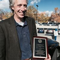
Robert Anderson one of four faculty members receive high honor for research, teaching, and service
06 Nov 2015 - Leaders in science, medicine are newest University of Colorado Distinguished Professors
Water Resources Research Special Collection: Concentration-discharge relations in the critical zone
30 Oct 2017 - Water Resources Research published a new special collection in September 2017 featuring concentration-discharge research from multiple CZOs.
2017 CZO Webinar Series: Critical Zone and Society
06 Apr 2017 - 2017 CZO Webinar Series: Critical Zone and Society.
Critical Zone Q&A with researcher Adrian Harpold
19 Oct 2016 - University of Nevada Reno's Adrian Harpold reflects on his past and present time researching at Critical Zone Observatories.
Shale Hills hosts eight-member delegation from China
09 Sep 2016 - To further their knowledge in critical zone research, a delegation of geologists from the China Geological Survey (CGS) and students from the China...
Cold Springs fire update
11 Jul 2016 - From Bill Bowman up at Mountain Research Station: After a conference call with CU Risk Management and Police Department this morning, the decision...
Field Areas:
![]()
Boulder Creek Watershed
1158 km2, 1480-4120 m elevation,
The Boulder Creek CZO lies within the Boulder Creek watershed (1160km2), which drains the Front Range from the Continental Divide (4120m) to the eastern plains (1480m). Our work concentrates on four research sites that span large differences in elevation, climate, geologic history, and weathering regime: Betasso (1810-2024 m) Gordon Gulch (2446-2737m) Green Lakes Valley (3567-3745)
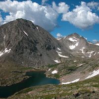
Green Lakes Valley
2.32 km2, 3567-4024 m elevation, -3.7 °C, 1214 mm/yr
Gordon Gulch
2.6 km2, 2446-2737 m elevation, 5.1 °C, 519 mm/yr
Betasso
0.45 km2, 1810-2024 m elevation, 12.3 °C, 563 mm/yr
Explore Further
