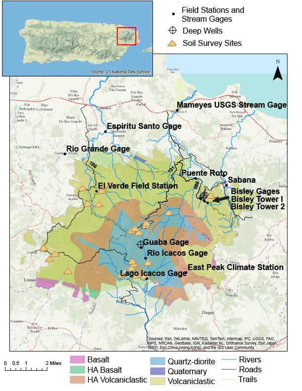
Field Areas
The Luquillo Experimental Forest includes El Yunque National Forest and extends to the coastal planes on the north and south sides of North Eastern Puerto Rico.
When planning field work it is important to consider your safety. A safety tip sheet is available in an associated file below.
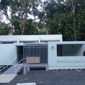
El Verde Field Station
1.05 km2,
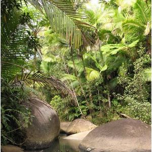
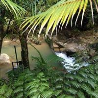
We are located within El Yunque National Forest in Puerto Rico, surrounded by tropical rainforests representative of many Caribbean island ecosystems. Research at El Verde focuses on forest dynamics, stream ecology and hydrology, and ecosystem processes. Most research is conducted by the Luquillo Long-Term Ecological Research (LTER) program, LCZO and by scientists from the University of Puerto Rico and universities in mainland US.
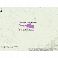
Quebrada Prieta
0.3077 km2,
Quebrada Sonadora
2.6159 km2,
Northeastern Puerto Rico and the Luquillo Mountains
0-1075 m elevation, 1000-5000 mm/yr
The Luquillo Critical Zone Observatory (LCZO) is located in Luquillo Mountains of northeastern Puerto Rico. This Includes El Yunque National Forest, Rio Mameyes and Rio Blanco watersheds, surrounding coastal plains and nearby urbanized areas such as the San Juan metro area, Luquillo and Fajardo.
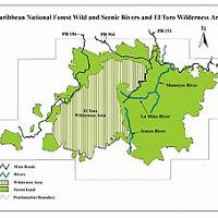
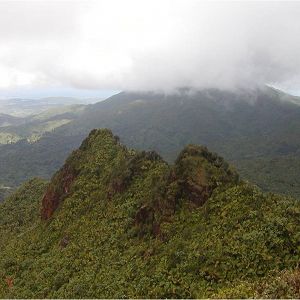
El Toro Wilderness Area
40.5 km2,
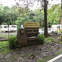
Sabana Field Station
10.26 km2,
Rio Blanco
3.26338502 km2, 0-1043 m elevation, 3080 mm/yr
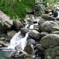
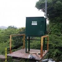
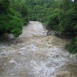
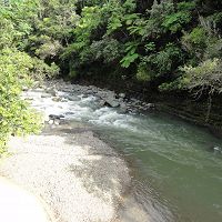
Large Instrumented river drains the majority of the south side of the Luquillo Mountains, underline with a granodirite bedrock. Sandy river bed with large boulders. Instrumentation includes multiple gagued streams, lysimeter fields, climate stations, water chemistry sampling as well as other event based and field campaign sampling.
East Peak
-1028 m elevation,
Rio Blanco nr Florida
Lago Icacos
Rio Icacos
618-775 m elevation,
Rio Mameyes
17.8191 km2,
The Rio Mameyes flows in a northerly direction and has outstanding scenic, biological, recreation and historic values. The Rio Mameyes watershed covers 6.88 square miles within the forest, or 10.4% of the forest. Water quality is optimum within the study area of the upper segment, since the entire corridor is located in the Baño de Oro Natural Area and no development exist. Due to steep slopes, no significant flood plains occur. There are approximately 73 acres of riparian wetlands along the Rio Mameyes designated segments.
Bisley
265-460 m elevation,
Puente Roto
17.8191 km2,
Puerto Rico
Puerto Rico is a Caribbean island located between the Caribbean Sea and the North Atlantic Ocean, east of the Dominican Republic and west of the Virgin Islands. It is about 1,000 miles (1,600 km) southeast of Miami, Florida. Puerto Rico is a self governing unincorporated territory of the United States.
Geographic Coordinates: Latitude: 18 15 N Longitude: 66 30 W 9,104 sq km (3,515 sq mi)
The maximum length from east to west (from Punta Puerca to Punta Higuero) of 180 km (110 mi) and with a maximum width from north to south (from Isabella to Punta Colón) of 65 km (40 mi).
Infrastructure overview
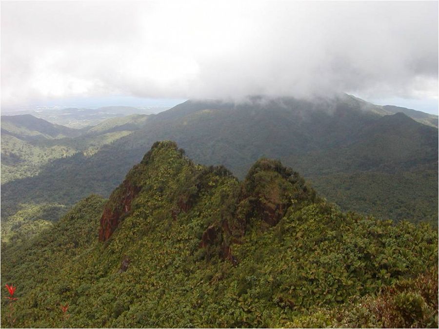
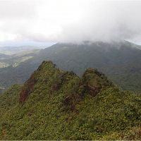
The Luquillo Mountains
El Yunque National Forest is the only tropical rain forest in the U.S. National Forest System. It differs significantly from all the other United States National Forests because of its year-round tropical climate and incredible biodiversity.
The Luquillo Mountains which rise to 3,533 ft. above sea level are mostly comprised of this forested land. Rainfall in the area can reach over 200 inches (508 centimeters) at higher elevations. The forest has an average temperature of 73° F (21° C), with indistinct seasonal changes, a perfect climate for tropical vegetation. The rain forest is noted for its biodiversity and has thousands of native plants including 150 fern species, 240 tree species (88 of these are endemic or rare and 23 are exclusively found in this forest). El Yunque National Forest has hundreds of small animals indigenous to the area, many of which cannot be found anywhere else in the world.
Working safely in the Luquillo Mountains
The Luquillo Mountains can be a trecherous place to work. When planning your field work please consider the safety precuations in the below file.
PR Map
Infrastructure overview
Associated Files
LCZO Safe Field Work Guide
(52 KB pdf)
Please consider the safety precautions in this document when planning your field work.
OSHA Zika guide lines
(357 KB pdf)
Guide lines for protection against the Zika Virus
Explore Further
