ARCHIVED CONTENT: In December 2020, the CZO program was succeeded by the Critical Zone Collaborative Network (CZ Net)
×
GIS, Remote Sensing & Geophysics
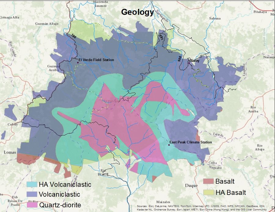
- Maps include: Geology, Soils, Elevation, Land Use ect.
- Email: Miguel.Leon@unh.edu for information about GIS data
Move laterally:
National | Boulder | Calhoun | Catalina-Jemez | Christina | Eel | Luquillo | Reynolds | Shale Hills | Sierra
Many existing GIS datasets have been collected and are maintained by the CZO data manager. Datasets include but are not limited to land cover studies based on remotely sensed information generated by the Institute for Tropical Forestry. NRCS soil survey data, vegetation cover types, Geological Survey data generated by the USGS, vector data sets representing roads, streams, census data, utilities, stream intake points, watersheds and other data. Digital elevation models are also available at 30 meter, 10 meter and 1 meter (LiDAR). Many satellite and aerial photographs have also been compiled.
Explore Further
