Field Areas
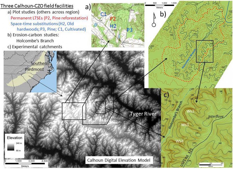
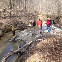
The Calhoun CZO is comprised of eight research areas in the Calhoun Experimental Forest and surrounding areas in the Sumter National Forest, including the Holcombe's Branch watershed, experimental catchments, and space-for-time (paired hardwood-pine-cultivated field) plots. The areas were chosen primarily for their wealth of historical data giving researchers an ideal platform for testing hypotheses on how critical zones evolve in response to human forcings at the landscape scale.
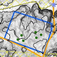
Digital elevation model of the Calhoun showing locations of three of the Calhoun CZO field areas.
Calhoun Critical Zone Observatory
134-190 m elevation, 16 °C, 1250 mm/yr
The Calhoun Critical Zone Observatory is comprised of eight research areas in the Calhoun Experimental Forest and surrounding areas in the Sumter National Forest in upstate South Carolina, including the Holcombe's Branch watershed, experimental catchments, and space-for-time (paired hardwood-pine-cultivated field) plots. The areas were chosen primarily for their wealth of historical data giving researchers an ideal platform for testing hypotheses on how critical zones evolve in response to human forcings at the landscape scale.
Calhoun CZO Research Area 8
0.77 km2,
Calhoun CZO Research Area 7

Calhoun CZO Research Area 6
0.30 km2,
Calhoun CZO Research Area 5
Calhoun CZO Research Area 3
6.5 km2, 108-195 m elevation, 16 °C, 1250 mm/yr
Calhoun CZO Research Area 2
.16 km2,
Calhoun CZO Research Area 4
0.42 km2,

Calhoun CZO Research Area 1
0.40 km2, 180-190 m elevation, 16 °C, 1250 mm/yr
Calhoun Pine Flux Tower
16 °C, 1250 mm/yr
Calhoun Long-Term Soil-Ecosystem Plots and Reference Areas
180-190 m elevation, 16 °C, 1250 mm/yr
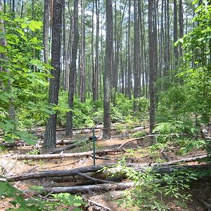
Calhoun Experimental Forest and Eco-hydrology Experiments
134-157 m elevation, 16 °C, 1250 mm/yr
Calhoun Experimental Forest
Located in Union County, South Carolina, in the Southern Piedmont region and the heart of the Old South's cotton belt, the John C. Calhoun Experimental Forest is a 5082 acre (2057 hectare) area that has for nearly 70 years been the site of studies of land and water degradation caused by agricultural land uses. The Calhoun was organized October 8, 1947 in response to USDA Forest Service efforts of the 1930s and 1940s that aimed to restore highly degraded soils, forests, and water of the Southern Piedmont. Shortly after World War II, the Calhoun Experimental Forest was established on land so eroded, gullied, and degraded by agriculture that they considered it "to represent poorest Piedmont conditions" (Metz, 1958). When the Calhoun Experimental Forest's laboratory with its scientific staff was abruptly closed in the early 1960s, data collection in its four experimental catchments terminated but records were archived at Coweeta Hydrologic Laboratory, holding the potential to be re-used if and when the catchments are re-instrumented. Today the Calhoun Experimental Forest is managed by the USDA Forest Service's Southern Research Station and Sumter National Forest, Enoree Ranger District.
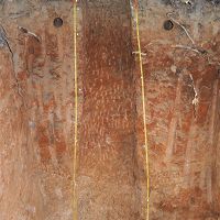
The Calhoun Experimental Forest warrants our interest not only because of its special 60-year history of research, but also because the history and contemporary uses of the site reflect important structures, forcings, and change ongoing in the large areas of the world not well represented among the initial six CZOs. The Calhoun's geologic substrata, landforms, vegetation, soil conditions, and land-use history are all closely comparable to conditions across much of the southeastern North America. The Calhoun's gently rolling to moderately steep landscapes are derived from granitic-gneiss which underlies nearly half of the Southern Piedmont (Richter and Markewitz 2001). The Calhoun has a warm temperate climate with mean annual precipitation and temperature 1300 mm and 16°C, respectively. Annual potential evapotranspiration averages 850 mm. Common soil series at the Calhoun include the Cecil, Pacolet, Appling, Cataula, Madison, and Chewacla, which comprise many of the region's most common soils. These advanced weathering-stage soils are common throughout the world in non-glaciated warm temperate regions and across the lowland tropics which are experiencing land-use pressures and conversions not dissimilar to those that have already affected the Calhoun.
For the exact locations of our research sites, see the map of Calhoun CZO Water, Soil, and Forest Sampling sites.
References
Explore Further
