Field Areas
Boulder Creek Watershed: 1158 km2, 1480-4120 m elevation,
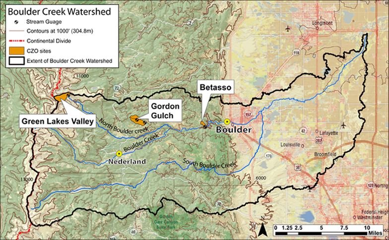
The Boulder Creek CZO lies within the Boulder Creek watershed (1160km2), which drains the Front Range from the Continental Divide (4120m) to the eastern plains (1480m). Our work concentrates on four research sites that span large differences in elevation, climate, geologic history, and weathering regime: Betasso (1810-2024 m, 0.45 km2) ; Gordon Gulch (2446-2737 m, 2.62 km2) ; Green Lakes Valley (3567-3745 m, 2.3 km2)
Boulder Creek CZO field areas.
![]()
Boulder Creek Watershed
1158 km2, 1480-4120 m elevation,
The Boulder Creek CZO lies within the Boulder Creek watershed (1160km2), which drains the Front Range from the Continental Divide (4120m) to the eastern plains (1480m). Our work concentrates on four research sites that span large differences in elevation, climate, geologic history, and weathering regime: Betasso (1810-2024 m) Gordon Gulch (2446-2737m) Green Lakes Valley (3567-3745)
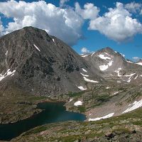
Green Lakes Valley
2.32 km2, 3567-4024 m elevation, -3.7 °C, 1214 mm/yr
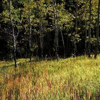
Gordon Gulch
2.6 km2, 2446-2737 m elevation, 5.1 °C, 519 mm/yr
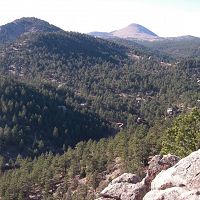
Betasso
0.45 km2, 1810-2024 m elevation, 12.3 °C, 563 mm/yr
Boulder Creek CZO
The Boulder Creek Critical Zone Observatory (CZO), located in the Front Range of Colorado, is designed to examine the effect of erosion on the development and function of the Critical Zone. The Critical Zone is the near-surface region that supports terrestrial life, extending vertically from the base of groundwater to the upper reaches of the vegetation canopy. The Boulder Creek Watershed is about 1160km2 and drains the Front Range from the Continental Divide (4120m) to the eastern plains (1480m) . In the upper reaches of Boulder Creek, it has 3 tributaries – North Boulder Creek, Middle Boulder Creek and South Boulder Creek. Boulder Creek watershed provides a natural laboratory for examining erosion and weathering histories and resulting critical zone architectures, because it encompasses several different erosion regimes . Boulder Creek runs east from the crest of the Colorado Front Range onto the High Plains of western United States, spanning eleva tions from 4000 to 1500m. The Front Range is one of a number of mountain ranges formed in the compressional tectonics of the Tertiary Laramide Orogeny. The orogeny thrust Paleoproterozoic crystalline rocks up against the marine sediments from the Cretaceous seaway. The first order topographic feature of the watershed arises from this lithologic contrast set by tectonic history. That is, the crystalline rocks of the Front Range tower above the soft sedimentary rocks of the Plains, and the two provinces are separated by an abrupt topographic front. As the name suggests, the Plains comprise smooth topography with broad alluvial terraces standing in low relief above the modern rivers. The Front Range contains more rugged terrain cut into crystalline rocks, notably deep canyons gashed upvalley from the Plains, and steep-sided glacial valleys hugging the range crest.
The large elevation range within the watershed encompasses five climatic zones – alpine, subalpine, montane, foothills and plains. Total annual precipitation generally decreases with elevation, from >100cm at the Continental Divide to about 46cm near the City of Boulder. The project will focus on the upper basin of the Boulder Creek Watershed (above City of Boulder).
Explore Further
