Field Areas
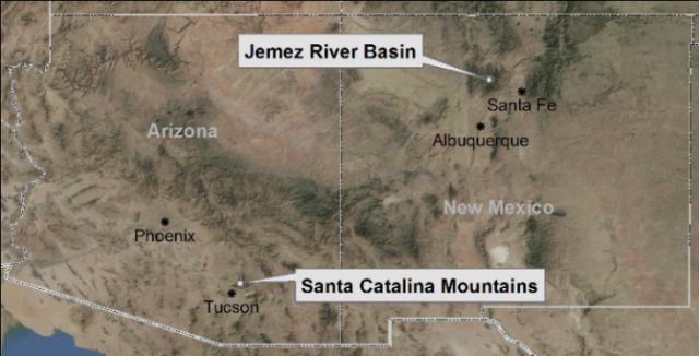
Santa Catalina Mountains and Jemez River Basin CZO consists of a pair of observatories:
- Santa Catalina Mountains (SCM) - is located north and east of metropolitan Tucson, in the Coronado National Forest of southern Arizona and within the Colorado River Basin, and
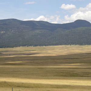
- Jemez River Basin (JRB) - is situated in the Valles Caldera National Preserve north of Albuquerque in north central New Mexico and within the Rio Grande Basin.
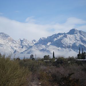
Santa Catalina Mountains
1022-2780 m elevation, 10-18 °C, 420-940 mm/yr
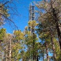
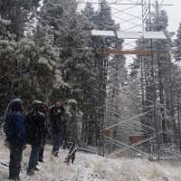
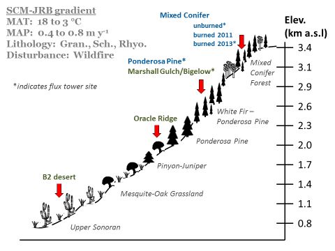
The Santa Catalina Mountains (Catalina) are located northeast of Tucson in southern Arizona. This location includes three sites: one in the Sonoran desert on the mountain foothill; the second in the mid elevation and the third - high elevation in the Marshall Gulch Creek catchment and Bigelow site which includes zero order basin (ZOB) and flux tower.
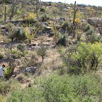
B2 Desert Site (Low-Elevation)
1022-1161 m elevation, 18.2 °C, 420 mm/yr
Oracle Ridge (Mid-Elevation)
1.09 km2, 2064-2388 m elevation, 11.9 °C, 840 mm/yr
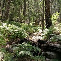
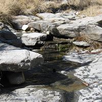
Marshall Gulch (High-Elevation)
1.54 km2, 2284-2634 m elevation, 10.4 °C, 940 mm/yr
Bigelow Site (High-Elevation)
0.016 km2, 2532-2574 m elevation, 9.2 °C, 609 mm/yr
Jemez River Basin
2060-3433 m elevation, 3 - 9 °C, 480-850 mm/yr
The Jemez River Basin is located in the transition zone between the southwestern desert and the Rocky Mountains.
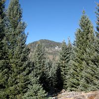
Jemez Unburned Site
0.01 km2, 2751-2753 m elevation,
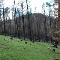
Jemez 2011 Burned ZOB
0.13 km2, 2664-2934 m elevation, 5.1 °C, 670 mm/yr
Jemez 2013 Burned ZOB
0.14 km2, 2986-3103 m elevation, 4.1 °C, 770 mm/yr
The Catalina-Jemez CZO comprises an elevation gradient in granite, schist, and rhyolite lithologies that spans a range of ecosystem types representative of much variation found in the larger southwestern US. The Santa Catalina Mountains location includes sites instrumented in Sonoran desert, Piñon-Juniper to Ponderosa Pine transition, and Ponderosa Pine – White Fir transition ecosystems. The Jemez location focuses on wildfire disturbance effects in high elevation mixed conifer forest with sites instrumented in unburned and wildfire-impacted (2011 and 2013) systems.
The Catalina-Jemez CZO is building and maintaining its field research infrastructure via close collaboration with the Valles Caldera National Preserve (VCNP) in northern New Mexico and the Coronado National Forest (CNF) in Southern Arizona. Lands associated with these federal agencies are the subject of CZO inquiry because they contain gradients in climate and lithology that represent a large portion of the southwestern US (Breshears et al., 2005, PNAS). Southwestern climate gradients such as those studied in the Catalina-Jemez CZO are undergoing rapid ecosystem transformations, including tree die-off thought to be the combined manifestation of prolonged relative drought and increased temperature that give rise to higher vapor pressure deficit (e.g., see Williams et al., 2012, Nature Climate Change).
Federal government personnel from these two land stewardship organizations are collaborating with CZO students, staff and faculty on identifying emergent problems that could be effectively addressed through collaborative research, locating appropriates sites for instrument installations and measurement/sampling campaigns and obtaining the requisite permits. These agencies facilitate NSF-funded CZO research by prioritizing Earth surface science among their set of multiple land use priorities. A broader impact goal of our CZO is to provide these agencies with foundational science to inform land management strategies. Doing so should enable the agencies to more effectively address future challenges to valuable public lands that are critical to sustaining water, soil and vegetation resources.
Depiction of the SCM-JRB CZO as an elevation gradient extending from Sonoran Desert (SCM, Arizona) to mixed conifer forest (JRB, New Mexico). Inclusion of the higher latitude and elevation JRB sites enables exploration of snow-rain boundary climate effects across a range of catchment aspects, and a steep gradient in disturbance (wildfire). Although lithology at highest elevation (JRB-rhyolite) differs from that at all lower elevations (SCM-granite and schist), all are felsic igneous rock, and rock type is held constant across elevation and aspect in SCM or across disturbance and aspect in JRB.
Explore Further
