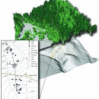
Field Areas
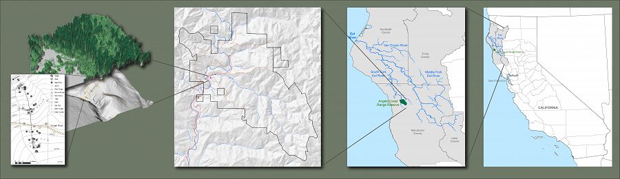
Eel River CZO field locations at multiple scales.
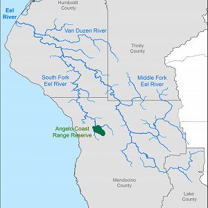
Eel River Watershed
9540.0 km2, 0-2464 m elevation,
The Eel River Watershed (9,540 km2) is a steep mostly undammed Northern California coastal river eroding rapidly through mechanically weak rock with active uplift. Both watershed-climate-ocean productivity investigations and education & outreach have occurred here (supported by prior NSF funds and in collaboration with Friends of the Eel River and the Eel River Recovery Project).
Angelo Coast Range Reserve
31 km2, 120-1260 m elevation, 10.1 °C,
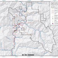
Sagehorn-Russell Ranch
21 km2, 460-980 m elevation,
Rivendell
0.004 km2, 400-470 m elevation,
The Eel River CZO is based out of the Angelo Coast Range Reserve, part of the University of California Natural Reserve System with affiliation to UC Berkeley. The CZO operates at three spatial scales: 1) "Rivendell" is our intensively instrumented and sampled site and location for manipulative experiments; 2) Angelo Reserve tributaries and the South Fork Eel river provide the broader context; and 3) Eel River system provides upscaling, ocean interactions, and outreach context.
Explore Further
