Field Areas
The IML-CZO consists of three core sites: the 3,690-km2 Upper Sangamon River Basin in Illinois, the 270-km2 Clear Creek Watershed in Iowa, and the 44,000-km2 Minnesota River Basin. These sites are characterized by low-relief landscapes with poorly drained soils and represent a broad range of physiographic variations found throughout the glaciated Midwest. Thus, they provide an opportunity to advance understanding of the CZO in this important region.
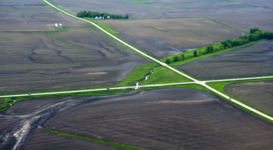
An aerial view of erosion in Eastern Iowa during spring flooding in 2013.
Sangamon River Basin
3,690 km2, 180-291 m elevation, 11 °C, 1000 mm/yr
The Sangamon River Basin includes a broad range of variations typical of the glaciated Midwest, which offer an opportunity to better understand the critical zone in this region. The basin is characterized by low-relief landscapes with poorly drained soils. The hydrological and biogeochemical cycles are strongly affected by freeze–thaw cycles and artificial drainage systems. The landscape is covered with patchy, thin loess (<1.5 m). This basin has a poorly integrated, natural drainage network with extensive areas of poorly drained soils. Weathering profiles are relatively thin and usually grade to unweathered fine-grained glacial till within 5 m of the land surface. Soil patterns generally reflect glacial depositional patterns, except where modified by stream processes in valleys.
Clear Creek Watershed
270 km2, 197-248 m elevation, 9 °C, 889 mm/yr
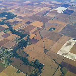
The Clear Creek, Iowa, watershed covers approximately 270 km2 in East Central Iowa and joins the Iowa River in Coralville, Iowa. Clear Creek is representative of most U.S. Midwestern watersheds with regards to land use (predominantly agricultural), soil type/order (Alfisols and Mollisols), and climate (humid-continental). The combination of extensive agricultural activities, increased urbanization, highly erodible soils, and a humid climate on the steep slopes within the watershed have influenced the erosion processes in the watershed.
Minnesota River Basin
44,000 km2, 210-294 m elevation, 5 °C, 747 mm/yr
The Minnesota River flows more than 335 miles from its source near the Minnesota-South Dakota border to its confluence with the Mississippi River at Minneapolis/St. Paul. It winds through diverse landscapes and drains nearly 20 percent of Minnesota (16,770 square miles total, 14,840 in Minnesota). Agriculture, primarily corn and soybean production, accounts for the majority of the basin’s land use. As the river enters the Twin Cities Metropolitan area, the basin is characterized by densely populated urban landscapes. The Minnesota River has been cited as one of the most polluted rivers in the state and the nation. In 2008, it was listed on American Rivers top 10 most endangered rivers in the United States. It is the focus of a major restoration effort by local, state, and federal agencies, as well as citizen and nonprofit groups.
The glaciers that shaped the Upper Midwest left a legacy of rich topsoil that supports the area's economy and provides food for millions worldwide. That said, there are variations among the three IML-CZO sites.
The IML-CZO lies within the Prairie Peninsula, an eastward protuberance of the tallgrass prairie from Iowa to Indiana. Before settlement, tallgrass prairie, with dispersed wetlands, covered upland areas, while woodlands lined drainageways. Spatial and temporal patterns in precipitation and temperature shaped the landscape, its soils, and the dominant native vegetation of the Upper Midwest. Today, all three areas are subject to intensive, tile-drained, row-crop agriculture. Construction of drainage ditch systems drained the former wetlands and altered the hydrology and biogeochemistry of the region.
The Upper Sangamon River Basin in Illinois is covered with patchy, thin loess, with a poorly integrated natural drainage network and areas of poorly drained soil. In Iowa, the Clear Creek Watershed is drained by a well-integrated netowrk of streams, and loess thickness, while varied, is quite substantial, ranging from 5 to 30 m in thickness. The Minnesota River Basin in Minnesota is subject to rapidly eroding banks, bluffs, and ravines, which are very sensitive to changes in river discharge and contribute significantly to sediment in the river. The basin has undergone extensive changes in land use, from a forest-wetland-prairie system to row-crop agriculture, which now covers nearly 80 percent of the basin.
Explore Further
