Sensors & Field Instruments
Boulder Creek CZO deploys datalogger and sensors to measure a wide array of parameters such as meteorological, soil moisture, soil temperature and resistivity, water discharge, snow depths. Such parameters make up the bulk of our time-series data. We also conduct manual sampling for water and groundwater chemistry, maintain snowpole transects and snowpits. In addition, we installed time-lapse cameras at 6 locations within Green Lakes Valley and Gordon Gulch.
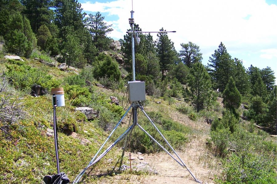
Sensor at Gordon Gulch.
Meteorological Towers
BCCZO operates a 10 m meteorologic tower in the Betasso watershed which collects data on 10 minute intervals. The data is available “live” on the website via Frewave Ethernet radio connection. Within the Gordon gulch watershed we have 2 3 m meteorologic tripods representing the North and South facing aspects of Gordon Gulch. Gordon Gulch is in the process of being networked with fm radios communicating via cellular modem to transmit data off site to the office and the project should be complete in January 2016. Each tower has multiple sensors that measures air temperature, relative humidity, soil parameters, precipitation, shortwave radiation, wind speed and direction. BCCZO is currently collaborating with the Niwot Ridge LTER to revive 2 more historical climate sites which will better help to characterize these parameters on an elevational gradient from Niwot ridge down to Betasso. With the exception of the Betasso tower where we have hard line power our meteorologic towers utilize solar power to ensure continuous data collection and minimize transportation of heavy batteries in the field.

Meteorological tower at Betasso.
Soil Sensor Arrays
We installed a multitude of soil sensors in 15 soil pits at various heights to measure soil temperature, volumetric water content, water potential and conductivity. Sensor types include Decagon EC-5 soil moisture sensors, Decagon MPS-1 soil water potential sensors, 107 Campbell scientific temperature sensors and CS616 Campbell scientific soil moisture sensors. Our soil sensor arrays are currently being updated to allow for communication via fm radio and cellular modem. “Live” data should be available January 2016.
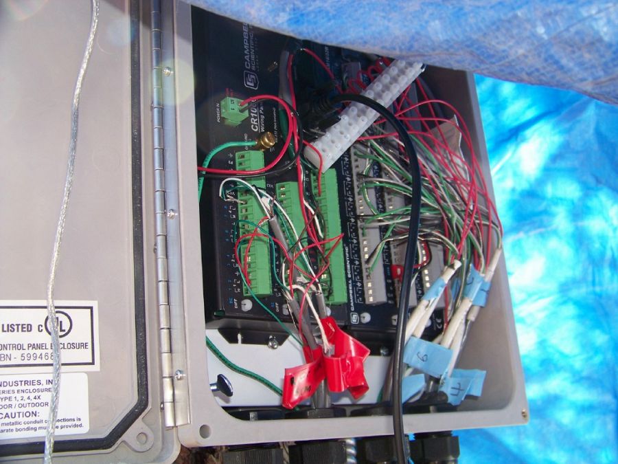
Sensor panels.
Snow Pole Transects, Snow Pits and Snow Sensors
We maintain snow pole transects at Upper and Lower Gordon Gulch. Weekly snow depth measurements are taken at the poles. We also characterize snow pits which are dug weekly. Judd Snow Sensors are co-located at most of soil sensor locations to measure snow depths at 10 minute intervals.
Time-Lapse Camera
We installed 6 time-lapse cameras at various locations in Green Lakes Valley and Gordon Gulch. Pictures are taken every 4-8 hours. These cameras provide valuable ground confirmation of precipitation events, the magnitude and immediate effets of these events.
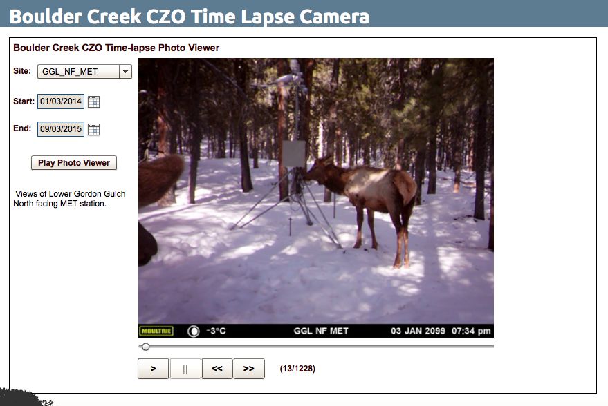
Time-Lapse Camera application at 6 locations.
Geophysical Characterization
We use Shallow Seismic Refraction (SSR), Ground Penetrating Radar (GPR), and Electrical Resistivity(ER) to visualize subsurface physical properties, including depth to the water table, thickness of weathered material, and depth to fresh bedrock. We have characterized the subsurface of Betasso, Gordon Gulch, and Green Lakes Valley using Shallow Seismic Refraction (2009) & Electrical Resistivity (2012).
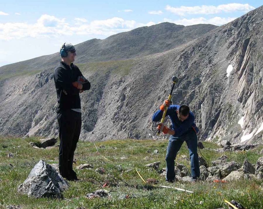
A Shallow Seismic Refraction (SSR) setup at Green Lakes Valley.
Water Chemistry and Stream Discharge
Water chemistry is collected manually on a weekly basis from In addition to stream water chemistry collected by auto-samplers, we also analyze intermittent spring chemistry, groundwater, precipitation and soil pore chemistry. We measure a wide range of parameters including pH, conductivity, alkalinity, multiple cations and anions as well as stable isotopes. We currently operate 3 stream gauges and have ancillary discharge data provided by the USGS and Niwot LTER.

BT_SW_0 Modified Parshall flume nearing completion
International Geodatabase Sampling Numbers (IGSN)
The BCCZO has recently begun the process of registering our vast number of soil, water and rock samples with the System for Earth Sample Registration (SESAR). While this project is in its infancy we look forward to collaborating with others and making archival samples available for those with interest.
Time-Lapse Camera application at 6 locations.
Meteorological tower at Betasso.
Sensor panels.
A Shallow Seismic Refraction (SSR) setup at Green Lakes Valley.
BT_SW_0 Modified Parshall flume nearing completion
Explore Further
