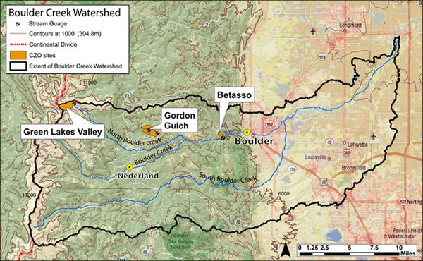
Boulder Creek Watershed
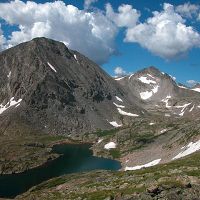
The Boulder Creek CZO lies within the Boulder Creek watershed (1160km2), which drains the Front Range from the Continental Divide (4120m) to the eastern plains (1480m). Our work concentrates on four research sites that span large differences in elevation, climate, geologic history, and weathering regime: Betasso (1810-2024 m) Gordon Gulch (2446-2737m) Green Lakes Valley (3567-3745)
1158 km2 Area
1480 - 4120 m Elev
Areas within Boulder Creek Watershed
-
Setting & Research
The Boulder Creek Watershed
The Boulder Creek Critical Zone Observatory (CZO), located in the Front Range of Colorado, is designed to examine the effect of erosion on the development and function of the Critical Zone. The Critical Zone is the near-surface region that supports terrestrial life, extending vertically from the base of groundwater to the upper reaches of the vegetation canopy. The Boulder Creek Watershed is about 1160km2 and drains the Front Range from the Continental Divide (4120m) to the eastern plains (1480) (Murphy, 2000). In the upper reaches of Boulder Creek, it has 3 tributaries – North Boulder Creek, Middle Boulder Creek and South Boulder Creek. The confluence of North Boulder Creek and Middle Boulder Creek is at ?m. South Boulder Creek joins Boulder Creek near the City of Boulder.
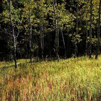
The large elevation range within the watershed encompasses five climatic zones – alpine, subalpine, montane, foothills and plains. Total annual precipitation generally decreases with elevation, from >100cm at the Continental Divide to about 46cm near the City of Boulder. The project will focus on the upper basin of the Boulder Creek Watershed (above the City of Boulder).
Three Distinct Erosion Regimes
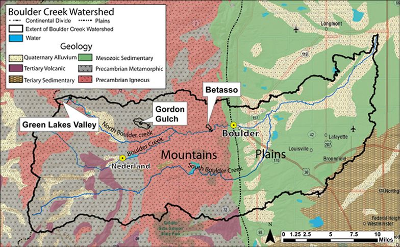
The upper half of the watershed is a mountainous landscape of crystalline rocks, while the lower half crosses the piedmont and is underlain by sedimentary rocks and lined with alluvial terraces. The project will focus on the mountain portion, carved in Precambrian (1.7 by) granodiorite and older biotite gneiss (Lovering & Goddard, 1950), where three distinct erosion regimes arise (Birkeland et al., 2003).
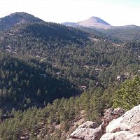
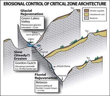
At the crest, the watershed was glaciated. U-shaped valleys, cirques (a few still with ice), and rock-dominated valley floors are found. Cosmogenic radionuclide (CRN) exposure ages on glacially polished bedrock in the valley floor document that glacial erosion removed the previous cosmogenic production layer, and that glaciers retreated from their maximum position at ~17ka to the divide between 14-12 ka (Ward et al., 2006). East of the glacial limit is a broad, high (2500-2750 m) post-Laramide surface of low relief (Bradley, 1987), in which weathered rock profiles are up to 15 m thick (Isherwood & Street, 1976; Dethier & Lazarus, 2005). Still further east, renewed bedrock channel incision over the last 5 My has progressed headward from the plains, cutting deeply into the post-Laramide surface, forming the steep slopes and deep canyons of the range front (Anderson et al., 2006).
The glacially scoured headwaters, the post-Laramide low relief surface, and the deeply-incised range front canyons are all in close proximity and are developed in similar granitoid rocks. The variation in weathered profile development resulting from these erosion regimes therefore constitutes a natural experiment that will enable us to test coupled models of weathering front advance, regolith production and sediment transport in an accessible field laboratory. The impacts of this spatial variation in the critical zone on hydrologic and biologic activities can also be documented, which will in turn constrain hydrologic and ecological models.

Geology of the Boulder Creek Watershed
The last episode of mountain building to shape this landscape started roughly 65 million years ago in the Laramide Orogeny. This brought hard crystalline rock from great depths, and juxtaposed it with softer Mesozoic and Paleozoic sedimentary rocks. This transition in rock type still dominates by localizing the abrupt mountain front. Decay of the mountains since the end of the Laramide Orogeny about 40 million years ago resulted in slow erosion and smoothing of the mountains, and construction of a ramp of sediment sloping down to the east across the plains. Perhaps as recently as 7-3 million years ago, the ramp of the Great Plains was disrupted and incised on its upstream, western edge by the South Platte River and its tributaries. This incision acted as a baselevel fall for the streams draining the harder rocks of the crystalline core of the Front Range, and has sent a wave of incision up each of these rivers. The range is therefore in the midst of a transient response to the incision of the western edge of the Great Plains. In the same timeframe, in the last couple million years, or Pleistocene time, alpine glaciers carved U-shaped valleys and cirques into the headwaters of these river basins.
Three Distinct Erosion Regimes
Geology of the Boulder Creek Watershed
Geology of the Boulder Creek Watershed
-
Overview Maps
3 Field Areas of Boulder Creek CZO
Boulder Creek CZO Field Areas
See full size (in new tab/window)
-
Dynamic Map
To fully zoom into a small area, you may need to visit the "Map" button and uncheck "Terrain" view.
-
Data
B1 - Air Temperature - B1 Air Temp & Relative Humidity (B1_TempRH) (2012-2015)
1 components • Boulder Creek Watershed • Climatology / Meteorology, Hydrology • Jen MorseB1 - Climate, Air Temperature, Electrical Conductivity, Snow Depth - B1 Meteorological Site (B1_Met) (2017-2018)
2 components • Boulder Creek Watershed • Climatology / Meteorology, Soil Science / Pedology, Hydrology • Suzanne Anderson; Nathan Rock; Dillon RagarB1 Historical Site - Air Temperature, Solar Radiation - B1 Historical AirT Site (B1_Hist_AirT) (1987-2000)
1 components • Boulder Creek Watershed • Climatology / Meteorology • Mark LoslebenB1 Historical Site - Climate, Meteorology - B1 Historical Meteorological Site (B1_Hist_Met) (1952-1970)
1 components • Boulder Creek Watershed • Climatology / Meteorology • Mark LoslebenB1 Historical Site - Precipitation - B1 Historical Precipitation Site (B1_Hist_Precip) (1952-1964)
1 components • Boulder Creek Watershed • Climatology / Meteorology • Mark LoslebenBoulder Creek - GIS/Map Data - ArcGIS API BCCZO GIS (2010-2018)
1 components • Boulder Creek Watershed • GIS / Remote Sensing • Eric ParrishBoulder Creek - LiDAR - Point Cloud Data at OpenTopography.com (Snow off) (2010)
1 components • Boulder Creek Watershed • GIS / Remote Sensing • Suzanne Anderson; Eric ParrishBoulder Creek - LiDAR - Derived DEM from LIDAR (2010)
12 components • Boulder Creek Watershed • GIS / Remote Sensing • Eric Parrish; Suzanne AndersonBoulder Creek - Streamflow / Discharge - (USGS Gauges) (2007-2013)
4 components • Boulder Creek Watershed • Hydrology • US Geological SurveyBoulder Creek - Streamflow / Discharge - Colorado Division of Water Resources Stream Gauges (2000-2013)
3 components • Boulder Creek Watershed • Hydrology • Colorado Division of Water ResourcesBoulder Creek - Diatoms - Didymosphenia Geminata (2008-2010)
1 components • Boulder Creek Watershed • Biology / Ecology, Hydrology • James CullisBoulder Creek catchment and vicinity - Geology, Geomorphology (2006)
1 components • Boulder Creek Watershed • Geomorphology, Geochemistry / Mineralogy, Geology / Chronology, Geophysics • David P. Dethier; Eli D. LazarusBoulder Creek CZO - Stream Water Chemistry, Surface Water Chemistry - (Isaac Bukoski Thesis) (2018)
1 components • Gordon Gulch, Betasso, Boulder Creek Watershed • Water Chemistry • Isaac BukoskiBoulder Creek CZO - Surface Water Chemistry - (BC_SW_Array) (2008-2017)
2 components • Boulder Creek Watershed • Water Chemistry • Suzanne Anderson; Clayton JensenComo Creek - Topographic Carbon Storage, GIS/Map Data, LiDAR, Land Cover (2010)
2 components • Boulder Creek Watershed • GIS / Remote Sensing, Biology / Ecology, Geomorphology, Hydrology • Tyson Lee Swetnam; Paul Brooks; Holly Barnard; Adrian Harpold; Erika GalloNational - Air Temperature, Flux Tower, Meteorology - NADP and NOAA or other weather stations (2017)
8 components • Boulder Creek Watershed, Calhoun Critical Zone Observatory, Jemez River Basin, Susquehanna Shale Hills Critical Zone Observatory • Climatology / Meteorology • NADP; NOAA; othersNational - Climate, Flux Tower, Streamflow / Discharge - CUAHSI WDC web services (1968-2015)
7 components • Boulder Creek Watershed, Christina River Basin, Jemez River Basin, Santa Catalina Mountains, El Verde Field Station, Northeastern Puerto Rico and the Luquillo Mountains, Rio Blanco, Rio Mameyes, Susquehanna Shale Hills Critical Zone Observatory, Providence Creek Headwater Catchments (1660 - 2115 m elevation), Wolverton Basin (2230 - 2700 m elevation), Other instrumented sites • Climatology / Meteorology, Hydrology, Soil Science / Pedology • Boulder Creek Critical Zone Observatory; Catalina-Jemez Critical Zone Observatory; Luquillo Critical Zone Observatory; Shale Hills Critical Zone Observatory; Southern Sierra Critical Zone Observatory; Christina River Basin Critical Zone ObservatoryNational - Flux Tower - AmeriFlux Network data (2007-2018)
14 components • Boulder Creek Watershed, Jemez River Basin, Reynolds Creek Experimental Watershed, Susquehanna Shale Hills Critical Zone Observatory, San Joaquin Experimental Range (210-520 m elevation), Soaproot Saddle (1000-1500 m elevation), Short Hair (2670 m elevation) • Climatology / Meteorology • Boulder Creek Critical Zone Observatory; Catalina-Jemez Critical Zone Observatory; Reynolds Creek Critical Zone Observatory; Shale Hills Critical Zone Observatory; Southern Sierra Critical Zone ObservatoryNational - LiDAR, Land Cover, GIS/Map Data - OpenTopography (2010-2017)
18 components • Boulder Creek Watershed, Eel River Watershed, Jemez River Basin, Reynolds Creek Experimental Watershed, Susquehanna Shale Hills Critical Zone Observatory, Northeastern Puerto Rico and the Luquillo Mountains, Sangamon River Basin, Clear Creek Watershed, Calhoun Critical Zone Observatory, Providence Creek Headwater Catchments (1660 - 2115 m elevation) • Geomorphology, GIS / Remote Sensing, Hydrology, Biology / Ecology • National Center for Airborne Laser Mapping; Boulder Creek Critical Zone Observatory; Calhoun Critical Zone Observatory; University of Arizona; University of California Merced; Valles Caldera National Preserve; Bandelier National Monument; National Park Service; Jemez River Basin and Santa Catalina Mountains Critical Zone Observatory; Luquillo Critical Zone Observatory; Reynolds Creek CZO; Eel River CZO; Shale Hills CZONational - Streamflow / Discharge - USGS and USDA Data Resources (1985-2017)
22 components • Boulder Creek Watershed, Santa Catalina Mountains, Jemez River Basin, Reynolds Creek Experimental Watershed, Susquehanna Shale Hills Critical Zone Observatory, Northeastern Puerto Rico and the Luquillo Mountains, Clear Creek Watershed, Sangamon River Basin, Calhoun Critical Zone Observatory, Providence Creek Headwater Catchments (1660 - 2115 m elevation) • Hydrology • USGS National Water Information SystemShale Hills, Boulder, Luquillo, JRB-SCM, Calhoun - Soil Geochemistry (2001-2013)
1 components • Susquehanna Shale Hills Critical Zone Observatory, Bisley, Boulder Creek Watershed, Northeastern Puerto Rico and the Luquillo Mountains, Santa Catalina Mountains • Geochemistry / Mineralogy, Biogeochemistry • Niu, Xianzeng; Williams, Jennifer; Brantley, Susan L.; Miller, Doug; Bills, Brian -
Photos
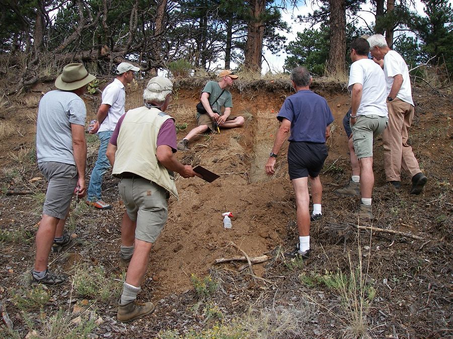
Boulder Creek CZO

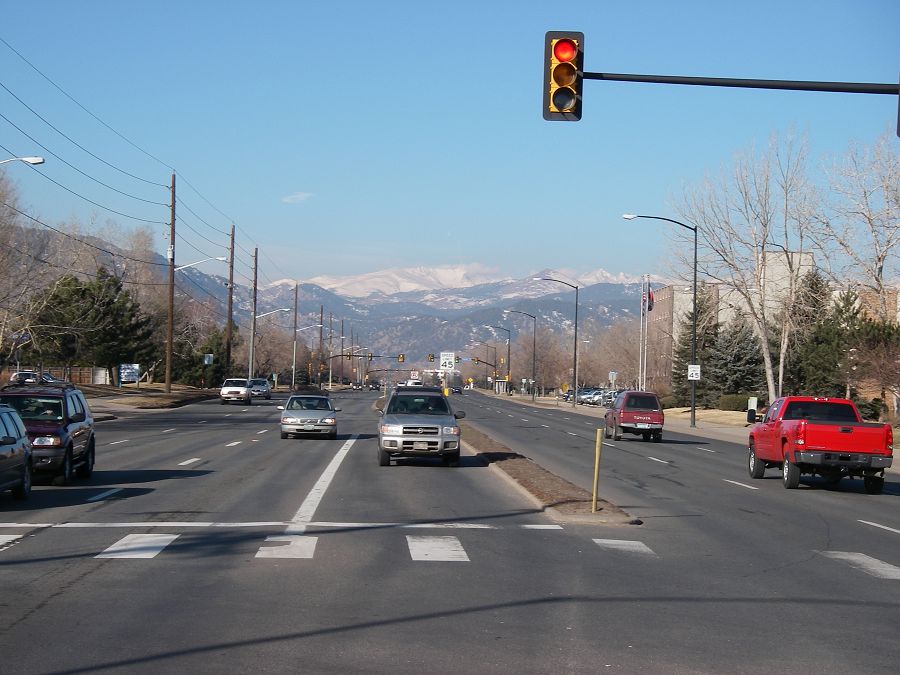
Bloulder Cayon as seen from Arapahoe Road and 30th Street in Boulder colorado

Keck Students

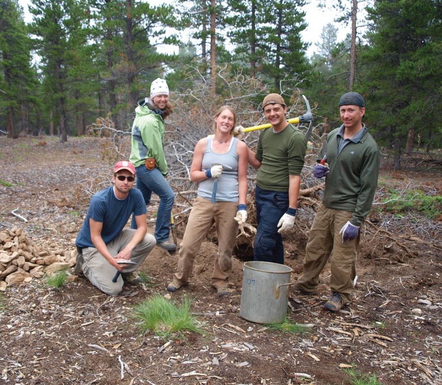
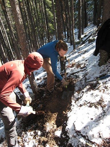
Abby and Daniel digging a trench

Boulder Creek CZO

Students

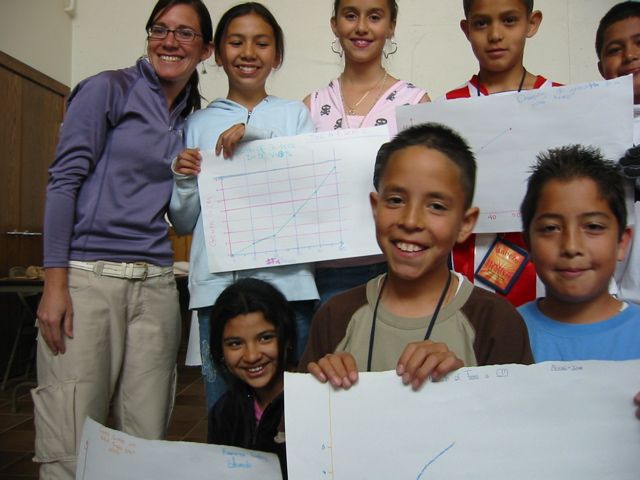
Outreach
Boulder Creek Critical Zone Observatory
-
Partner Organizations


-
Geology
"The upper half of the watershed is a mountainous landscape of crystalline rocks, while the lower half crosses the piedmont and is underlain by sedimentary rocks and lined with alluvial terraces. The project will focus on the mountain portion, carved in Precambrian (1.7 by) granodiorite and older biotite gneiss (Lovering & Goddard, 1950), where three distinct erosion regimes arise (Birkeland et al., 2003).

Geology of the Boulder Creek Watershed
At the crest, the watershed was glaciated. U-shaped valleys, cirques (a few still with ice), and rock-dominated valley floors are found. Cosmogenic radionuclide (CRN) exposure ages on glacially polished bedrock in the valley floor document that glacial erosion removed the previous cosmogenic production layer, and that glaciers retreated from their maximum position at ~17ka to the divide between 14-12 ka (Ward et al., 2006). East of the glacial limit is a broad, high (2500-2750 m) post-Laramide surface of low relief (Bradley, 1987), in which weathered rock profiles are up to 15 m thick (Isherwood & Street, 1976; Dethier & Lazarus, 2005). Still further east, renewed bedrock channel incision over the last 5 My has progressed headward from the plains, cutting deeply into the post-Laramide surface, forming the steep slopes and deep canyons of the range front (Anderson et al., 2006).
The glacially scoured headwaters, the post-Laramide low relief surface, and the deeply-incised range front canyons are all in close proximity and are developed in similar granitoid rocks. The variation in weathered profile development resulting from these erosion regimes therefore constitutes a natural experiment that will enable us to test coupled models of weathering front advance, regolith production and sediment transport in an accessible field laboratory. The impacts of this spatial variation in the critical zone on hydrologic and biologic activities can also be documented, which will in turn constrain hydrologic and ecological models.
The last episode of mountain building to shape this landscape started roughly 65 million years ago in the Laramide Orogeny. This brought hard crystalline rock from great depths, and juxtaposed it with softer Mesozoic and Paleozoic sedimentary rocks. This transition in rock type still dominates by localizing the abrupt mountain front. Decay of the mountains since the end of the Laramide Orogeny about 40 million years ago resulted in slow erosion and smoothing of the mountains, and construction of a ramp of sediment sloping down to the east across the plains. Perhaps as recently as 7-3 million years ago, the ramp of the Great Plains was disrupted and incised on its upstream, western edge by the South Platte River and its tributaries. This incision acted as a baselevel fall for the streams draining the harder rocks of the crystalline core of the Front Range, and has sent a wave of incision up each of these rivers. The range is therefore in the midst of a transient response to the incision of the western edge of the Great Plains. In the same timeframe, in the last couple million years, or Pleistocene time, alpine glaciers carved U-shaped valleys and cirques into the headwaters of these river basins."
-
Climate
The large elevation range within the watershed encompasses five climatic zones – alpine, subalpine, montane, foothills and plains. Total annual precipitation generally decreases with elevation, from >100cm at the Continental Divide to about 46cm near the City of Boulder.
Explore Further
