Gordon Gulch

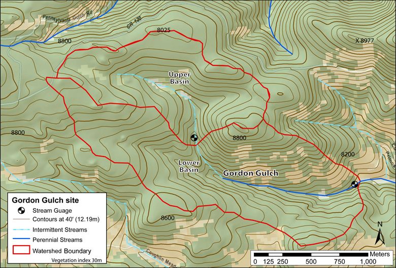
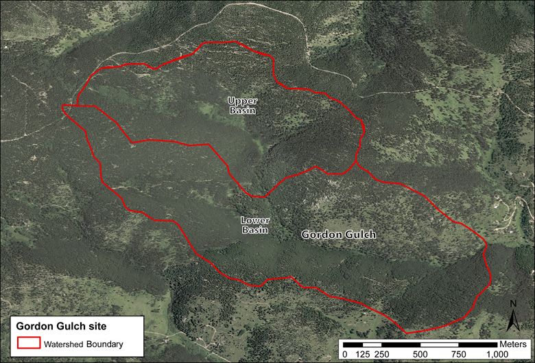
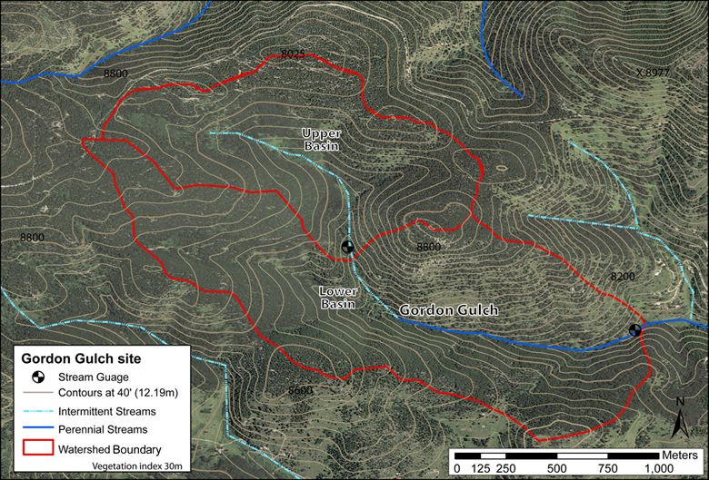
"The Gordon Gulch site lies within Arapahoe National Forest and is divided into Lower and Upper Gordon Gulch. Gordon Gulch (part intermittent part permanent; see map above) joins the North Boulder Creek about 16 km downstream from Green Lakes Valley (GLV)."
2.6 km2 Area
2446 - 2737 m Elev
5.1 °C Temp
519 mm Precip
Parent Field Area:
Boulder Creek Watershed ▲
Lithology
igneous-felsic extrusive, igneous-felsic intrusive, igneous-ultramafic extrusive
-
Setting & Research
Lower Gordon Gulch
Area: 2.6252 km2
Minimum Elevation: 2446m
Maximum Elevation: 2737m
Average Elevation: 2627mUpper Gordon Gulch
Area: 0.9466 km2
Minimum Elevation: 2588m
Maximum Elevation: 2734m
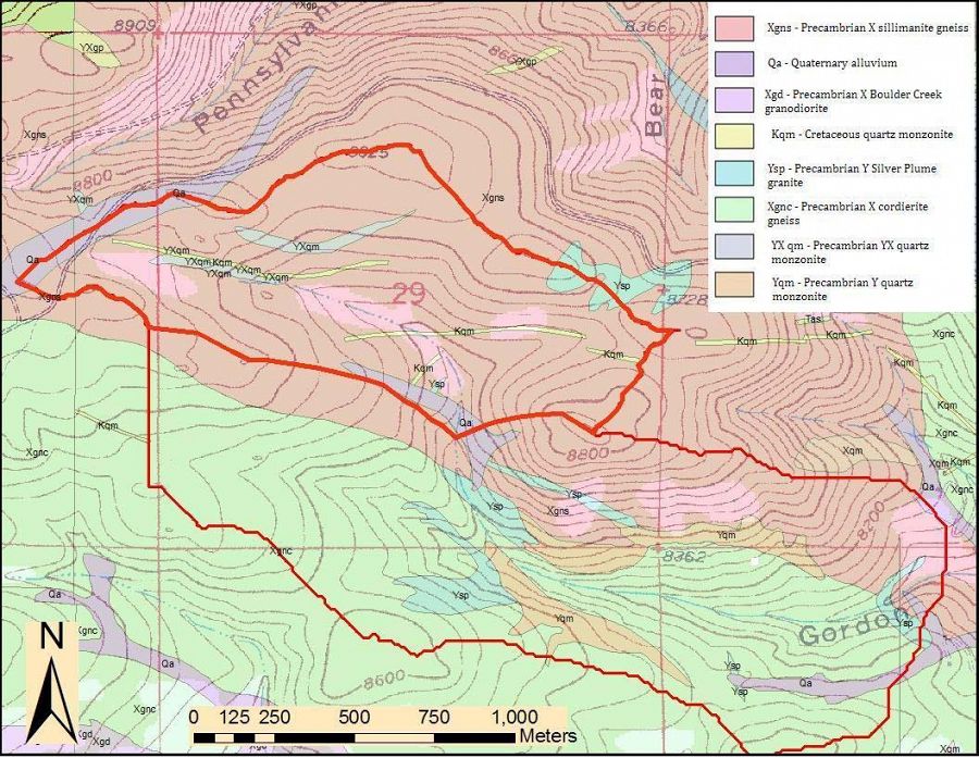
Average Elevation: 2680mThe Gordon Gulch site lies within Arapahoe National Forest and is divided into Lower and Upper Gordon Gulch. Gordon Gulch (part intermittent part permanent; see map above) joins the North Boulder Creek about 16 km downstream from Green Lakes Valley (GLV). This site is underlain by biotite gneiss and is mostly forested. Unlike GLV, it is not affected by the Pleistocene Glaciers. It is characterized by the low-relief remnants of a dissected Tertiary erosion surface in which weathered rock profiles are up to 15 m thick. This dissected Tertiary erosion surface rises gently from 2500m to about 2750 m over distances of 10-20km.
Geologic map of Gordon Gulch (Gable, 1980)
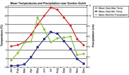
Gordon Gulch is within the montane climatic zone. The maximum precipitation is received around May, with a minimum in the winters. The forests on the north-facing slopes are generally more lush. The south-facing slopes have fewer trees and more undergrowths.Mean temperatures and precipitation are based on meteorological data collected from 1950-1970 at Sugarloaf (2591m) (Barry, 1973).
Geologic map of Gordon Gulch (Gable, 1980)
-
Overview Maps
Map Overlays
-
-
Dynamic Map
To fully zoom into a small area, you may need to visit the "Map" button and uncheck "Terrain" view.
-
Data
All Time lapse Cameras - Photographic Imagery - Betasso, Gordon Gulch, Green Lakes Valley (2009-2018)
1 components • Betasso, Gordon Gulch, Green Lakes Valley • Data Management / CyberInfrastructure • Suzanne Anderson; Bob Anderson; Dillon RagarBetasso - Photographic Imagery - (BT_Camera_Array) (2014-2016)
1 components • Betasso, Gordon Gulch, Green Lakes Valley • Data Management / CyberInfrastructure • Bob Anderson; Suzanne Anderson; Nathan RockBetasso & Gordon Gulch - Precipitation - Water Chemistry (BT-GGU_P_Canopy-Open) (2011-2016)
2 components • Betasso, Gordon Gulch • Water Chemistry • Suzanne Anderson; Clayton JensenBetasso & Gordon Gulch - Soil Respiration - (BT-GG_Flux_Array) (2012-2013)
2 components • Betasso, Gordon Gulch • Soil Science / Pedology • Holly Barnard; Erin BerrymanBoulder Creek CZO - Stream Water Chemistry, Surface Water Chemistry - (Isaac Bukoski Thesis) (2018)
1 components • Gordon Gulch, Betasso, Boulder Creek Watershed • Water Chemistry • Isaac BukoskiGordon Gulch - Electrical Conductivity - GGL_SW_Conductivity, GGU_SW_Conductivity (2011-2014)
2 components • Gordon Gulch • Water Chemistry • Nate Rock; Suzanne AndersonGordon Gulch - Land Cover (2008)
2 components • Gordon Gulch • Biology / Ecology • Eric ParrishGordon Gulch - Snow Pits - Snow Pit Stratigraphy, Density - SWE (GG_SN_Array) (2008-2017)
4 components • Gordon Gulch • Hydrology • Suzanne Anderson; Nathan RockGordon Gulch - Snow Survey (2008-2009)
3 components • Gordon Gulch • Hydrology • Suzanne AndersonGordon Gulch - Geophysics - Shallow Seismic Refraction, Electrical Resistivity (2009-2012)
1 components • Gordon Gulch • Geophysics • Kevin Befus; Matthais LeopoldGordon Gulch - Soil Microbes (2011)
2 components • Gordon Gulch • Biology / Ecology • Kathryn EilersGordon Gulch - Tree Growth & Physiology (2011-2012)
2 components • Gordon Gulch • Biology / Ecology • Hallie R. Adams; Holly R. Barnard; Alexander K. LoomisGordon Gulch - Surface Water Chemistry - (GG_IS_Array) (2011-2017)
2 components • Gordon Gulch • Water Chemistry • Suzanne AndersonGordon Gulch - Surface Water Chemistry - (GG_SW_Array) (2008-2017)
2 components • Gordon Gulch • Water Chemistry • Suzanne Anderson; Clayton JensenGordon Gulch - Topographic Carbon Storage, GIS/Map Data, LiDAR, Land Cover (2010)
2 components • Gordon Gulch • GIS / Remote Sensing, Biology / Ecology, Geomorphology, Hydrology • Tyson Lee Swetnam; Paul Brooks; Holly Barnard; Adrian Harpold; Erika GalloGordon Gulch - Photographic Imagery - (GG_Camera_Array) (2009-2016)
1 components • Gordon Gulch, Betasso, Green Lakes Valley • Data Management / CyberInfrastructure • Bob Anderson; Suzanne Anderson; Dillon RagarGordon Gulch Upper - Well Water Levels - GGU_Slug_Test (2016)
2 components • Gordon Gulch • Hydrology • Steven HenningGordon Gulch: Lower - Air Temperature, Meteorology - South-Facing Meteorological Tower (GGL_SF_Met) (2012-2019)
2 components • Gordon Gulch • Climatology / Meteorology • Suzanne Anderson; Dillon RagarGordon Gulch: Lower - Air Temperature, Meteorology - North-Facing Meteorological Tower (GGL_NF_Met) (2012-2019)
2 components • Gordon Gulch • Climatology / Meteorology • Suzanne Anderson; Dillon RagarGordon Gulch: Lower - Electrical Conductivity, Soil Moisture, Soil Temperature - North-Facing Middle Pit (GGL_NF_MP) (2012-2018)
2 components • Gordon Gulch • Soil Science / Pedology • Bob Anderson; Suzanne Anderson; Dillon RagarGordon Gulch: Lower - Electrical Conductivity, Soil Moisture, Soil Temperature - South-Facing Middle Pit (GGL_SF_MP) (2011-2017)
2 components • Gordon Gulch • Soil Science / Pedology • Bob Anderson; Suzanne Anderson; Dillon RagarGordon Gulch: Lower - Snow Depth, Air Temperature - Judd Sensors (GGL_NF_SP3-4SF_SP10_SD_Array) (2010-2018)
6 components • Gordon Gulch • Climatology / Meteorology • Suzanne Anderson; Dillon RagarGordon Gulch: Lower - Snow Depth - Snow Pole Transects (manual) (GGL_SP_1-10_Tran) (2008-2017)
2 components • Gordon Gulch • Climatology / Meteorology • Suzanne Anderson; Dillon RagarGordon Gulch: Lower - Soil Geochemistry - XRD and XRF analysis from shallow subsurface (2012)
2 components • Gordon Gulch • Geochemistry / Mineralogy • Patrick KellyGordon Gulch: Lower - Soil Temperature, Soil Moisture - Soil Sensors (GGL_SPTran_SLTmpSLMist_Array) (2009-2019)
12 components • Gordon Gulch • Soil Science / Pedology • Suzanne Anderson; Eve-Lyn Hinckley; Nathan Rock; Dillon RagarGordon Gulch: Lower - Streamflow / Discharge - Manual (GGL_SW_0_ManDis) (2013-2017)
2 components • Gordon Gulch • Hydrology • Suzanne Anderson; Dillon RagarGordon Gulch: Lower - Streamflow / Discharge - (GGL_SW_0_Dis) (2010-2014)
2 components • Gordon Gulch • Hydrology • Suzanne Anderson; Dillon RagarGordon Gulch: Lower - Soil Water Chemistry - (GGL_LW_Array) (2011-2013)
2 components • Gordon Gulch • Water Chemistry • Suzanne Anderson; Nathan RockGordon Gulch: Lower - Dissolved Organic Matter (DOM), Lysimeter Water Samples Chemistry, Groundwater Chemistry (2013)
1 components • Gordon Gulch • Biogeochemistry, Hydrology, Water Chemistry • Margaret A. Burns; Holly R. BarnardGordon Gulch: Upper - Groundwater Chemistry - (GGU_GW_1-6_Array) (2011-2017)
2 components • Gordon Gulch • Water Chemistry • Suzanne Anderson; Clayton JensenGordon Gulch: Upper - Snow Depth - Snow Pole Transects (manual) (GGU_SP_1-10_Tran) (2008-2017)
2 components • Gordon Gulch • Climatology / Meteorology • Suzanne Anderson; Dillon RagarGordon Gulch: Upper - Soil Temperature, Soil Moisture - at various depths (GGU_NF_SP4_SLTmpSLMist_Array) (2009-2019)
2 components • Gordon Gulch • Soil Science / Pedology • Suzanne Anderson; Dillon RagarGordon Gulch: Upper - Soil Temperature - (GGU_Hobo_Array) (2008-2017)
3 components • Gordon Gulch • Soil Science / Pedology • Suzanne Anderson; Dillon RagarGordon Gulch: Upper - Streamflow / Discharge - Manual (GGU_SW_0_ManDis) (2013-2017)
2 components • Gordon Gulch • Hydrology • Suzanne Anderson; Dillon RagarGordon Gulch: Upper - Streamflow / Discharge - (GGU_SW_0_Dis) (2009-2014)
2 components • Gordon Gulch • Hydrology • Suzanne Anderson; Dillon RagarGordon Gulch: Upper - Well Water Levels - (GGU_GW_1,2,6_Pducer_Tran) (2011-2018)
6 components • Gordon Gulch • Hydrology • Suzanne Anderson; Dillon RagarGreen Lakes Valley - Photographic Imagery - (GLV_Camera) (2008-2016)
1 components • Green Lakes Valley, Betasso, Gordon Gulch • Data Management / CyberInfrastructure • Bob Anderson; Suzanne Anderson; Dillon Ragar -
Photos
Gordon Gulch

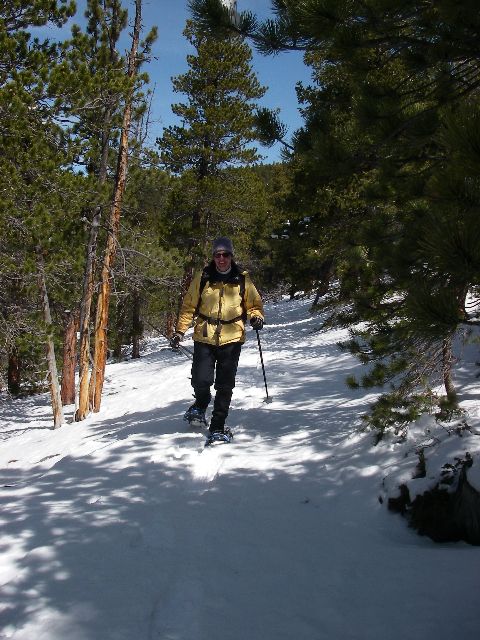
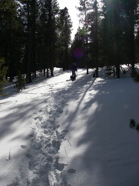
Anne Sheehan during a snow survey

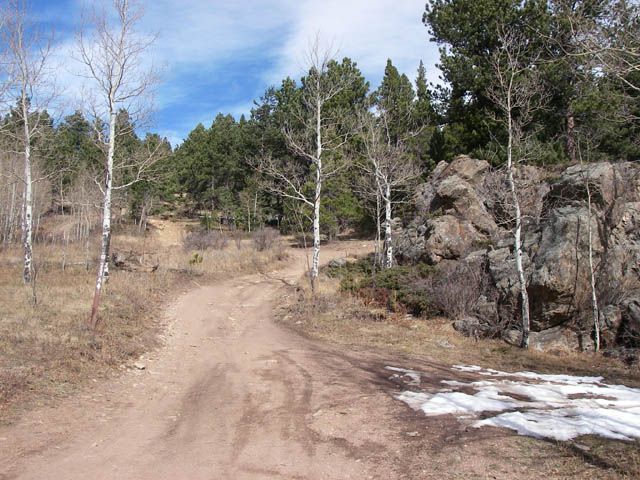
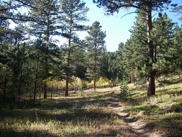
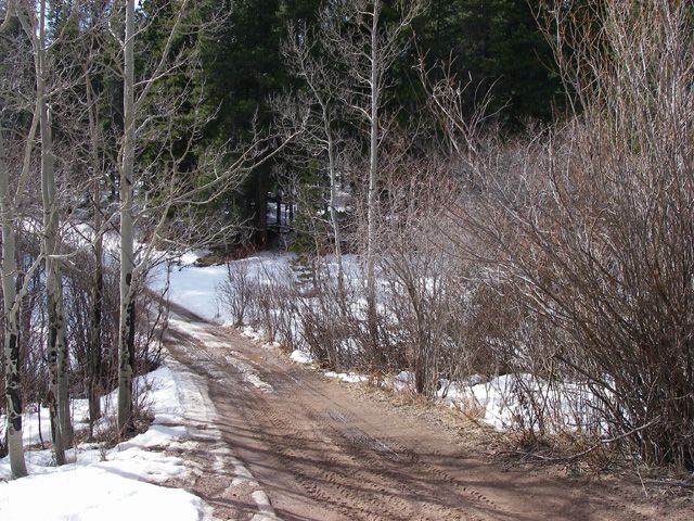
Two track road to Gordon Gulch

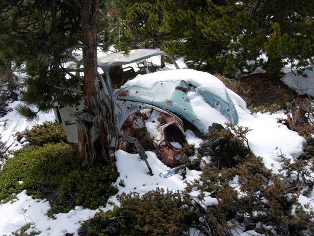
Human impacts

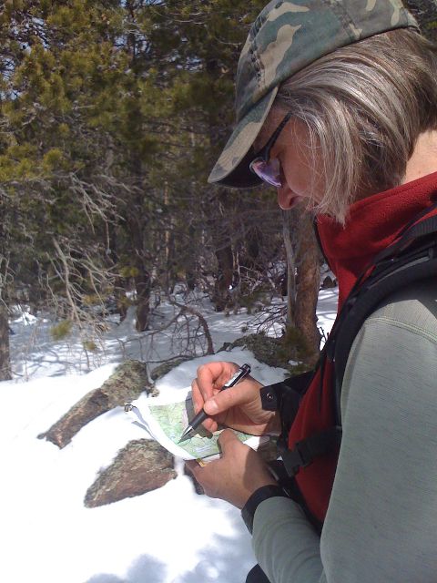
Suzanne Anderson

Sun through the trees

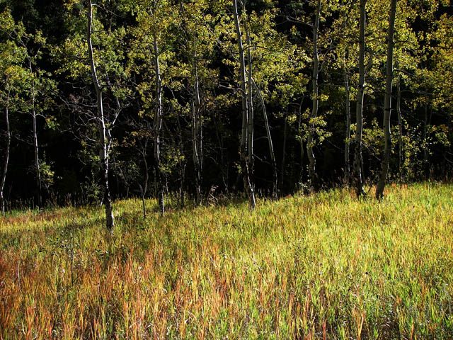
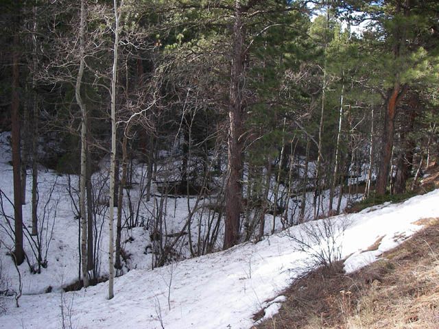
Aspens In Gordon Gulch

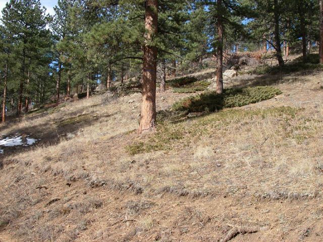
Gordon Gulch

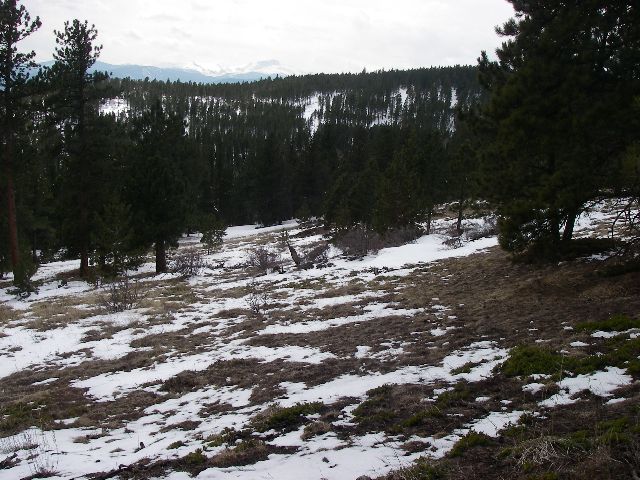
relatively shallow relief of Gordon Gulch

South facing slope

Aspens around the stream bed

Two track path around Gordon Gulch
20 km west of Boulder, 2630 m elevation
The low-relief forested Gordon Gulch was affected by periglacial processes. Part of the Arapahoe National Forest and is divided into Lower and Upper Gordon Gulch.MORE ABOUT GORDON GULCH
All Photos are property and © copyright of the Boulder Creek CZO unless otherwise Noted
-
Partner Organizations
-
Geology
- igneous-felsic extrusive
- igneous-felsic intrusive
- igneous-ultramafic extrusive
Geologic map of Gordon Gulch (Gable, 1980)
Gordon Gulch lies within the upper montane forest, within the Rocky Mountain surface, an area of relatively low relief despite its altitude, and is underlain by Paleoproterozoic biotite gneiss. This site is underlain by biotite gneiss and is mostly forested. Unlike GLV, it is not affected by the Pleistocene Glaciers. It is characterized by the low-relief remnants of a dissected Tertiary erosion surface in which weathered rock profiles are up to 30 m thick. This dissected Tertiary erosion surface rises gently from 2500m to about 2750 m over distances of 10-20km.
The Rocky Mountain surface in the Colorado Front Range lies outside the limits of Pleistocene glaciers, and above canyons incised during the Quaternary by rivers draining eastward toward the Great Plains. This region has evolved without substantial tectonic perturbation since the end of the Laramide orogeny at approximately 50 Mya. The lack of rapid erosional perturbations and presence of some areas of hydrothermal alteration produce a landscape in which the depth to the weathering front averages ~8 m, and reaches up to 30 m, as determined from water well drilling records and sparse road-cuts
-
Topography
2446 - 2737 m elevation (2650 m mean)
Gordon Gulch is aligned east–west, and, therefore has north- facing and south-facing slopes with differing energy balances, vegetation, and depth to fresh rock . A snowpack develops on north-facing slopes each winter, but winter snowcover is patchy in both time and space on south-facing slopes. The north-facing slopes are dominated by Pinus contorta (lodgepole pine), which grows in dense stands with little to no understory, while south-facing slopes are dominated by Pinus ponderosa (ponderosa pine) wood- lands, with widely spaced trees and grass-herbaceous understory. Tors mark the topography on both slopes, although a greater number occur on south-facing slopes
In a series of nine soil pits dug through the mobile regolith and into the underlying saprolite, the average depth of mobile regolith was greater on sites on north-facing slopes (50–75cm vs. 20– 70 cm). The hand excavations of saprolite extended to greater depths on north-facing slopes as well (30–65 cm vs. 20–45 cm), owing to material that was easier to dig through on north-facing slopes, giving a qualitative sense of more weathered saprolite on north-facing slopes. Shallow seismic refraction surveys rein- force this impression: depth to seismic velocities of >3500 m/s characteristic of fresh crystalline rock were on average 15 m on north-facing slopes and 5–10 m on south-facing slopes in catch- ment-crossing transects.
-
Climate
5.1 °C Mean Annual Temp 16 °C Mean Warmest Month -4 °C Mean Coldest Month 519 mm Mean Annual Precipitation 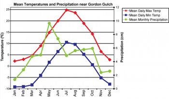
Mean temperatures and precipitation are based on meteorological data collected from 1950-1970 at Sugarloaf (2591m) (Barry, 1973).
Gordon Gulch is within the montane climatic zone. The maximum precipitation is received around May, with a minimum in the winters. Gordon Gulch is within the montane climatic zone. The maximum precipitation is received around May, with a minimum in the winters. The forests on the north-facing slopes are generally more lush. The south-facing slopes have fewer trees and more undergrowths.
-
Ecosystems
The forests on the north-facing slopes are generally more lush. The south-facing slopes have fewer trees and more undergrowths.
Explore Further
