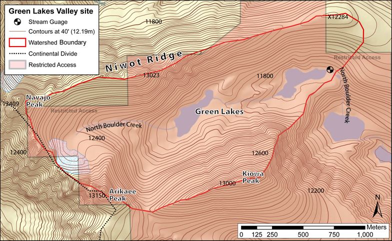
Green Lakes Valley
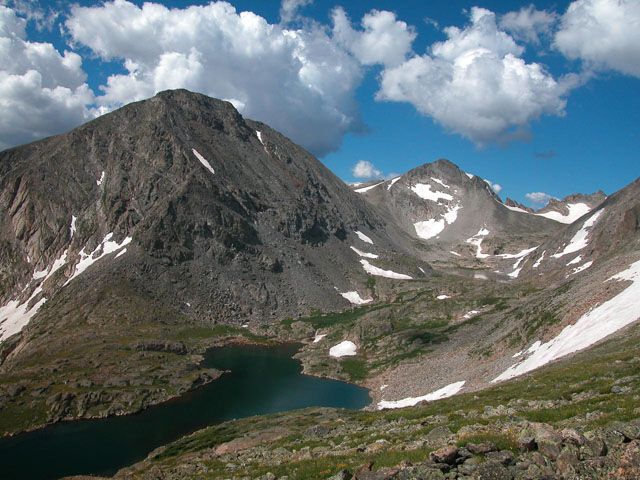
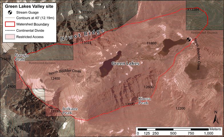
"Green Lakes Valley (GLV) is located in the upper catchment of Boulder Creek (above 3200m) and lies within the City of Boulder Watershed. GLV is part of the Niwot Ridge Long Term Ecological Research (LTER), where snow studies, geomorphic processes and hydrologic research had been conducted since 1981"
2.32 km2 Area
3567 - 4024 m Elev
-3.7 °C Temp
1214 mm Precip
Parent Field Area:
Boulder Creek Watershed ▲
© William Bowman
Lithology
metasediments
-
Setting & Research
Area: 2.3233 km2
Minimum Elevation: 3567m
Maximum Elevation: 4024m
Average Elevation: 3745mGreen Lakes Valley (GLV) is located in the upper catchment of Boulder Creek (above 3200m) and lies within the City of Boulder Watershed. GLV is part of the Niwot Ridge Long Term Ecological Research (LTER), where snow studies, geomorphic processes and hydrologic research had been conducted since 1981.
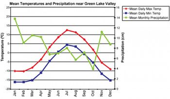
Mean temperatures and precipitation are based on meteorological data collected from 1950-1970 at Niwot Ridge (3750m) (Barry, 1973).
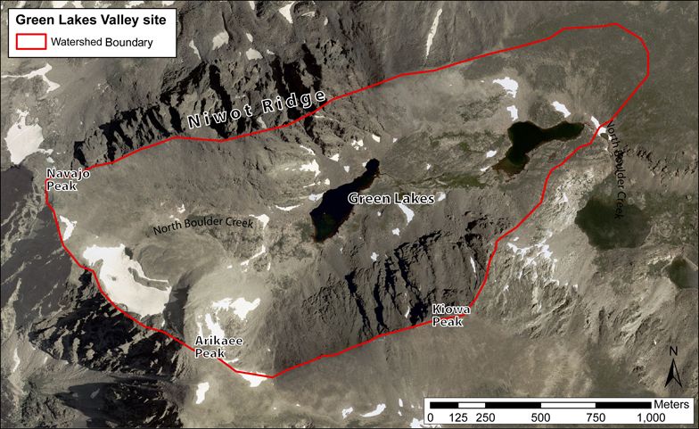
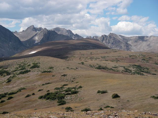
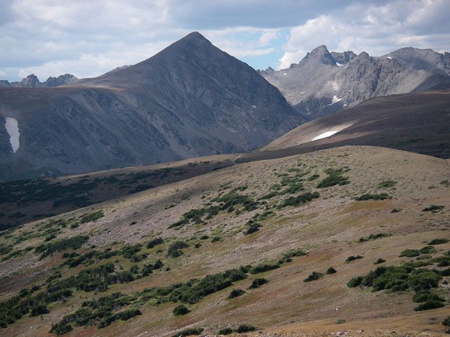
The site receives about 1000mm of precipitation, with 80% occurring as snow (Caine, 1996). GLV consists of two distinct basins, separated by a 90m glaciated valley-step. The upper basin is mostly alpine tundra environment, with 29% covered by vegetated soils. It has mostly steep rock walls and talus slopes and permanent snowfields. The Arikaree Glacier sits in the head of the valley and is the source of North Boulder Creek. The lower GLV has less exposed bedrock, fewer talus slopes, more extensive soil and vegetation cover.
Based on meteorological data collected on the ridge top of GLV, the mean average temperature is -3.70C. The valley floor is less windy and exposed with more snow accumulation compared to the surrounding ridges. Also, it was last scoured by glaciers about 18000 years ago and subsequently has an immature and truncated Critical Zone.
Mean temperatures and precipitation are based on meteorological data collected from 1950-1970 at Niwot Ridge (3750m) (Barry, 1973).
-
Overview Maps
Map Overlays
-
zkxjcblZHvl nfhgf hff rhhfhyr
-
hrgbyarg
-
wuieynN SIUFSAYG
-
-
Dynamic Map
To fully zoom into a small area, you may need to visit the "Map" button and uncheck "Terrain" view.
-
Data
All Time lapse Cameras - Photographic Imagery - Betasso, Gordon Gulch, Green Lakes Valley (2009-2018)
1 components • Betasso, Gordon Gulch, Green Lakes Valley • Data Management / CyberInfrastructure • Suzanne Anderson; Bob Anderson; Dillon RagarBetasso - Photographic Imagery - (BT_Camera_Array) (2014-2016)
1 components • Betasso, Gordon Gulch, Green Lakes Valley • Data Management / CyberInfrastructure • Bob Anderson; Suzanne Anderson; Nathan RockGordon Gulch - Photographic Imagery - (GG_Camera_Array) (2009-2016)
1 components • Gordon Gulch, Betasso, Green Lakes Valley • Data Management / CyberInfrastructure • Bob Anderson; Suzanne Anderson; Dillon RagarGreen Lakes Valley - Climate, Meteorology (1986-2006)
2 components • Green Lakes Valley • Climatology / Meteorology • Mark LoslebenGreen Lakes Valley - Land Cover (2008)
2 components • Green Lakes Valley • Biology / Ecology • Eric ParrishGreen Lakes Valley - Soil Temperature, Soil Moisture - (GLV_Catena_1-5_Array) (2009-2018)
2 components • Green Lakes Valley • Soil Science / Pedology • Suzanne Anderson; Dillon RagarGreen Lakes Valley - Stream Water Chemistry - (data from Niwot Ridge LTER) (1985-2011)
3 components • Green Lakes Valley • Water Chemistry • Niwot Ridge LTERGreen Lakes Valley - Geophysics - Shallow Seismic Refraction, Electrical Resistivity (2009)
1 components • Green Lakes Valley • Geophysics • Kevin Befus; Matthais LeopoldGreen Lakes Valley - Photographic Imagery - (GLV_Camera) (2008-2016)
1 components • Green Lakes Valley, Betasso, Gordon Gulch • Data Management / CyberInfrastructure • Bob Anderson; Suzanne Anderson; Dillon Ragar -
Photos
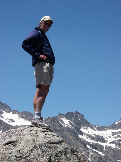
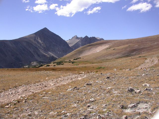
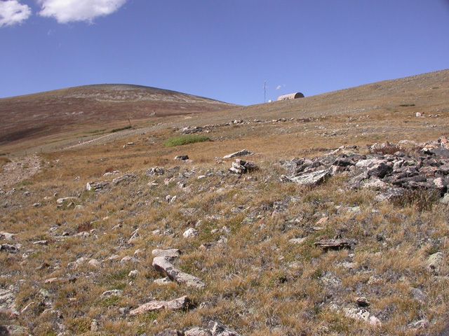
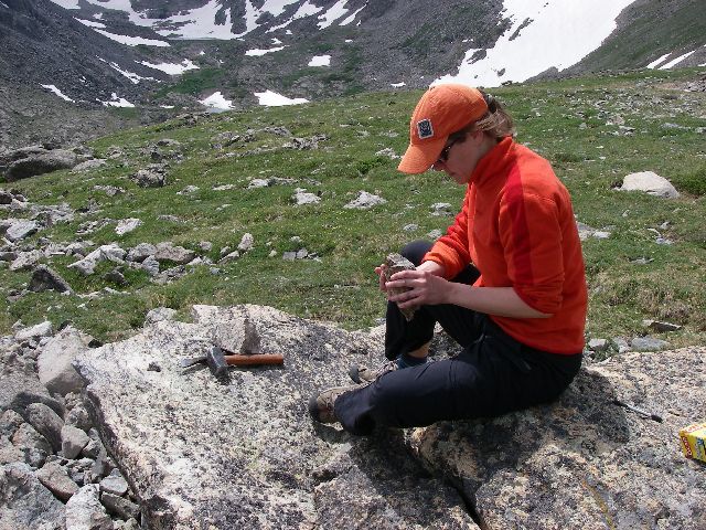
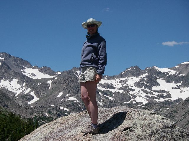
Green Lakes Valley

Robert Anderson

Niwot ridge tundra lab panorama part 1

Niwot ridge tundra lab panorama part 2

Green Lakes Valley photo © William Bowman

Niwot ridge panorama part 1

Niwot ridge panorama part 2

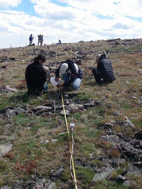
Seismic survey

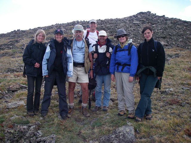
Group shot

Miriam Dühnforth

Suzanne Anderson
40 km west of Boulder, 3750 m elevation.
Green Lakes Valley is the highest elevation field area of any U.S. Critical Zone Observatory.MORE ABOUT GREEN LAKES VALLEY
All Photos are property and © copyright of the Boulder Creek CZO unless otherwise Noted
-
Partner Organizations


-
Geology
- metasediments
The bedrock of the upper Greens Lakes Valley is primarily composed of Precambrian schists and gneisses, the Silver Plume quartz monzonite, and Audubon-Albion stock [Wallace, 1967]. In the region, the Precambrian gneisses are quite variable in composition and include cordierite- and magnetite-bearing-silliminite-biotite, biotite-quartz-plagioclase, and hornblende gneisses and migmatites. Exposed on the north slope of Kiowa Peak, above RG5, are cordierite- and magnetite-bearing-silliminite-biotite gneisses.
Above Green Lake 5 and extending to the Continental Divide, the Silver Plume quartz monzonite is a light to pinkish gray, coarse-grained, equigranular to porphyritic rock with distinctive white orthoclase phenocrysts up to several cm in length and etched into high relief on weathered surfaces [White, 1981]. Silver Plume quartz monzonite is variable in composition but in general is comprised of microcline, quartz, and feldspar with lesser amounts of biotite and muscovite [Gamble, 1976]. The Audubon-Albion stock, exposed along the north side of Green Lake 5 and extending to the high point of Niwot Ridge, is monzonitic to quartz monzonitic in composition, dark-gray in color, and medium-grained texture consisting of plagioclase, hornblende, pyroxene, quartz, and minor biotite. A fault runs south from the Audubon-Albion stock on Niwot Ridge through GL5 and along the north slope of Kiowa Peak, through and above RG5.
The rocks exposed on the surface of RG5 are angular to subangular, variable in size from cobbles to boulders, and primarily gneissic with minor schistose layers. Gneisses exposed along the active front contain layers that have been propylitically altered and are primarily composed of epidote with minor chlorite, calcite, and pyrite. The origin of the hydrothermal fluids that caused this alteration is unclear, but the rock glacier is located at the edge of the Lake Albion mining district. Within a kilometer of RG5, the Snow Range vein produced lead, gold, and silver in the early 1900s. Alternatively, the fault that projects under the rock glacier may have been a channel for these fluids, or this mineral assemblage could result from a low grade metamorphic overprinting from the intrusion of the Audubon-Albion stock.
-
Climate
-3.7 °C Mean Annual Temp 8 °C Mean Warmest Month -13 °C Mean Coldest Month 1214 mm Mean Annual Precipitation Based on meteorological data collected on the ridge top of GLV, the mean average temperature is -3.70C. The valley floor is less windy and exposed with more snow accumulation compared to the surrounding ridges. The site receives about 1000mm of precipitation, with 80% occurring as snow (Caine, 1996).
-
Soil
GLV consists of two distinct basins, separated by a 90m glaciated valley-step. The upper basin is mostly alpine tundra environment, with 29% covered by vegetated soils. It has mostly steep rock walls and talus slopes and permanent snowfields. The Arikaree Glacier sits in the head of the valley and is the source of North Boulder Creek. The lower GLV has less exposed bedrock, fewer talus slopes, more extensive soil and vegetation cover.
-
Human Impacts
Green Lakes Valley is a municipal water source for the city of Boulder and is designated as a UNESCO
Biosphere Reserve. Public access has been restricted since the 1950‘s, leaving the watershed
relatively undisturbed. The northern drainage divide is Niwot Ridge, a Long-Term Ecological
Research (LTER) area and National Atmospheric Deposition Program (NADP) site where a
variety of environmental studies have been conducted since the early 1950‘s. The continental,
high-mountain climate of Green Lakes Valley has been recorded continuously at the D1 6
meteorological station on Niwot Ridge for over 50 years and for shorter periods on
the valley floor.
Explore Further
