Betasso
"The Betasso site is situated in the lower Boulder Canyon, just 6 miles west of City of Boulder.
0.45 km2 Area
1810 - 2024 m Elev
12.3 °C Temp
563 mm Precip
Parent Field Area:
Boulder Creek Watershed ▲
Betasso
-
Setting & Research
Area: 0.45 km2
Minimum Elevation: 1810m
Maximum Elevation: 2024m
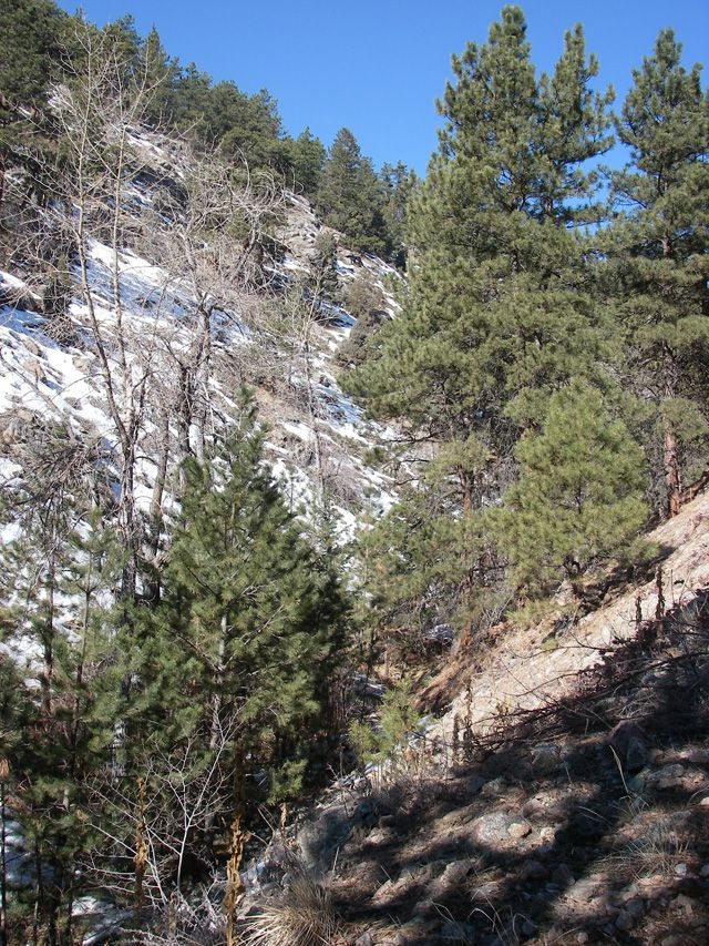
Average Elevation: 1934mThe Betasso sit e is situated in the lower Boulder Canyon, just 6 miles west of City of Boulder. It consists of a cutoff that is a steep ephemeral gully stretching from Boulder Canyon into Betasso Preserve (a Boulder County Open Space Park). At the lower Boulder Canyon, renewed bedrock channel incision over the last 5 million years has progress headward from the plains, cutting deeply into the post-Laramide surface. This results in steep slopes and deep canyons in front range.
Betasso is in the foothills climatic zone. Maximum precipitation occurs in the month of May. The area is a mix of steep forested slopes with several intermittent streams, and sloping meadows, sub-summits, and rock outcrops. The south facing slopes are primarily warmer with Ponderosa Pine stands. The cooler north-facing slopes are a Ponderosa Pine-Douglas fir mix. The Boulder Filtration Plant is located just outside the Betasso Preserve. In February of 2009, a met station was installed near the filtration plant.
Mean temperatures and precipitation are based on meteorological data collected from 1950-1970 at Ponderosa (2195m) (Barry, 1973).
-
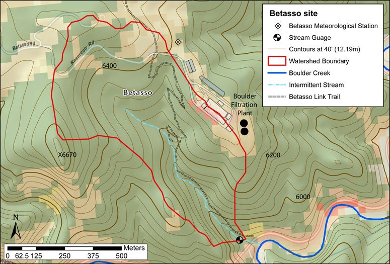
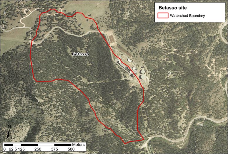
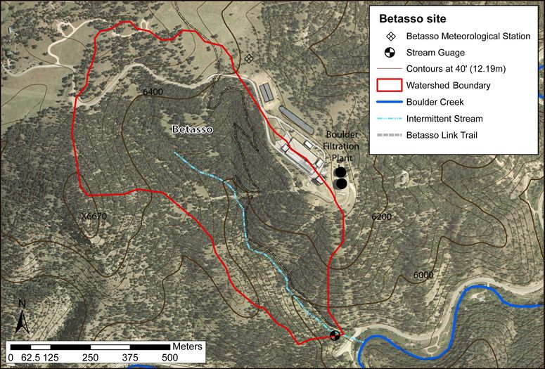
Overview Maps
Map Overlays
-
-
Dynamic Map
To fully zoom into a small area, you may need to visit the "Map" button and uncheck "Terrain" view.
-
Data
All Time lapse Cameras - Photographic Imagery - Betasso, Gordon Gulch, Green Lakes Valley (2009-2018)
1 components • Betasso, Gordon Gulch, Green Lakes Valley • Data Management / CyberInfrastructure • Suzanne Anderson; Bob Anderson; Dillon RagarBetasso - Air Temperature, Climate, Meteorology - LIVE Betasso Meteorological Data (BT_Met) (2009-2017)
1 components • Betasso • Climatology / Meteorology • Dillon RagarBetasso - Groundwater Chemistry - (BT_GW_1) (2013-2017)
2 components • Betasso • Water Chemistry • Suzanne Anderson; Dillon RagarBetasso - Land Cover (2008)
2 components • Betasso • Biology / Ecology • Eric ParrishBetasso - Meteorology, Air Temperature - (BT_Met) (2009-2019)
2 components • Betasso • Climatology / Meteorology • Suzanne Anderson; Nathan Rock; Dillon RagarBetasso - Snow Depth, Air Temperature - Judd Snow Sensors (BT_Gully_SD_1-5_Array) (2010-2017)
2 components • Betasso • Climatology / Meteorology, Hydrology • Suzanne Anderson; Noah Molotch; Nathan RockBetasso - Snow Pits - Snow Pit Density & Stratigraphy (BT_SN) (2011-2014)
4 components • Betasso • Hydrology • Suzanne Anderson; Dillon RagarBetasso - Soil Moisture, Water Potential - Gully Site, Soil Pit (BT_Gully_SLmstWRPtn) (2010-2019)
2 components • Betasso • Soil Science / Pedology • Suzanne Anderson; Dillon RagarBetasso - Soil Moisture, Water Potential - BT_Borrow_SLmstWRPtn (2010-2019)
2 components • Betasso • Soil Science / Pedology • Suzanne Anderson; Dillon RagarBetasso - Streamflow / Discharge - Manual (BT_SW_0_ManDis) (2013-2017)
2 components • Betasso • Hydrology • Suzanne Anderson; Dillon RagarBetasso - Well Water Levels - (BT_GW_1_Pducer) (2013-2018)
2 components • Betasso • Hydrology • Suzanne Anderson; Dillon RagarBetasso - Geophysics - Shallow Seismic Refraction, Electrical Resistivity (2009-2012)
1 components • Betasso • Geophysics • Kevin Befus; Matthais LeopoldBetasso - Surface Water Chemistry - (BT_SW_0) (2008-2017)
2 components • Betasso • Water Chemistry • Suzanne AndersonBetasso - Topographic Carbon Storage, GIS/Map Data, LiDAR, Land Cover (2010)
2 components • Betasso • GIS / Remote Sensing, Biology / Ecology, Geomorphology, Hydrology • Tyson Lee Swetnam; Paul Brooks; Holly Barnard; Adrian Harpold; Erika GalloBetasso - Photographic Imagery - (BT_Camera_Array) (2014-2016)
1 components • Betasso, Gordon Gulch, Green Lakes Valley • Data Management / CyberInfrastructure • Bob Anderson; Suzanne Anderson; Nathan RockBetasso & Gordon Gulch - Precipitation - Water Chemistry (BT-GGU_P_Canopy-Open) (2011-2016)
2 components • Betasso, Gordon Gulch • Water Chemistry • Suzanne Anderson; Clayton JensenBetasso & Gordon Gulch - Soil Respiration - (BT-GG_Flux_Array) (2012-2013)
2 components • Betasso, Gordon Gulch • Soil Science / Pedology • Holly Barnard; Erin BerrymanBoulder Creek CZO - Stream Water Chemistry, Surface Water Chemistry - (Isaac Bukoski Thesis) (2018)
1 components • Gordon Gulch, Betasso, Boulder Creek Watershed • Water Chemistry • Isaac BukoskiGordon Gulch - Photographic Imagery - (GG_Camera_Array) (2009-2016)
1 components • Gordon Gulch, Betasso, Green Lakes Valley • Data Management / CyberInfrastructure • Bob Anderson; Suzanne Anderson; Dillon RagarGreen Lakes Valley - Photographic Imagery - (GLV_Camera) (2008-2016)
1 components • Green Lakes Valley, Betasso, Gordon Gulch • Data Management / CyberInfrastructure • Bob Anderson; Suzanne Anderson; Dillon RagarNational - Stream Water Chemistry - Cations, Anions, Metals (1982-2015)
1 components • Bisley, Betasso, East Peak, Marshall Gulch (High-Elevation), Providence Creek Subcatchment P301, Providence Creek Subcatchment P303, Providence Creek Subcatchment P304, Eel River Watershed, Puente Roto, Rio Blanco, Rio Icacos, Susquehanna Shale Hills Critical Zone Observatory • Biogeochemistry, Biology / Ecology, Hydrology, Water Chemistry • Hyojin, Kim; Bishop, Jim; Dietrich, William; Fung, Inez; McDowell, William H.; Brantley, Susan L.; Hoagland, Beth; Sullivan, Pamela L.; Cain, Molly; Neal, Andrew; Fisher, Jessica; Russo, Tess; Niwot Ridge LTER; Liu, Fengjing; Chorover, Jon; Troch, Peter; McIntosh, Jennifer; Brooks, Paul; Abramson, Nate; Heidbuechel, Ingo; Amistadi, Mary Key; Alexander Pedron, Shawn; Chorover, Jon; Troch, Peter; Corley, Timothy; Zapata-Rios, Xavier; Losleben, Mark; Condon, Katherine -
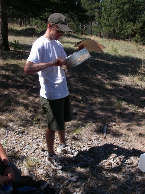
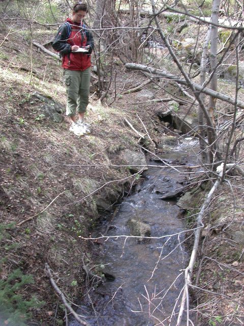
Photos
Betasso

Cameron Wobus

Cary Kandel

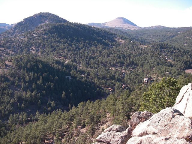
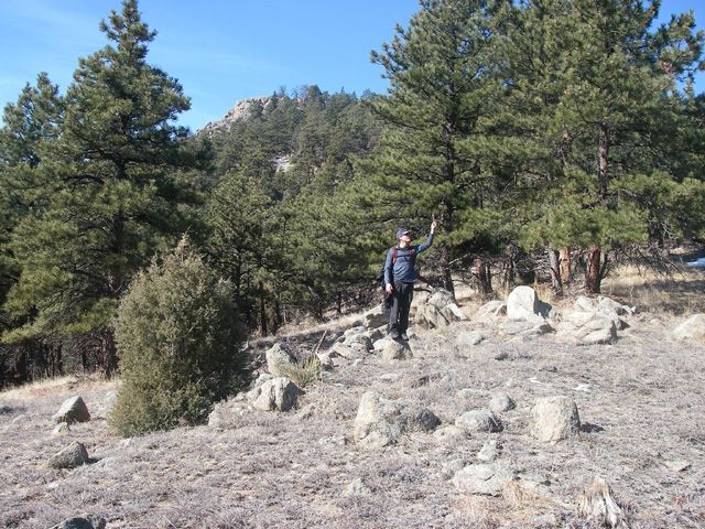
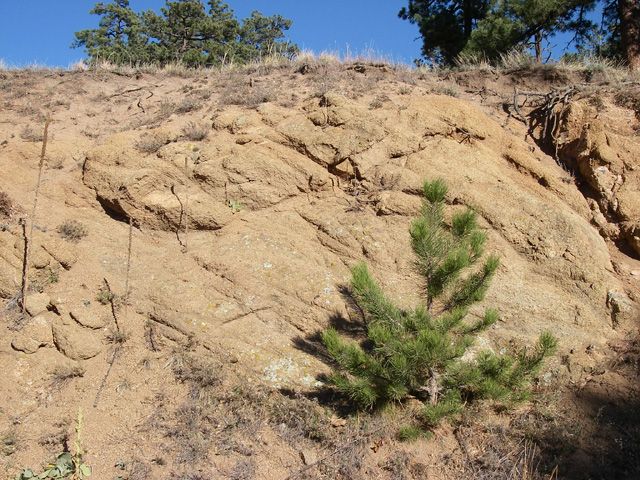
Betasso terrain

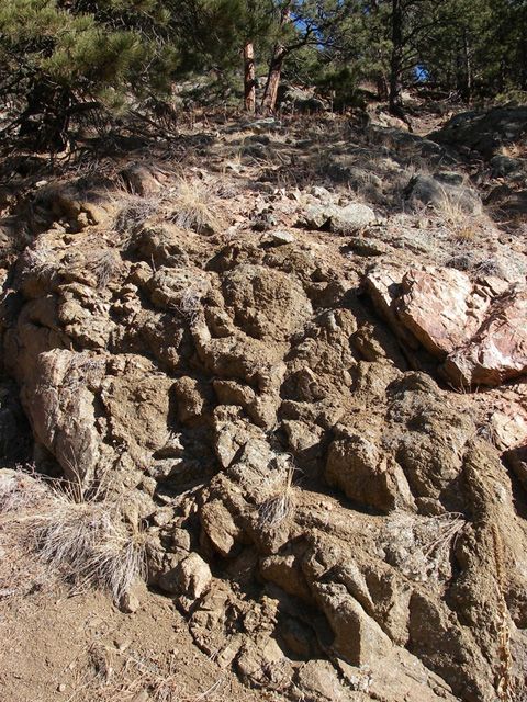
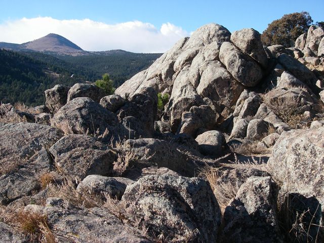
Boulder Creek Granodiorite (Paleoproterozoic)

Zan Frederick

Betasso

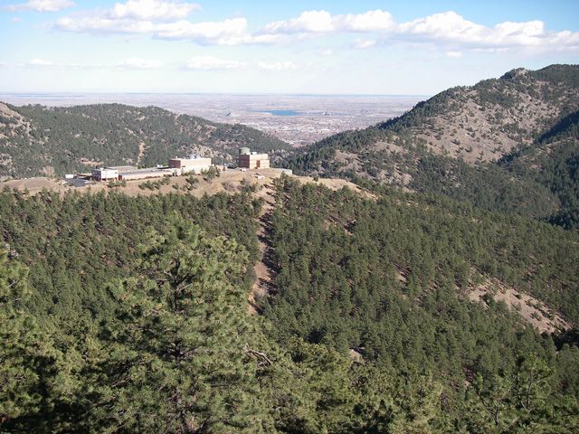
The Boulder Filtration Plant is located just outside the Betasso Preserve.

View towards Boulder

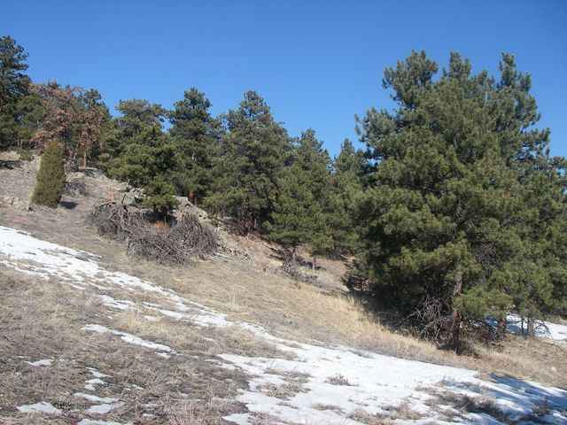
Betasso views

Betasso views

Errosion of the Boulder creek granodiorite
_pete_joergIMGP0003_76_76_80auto_s_c1.jpg)
Juliane Huber, Pete Joerg
Betasso is located 10 km west of Boulder at 1930 m elevation. The steep Betasso catchment is influenced by incision of adjacent Boulder Creek. All photos are property and © copyright of the Boulder Creek CZO unless otherwise noted.
-
Partner Organizations


_pete_joergIMGP0003_640_480_80auto.jpg)
-
Climate
12.3 °C Mean Annual Temp 19 °C Mean Warmest Month 563 mm Mean Annual Precipitation 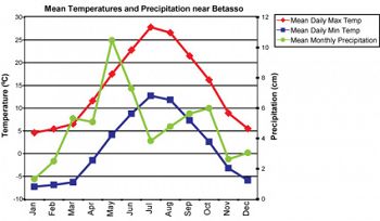
Mean temperatures and precipitation are based on meteorological data collected from 1950-1970 at Ponderosa (2195m) (Barry, 1973).
Betasso is in the foothills climatic zone. lMaximum precipitation occurs in the month of May and about 32% of the precipitation occurs as snow (Cowie, 2010). The area is a mix of steep forested slopes with several intermittent streams, and sloping meadows, sub-summits, and rock outcrops. The south facing slopes are primarily warmer with Ponderosa Pine stands. The cooler north-facing slopes are a Ponderosa Pine-Douglas fir mix. The Boulder Filtration Plant is located just outside the Betasso Preserve. In February of 2009, a met station was installed near the filtration plant.
-
Ecosystems
The area is a mix of steep forested slopes with several intermittent streams, and sloping meadows, sub-summits, and rock outcrops. The south facing slopes are primarily warmer with Ponderosa Pine stands. The cooler north-facing slopes are a Ponderosa Pine-Douglas fir mix.

Explore Further
