Sample Collection Resources
The Boulder Creek Critical Zone Observatory (BCCZO) regularly collects soil, water, and rock samples from within the Boulder Creek watershed.
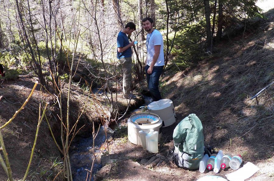
Andy Safulko and Jacob Coate collect water samples from the automated water sampler at GGU_SW_0.
Water Chemistry Samples
Stream water, spring water, groundwater, soil pore water, precipitation (snow and rain) samples are collected regularly within the Boulder Creek CZO. These samples are analyzed for parameters such as pH, conductivity, alkalinity, anions, cations and stable isotopes by the CZO water lab, the LEGS lab at the University of Colorado as well as the Kiowa lab at INSTAAR. Snow samples are collected weekly along with snow pit characterization data when snow is present, usually from November until May. There are 75 soil lysismeters in the Lower Gordon Gulch watershed located in clusters at varying soil depths. Soil lysimeters have been sampled intensely during individual campaigns but sampling is not continuous. Six groundwater wells have been drilled in the upper Gordon Gulch watershed and groundwater chemistry samples are collected monthly from the wells using a Geotech bladder pump sampling system as well as continuous water table measurements in 3 of the wells representing the North and South facing aspects as well as the valley floor. These samples are analyzed for the same suite of parameters as surface water with the exception of Chlorophyl A.
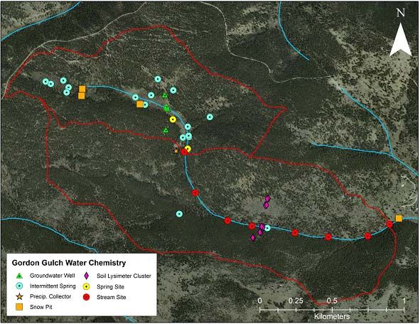
Map of sampling points for Gordon Gulch for water chemistry.

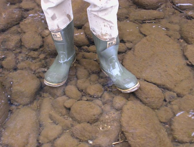
Undergraduate Field technicians Joel Jones samples Gordon Creek after a spring snowstorm.
Rock Cores
Rock core sections were obtained from 8 locations in Gordon Gulch using a Shaw portable back pack drill. These samples are analyzed by XRF (X-Ray Fluorescence and XRD (X-Ray powder Diffraction) at the USGS sediment analysis lab in Boulder for elemental, oxides and compounds.
In January 2013 BCCZO undertook a deep well drilling project on the ridge line in the Betasso watershed. Rock core was obtained when possible down to a depth of 121 meters. Before casing and instrumenting the borehole was analyzed with downhole profiling equipment to obtain a digital core log. Downhole analysis was performed by Kamini Singha and the Colorado School of Mines and included gamma and resistivity as well as a 3 arm caliper. Rock core has been analyzed for fracture spacing and density and is currently awaiting further characterization. Water table monitoring and chemical analyses are ongoing at this location.
Rock core extraction sites in Gordon Gulch
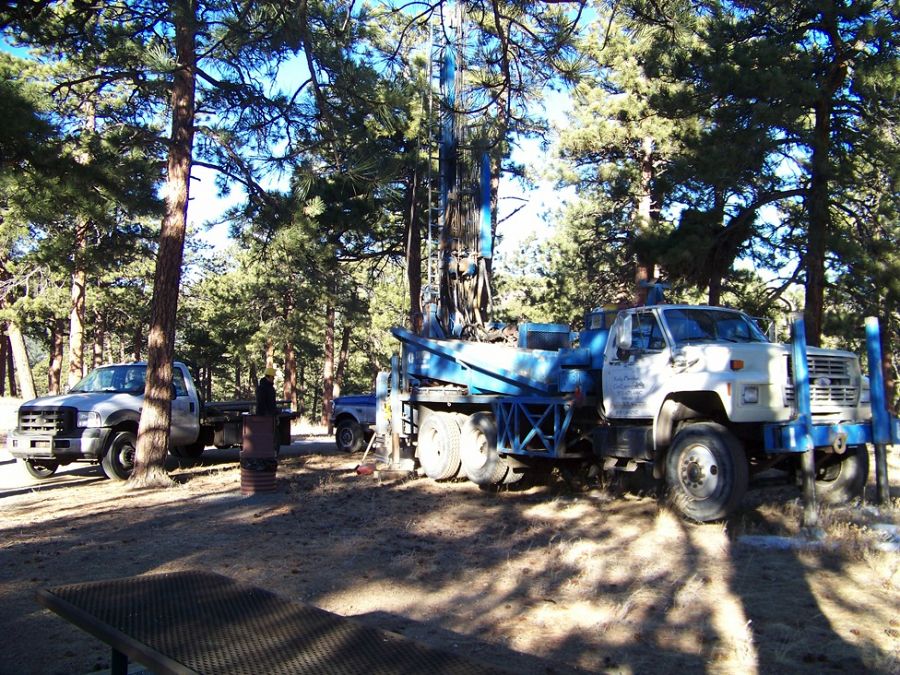
Deep well drilling rig at Betasso ridge
Soil Microbial Characterization
In a study conducted by Katherine Eilers (graduate student), distributions of Bacteria and Archaea were conducted within Upper and Lower Gordon Gulch. The purpose of this study is to discover how the distributions are related to slope aspect, vegetation type, and edaphic factors. Sampling was conducted along five transects approximately 200m, 400m or 600m in length in the two regions of the watershed with samples collected from twenty, regularly spaced points (10 m, 20 m, or 30 m apart) along each transect. Each sample consisted of twenty, 0-5 cm cores, taken within a one meter radius, that were homogenized and sieved to 2 mm. Samples were then stored at 40C and split for analysis within two days of collection. Samples used for soil microbial community analysis were frozen at -800C until DNA was extracted.
In November of 2015 2 soil microbe transects were delineated and sampled by field technicians supervised by Paul Carini, Noah Fierer and Eve Lynn Hinckley. Sampling will continue for one year on an approximate 6-8 week interval.
The goals of this study are to:
- Determine whether there is a seasonal signal with individual microbial species on the opposing slopes of Gordon Gulch
- Identify specific taxa or environmental variables that are correlated through time, which might explain some of the observed seasonality or geochemistry.
![]()
Map of soil microbial transects in Gordon Gulch.
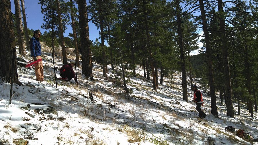
Noah fierer, Paul carini and Eve lynn Hinckley delineate soil transect on South facing slope in Gordon Gulch
Didymosphenia Geminata Studies Along Boulder Creek
In the recent years, particularly since the 2002 drought, the presence of Didymosphenia Geminata have significantly increased in Colorado mountain streams. Didymosphenia geminata is a nuisance algal species also known as "didymo" or "rock snot". Didymo can coat streambeds as a thick brown algal mat, with mats as thick as 1-2cm. A study was conducted along Boulder Creek from 2008-2010 to investigate factors affecting the removal of D. geminta. Samples of D. geminata were collected at various points Boulder Creek between June 2008 and September 2010. Metrics for measuring didymo growth includes Didymo Rating Index (DRI), ash-free-dry-mass(AFDM), chlorophyll concentration and didymo cell densities. Didymo Rating Index(DRI) is a qualitative way to gauge didymo growth. It ranges from 0, representing no obvious signs of didymo growth, to a maximum of 10, representing 100% coverage and mats greater than 5 cm thick. The maximum DRI for Boulder Creek was a 6 or 7 (100% coverage with a mat thickness of 1 to 2cm).
Didymosphenia Geminata aka "rock snot" covering the beds of Boulder Creek.
Rock core samples.
Undergraduate Field technicians Joel Jones samples Gordon Creek after a spring snowstorm.
Niwot Ridge Research Station in alpine setting.
Map of sampling points for Gordon Gulch for water chemistry.
Rock core extraction sites in Gordon Gulch
Map of soil microbial transects in Gordon Gulch.
Didymosphenia Geminata aka "rock snot" covering the beds of Boulder Creek.
Deep well drilling rig at Betasso ridge
Noah fierer, Paul carini and Eve lynn Hinckley delineate soil transect on South facing slope in Gordon Gulch
Explore Further
