Calhoun CZO Research Area 6

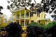
Research Area 6 is centered on the historic Rose Hill Plantation, home of South Carolina's secessionist governor William Henry Gist (1807-1874).
0.30 km2 Area
Parent Field Area:
Calhoun Critical Zone Observatory ▲
The home of William Henry Gist (1807-1874), the 68th governor of South Carolina, built circa 1840.
-
Setting & Research
Infrastructure in R6 so far includes two 15-m diameter vegetation plots, one in a hickory grove that was likely planted in the mid-1800s, one in a 70+ year old pine forest that covers a former cotton field. We plan to core all the trees in these plots to determine stand age. The research area includes all of Rose Hill Plantation State Historic Site (17.8 ha), part of the South Carolina State Parks system, as well as surrounding areas of the Sumter National Forest (12.1 ha).
-
Overview Maps
CCZO R6
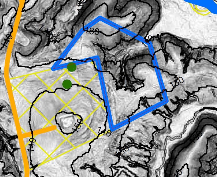
The blue polygon indicates areas of R6 in the Sumter National Forest. R6 also includes all of the Rose Hill Plantation State Historic Site (yellow crosshatch), which is centered on the plantation house atop the hill to the southwest of this polygon.
See full size (in new tab/window)
-
Dynamic Map
To fully zoom into a small area, you may need to visit the "Map" button and uncheck "Terrain" view.
-
Data
Calhoun CZO - Soil Geochemistry (2016)
1 components • Calhoun CZO Research Area 1, Calhoun CZO Research Area 2, Calhoun CZO Research Area 6, Calhoun CZO Research Area 7, Calhoun CZO Research Area 8 • Geochemistry / Mineralogy • Austin, Jason C.; Schroeder, Paul A. -
Partner Organizations
Explore Further
