Calhoun CZO Research Area 5
Calhoun Research Area 5, located at the corner of Old Buncombe and Sardis Roads, includes adjacent pine and hardwood stands.
Parent Field Area:
Calhoun Critical Zone Observatory ▲
Research Area 5
-
Setting & Research
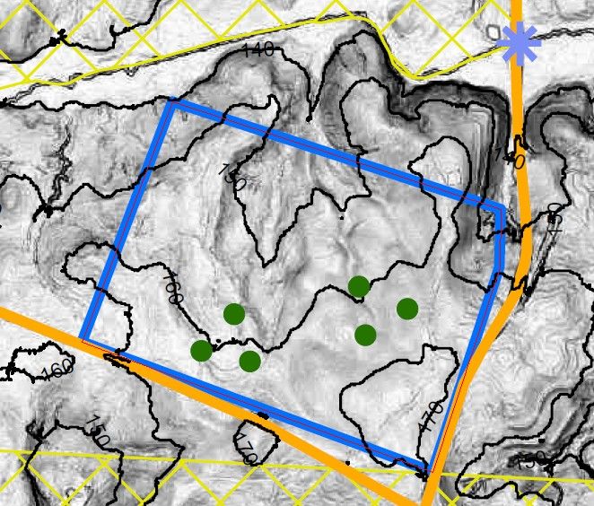
Research area 5 includes 6 15-m diameter vegetation plots, where all the trees have been identified and measured (diameter at breast height, height) and also cored in order to determine stand age. Three of the plots are in the pine stand, three in the hardwood stand. Two pine and two hardwood plots have litter baskets with monthly collection.
-
Overview Maps
Map Overlays
-
-
Dynamic Map
To fully zoom into a small area, you may need to visit the "Map" button and uncheck "Terrain" view.
-
Data
Calhoun CZO - Vegetation - Litterfall (2014-2017)
1 components • Calhoun CZO Research Area 1, Calhoun CZO Research Area 2, Calhoun CZO Research Area 3, Calhoun CZO Research Area 4, Calhoun CZO Research Area 5 • Biology / Ecology • Cook, Charles W.; O'Neill, K. P.; Richter, Daniel deB.

Explore Further
