Research at the Southern Sierra Critical Zone Observatory utilizes multi-disciplinary expertise to advance our understanding of water balance, nutrient cycling, and critical zone formation. Below are some examples of the integrated, tightly-linked research currently being conducted at the Southern Sierra Critical Zone Observatory. To learn about our Observatory's broader research goals and framework, please read our research overview page.
Core Observatory measurements, data management and integration
Bales, Conklin, Stacy, Meng, Gilmore
CROSS-CZO
The field areas of the Southern Sierra Critical Zone Observatory are bases for measuring water, soil, and nutrient fluxes across an elevation transect on the west slope of the southern Sierra Nevada. Intesive monitoring serves as a foundation for related projects such as eddy co-variance flux measurements, soil and regolith investigations, and remote sensing endeavors. Measurements of water, soil, and energy balances in selected watershed catchments, along with data and information management for these core measurements, provide a framework for other projects. We also support cross-CZO studies by using common measurements across the network of Critical Zone Observatories.
Connections between above-ground and below-ground critical zone processes at tree-slope scale
Hartsough, Safeeq
Understanding where water supply for an ecosystem goes and how it is replenished is vital, especially during times of drought. We are investigating the amount of water that can be stored in weathered material in the subsurface, as well as the location of tree roots and their ability to access moisture. Data for this project are collected through Critical Zone Trees and input in relevant models to test the coupling of lower atmosphere boundary conditions (evapotranspiration) and tree canopy measurements (canopy water potential, tree stem sap flow) with relevant subsurface hydrological processes (depth to bedrock, deep vadose zone, lateral flow).
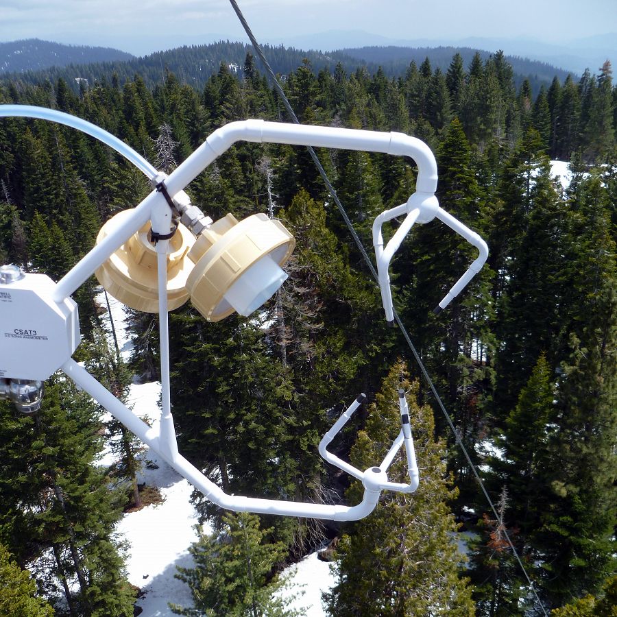
Balance of land-vegetation-atmosphere water use interactions in a drought
Goulden, Bales, Safeeq, McCormick, Stacy
Due to the California drought, millions of trees have died from water stress and insect infestation. Changing temperatures and precipitation patterns, combined with this tree mortality, are predicted to change vegetation species and abundance found at particular elevations. Higher elevations may support more forested ecosystems, and forest ecosystems may shift to chapparal at lower elevations. Eddy-covariance water vapor and carbon dioxide fluxes can help us understand how these changes affect ecosystem productivity and water use. Four eddy-covariance flux towers located at distinct elevations across a 2300-m elevational transect are part of the backbone of our research sites. Flux measurements from the towers are being used to evaluate ecosystem productivity and water use at scales from grove to landscape to build our understanding of land-vegetation-atmosphere connections.
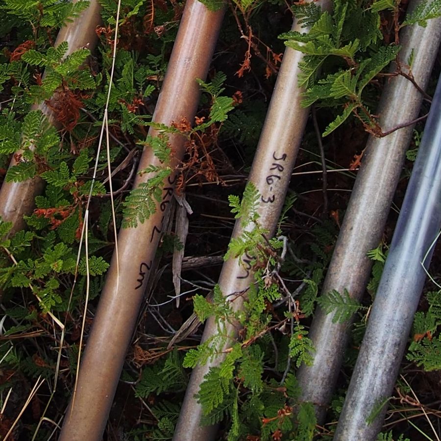
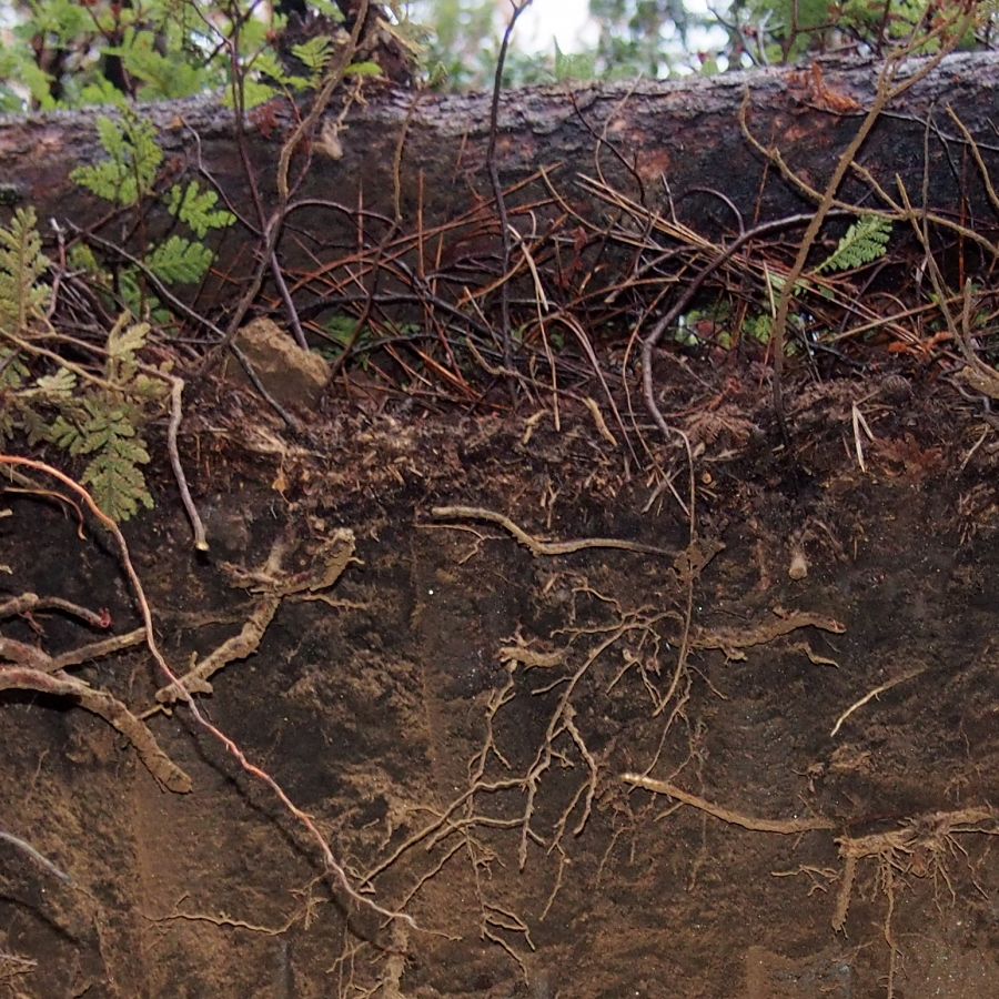
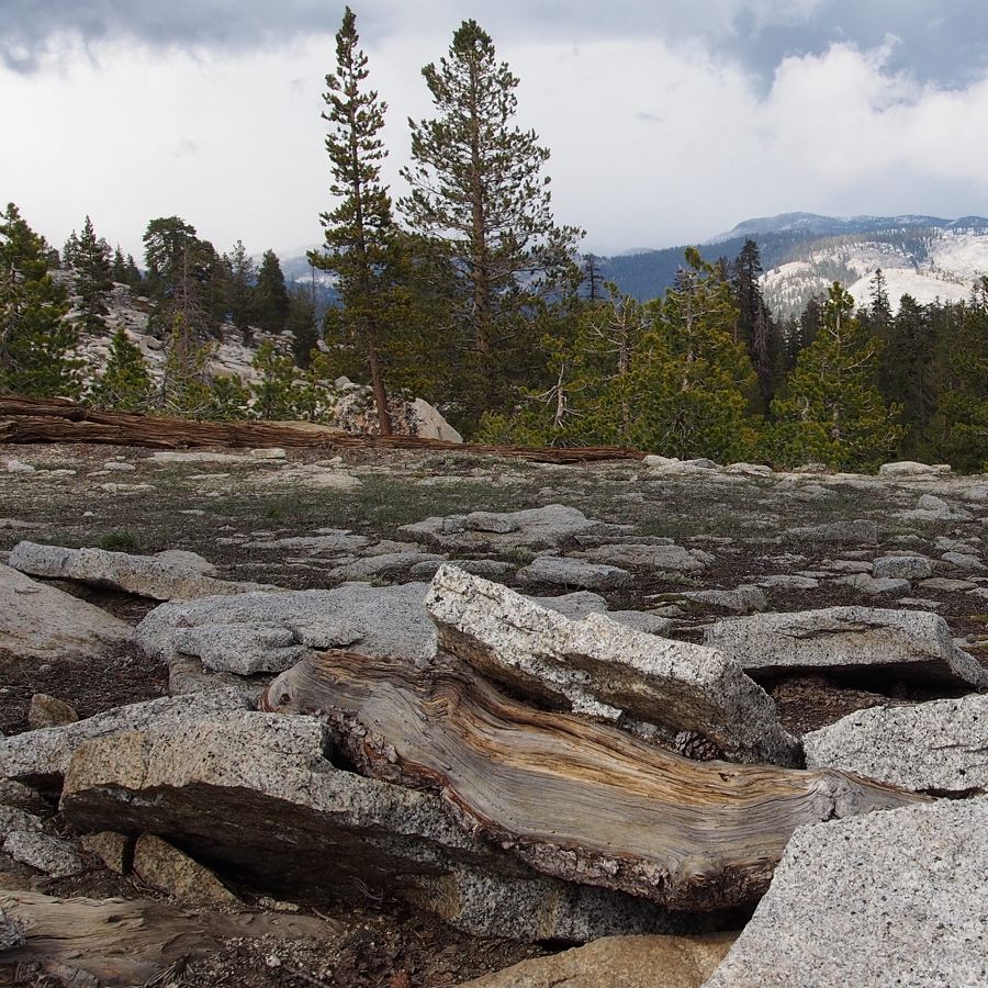
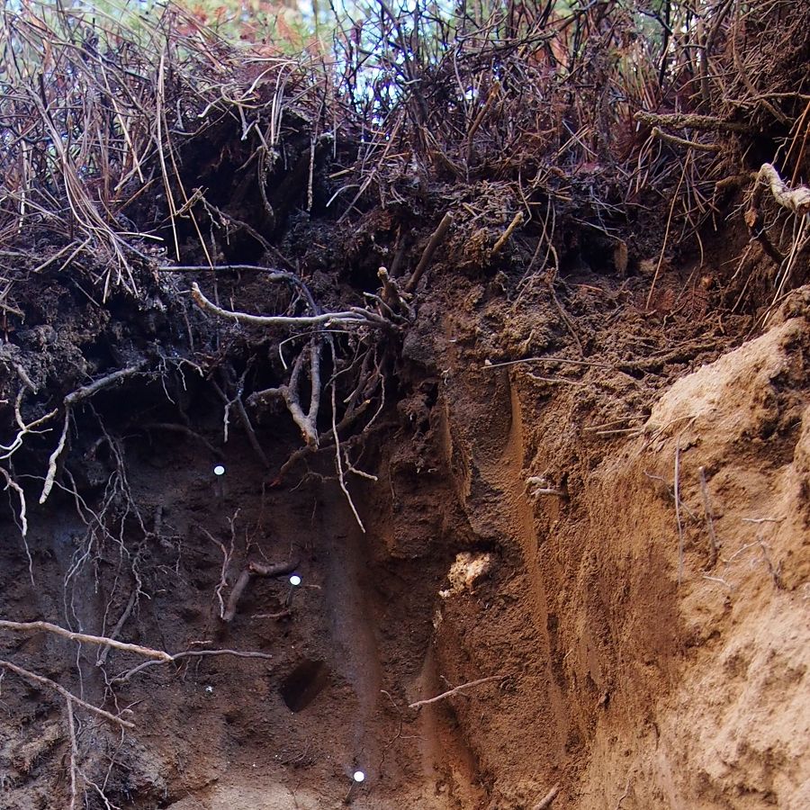
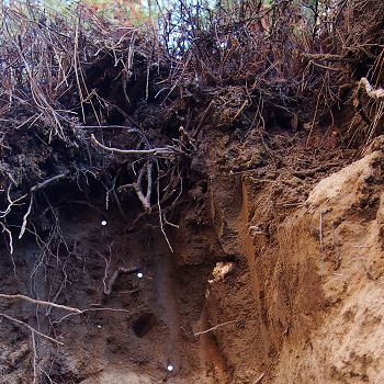
Deep soil and regolith characterization across an elevational transect
O'Geen, Hart, Berhe, Riebe, Goulden, Hayes, Hartsough, Holbrook, Barnes, Dove, Ferrell, Moreland, Zhiyuan
CROSS-CZO
Deep soil and regolith are vital subsurface reservoirs of nutrients and water in montane ecosystems. Understanding the stocks and fluxes of these materials in the critical zone is important to predict ecosystem resilience and response to changes in climate, topography, and land use. At four sites spanning the 400 to 2700 m SSCZO elevation transect, we are measuring properties such as bulk geochemistry, porosity, water dynamics and carbon, nitrogen and phosphorus content in soil profiles and deep regolith cores. Additionally, we are assessing how the composition of the soil microbial community covaries with depth-related changes in soil properties. Finally, we are coupling geophysical properties along hillslope transects with remote sensing and quantitative soil modeling techniques allowing us to scale up from point measurements to landscape scales that can be used for cross-czo comparison.
Distinguishing soil nutrient hot spots and hot moments in a spatial context
Hart, Berhe, Johnson, Barnes
Nutrient hot spots and hot moments are being studied on the high elevation watersheds of the Southern Sierra. This study will investigate the spatial relationship between preferential flow paths with hot spots and hot moments. With the use of a non-toxic dye, researchers are able to track and characterize the flow paths of nutrients throughout the landscape. The information obtained from the dye study will be used as input parameters for a HYDRUS 2D simulation to model water flow and standard solute transport.
Dust and related microbial inputs to the Southern Sierra ecosystems
Aronson, Hart, Riebe, Aciego, Carey, Blakowski
With California’s recent severe drought there have been elevated dust transports that have the potential to transport nutrients and microorganisms across the California Valley and the Sierra Nevada mountain range, bringing unknown, but potentially transformational impacts on the ecosystems where dust is deposited. Soil samples are being collected and analyzed to reveal any dust-related contribution to the geobiology and biogeochemist of soils and ecosystems, understanding the role of local versus distant dust sources of microorganisms such as bacteria, archaea and fungi and of nutrients to the Sierra Nevada, along with understanding the role of elevation in determining the ecological effects of mega-drought-induced dust transport. Such data will be looked at and compared to the data collected during wetter years.
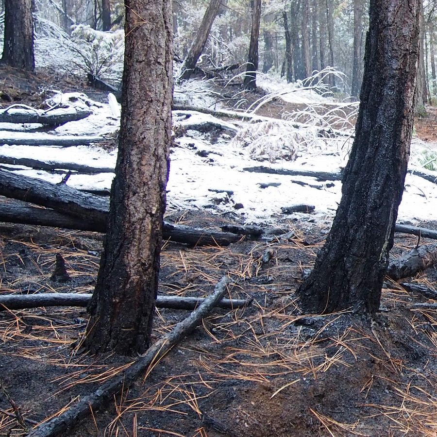
Immediate effects of prescribed fire on microbial communites and associated processes
Hart, Hunsaker, Dove
Although prescribed fire treatments have been lauded for increasing understory plant diversity, reducing wildfire hazard, and increasing habitat for wildlife, relatively little is known about the impacts of prescribed fire on microbial communities and their control of soil C and nitrogen (N) stability. We aim to pair next-generation high-throughput sequencing of microbial communities with a suite of biogeochemical assays that measure C and N cycling to elucidate the microbial foundations of decomposition and nitrification in a post-prescribed fire context to understand how forest restoration activities impact these biogeochemical cycles.
Quantifying nutrient contributions to soils and vegetation: The relative importance of of local bedrock and transoceanic dust
Riebe, Aciego, Arvin
The relative importance of exogenous dust and underlying bedrock in the supply of nutrients to montane ecosystems has not often been investigated, in part because inputs of dust are commonly assumed to be relatively unimportant due to rapid erosion, which promotes a continuous supply of bedrock-derived nutrients to vegetation. To overcome this limitation at the SSCZO, we are using cosmogenic nuclide measurements of erosion rates and a new Nd isotopic approach that quantifies the relative importance of dust and bedrock in nutrient supply to vegetation. When coupled together with a global compilation of erosion rates and modeled dust fluxes, our results indicate that dust is often on par with bedrock in the supply nutrients to mountain ecosystems where erosion rates are substantial. This suggests that dust may be an important source of nutrients across a wider variety of ecosystems than previously thought.
Quantifying the influence of regolith water-holding capacity and bedrock-derived nutrients on forest ecosystem productivity
Taylor, Riebe, Dueker, Goulden, Holbrook, Callahan, Hahm
Both climate and lithology regulate the distribution of vegetation across Earth’s surface. However, lithologic effects on vegetation are inherently difficult to understand, because they integrate both the properties of bedrock and the processes that alter it in the critical zone. To disentangle the effects of bedrock on vegetation, we used seismology to quantify subsurface porosity in 3D, integrated from the surface to vegetation rooting depths, at three climatically similar but geologically diverse granitic sites in the Sierra Nevada, California. Evapotranspiration (ET) varies tenfold, allowing us to test the hypothesis that differences in ecosystem productivity are driven by lithologic differences in subsurface water storage capacity. Our results suggest that, for a given climate, ecosystem productivity can be predicted from bedrock nutrient concentrations and bedrock weathering, implying that vegetation is limited by both water and bedrock-derived nutrients.
Southwest U.S. drought characterization
Bales, Goulden, Rungee
CROSS-CZO
Eddy covariance flux-tower measurements of evapotranspiration show high variability in a site's response to multi-year dry periods. Developing an understanding for the primary characteristics governing this variability will aid water-resource and forest management in making more informed decisions regarding reservoir operations, thinning practices and fire risk based upon a sites resistance, or lack thereof, to multi-year dry periods. This is being accomplished using a suite of eddy-covariance flux towers in the mountain west compiled from two CZOs, AmeriFlux, and through direct contact with flux-tower PIs. The final output will be basin scale raster maps of multi-year dry-period resistance and basin throughput.
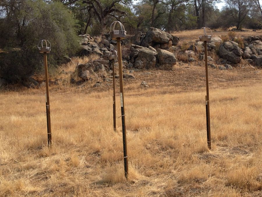
Spatial variation of soil moisture and snow across the landscape
Glaser, Bales, Oroza, Zheng, Stacy
Snow depth sensors distributed across the landscape have improved real-time information for water resource management. However, soil water storage capacity and patterns of soil moisture usage across the landscape are still little understood. We are analyzing soil moisture storage and vegetation water use by evaluating soil moisture data from existing installations at the P301 subcatchment and Upper and Lower Meteorological Stations of the Providence area. Current research goals for this subproject include algorithm development and analysis for determining optimal sensor locations, and testing new radio network hardware.
Tracking Water through the Critical Zone, Part 1: Isotopic Characterization of Water Fluxes
Visser, Thaw, Deinhart, Conklin
Prolonged drought can present vulnerability to alpine water supplies when upstream catchments lack the ability to maintain stream flows. This vulnerability is dependent on interactions between precipitation, catchment storage and water losses to evaporation and plant transpiration. To link water fluxes to sources and catchment transit times, we are evaluating the age of water leaving as stream flow using a novel combination of stable isotopes of water (2H, 18O), and the radioactive isotopes sulfur-35, sodium-22, and tritium. To investigate seasonal variation in sources of evapotranspiration, we are also analyzing groundwater, soil moisture and plant material samples for isotopic signatures.
Tracking Water through the Critical Zone, Part 2: Modeling Water Fluxes from Drop to Catchment Scale
Visser, Collins, Osuna, Maxwell
Improved characterization of hydrology-biosphere-atmosphere interactions in the alpine critical zone, especially during drought, will increase the adaptability of water management practices. By integrating multi-isotope fingerprints into a coupled hydrology and land surface model (PARFLOW+CLM), we will be able to track every material drop of water through the critical zone. Isotopic fingerprints will validate modeled fluxes and water ages, and provide constraints on the parameterization of the rooting depth and the ability of plants to access deeper water sources such as groundwater.
_900_900_80auto.jpg)
_900_900_80auto.jpg)
_900_900_80auto.jpg)