Do not fill out this information.
On this particular page, the Initial Text and Image fields for this template are not used (inactive). A Carousel Slideshow is displayed instead.
To edit the Carousel Slideshow, Choose Edit Existing > Carousel Slides. Then navigate to your CZO's entry entitled "About"
Researching Earth's outermost layer
The Southern Sierra Critical Zone Observatory (SSCZO) is an Earth-systems research program investigating the living layer of Earth where water, soil, rock, air, and biota interact to form landscapes and support ecosystems. Hydrologists, geomorphologists, soil scientists, and ecologists from University of California campuses, University of Wyoming, and other institutions collaborate to improve our understanding of water and nutrient cycling, weathering processes, and forest function in the Sierra Nevada.
>> Learn more about the critical zone >>
Interdisciplinary research and ongoing monitoring at our intensively studied sites allows us to research this thin skin of the Earth at spatial scales ranging from bacteria to batholith and water droplet to watershed, and temporal scales from minutes to millenia. Coordinated, linked activities enable us to explain and predict the properties and processes southern Sierra landscapes and ecosystems, including water cycle responses to drough, fire, tree mortality, changing climate, and other disturbances to the landscape.
>> Explore our research >>
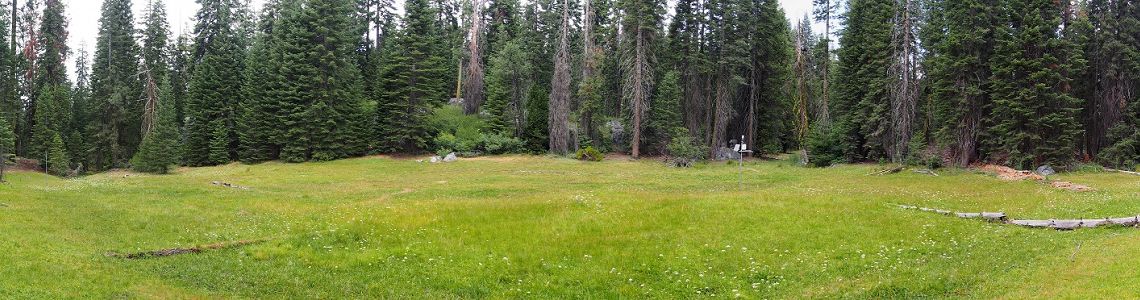
Our Critical Zone Observatory's field areas are located in the headwaters of the Kings River on the western slope of the southern Sierra Nevada, on federal lands including Sierra National Forest, San Joaquin Experimental Range, and Sequioa National Park. Sites span a range of elevation from 400 m to over 2100 m above sea level. As elevation increases, vegetation, temperature, and dominant precipitation phase also change.
>> View our field areas >>
Critical for sustaining societies and ecosystems of today and tomorrow
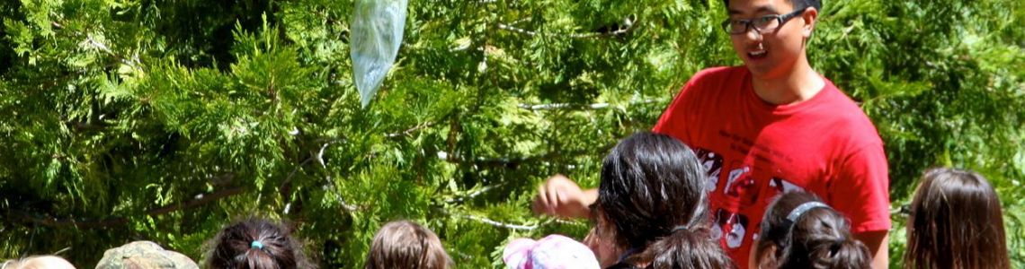
Advancing our knowledge of the critical zone and Sierra Nevada headwaters and forests—California’s largest water tower—is vital to California and beyond. The critical zone is where water flows, soils form, food grows, and ecosystems thrive; and it is facing increasing pressure from changing population, climate, and land use. We engage with research communities, stakeholders, students, educators, and public audiences in order to increase understanding and awareness of the critical zone, and share findings from our Observatory about these sensitive mountain regions.
>> Learn about our outreach >>
A platform of research, infrastructure, models, and data for the critical zone science community
We and nine other Critical Zone Observatories (CZOs) in the U.S. Critical Zone Observatory Network funded by the National Science Foundation, as well as several other international CZOs, strive to rapidly advance Earth-systems knowledge through our open sites, datasets, and other resources for researchers.
RESEARCH
Investigators, students, collaborators, and other research site users conduct research on a variety of topics spanning several disciplines, at multiple spatial and temporal scales:
- hydrology
- geochemistry
- pedology
- geomorphology
- ecology
- geophysics
INFRASTRUCTURE
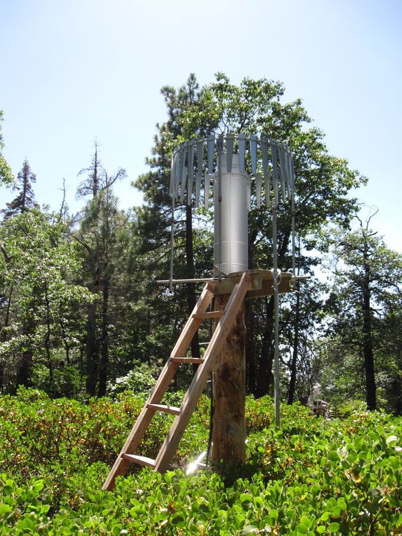
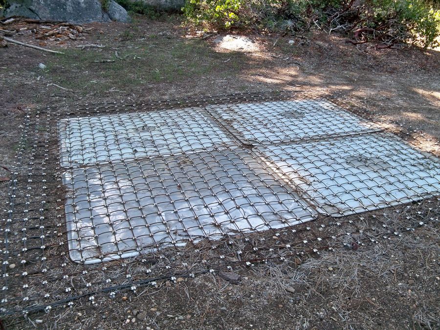
Hundreds of instruments are installed and maintained at SSCZO, many continuously logging measurements through a wireless sensor network:
- covariant eddy flux towers
- meteorological stations
- soil matric potential senors
- sap flow meters
- peizometers and wells
- snow depth sensors
DATA
Data from instruments and other measurements are available for research analysis and modeling. Our data catalog:
- covers a range of research disciplines
- contains thousands of entries from several sites
- provides opportunities for cross-czo comparison
MODELS
SSCZO continues to develop and expand conceptual and numerical models of the critical zone covering:
- drivers of critical zone development
- ecohydrological processes
- changes in properties and processes with space and time
Problems with this form? Please email Michelle Gilmore.
Archive of older updates and announcements: 2014-01-24 || 2014-01-31 || 2014-02-03 || 2014-02-08 || 2014-02-27 || 2014-03-24 || 2014-04-07 || 2014-05-20a || 2014-05-20b || 2014-06-17 || 2014-07-01 || 2014-07-08 || 2014-07-18 || 2014-08-26 || 2014-09-02 || 2014-11-06 || 2014-12-04 || 2015-01-21 || 2015-01-22 || 2015-02-13 || 2015-02-17 || 2015-03-18 || 2015-04-15 ||
The following are links to a local document archive at the Southern Sierra CZO
Document archive: Public || Background || Internal || Other presentations || Forms
Annual Reports (pdf): 2008 || 2009 || 2010 || 2011 || 2012 || Final for 2007-2012 grant || 2013 || 2014 + Addendum || 2015 + Additional Reporting + Figures || 2016
Work plan: 2008 || 2010 || 2014 Management Plan (including Work plan)
© Southern Sierra Critical Zone Observatory
Warm sunlit morning at SJER this past winter.
Gallery
SSCZO - Instruments
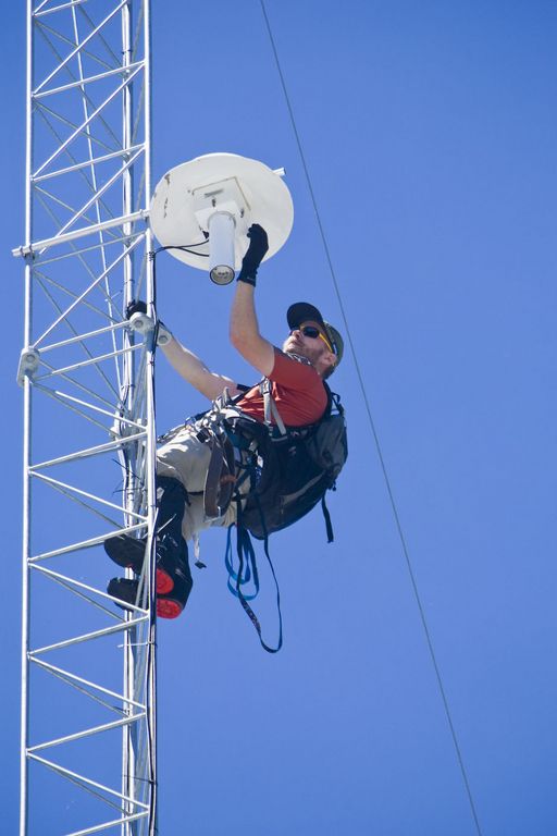
Matt Meadows (Field Manager, UC Merced) checks on an instrument on the P301 flux tower.
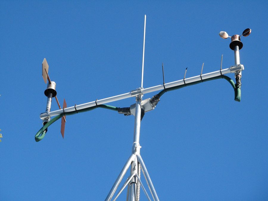
Anemometer measuring wind speed and direction.
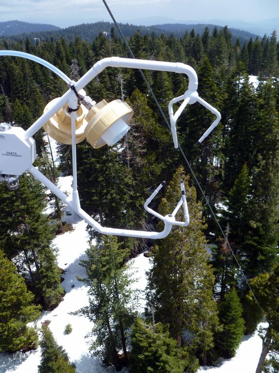
Ultrasonic anemometer on the P301 flux tower measures wind speed and direction in 3 dimensions. Data is connected to gas samples taken every quarter second at the filters on the left (beige circles).
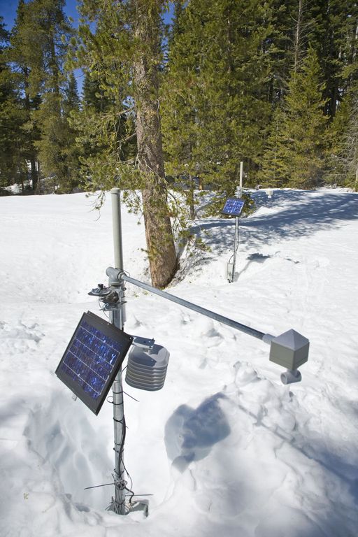
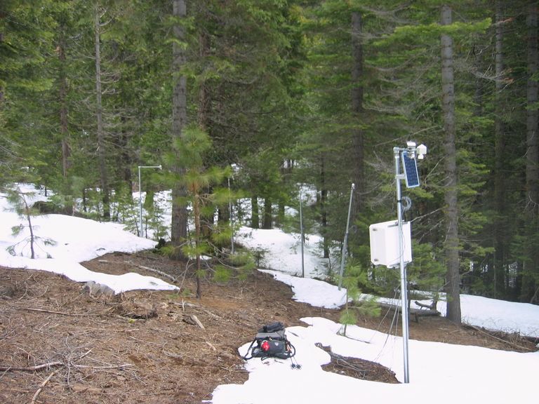
Instrument cluster featuring a relative humidity sensor, ultrasonic snow depth sensor, co-located soil moisture and temperature sensors at different depths, and a solar panel to power it all.
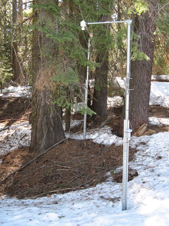
Instrument cluster at the P303 Upper Met site with ultrasonic snow depth sensor and co-located soil moisture and temperature sensors.
Instrument cluster at the P300 Lower Met site with ultrasonic snow depth sensor and co-located soil moisture and temperature sensors. The pole also psupports a solar panel, and an enclosure with a backup power supply and the data logger.
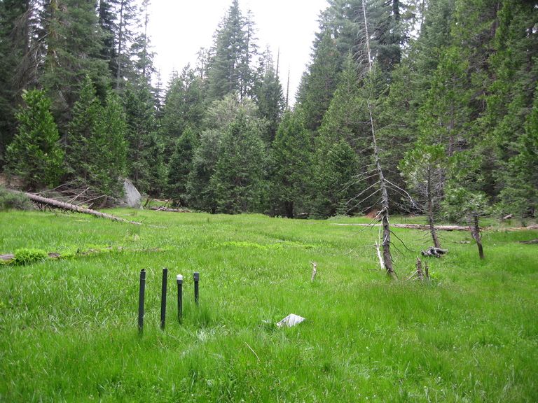
Instruments installed in the P301 meadows include wells and piezometers, at different locations to assess surface and groundwater flows.
Several clusters of instruments measure the water balance. These clusters each contain soil moisture and temperature sensors, an air temperature sensor, relative humidity sensor, and an ultrasonic snow depth sensor.
These water balance instruments are clustered at two different elevations, with north, flat, and south facing aspects. Conditions are measured under canopy, at drip edge, and at open canopy. Water balance measurements are also made in the wireless sensor network that stretches along the P301 meadow.
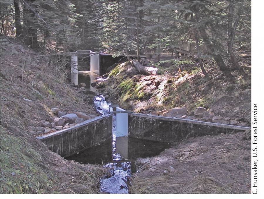
The eight subcatchments and two integrating catchments in the KREW project have flumes to measures discharge.
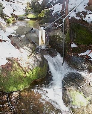
The large KREW flumes are complemented by small flumes for low flow.
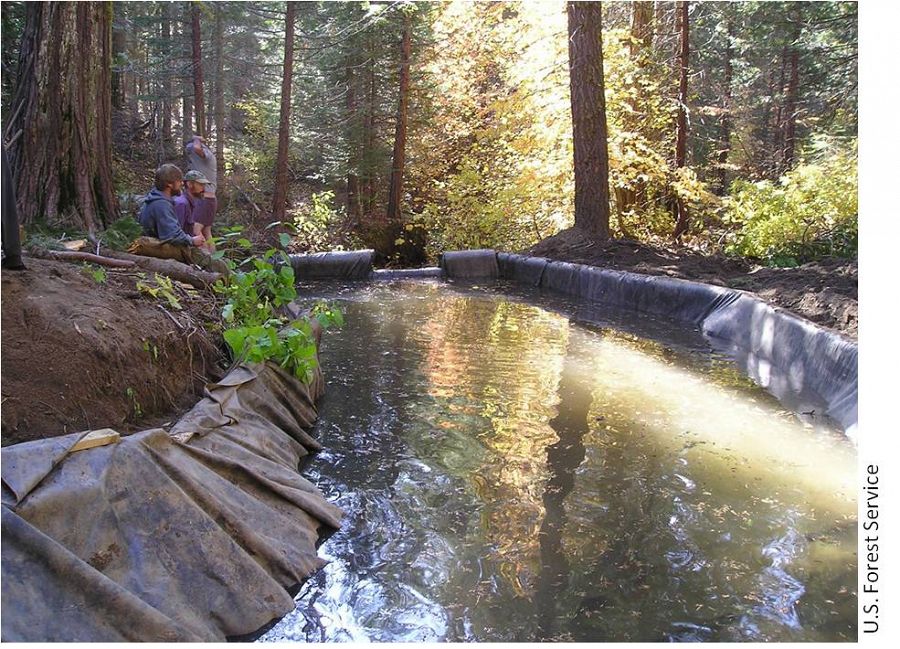
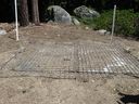
Each of those eight KREW subcatchments also has a plastic-lined settling basin to capture sediment.
There are two meteorological stations in the Providence catchment - one at the lower elevation range and one near the crest. Each meteorological station has a rain gauge.
At the upper meteorological station, there is a snow pillow. This snow pillow tracks the weight of snow above it. Combined with the snow depth measurements, the two permit the calculation of amount of water in the snow pack.
Another view of the snow pillow.
Hundreds of instruments and sensors have been deployed in the primary SSCZO research site of the Providence Creek watershed as well as in Wolverton basin. Additional SSCZO flux towers and instruments have also been installed at the San Joaquin Experimental Range, Soaproot Saddle, and Short Hair Creek.
Explore more photos of the intstuments and sensors used by SSCZO.
Southern Sierra CZO
California
Established 2007
"We investigate the critical zone across a mountainous elevation gradient, focusing on water balance, nutrient cycling, and weathering processes."
Science Questions:
- How do regolith, or weathered bedrock, properties and soil formation processes vary over 10-m to 100-km scales?
- How do physics, chemistry, and biology interact to influence critical zone function over instantaneous to decadal timescales?
- How quickly do regolith properties change in response to longer-term climactic and shorter-term biologic processes?
- How do regolith development and properties control, limit or regulate the effects of climate change and forest management, or of hydrologic, biogeochemical and ecologic disturbances?
- What measurements of the critical zone can best advance knowledge of the critical zone, using cutting edge technology and a range of spatial and temporal scales?
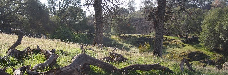
SSCZO is based in the southwestern Sierra Nevada with sites ranging from oak savannah to subalpine forest, crossing the rain-snow transition zone.
Research at these sites focuses on water, nutrient, and soil fluxes; and landscape and climate changes cross space and time.
Explore Further
