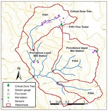
Providence Creek Headwater Catchments (1660 - 2115 m elevation)
The most intensively studied research area of the Southern Sierra Critical Zone Observatory is the Providence Creek headwaters area, located along a tributary to the North Fork of the Kings River in the Sierra National Forest. Most of the long-term observations by SSCZO are located at this site. The P300 area includes forested hillslopes, some glacial erratics and areas of exposed bedrock, multiple meadows, and creeks draining the catchment.
4.6 km2 Area
Critical Zone Tree 1 at P301 within the Providence Creek Headwater Catchments field area. © Southern Sierra Critical Zone Observatory
Areas within Providence Creek Headwater Catchments (1660 - 2115 m elevation)

-
Setting & Research
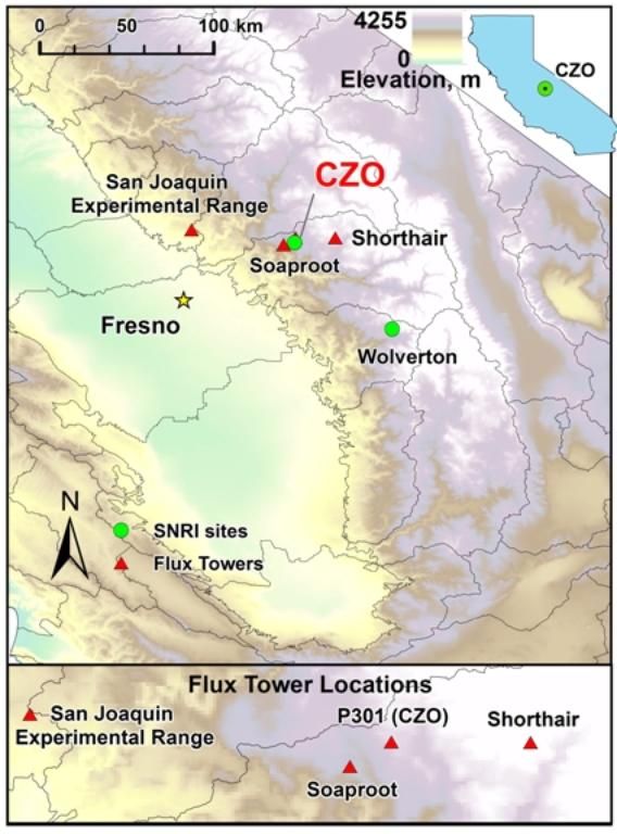
This site is part of an elevational transect that increases in altitude from west to east.
Sites include San Joaquin Experimental Range, Soaproot Saddle, Providence Creek Headwater Catchments, and Short Hair Creek, spanning a 2300-m elevation range that captures gradients in climate, regolith, soils, and vegetation. Along this transect, bedrock lithology is generally constant (intrusive felsic plutons). Ecosystems range from low-elevation oak savannah (rain-dominated) to high-elevation subalpine forest (snow-dominated). A series of eddy-covariance gas flux towers are installed at these sites (see below). Examples of transect-length work include soil and regolith depth, chemistry, and moisture characterizations; vegetation surveys; forest water-balance research; and wind-blown dust geochemistry and microbiology studies.
SSCZO & KREW
The Providence Creek Headwater Catchments are part of the Kings River Experimental Watersheds (KREW) program which is run by scientists from the USDA Forest Service Pacific Southwest Research Station. Sub-catchments of Providence Creek have undergone various management treatments and KREW is studying the effects of these treatments such as impacts on sediment production, stream water quantity and quality, and forest health. Providence is the primary SSCZO--KREW research area. For an overview of SSCZO and KREW measurement programs, see O'Geen et al. (2018).
Climate, Landscape, Soils, Vegetation
From O'Geen et al., 2018:
Providence Creek Headwater Catchments represents a rain-snow mixed-conifer forest site. Mean Annual Temperature: 8°C. Mean Annual Precipitation: 1015 mm yr−1.
Nested within the 4.6 km2 Providence Creek catchment (P300) are three subcatchments: P301, P303, and P304. Providence Creek is a tributary to the North Fork of the Kings River.
Three main soil series are mapped in the Providence catchments: Gerle (coarse-loamy, mixed, superactive, frigid Humic Dystroxerepts) and Cagwin (mixed, frigid Dystric Xeropsamments) are found at higher elevations (1800–2400 m), and Shaver (coarse-loamy, mixed, superactive, mesic Humic Dystroxerepts) occurs at 1750 to 1900 m (Bales et al., 2011). Gerle and Cagwin have a frigid soil-temperature regime. Cagwin and Gerle series are classified as Dystric Xeropsamments and Humic Dystroxerepts, respectively. Cagwin tends to occur on erosive landscapes such as convex ridge tops, steep mountain slopes, and sparsely vegetated areas intermixed with rock outcrops. As a result, Cagwin is sandy with shallow and moderately deep phases and minimal horizon differentiation. Gerle series displays some initial stages of pedogenesis. It is very deep, well drained and formed in glacial till, glacial outwash, and alluvium derived primarily from granitic rocks. Shaver has a warmer (mesic) soil temperature regime compared with higher elevation sites. The profile shows initial stages of pedogenesis with sandy loam textures throughout and slight rubification and transformation of primary minerals.
Vegetation community comprises largely mixed-coniferous forest (76 to 99%) with some mixed chaparral and barren land cover. Sierran mixed-conifer vegetation at the site consists largely of white fir [Abies concolor (Gord. & Glend.) Lindl. ex Hildebr.], ponderosa pine, Jeffrey pine (Pinus jeffreyi Balf.), California black oak, sugar pine (Pinus lambertiana Douglas), and incense cedar.
For additional information on climate and vegetation, see also Goulden et al., 2012.
Instrumentation
Sensors and instruments installed within the Providence Creek headwaters are used principally to measure forest water fluxes. The primary catchment is designated P300 with multiple subcatchments contained within it (P301 through P304). Subcatchment P301 contains the majority of instrumentation, with meteorological and stream-gauging stations also installed in other subcatchments. For additional technical information visit our Sensors & Field Instruments page or see O'Geen et al., 2018.
Flux Tower
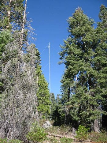
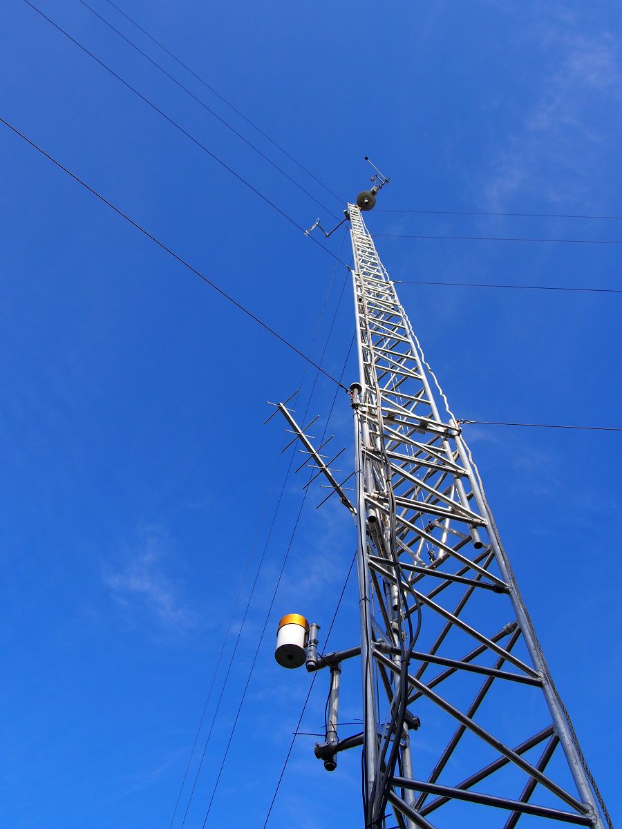
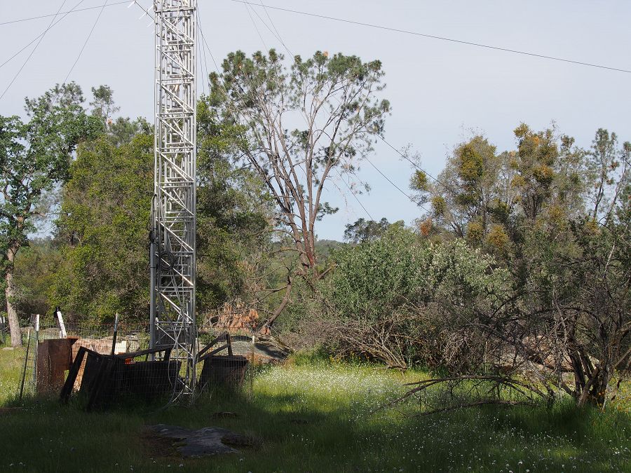
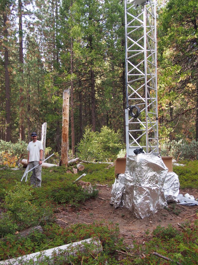
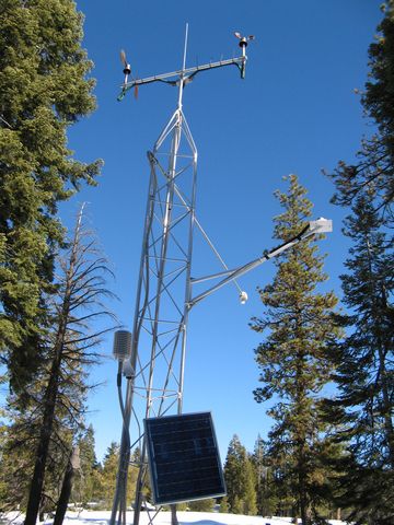
An eddy covariance flux tower is located near the top of the P301 subcatchment. The tower was installed in September 2008 at an elevation of 2015 m above sea level. This data can be analyzed to determine the physiological responses of the site (for example, how photosynthesis increases with light) and summed over a year to determine the carbon balance of a site (how much carbon it is gaining or losing).
Critical Zone Tree
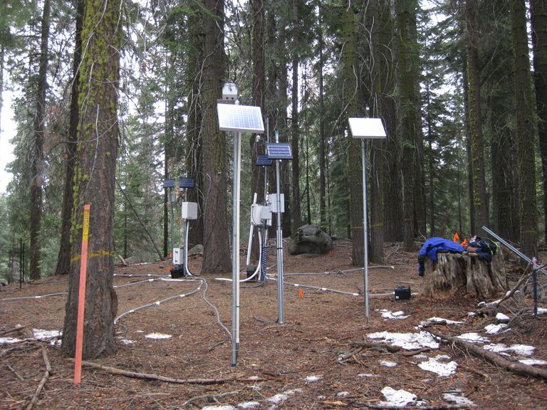
Inside the P301 subcatchment, the SSCZO's established the first Critical Zone Tree in October 2008 at an elevation of 2020 meters. This CZO tree is a White Fir (Abies concolor) that has been intensely instrumented with soil moisture, temperature, and matric potential sensors, snow depth, solar radiation, and sap flow sensors, resin nutrient collectors, tension lysimeters and time lapse photography. Snowmelt patterns around the tree can be viewed in this 2008-2009 time lapse video.
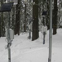
Meteorological Stations
Field staff from the USDA Forest Service KREW project maintain two meteorological (met) stations located in the Providence Creek headwaters. The upper elevation station (Upper Met) is located within the P303 subcatchment at an elevation of 1980 meters. The lower elevation station (Upper Met) is located within the larger P300 catchment at an elevation of 1750 meters. Both met stations were installed in October 2002.
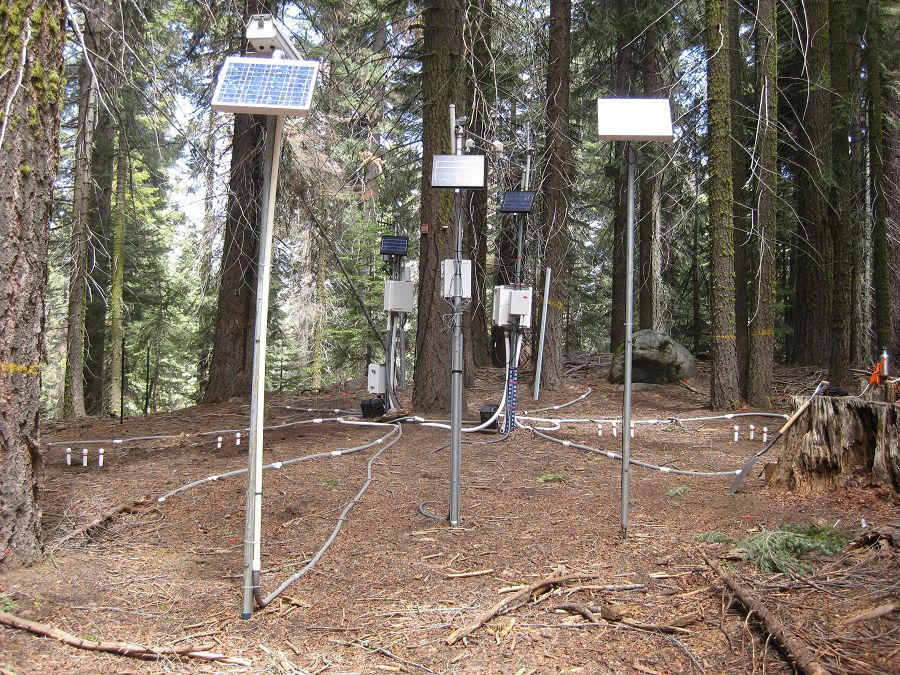
Water Balance Instrument Cluster

Water balance instrument clusters are used to monitor snow depth, solar radiation, air temperature, soil water content, and soil temperature. The instruments capture forest-cover and landscape variability through node placements under tree canopy, at drip edge, and in open areas; and on North, South, and Flat slope aspects. Instrument cluster sites include the Upper Met Station and Lower Met Station, installed installed October 2007 (Flat aspect) and December 2007 (North and South aspects). Another water-balance transect was installed in December 2008 around the P301 meadow complex and the forested slopes adjacent to the meadows. In addition to the instrument clusters, the transect also includes monitoring wells, piezometers, soil sensors, and meteorological sensors, with elevations ranging between 1950 and 1990 m.
Stream Gauging Stations
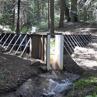
Providence Creek gauging stations are located at the outlet of each research catchment. The four catchments (P300, P301, P303 and P304) are instrumented in similar ways, outfitted with both high and low flow flumes, water depth sensors, and an ISCO sampler. These instrumented stream sites are operated and maintained by field staff from KREW and SSCZO. KREW installed P300 instruments in October 2009; P301, P303, and P304 instruments were installed in September 2008. They are located at a mean elevation of 1740 meters.
Micromet Sensors
The four research catchments in the Providence Creek headwaters have also been instrumented with HOBO microclimate sensors, measuring air temperature and relative humidity. These micromet sensors were installed in summer 2011 and removed late 2013-summer 2015. Elevations ranged from 1500 and 2020 meters. Sensor location varies in each catchment, selected based on existing soil moisture and sapflux sampling locations and elevation gradients. The collected microclimate data will increase the density of the distributed microclimate network which will allow us to better estimate the spatial variability of microclimate and eventually improve model predictions of snow, soil moisture, transpiration and streamflow.
A critical research zone in the Sierra
Video by Nick Strayer, Office of the President.
University of California Research video
The P301 eddy covariance flux tower stands near the top of the P301 subcatchment. © Southern Sierra Critical Zone Observatory
The Critical Zone Tree-1 is an intensively instrumented tree in P301. © Southern Sierra Critical Zone Observatory
© Southern Sierra Critical Zone Observatory
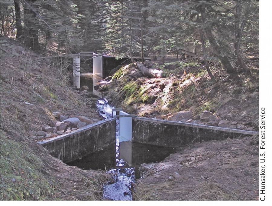
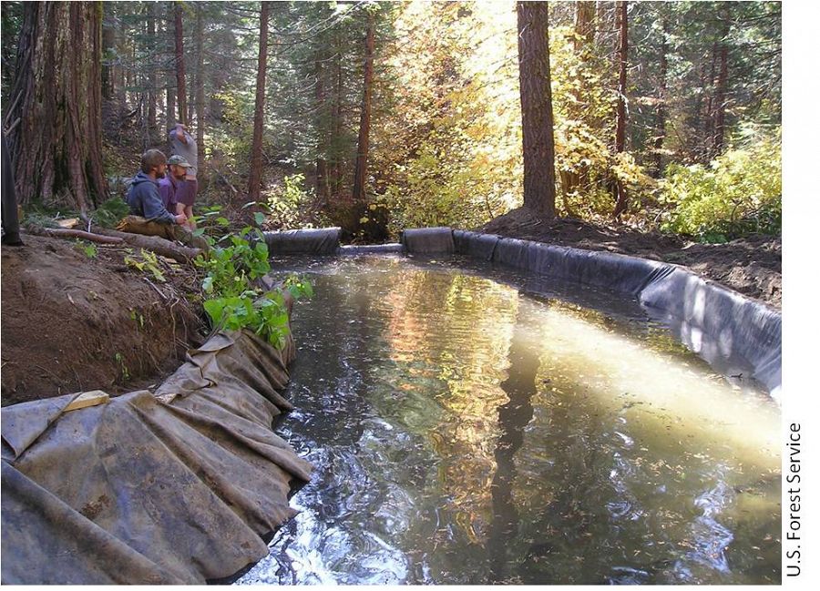
P300 flume © USDA Forest Service / Pacific Southwest Research Station
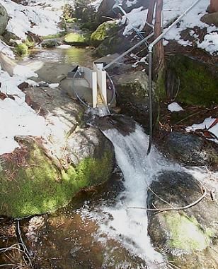
Solar-powered water-balance instrumentation near the meadow complex at P301. Photo by Roger Wyan
-
Overview Maps
Southern Sierra CZO overview map
See full size (in new tab/window)
Providence Creek headwaters map
See full size (in new tab/window)
-
Dynamic Map
To fully zoom into a small area, you may need to visit the "Map" button and uncheck "Terrain" view.
-
Data
Critical Zone Tree 2 - Soil Moisture, Soil Temperature, Electrical Conductivity, Matric Potential, Sap Flow (2010-2012)
11 components • Providence Creek Headwater Catchments (1660 - 2115 m elevation) • Hydrology, Biology / Ecology • Peter Hartsough; Jan HopmansMet Stations, Providence, Lower - Meteorology (2002-2011)
19 components • Providence Creek Headwater Catchments (1660 - 2115 m elevation) • Climatology / Meteorology • Carolyn HusakerNational - Climate, Flux Tower, Streamflow / Discharge - CUAHSI WDC web services (1968-2015)
7 components • Boulder Creek Watershed, Christina River Basin, Jemez River Basin, Santa Catalina Mountains, El Verde Field Station, Northeastern Puerto Rico and the Luquillo Mountains, Rio Blanco, Rio Mameyes, Susquehanna Shale Hills Critical Zone Observatory, Providence Creek Headwater Catchments (1660 - 2115 m elevation), Wolverton Basin (2230 - 2700 m elevation), Other instrumented sites • Climatology / Meteorology, Hydrology, Soil Science / Pedology • Boulder Creek Critical Zone Observatory; Catalina-Jemez Critical Zone Observatory; Luquillo Critical Zone Observatory; Shale Hills Critical Zone Observatory; Southern Sierra Critical Zone Observatory; Christina River Basin Critical Zone ObservatoryNational - LiDAR, Land Cover, GIS/Map Data - OpenTopography (2010-2017)
18 components • Boulder Creek Watershed, Eel River Watershed, Jemez River Basin, Reynolds Creek Experimental Watershed, Susquehanna Shale Hills Critical Zone Observatory, Northeastern Puerto Rico and the Luquillo Mountains, Sangamon River Basin, Clear Creek Watershed, Calhoun Critical Zone Observatory, Providence Creek Headwater Catchments (1660 - 2115 m elevation) • Geomorphology, GIS / Remote Sensing, Hydrology, Biology / Ecology • National Center for Airborne Laser Mapping; Boulder Creek Critical Zone Observatory; Calhoun Critical Zone Observatory; University of Arizona; University of California Merced; Valles Caldera National Preserve; Bandelier National Monument; National Park Service; Jemez River Basin and Santa Catalina Mountains Critical Zone Observatory; Luquillo Critical Zone Observatory; Reynolds Creek CZO; Eel River CZO; Shale Hills CZONational - Streamflow / Discharge - USGS and USDA Data Resources (1985-2017)
22 components • Boulder Creek Watershed, Santa Catalina Mountains, Jemez River Basin, Reynolds Creek Experimental Watershed, Susquehanna Shale Hills Critical Zone Observatory, Northeastern Puerto Rico and the Luquillo Mountains, Clear Creek Watershed, Sangamon River Basin, Calhoun Critical Zone Observatory, Providence Creek Headwater Catchments (1660 - 2115 m elevation) • Hydrology • USGS National Water Information SystemProvidence - Streamflow / Discharge (2003-2010)
22 components • Providence Creek Headwater Catchments (1660 - 2115 m elevation) • Hydrology • Carolyn HunsakerProvidence, Lower Met, North aspect - Soil Moisture, Soil Temperature, Snow Depth, Air Temperature (2008-2018)
31 components • Providence Creek Headwater Catchments (1660 - 2115 m elevation) • Hydrology, Climatology / Meteorology • Roger Bales; Matthew Meadows; Erin Stacy; Xiande MengProvidence, Lower Met, South aspect - Soil Moisture, Soil Temperature, Snow Depth, Air Temperature (2008-2018)
31 components • Providence Creek Headwater Catchments (1660 - 2115 m elevation) • Hydrology, Climatology / Meteorology • Roger Bales; Matthew Meadows; Erin Stacy; Xiande MengProvidence, Upper Met, Flat aspect - Soil Moisture, Soil Temperature, Snow Depth, Air Temperature (2008-2018)
33 components • Providence Creek Headwater Catchments (1660 - 2115 m elevation) • Hydrology, Climatology / Meteorology • Roger Bales; Matthew Meadows; Erin Stacy; Xiande MengSouthern Sierra Nevada - LiDAR, Digital Elevation Model (DEM), Snow Survey - Snow-on, Snow-off Flyover (2010)
2 components • Providence Creek Headwater Catchments (1660 - 2115 m elevation), Wolverton Basin (2230 - 2700 m elevation), Other instrumented sites • GIS / Remote Sensing, Hydrology • Qinghua Guo; Roger Bales; National Center for Airborne Laser MappingSpatial Data - GIS/Map Data (2013-2018)
9 components • Providence Creek Headwater Catchments (1660 - 2115 m elevation) • GIS / Remote Sensing • Stacy, E.Spatial Data - GIS/Map Data (2003-2011)
11 components • Wolverton Basin (2230 - 2700 m elevation), Providence Creek Headwater Catchments (1660 - 2115 m elevation), Other instrumented sites • GIS / Remote Sensing • Meadows, M.; Stuemky, M. -
Photos
SSCZO - Flux Towers

At the San Joaquin Experimental Range (SJER), the SSCZO flux tower sits on a small rise in the oak-pine woodland. This is the lowest site of the flux-tower transect, with the tower installed at 405 m in elevation.

Fully erected, the SJER tower stands about 29 m tall (~95 ft).

However, the tower also telescopes down for maintenance.

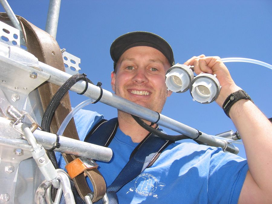
Erin Stacy (UC Merced) exchanges the filters on the gas intake.

The flux tower at Soaproot Saddle stands in a small forest clearing. The tower, approximately 39 m tall (125-130 ft), is surrounded by a mix of Ponderosa pine and oak. Here the WyCEHG (Wyoming) sets out equipment to conduct geophysical surveys in the tower footprint.

Defensive measures were taken for the Soaproot Saddle tower in advance of a prescribed burn. The Clarence Burn burned up to a nearby firebreak in January 2014, but did not burn the area immediately around the tower

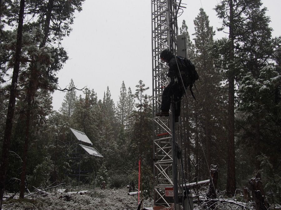
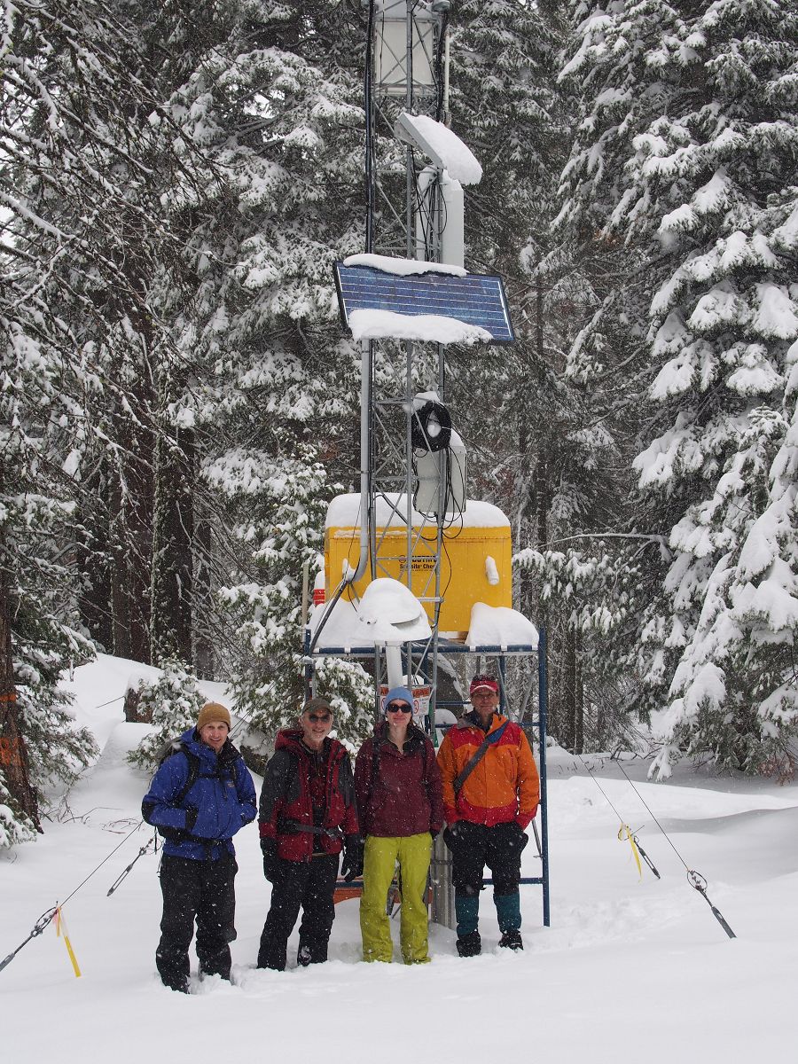
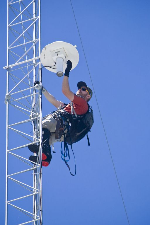
Matt Meadows (Field Manager, UC Merced) begins the climb for routine tower maintenance in a late January storm, 2014.

Pete Hartsough (collaborator, UC Davis) stands next to the Soaproot tower, September 2013, with core tubes in hand. A large drilling unit cored soil and saprolite to a depth of ~4 m on most attempts at this site.

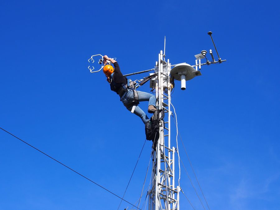
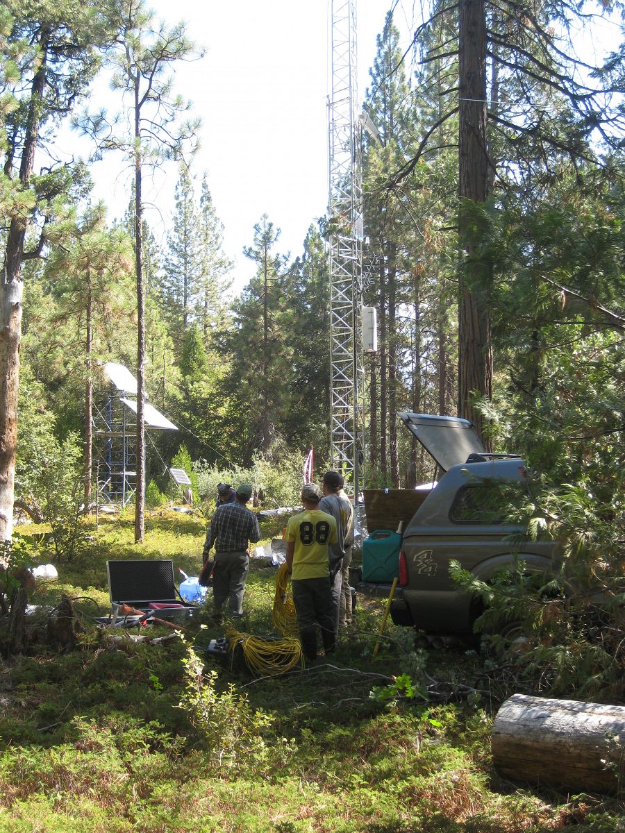
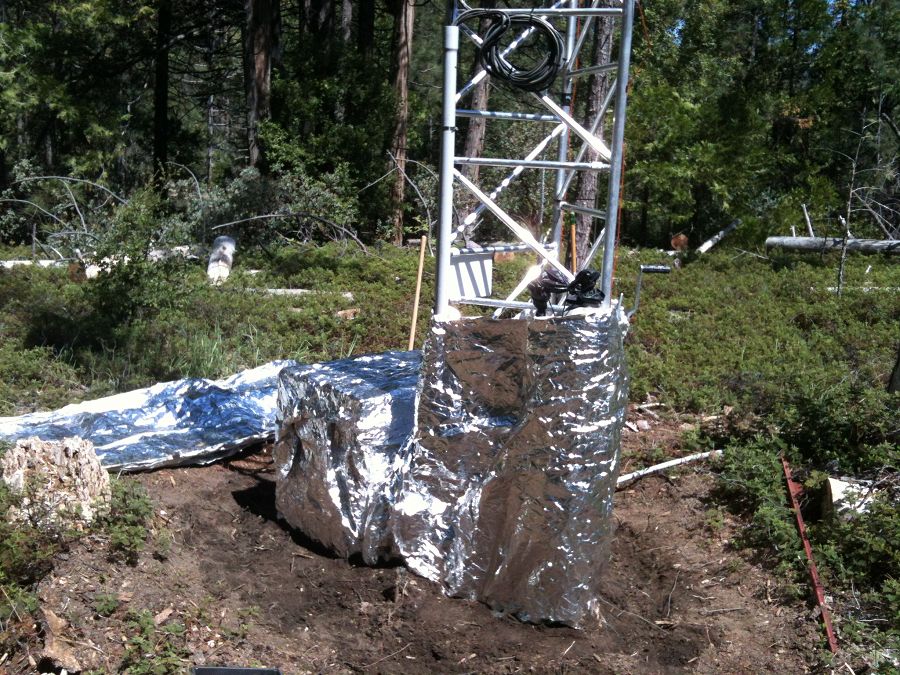
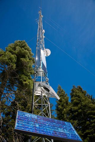
The P301 tower is the tallest of the four towers at 50 m (160 ft), plus a lightning rod. It stands near the top of the Providence catchments at 2015 m in elevation.

The P301 tower near the end of the 2014 winter.

Matt Meadows (Field Manager, UC Merced) shows off the filter intakes at the top of the P301 tower.
An eddy covariance flux tower is located near the top of the P301 watershed. Instruments collect data on temperature, relative humidity, and fluxes of carbon dioxide and water vapor to determine the physiological responses of the site (for example, how photosynthesis increases with light) and summed over a year to determine the carbon balance of a site (how much carbon it is gaining or losing). Three other flux towers have been instrumented at different elevations with the Sierras including the San Joaquin River, Soaproot, and Short Hair Creek.
This west-east transect spans elevation gradient from 400 m to 2700 m. The change in elevation is accompanied by a slight increase in precipitation, but the main change is a shift from rain-dominated precipitation to snow-dominated precipitation. The climatic shift plays out in other ways as well. At lower elevations, high temperatures and low water availability limit evapotranspiration by vegetation. Meanwhile, forest activity (evapotranspiration) at higher elevations is limited by cold winter temperatures. There is a sweet spot at middle elevations of yera-round evapotranspiration and forest activity.
Photo galleries of each flux tower are available: San Joaquin Experimental Range; Soaproot Saddle; Providence subcatchment P301; and Short Hair Creek.
SSCZO - Critical Zone Trees

© Southern Sierra Critical Zone Observatory
The primary Critical Zone Tree in the Southern Sierra CZO is a White Fir (Abies concolor) that has been intensely instrumented with soil moisture, temperature, and matric potential sensors, snow depth, solar radiation, and sap flow sensors, resin nutrient collectors, tension lysimeters and time lapse photography. The Southern Sierra CZO currently has three instrumented trees.
A photo gallery of the Critical Zone Trees can be found here.
SSCZO - Water Balance Transect

© Southern Sierra Critical Zone Observatory
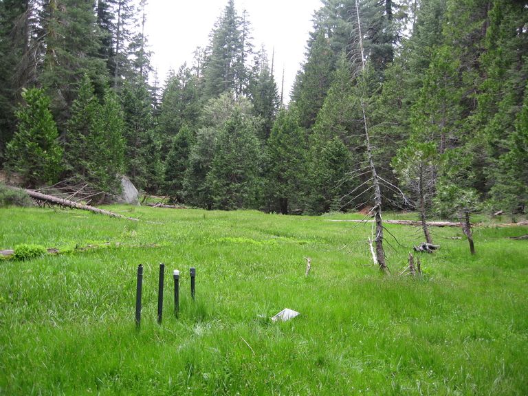
Within the headwaters of the P301 catchment is a series of montane meadows. The P301 water balance transect is comprised of monitoring wells, piezometers, soil sensors, and meteorological sensors.
A photo gallery of the P301 water balance transect can be found here.
SSCZO - Meteorological Stations

© Southern Sierra Critical Zone Observatory
The Providence Creek upper meteorological station is located in a high elevation spot of the Providence Creek study area. Collocated at this site are three water balance instrument clusters to monitor snow depth, solar radiation, air temperature, soil water content, and soil temperature. The other meteorological station is located in a low elevation spot within the P300 catchment. Instrumentation is similar to the upper elevation site.
A photo gallery of the Upper Met Station can be found here.
A photo gallery of the Lower Met Station can be found here.
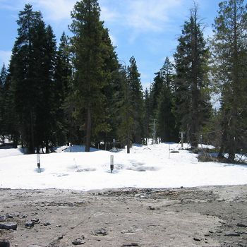
SSCZO - Snowmelt Plots

© Southern Sierra Critical Zone Observatory
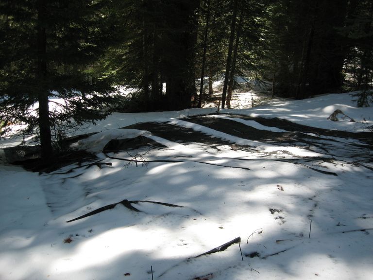
Prototype snowmelt plots were installed in Spring 2009. Additional snowmelt plot studies were conducted in WY2010-2011.
A photo gallery of the snowmelt plots can be found here.
SSCZO - Instruments

Matt Meadows (Field Manager, UC Merced) checks on an instrument on the P301 flux tower.

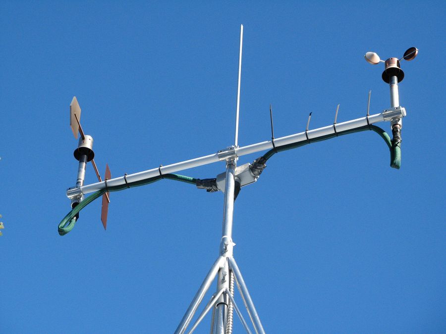
Anemometer measuring wind speed and direction.

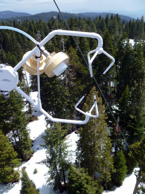
Ultrasonic anemometer on the P301 flux tower measures wind speed and direction in 3 dimensions. Data is connected to gas samples taken every quarter second at the filters on the left (beige circles).

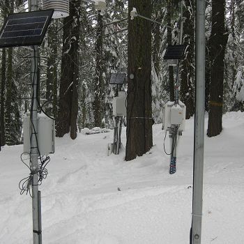
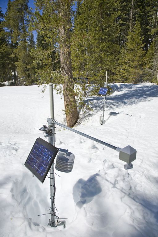
Instrument cluster featuring a relative humidity sensor, ultrasonic snow depth sensor, co-located soil moisture and temperature sensors at different depths, and a solar panel to power it all.

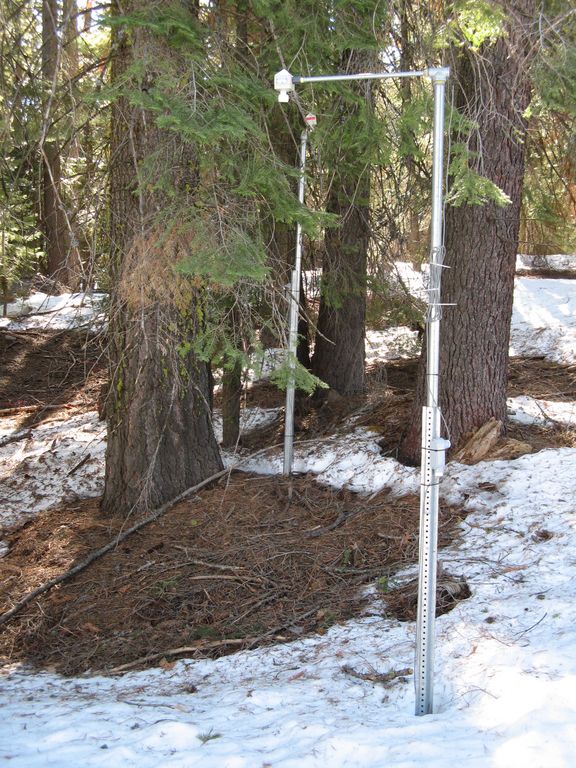
Instrument cluster at the P303 Upper Met site with ultrasonic snow depth sensor and co-located soil moisture and temperature sensors.

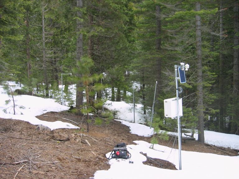
Instrument cluster at the P300 Lower Met site with ultrasonic snow depth sensor and co-located soil moisture and temperature sensors. The pole also psupports a solar panel, and an enclosure with a backup power supply and the data logger.

Instruments installed in the P301 meadows include wells and piezometers, at different locations to assess surface and groundwater flows.
Several clusters of instruments measure the water balance. These clusters each contain soil moisture and temperature sensors, an air temperature sensor, relative humidity sensor, and an ultrasonic snow depth sensor.
These water balance instruments are clustered at two different elevations, with north, flat, and south facing aspects. Conditions are measured under canopy, at drip edge, and at open canopy. Water balance measurements are also made in the wireless sensor network that stretches along the P301 meadow.

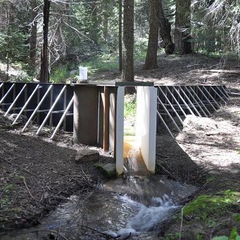
The eight subcatchments and two integrating catchments in the KREW project have flumes to measures discharge.

The large KREW flumes are complemented by small flumes for low flow.

Each of those eight KREW subcatchments also has a plastic-lined settling basin to capture sediment.

There are two meteorological stations in the Providence catchment - one at the lower elevation range and one near the crest. Each meteorological station has a rain gauge.

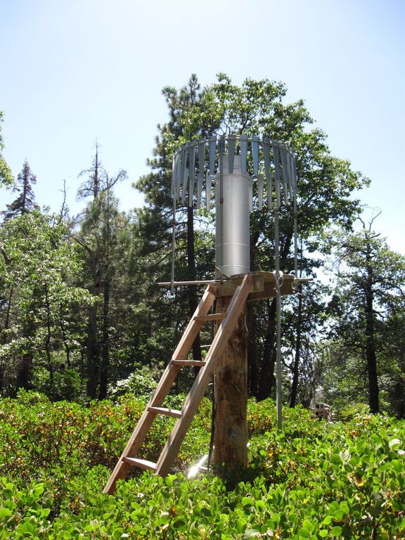
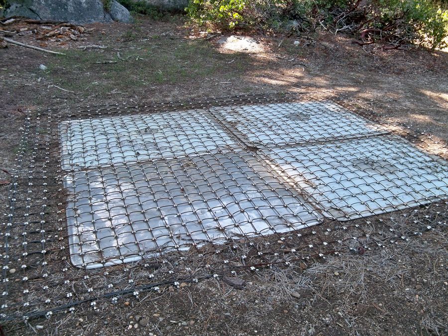
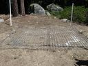
At the upper meteorological station, there is a snow pillow. This snow pillow tracks the weight of snow above it. Combined with the snow depth measurements, the two permit the calculation of amount of water in the snow pack.

Another view of the snow pillow.
Hundreds of instruments and sensors have been deployed in the primary SSCZO research site of the Providence Creek watershed as well as in Wolverton basin. Additional SSCZO flux towers and instruments have also been installed at the San Joaquin Experimental Range, Soaproot Saddle, and Short Hair Creek.
Explore more photos of the intstuments and sensors used by SSCZO.


Explore Further
