Sensors & Field Instruments
The conceptual science model for the Southern Sierra CZO is built around bi-directional links between landscape/climate variability and water/material fluxes across the rain-snow transition. The SSCZO uses a wide array of sensors and instruments to help conduct this research work.
© Southern Sierra Critical Zone Observatory
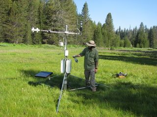
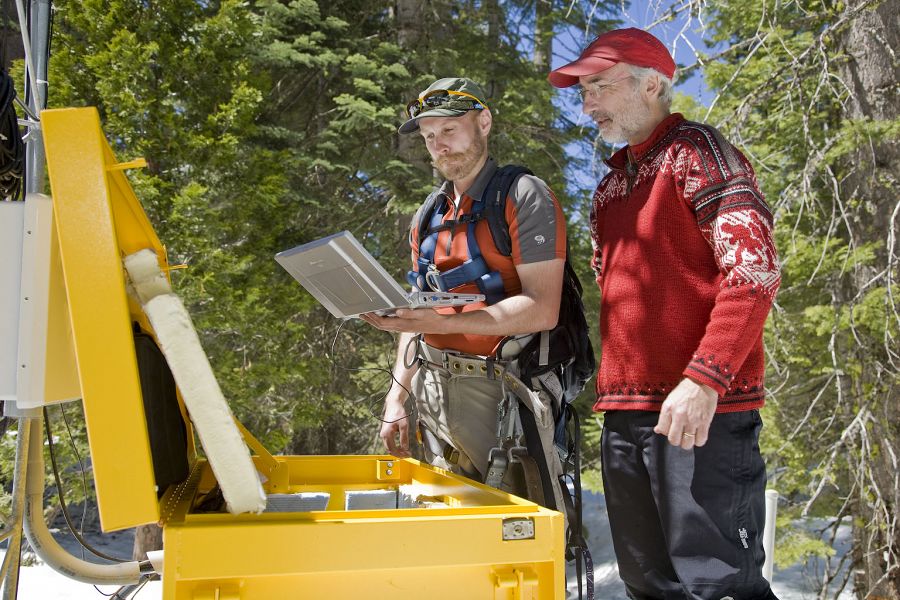
Instrument Cluster Components
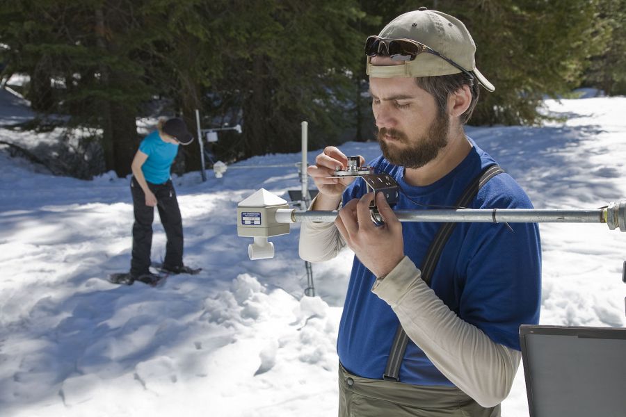
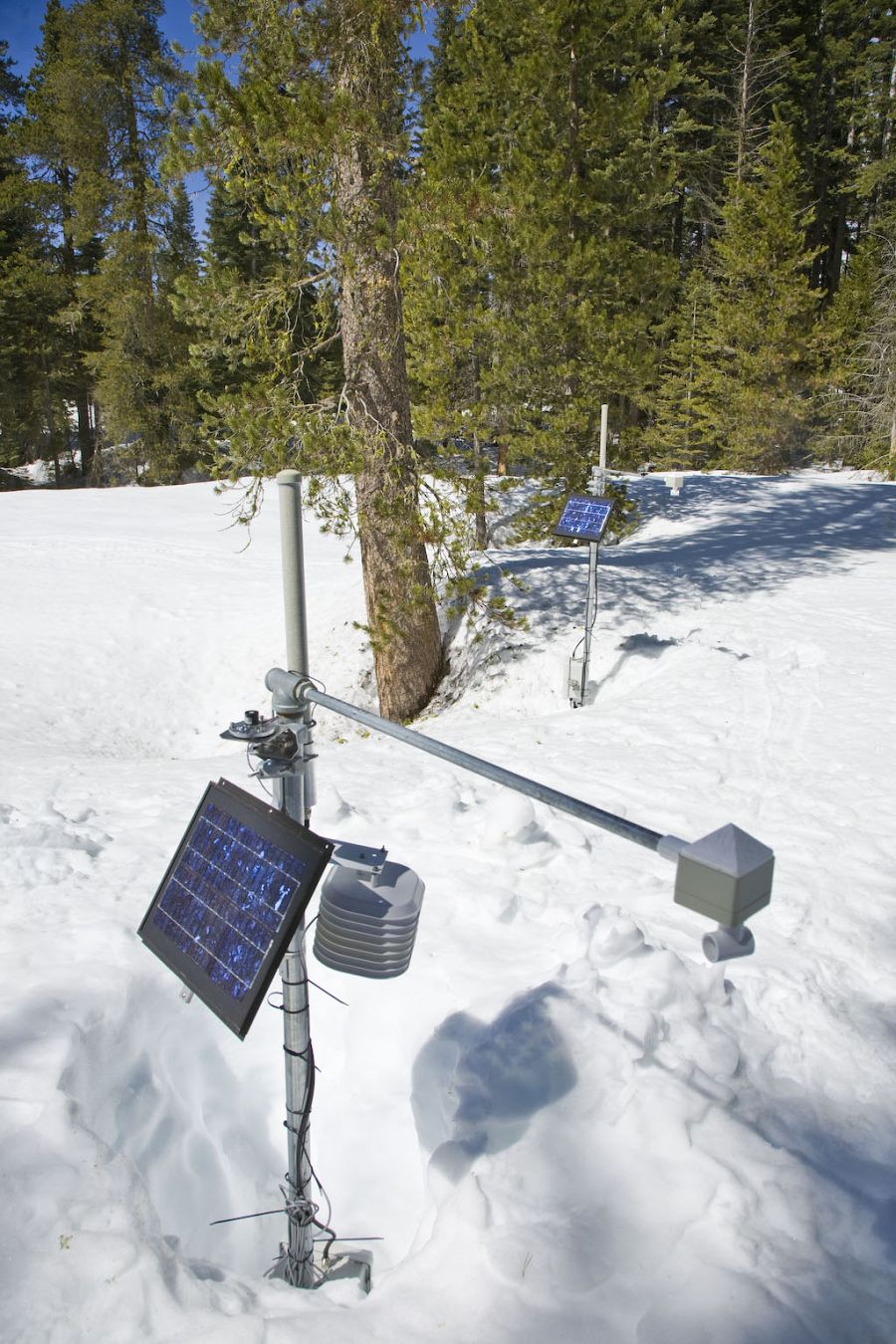
Water-balance instrument clusters have been installed at several different field areas, as early as 2007 in the Providence Creek Catchments site. At Providence, he instrument cluster includes over 380 individual sensors, placed around 13 trees, in three meadow transects, at three aspects and different elevations. The sensors in P301 form a wireless sensor network (WSN) (pdf).
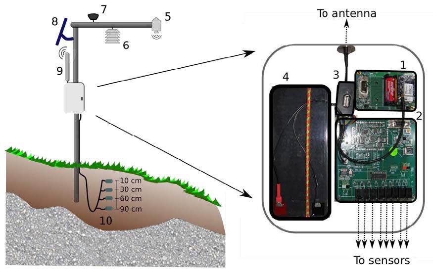
Each CZO sensor node interfaces: (1) mote, (2) custom data-logger to interface the sensor array, (3) on-site storage, (4) 12V battery, (5) snow-depth sensor, (6) humidity and temperature sensor, (7) solar radiation sensor, (8) 10W solar panel, (9) external 8dBi antenna, (10) four soil moisture, temperature, and matric potential sensors at varying depths.
© Southern Sierra Critical Zone Observatory
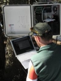
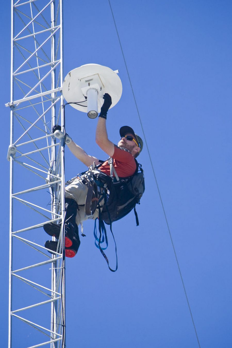
The DUST wireless network is distributed, self-assembling, and self-healing, meaning that if links in the network go down unexpectedly, alternative links form to ensure data will continually transmitted. The WSN currently consists of 60 radio motes, and links over 250 of the sensors to a central data hub. The wireless nature of the systems permits for data to be sampled at a large scale, and subsequently to be piped to a central location, aggregated for easy collection, and transmitted off site via cellular modem. All of our systems use solar power.
All of the sensor-nodes (A) are now equipped with Sensirion humidity and temperature sensors. From the hydrologic perspective, humidity is an important indicator of the snow-rain transition zone; the readings will also permit us to study the effects of rH on 2.4 GHz low-powered radio communications, a significant issue which has not been studied for hydrologic WSN deployments. Real-time data is currently available through a sporadic mobile phone connection. Optimization algorithms have been written to synchronize only newly acquired data, thus minimizing the power required for off-site transmissions. We are in the process of installing long-range 900MHz transmitters to tie the WSN to a nearby met-site. This met site not only has more reliable mobile phone communications, but will also feature a new, slightly smaller, WSN. This will, in effect, aggregate multiple WSNs over long distances, and will set the stage for a network-of-networks paradigm. For more information on the wireless sensor networks, see our SS CZO Field Areas section.
- 3 headwater catchments w/ stream gauges & water-quality measurements
- 2 met stations
- 60-m tall flux tower
- 60-node wireless embedded sensor network
- 214 EC-TM sensors for volumetric water content
- 113 MPS sensors for matric potential
- 57 snow-depth sensors
- Meadow piezometers & wells
- Sap-flow sensors
COSMOS Soil Moisture
In June, 2011, through a collaboration with the University of Arizona and the SSCZO, Cosmic-ray Soil Moisture Observing Systems (COSMOS) were installed at Soaproot and P301 flux towers. COSMOS measures low-energy cosmic-ray neutrons above the ground in order to measure soil water content over large areas (34ha area and up to 50 cm depth). Click here for more information about COSMOS. COSMOS data is available in real time using their data portal. Real time data is available for both P301 and Soaproot.
KREW Infrastructure
Existing infrastructure and research as part of the KREW watershed project include stream gauges, water quality measurements, met stations, sediment basins, snow pillows, atmospheric deposition and soil chemistry. Met stations have been retrofitted with snow depth sensors. The main source of power for sensors is from a vast network of 24 v batteries bank totaling 1500 amps, connected to solar panels. The main solar array at the P301 flux tower has 1kw hr of power.
Critical Zone Trees
In 2008, the area underneath a white fir was instrumented with numerous soil moisture, matric potential, and sap flux sensors to better understand the water balance of a single tree. Since then, 7 more Critical Zone Trees have been instrumented throughout the watershed.
The deployment of more than 250 sensors measure temperature, volumetric water content, matric potential, and snow depth surrounding the two trees complements sap-flow measurements in the trunk and stem-water-potential measurements in the canopy to capture the seasonal cycles of soil wetting and drying.
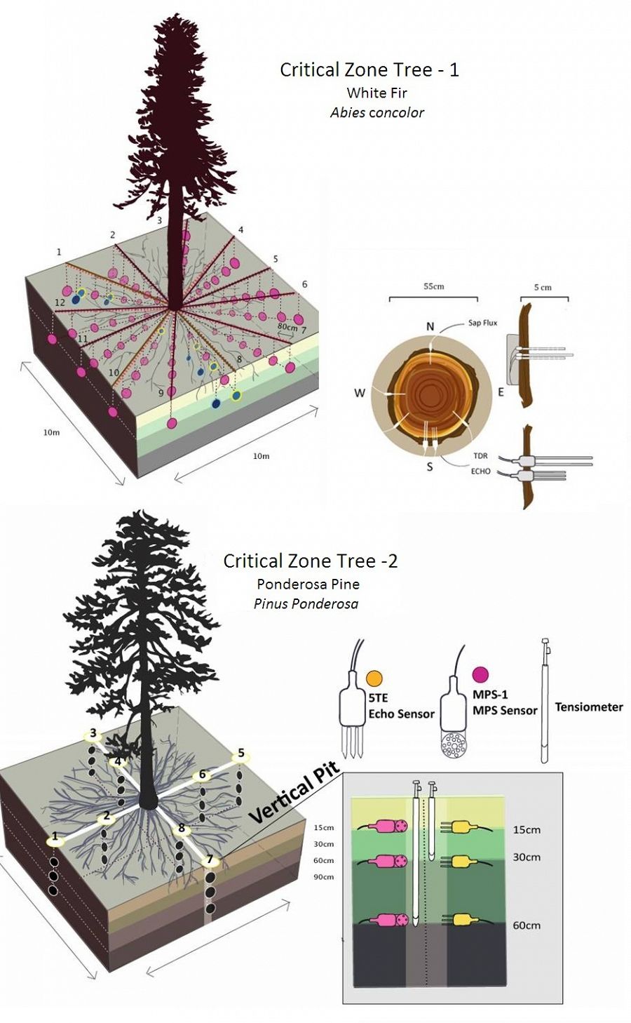
The main Critical Zone Tree infrastructure includes:
- MPS-1: Matric Potential
- 5TE: Volumetric Water Content, Temperature, Conductivity
- CZT-1 has a 72 MPS sensor array at 30cm, 6 veritcal pits, water content, MPS sensors and tensiometers at 3 depths
- 214 EC-TM sensors for volumetric water content
- CZT-2 8 vertical pits containing water content, MPS and tensiometers
- All eight critical zone trees have sap-flow sensors installed into the trunk of the tree
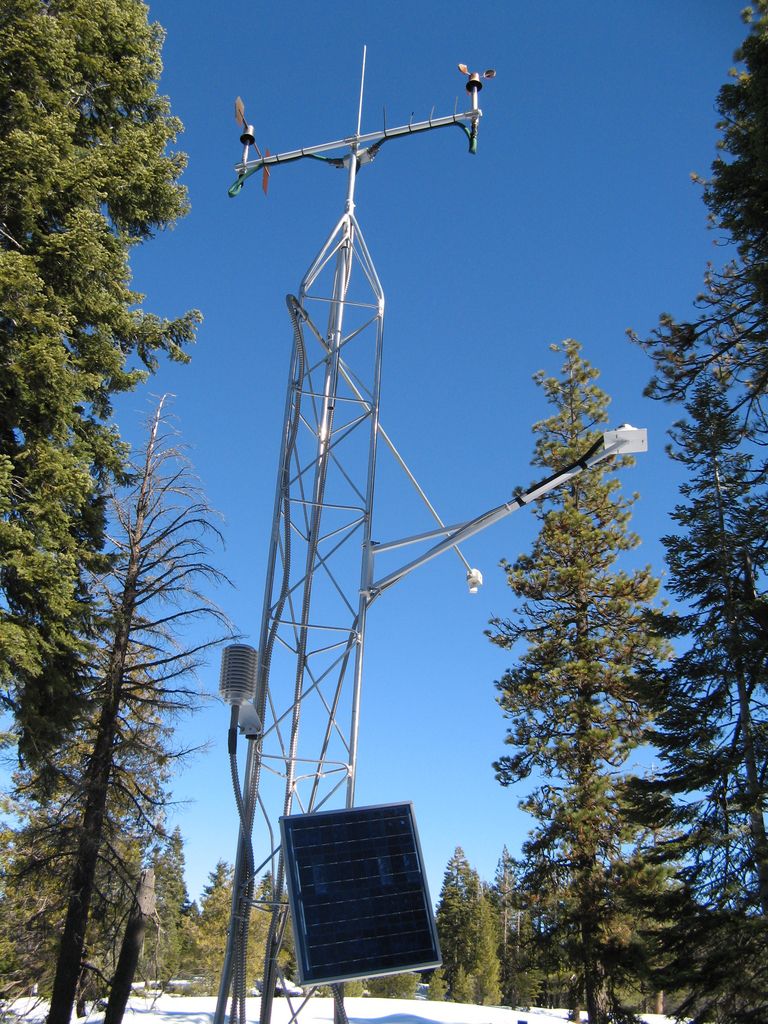
Flux Towers
Eddy Co-variance Flux Towers
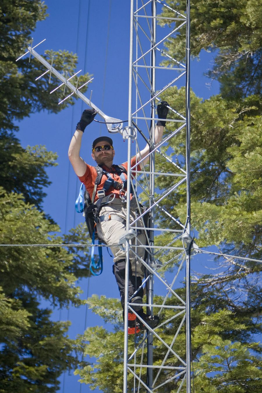
SSCZO's first eddy-covariance gas flux tower was installed at Providence Creek Catchments sub-catchment P301 in 2008. Since then, three additional flux towers have been installed that form an elevation transect from 400 m to 2700 m, incorporating major ecosystems on the western slope of the Sierra Nevada and crossing the rain-snow transition zone. The flux tower provides point measurements of water, energy and carbon exchange with the atmosphere, which will be extended outward using the meteorological, snow/soil, remotely sensed and other spatial data. Measurements include wind speed and direction, atmospheric water vapor flux, CO2 flux, shortwave and longwave radiation (incoming/outgoing), precipitation, relative humidity, and barometric pressure. We are using the climate gradient of four eddy covariance towers to understand the mechanistic interactions between climate, soil development, species distribution, biotic production, and hydrological balance.
The P301 flux tower is also the main transmission hub for the wireless sensor network and instrument clusters described above.
![]()
Flux tower data from SSCZO sites are also aligned with a larger network of flux towers located throughout the United States, called the AmeriFlux network. The AmeriFlux network is a community of sites and scientists measuring ecosystem carbon, water, and energy fluxes across the Americas, and committed to producing and sharing high quality eddy covariance data.
Wolverton Basin Instruments
Wolverton
Prior to the inception of the SSCZO, the water balance instrument cluster was being developed in the Wolverton and Long Meadow areas of Sequoia National Park. At an elevation of 2300-2600 m, this snow-dominated area encompasses the Red Fir zone of the southern Sierra Nevada. Instrumentation was completed in 2007.
Some of the instrumentation in Wolverton includes meteorological, soil moisture and temperature, snow depth, solar radiation, an sap flow instrumentation on north and south facing slopes at two different elevations. Other instrumentation includes clustered piezometers/monitoring wells in Long Meadow, and stream flow measurements at different locations along Wolverton Creek.
Long Meadow
Also located in Wolverton, the Long Meadow area has been instrumented with wells and piezometers to investigate groundwater/surface water interactions. In addition, a fiber optic cable distributed temperature sensor (DTS) was installed for collection high spatial and temporal resolution meadow stream temperature data. Other key data collection methods included a micro-meteorological station, a large geodesic evapotranspiration chamber, Hobo temperature loggers, pressure transducers in existing monitoring well/piezometers, and water geochemistry sampling.
Each CZO sensor node interfaces: (1) mote, (2) custom data-logger to interface the sensor array, (3) on-site storage, (4) 12V battery, (5) snow-depth sensor, (6) humidity and temperature sensor, (7) solar radiation sensor, (8) 10W solar panel, (9) external 8dBi antenna, (10) four soil moisture, temperature, and matric potential sensors at varying depths.
© Southern Sierra Critical Zone Observatory
© Southern Sierra Critical Zone Observatory
© Southern Sierra Critical Zone Observatory
© Southern Sierra Critical Zone Observatory
© Southern Sierra Critical Zone Observatory
© Southern Sierra Critical Zone Observatory
© Southern Sierra Critical Zone Observatory
© Southern Sierra Critical Zone Observatory
© Southern Sierra Critical Zone Observatory
© Southern Sierra Critical Zone Observatory
© Southern Sierra Critical Zone Observatory
Explore Further
