Providence Creek Subcatchment P303
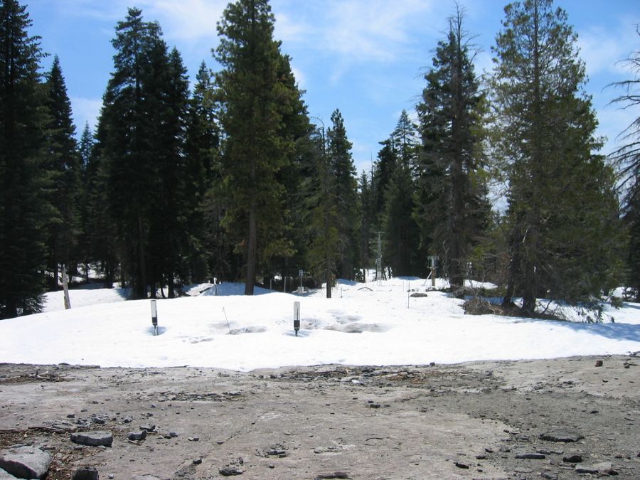
The P303 subcatchment contains a number of sensors and instruments, but the primary ones are the upper elevation meteorological station and the water balance instrument clusters, located at about 1985 m in elevation at the eastern edge of the watershed.
1.323 km2 Area
1731 - 2025 m Elev
Parent Field Area:
Providence Creek Headwater Catchments (1660 - 2115 m elevation) ▲
© Southern Sierra Critical Zone Observatory
-
Setting & Research
Meteorological Stations
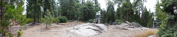
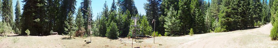
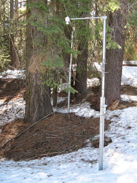
Staff from both the Kings River Experimental Watersheds (KREW) project and Southern Sierra CZO operate and maintain the two meteorological stations located in the Providence Creek headwaters. The upper elevation met station is located within the P303 subcatchment. The lower elevation met station is located within the larger P300 catchment.
Panorama of the upper elevation met station. July 2014.

Panorama of the lower elevation met station. July 2014.
Water Balance Instrument Clusters
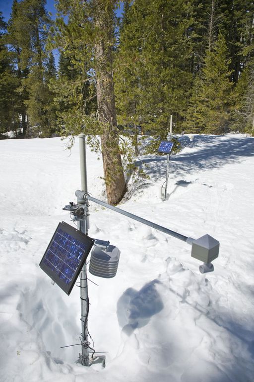
Also collocated at this site are three water balance instrument clusters used to monitor snow depth, solar radiation, air temperature, soil water content, and soil temperature. These instrument clusters incorporate North, South, and Flat aspects to capture landscape variability at the Upper Met station location.
Panorama of the lower elevation met station. July 2014.
Panorama of the upper elevation met station. July 2014.
-
Data
Met Stations, Providence, Upper - Meteorology (2002-2011)
19 components • Providence Creek Subcatchment P303 • Climatology / Meteorology • Carolyn HunsakerNational - Stream Water Chemistry - Cations, Anions, Metals (1982-2015)
1 components • Bisley, Betasso, East Peak, Marshall Gulch (High-Elevation), Providence Creek Subcatchment P301, Providence Creek Subcatchment P303, Providence Creek Subcatchment P304, Eel River Watershed, Puente Roto, Rio Blanco, Rio Icacos, Susquehanna Shale Hills Critical Zone Observatory • Biogeochemistry, Biology / Ecology, Hydrology, Water Chemistry • Hyojin, Kim; Bishop, Jim; Dietrich, William; Fung, Inez; McDowell, William H.; Brantley, Susan L.; Hoagland, Beth; Sullivan, Pamela L.; Cain, Molly; Neal, Andrew; Fisher, Jessica; Russo, Tess; Niwot Ridge LTER; Liu, Fengjing; Chorover, Jon; Troch, Peter; McIntosh, Jennifer; Brooks, Paul; Abramson, Nate; Heidbuechel, Ingo; Amistadi, Mary Key; Alexander Pedron, Shawn; Chorover, Jon; Troch, Peter; Corley, Timothy; Zapata-Rios, Xavier; Losleben, Mark; Condon, KatherineProvidence, Upper Met - Rainfall Chemistry, Meteorology - NADP (2008-2010)
4 components • Providence Creek Subcatchment P303 • Climatology / Meteorology • National Atmospheric Deposition ProgramProvidence, Upper Met, North aspect - Soil Moisture, Soil Temperature, Snow Depth, Air Temperature (2008-2018)
31 components • Providence Creek Subcatchment P303 • Hydrology, Climatology / Meteorology • Roger Bales; Matthew Meadows; Erin Stacy; Xiande MengProvidence, Upper Met, South aspect - Soil Moisture, Soil Temperature, Snow Depth, Air Temperature (2008-2018)
31 components • Providence Creek Subcatchment P303 • Hydrology, Climatology / Meteorology • Roger Bales; Matthew Meadows; Erin Stacy; Xiande Meng -
Photos
SSCZO - Meteorological Stations

© Southern Sierra Critical Zone Observatory
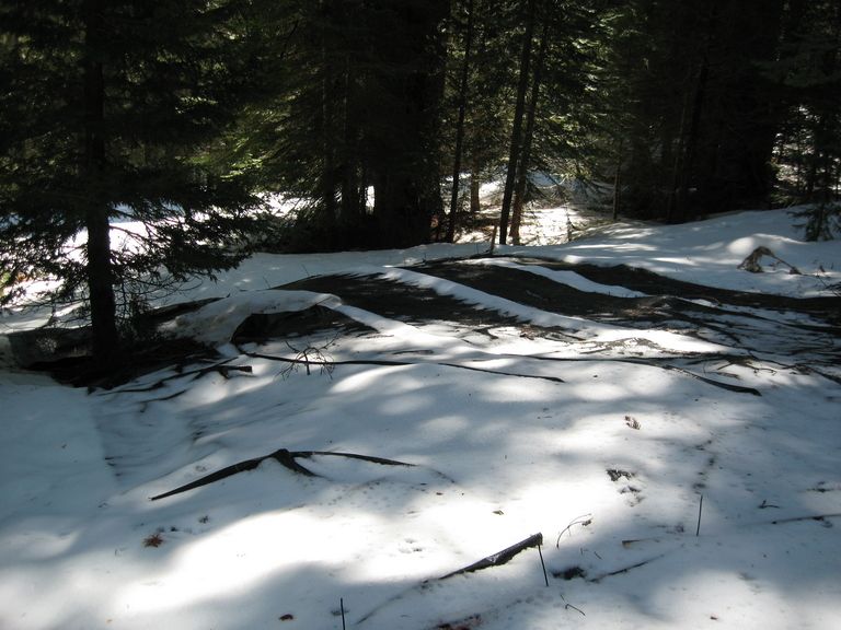
The Providence Creek upper meteorological station is located in a high elevation spot of the Providence Creek study area. Collocated at this site are three water balance instrument clusters to monitor snow depth, solar radiation, air temperature, soil water content, and soil temperature. The other meteorological station is located in a low elevation spot within the P300 catchment. Instrumentation is similar to the upper elevation site.
A photo gallery of the Upper Met Station can be found here.
A photo gallery of the Lower Met Station can be found here.
SSCZO - Snowmelt Plots

© Southern Sierra Critical Zone Observatory
Prototype snowmelt plots were installed in Spring 2009. Additional snowmelt plot studies were conducted in WY2010-2011.
A photo gallery of the snowmelt plots can be found here.
SSCZO - Instruments

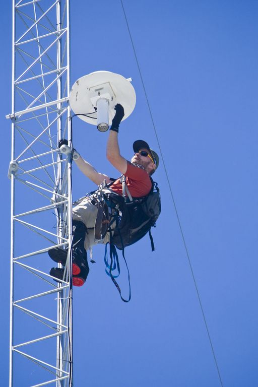
Matt Meadows (Field Manager, UC Merced) checks on an instrument on the P301 flux tower.

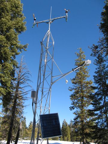
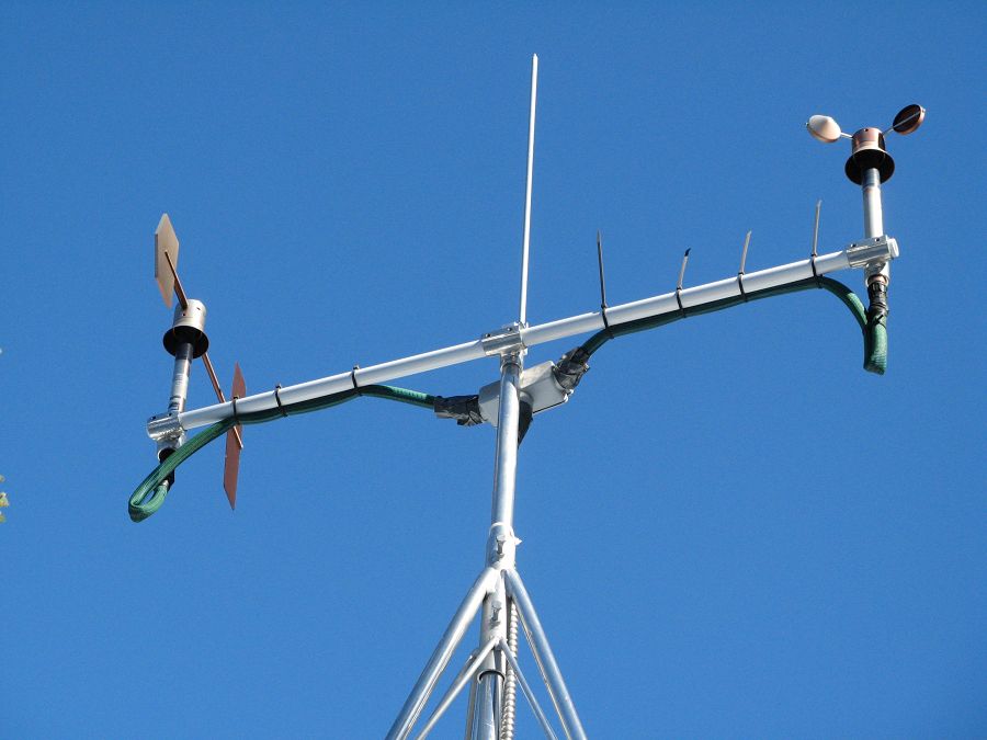
Anemometer measuring wind speed and direction.

Ultrasonic anemometer on the P301 flux tower measures wind speed and direction in 3 dimensions. Data is connected to gas samples taken every quarter second at the filters on the left (beige circles).

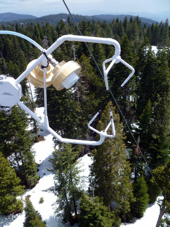
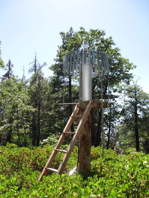
Instrument cluster featuring a relative humidity sensor, ultrasonic snow depth sensor, co-located soil moisture and temperature sensors at different depths, and a solar panel to power it all.

Instrument cluster at the P303 Upper Met site with ultrasonic snow depth sensor and co-located soil moisture and temperature sensors.

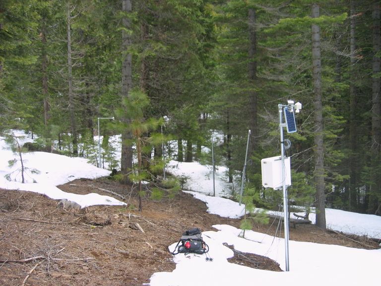
Instrument cluster at the P300 Lower Met site with ultrasonic snow depth sensor and co-located soil moisture and temperature sensors. The pole also psupports a solar panel, and an enclosure with a backup power supply and the data logger.

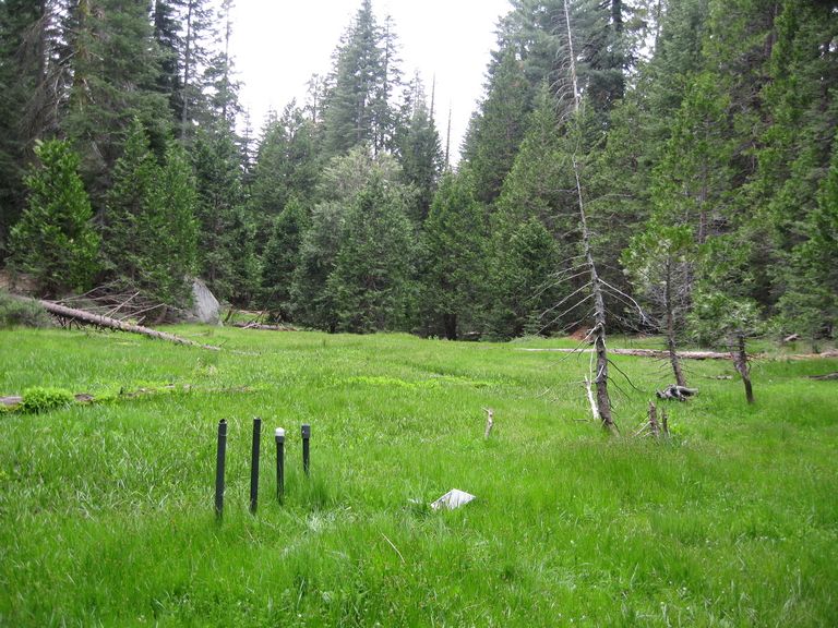
Instruments installed in the P301 meadows include wells and piezometers, at different locations to assess surface and groundwater flows.
Several clusters of instruments measure the water balance. These clusters each contain soil moisture and temperature sensors, an air temperature sensor, relative humidity sensor, and an ultrasonic snow depth sensor.
These water balance instruments are clustered at two different elevations, with north, flat, and south facing aspects. Conditions are measured under canopy, at drip edge, and at open canopy. Water balance measurements are also made in the wireless sensor network that stretches along the P301 meadow.

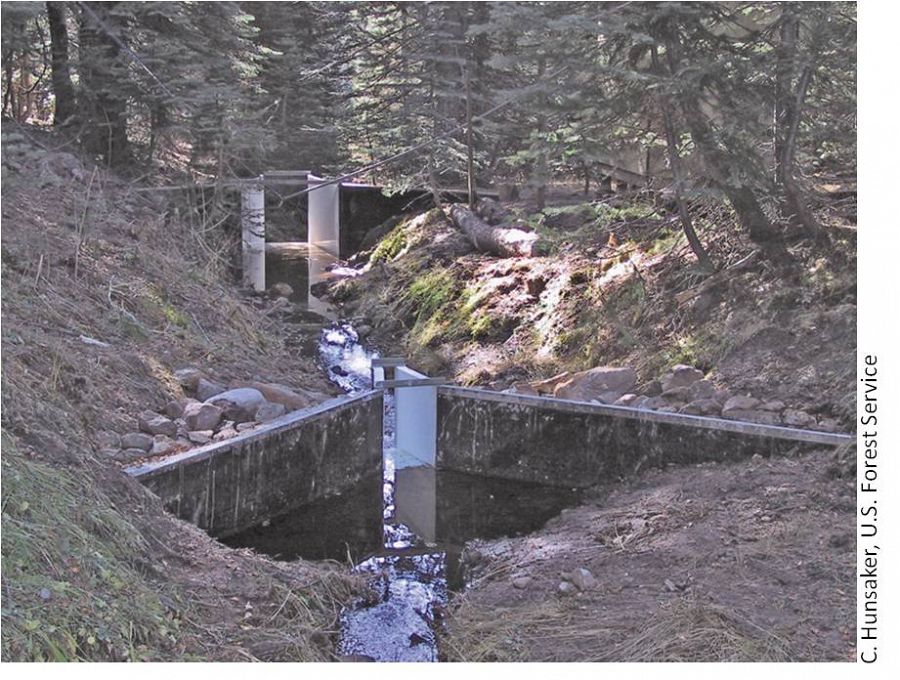
The eight subcatchments and two integrating catchments in the KREW project have flumes to measures discharge.

The large KREW flumes are complemented by small flumes for low flow.

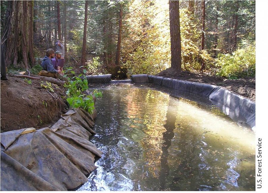
Each of those eight KREW subcatchments also has a plastic-lined settling basin to capture sediment.

There are two meteorological stations in the Providence catchment - one at the lower elevation range and one near the crest. Each meteorological station has a rain gauge.

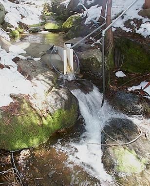
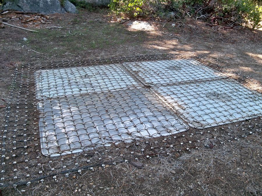
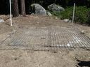
At the upper meteorological station, there is a snow pillow. This snow pillow tracks the weight of snow above it. Combined with the snow depth measurements, the two permit the calculation of amount of water in the snow pack.

Another view of the snow pillow.
Hundreds of instruments and sensors have been deployed in the primary SSCZO research site of the Providence Creek watershed as well as in Wolverton basin. Additional SSCZO flux towers and instruments have also been installed at the San Joaquin Experimental Range, Soaproot Saddle, and Short Hair Creek.
Explore more photos of the intstuments and sensors used by SSCZO.

Explore Further
