Dataset Listings
These dataset listings are out of date and have been archived.
See the updated listings on HydroShare.org >
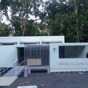
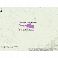
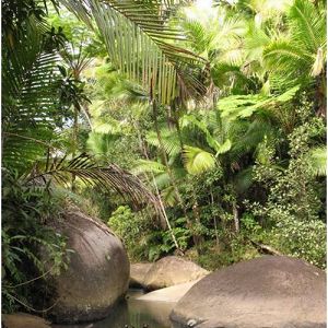
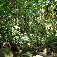
El Verde Field Station
1.05 km2,
We are located within El Yunque National Forest in Puerto Rico, surrounded by tropical rainforests representative of many Caribbean island ecosystems. Research at El Verde focuses on forest dynamics, stream ecology and hydrology, and ecosystem processes. Most research is conducted by the Luquillo Long-Term Ecological Research (LTER) program, LCZO and by scientists from the University of Puerto Rico and universities in mainland US.
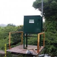
El Verde Field Station - Soil Biogeochemistry - Phosphorus fractionation response to dynamic redox (2016-2018)
1 components •
El Verde Field Station •
Biogeochemistry •
Lin, Yan; Bhattacharyya, Amrita; Campbell, Ashley N.; Nico, Peter S.; Pett-Ridge, Jennifer; Silver, Whendee L.
El Verde Instrumented hillslope - Soil Biogeochemistry - Iron and carbon cycling (2016)
1 components •
El Verde Field Station •
Biogeochemistry, Soil Science / Pedology •
Barcellos, Diego; O'Connell,Christine S.; Silver, Whendee; Meile, Christof ; Thompson, Aaron
National - Climate, Flux Tower, Streamflow / Discharge - CUAHSI WDC web services (1968-2015)
7 components •
Boulder Creek Watershed, Christina River Basin, Jemez River Basin, Santa Catalina Mountains, El Verde Field Station, Northeastern Puerto Rico and the Luquillo Mountains, Rio Blanco, Rio Mameyes, Susquehanna Shale Hills Critical Zone Observatory, Providence Creek Headwater Catchments (1660 - 2115 m elevation), Wolverton Basin (2230 - 2700 m elevation), Other instrumented sites •
Climatology / Meteorology, Hydrology, Soil Science / Pedology •
Boulder Creek Critical Zone Observatory; Catalina-Jemez Critical Zone Observatory; Luquillo Critical Zone Observatory; Shale Hills Critical Zone Observatory; Southern Sierra Critical Zone Observatory; Christina River Basin Critical Zone Observatory
Quebrada Prieta, El Verde - Vegetation, Soil Gas, Soil Moisture - Canopy Trimming Experiment (2003-2016)
8 components •
El Verde Field Station, Quebrada Prieta •
Biology / Ecology •
Cantrell, Sharon; Gonzalez, Grizelle; Lodge, D. Jean; McDowell, William H.; Richardson, Barbara A.; Sharpe, Joanne M.; Shiels, Aaron; Schowalter, Timothy D.; Silver, Whendee; Willig, Michael R.
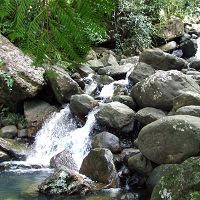
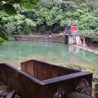
Quebrada Prieta
0.3077 km2,
Quebrada Prieta small gaged stream.
Quebrada Prieta, El Verde - Vegetation, Soil Gas, Soil Moisture - Canopy Trimming Experiment (2003-2016)
8 components •
El Verde Field Station, Quebrada Prieta •
Biology / Ecology •
Cantrell, Sharon; Gonzalez, Grizelle; Lodge, D. Jean; McDowell, William H.; Richardson, Barbara A.; Sharpe, Joanne M.; Shiels, Aaron; Schowalter, Timothy D.; Silver, Whendee; Willig, Michael R.
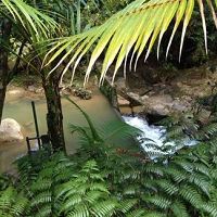
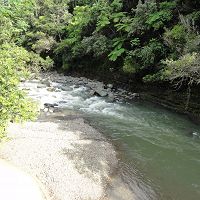
Quebrada Sonadora
2.6159 km2,
Gauged Stream near El Verde, drains into the Rio Espiritu Santo, boulder strewn stream bed underline by volcanoclastic rock.
Icacos and Quebrada Sonadora - Streamflow / Discharge, Stream Suspended Sediment, Electrical Conductivity - Hysteresis Analysis (2016-2017)
2 components •
Rio Icacos, Quebrada Sonadora •
Water Chemistry, Hydrology •
Wymore, Adam S.; Leon,Miguel C.; Shanley, James B.; McDowell, William H
Northeastern Puerto Rico and the Luquillo Mountains
0-1075 m elevation, 1000-5000 mm/yr
The Luquillo Critical Zone Observatory (LCZO) is located in Luquillo Mountains of northeastern Puerto Rico. This Includes El Yunque National Forest, Rio Mameyes and Rio Blanco watersheds, surrounding coastal plains and nearby urbanized areas such as the San Juan metro area, Luquillo and Fajardo.
Eastern Puerto Rico - Stream Water Chemistry, Stream Ecology - Data and R scripts (2009-2014)
1 components •
Northeastern Puerto Rico and the Luquillo Mountains •
Biogeochemistry, Water Chemistry •
McDowell, William H.; McDowell, William G.; Potter, Jody; Ramirez, Alonso; Leon, Miguel C.
El Verde - Soil Moisture - Soil Respiration, Oxygen and Water Content (2014-2016)
4 components •
Northeastern Puerto Rico and the Luquillo Mountains •
Biogeochemistry, Biology / Ecology, Soil Science / Pedology •
Whendee Silver
El Verde, Icacos, Espiritu Santo, and Bisley - Stream Water Chemistry, Streamflow / Discharge, Air Temperature, Stream Water Temperatures (2014-2019)
8 components •
Northeastern Puerto Rico and the Luquillo Mountains •
Biology / Ecology, Hydrology, Water Chemistry •
McDowell, William H.
Luquillo Mountains - Meteorology, Air Temperature - Daily (2002-2009)
1 components •
Northeastern Puerto Rico and the Luquillo Mountains •
Climatology / Meteorology •
Scatena, F.N.; IITF
Luquillo Mountains - Soil Geochemistry - Phosphorus (2010)
6 components •
Northeastern Puerto Rico and the Luquillo Mountains •
Biogeochemistry •
Porder, S.
Luquillo Mountains - Soil Geochemistry - X-ray Florescence (2010)
2 components •
Northeastern Puerto Rico and the Luquillo Mountains •
Geochemistry / Mineralogy •
Nawal, C.; Scatena, F.N.
Luquillo Mountains - Soil Survey - acid phosphatase kinetic parameters (2012)
1 components •
Northeastern Puerto Rico and the Luquillo Mountains •
Biogeochemistry •
Stone, M.M.; Plante, A.F.
Luquillo Mountains - Geophysics, Ground Penetrating Radar (GPR) (2012-2015)
2 components •
Northeastern Puerto Rico and the Luquillo Mountains •
Geophysics •
Comas, Xavier; Hynek, Scott; Wright, William; Brantley, Susan L.
Luquillo Mountains - Photographic Imagery, Meteorology - Cloud cover imagery (2014-2016)
1 components •
Northeastern Puerto Rico and the Luquillo Mountains •
Climatology / Meteorology •
Bassiouni, Maoya; Scholl, Martha A.; Torres-Sanchez, Angel J.; Murphy, Sheila F.
Luquillo Mountains - Soil Redox Potential, Soil Biogeochemistry - Fe speciation, redox (2016-2018)
1 components •
Northeastern Puerto Rico and the Luquillo Mountains •
Biogeochemistry, Soil Science / Pedology •
Elizabeth K. Coward; Aaron Thompson; Alain F. Plante
Luquillo Mountains, Puerto Rico - Precipitation, GIS/Map Data (2014)
1 components •
Northeastern Puerto Rico and the Luquillo Mountains •
Climatology / Meteorology, GIS / Remote Sensing •
Murphy, S.F.; Stallard, R.F.; Scholl, M.A.; Gonzalez, Grizelle; Torres-Sanchez, Angel
National - Climate, Flux Tower, Streamflow / Discharge - CUAHSI WDC web services (1968-2015)
7 components •
Boulder Creek Watershed, Christina River Basin, Jemez River Basin, Santa Catalina Mountains, El Verde Field Station, Northeastern Puerto Rico and the Luquillo Mountains, Rio Blanco, Rio Mameyes, Susquehanna Shale Hills Critical Zone Observatory, Providence Creek Headwater Catchments (1660 - 2115 m elevation), Wolverton Basin (2230 - 2700 m elevation), Other instrumented sites •
Climatology / Meteorology, Hydrology, Soil Science / Pedology •
Boulder Creek Critical Zone Observatory; Catalina-Jemez Critical Zone Observatory; Luquillo Critical Zone Observatory; Shale Hills Critical Zone Observatory; Southern Sierra Critical Zone Observatory; Christina River Basin Critical Zone Observatory
National - Streamflow / Discharge - USGS and USDA Data Resources (1985-2017)
22 components •
Boulder Creek Watershed, Santa Catalina Mountains, Jemez River Basin, Reynolds Creek Experimental Watershed, Susquehanna Shale Hills Critical Zone Observatory, Northeastern Puerto Rico and the Luquillo Mountains, Clear Creek Watershed, Sangamon River Basin, Calhoun Critical Zone Observatory, Providence Creek Headwater Catchments (1660 - 2115 m elevation) •
Hydrology •
USGS National Water Information System
National - LiDAR, Land Cover, GIS/Map Data - OpenTopography (2010-2017)
18 components •
Boulder Creek Watershed, Eel River Watershed, Jemez River Basin, Reynolds Creek Experimental Watershed, Susquehanna Shale Hills Critical Zone Observatory, Northeastern Puerto Rico and the Luquillo Mountains, Sangamon River Basin, Clear Creek Watershed, Calhoun Critical Zone Observatory, Providence Creek Headwater Catchments (1660 - 2115 m elevation) •
Geomorphology, GIS / Remote Sensing, Hydrology, Biology / Ecology •
National Center for Airborne Laser Mapping; Boulder Creek Critical Zone Observatory; Calhoun Critical Zone Observatory; University of Arizona; University of California Merced; Valles Caldera National Preserve; Bandelier National Monument; National Park Service; Jemez River Basin and Santa Catalina Mountains Critical Zone Observatory; Luquillo Critical Zone Observatory; Reynolds Creek CZO; Eel River CZO; Shale Hills CZO
National - Soil Gas - CO2 and O2 (2014-2017)
2 components •
Bigelow Site (High-Elevation), Jemez 2013 Burned ZOB, Jemez Unburned Site, Calhoun CZO Research Area 1, Garner Run - Sandstone Forested, Northeastern Puerto Rico and the Luquillo Mountains •
Biogeochemistry, Climatology / Meteorology, Soil Science / Pedology, Biology / Ecology •
Brecheisen, Zachary; Chorover, Jon; Kaye, Jason; Silver, Whendee; Abramson, Nate; Barron-Gafford, Greg; Condon, Katherine E.; Cook, Charles W.; Hill, Lillian; Losleben, Mark; Minor, Rebecca; O'Connell, Christine; Richter, Daniel deB.; Durcik, Matej
Northeastern Puerto Rico - Stream Ecology, Vegetation - Luquillo LTER (1975-2018)
3 components •
Northeastern Puerto Rico and the Luquillo Mountains •
All Disciplines, Biology / Ecology •
Luquillo Long Term Ecological Research (LTER)
Northeastern Puerto Rico - GIS/Map Data - GIS web map and Datasets (1998-2019)
1 components •
Northeastern Puerto Rico and the Luquillo Mountains •
All Disciplines •
Leon, M.
Northeastern Puerto Rico - GIS/Map Data, LiDAR (2010-2011)
1 components •
Northeastern Puerto Rico and the Luquillo Mountains •
All Disciplines •
Luquillo Critical Zone Observatory
Northeastern Puerto Rico - Soil Mineralogy - Mineral content of soils 0-20 cm XRD (2010-2011)
2 components •
Northeastern Puerto Rico and the Luquillo Mountains •
Geochemistry / Mineralogy •
Zhuo Wang
Northeastern Puerto Rico - Soil Gas - Soil Chemistry and Greenhouse Gas Emissions (2011)
1 components •
Northeastern Puerto Rico and the Luquillo Mountains •
Biogeochemistry •
G. McNicol; W. L. Silver
Northeastern Puerto Rico - Soil Microbes, Soil Geochemistry - Enzyme activity and microbial community structure (2011-2012)
1 components •
Northeastern Puerto Rico and the Luquillo Mountains •
Biogeochemistry •
Stone, M.M., DeForest, J.L., Plante, A.F.
Northeastern Puerto Rico - Soil Biogeochemistry - landscape-scale soil biogeochemistry and enzymes (2012)
1 components •
Northeastern Puerto Rico and the Luquillo Mountains •
Biogeochemistry •
Hall, Steven J.
Northeastern Puerto Rico - Soil Biogeochemistry - soil organic matter; Iron phase crystallinity (2016-2018)
1 components •
Northeastern Puerto Rico and the Luquillo Mountains •
Biogeochemistry •
Steven J. Hall; Asmeret A. Berhe; Aaron Thompson
Northeastern Puerto Rico and the Luquillo Mountain - Soil Survey (2011-2012)
11 components •
Northeastern Puerto Rico and the Luquillo Mountains, Bisley •
Biogeochemistry, Geochemistry / Mineralogy •
Johnson, A.J.; Xing, Hao
Northeastern Puerto Rico and the Luquillo Mountain - GIS/Map Data (2011-2016)
2 components •
Northeastern Puerto Rico and the Luquillo Mountains •
All Disciplines •
Porder, Stephen; Johnson, Arthur H.; Xing, Hao Xing; Brocard, Gilles; Goldsmith, Steven; Pett-Ridge, Julie; Hall, Steven J.; Silver, Whendee L.; Treffkorn, Jonathan
Prieta arm B and Gatos - Topographic Carbon Storage, Tree Growth & Physiology - Leaf litter collected over channel (2010-2016)
3 components •
Northeastern Puerto Rico and the Luquillo Mountains •
Biology / Ecology •
Alonso Ramirez
Puerto Rico - GIS/Map Data - San Juan ULTRA Mapping Data (1936-2016)
1 components •
Northeastern Puerto Rico and the Luquillo Mountains •
All Disciplines •
San Juan Ultra
Puerto Rico - Groundwater Chemistry, Groundwater Depth, Stream Water Chemistry, Streamflow / Discharge, Precipitation, Meteorology - USGS Caribbean Water Science Center (1969-2016)
6 components •
Northeastern Puerto Rico and the Luquillo Mountains •
All Disciplines •
US Geological Survey Caribbean Water Science Center
Puerto Rico - Precipitation, Reservoir Height, Streamflow / Discharge - Schoolyard Data Jam (1990-2016)
6 components •
Rio Mameyes, Northeastern Puerto Rico and the Luquillo Mountains •
Hydrology, Soil Science / Pedology, Outreach / Education Research •
USGS; USDA USFS; Whendee Silver; Miguel Leon
Puerto Rico - Stable Isotopes - Stable Isotope (δ18O and δ2H) Data (1994-2013)
8 components •
Northeastern Puerto Rico and the Luquillo Mountains, Rio Icacos, East Peak, Rio Mameyes •
Hydrology, Water Chemistry, Climatology / Meteorology •
Martha A. Scholl; Angel Torres-Sanchez; Manuel Rosario-Torres
Puerto Rico - GIS/Map Data (1998)
1 components •
Northeastern Puerto Rico and the Luquillo Mountains •
GIS / Remote Sensing, Geophysics, Geochemistry / Mineralogy •
Bawiec, W.J.; USGS
Puerto Rico - GIS/Map Data (1998-2012)
2 components •
Northeastern Puerto Rico and the Luquillo Mountains •
GIS / Remote Sensing, Geophysics, Geochemistry / Mineralogy •
Leon, M.C.
Puerto Rico - GIS/Map Data - land use (2000-2016)
1 components •
Northeastern Puerto Rico and the Luquillo Mountains •
GIS / Remote Sensing •
Gould, William, A.; Wadsworth, Frank, H.; Quinones, Maya.; Fain, Stephen J.; Alvarez-Berrios, Nora L.
Puerto Rico - Precipitation - NOAA NWS Precipitation Estimates (2003-2016)
2 components •
Northeastern Puerto Rico and the Luquillo Mountains •
Climatology / Meteorology •
M. Bonnin; D. Martin; B. Lin; T. Parzybok; M. Yekta; D. Riley
Puerto Rico - Geomorphology - Stream channel geomorphology (2009-2012)
1 components •
Northeastern Puerto Rico and the Luquillo Mountains •
Geomorphology •
Phillips, C.B.
Puerto Rico- Coastal Zone - Digital Elevation Model (DEM), LiDAR - 2016 USACE NCMP Topobathy Lidar (2016)
1 components •
Northeastern Puerto Rico and the Luquillo Mountains •
GIS / Remote Sensing •
U.S. Army Corps of Engineers (USACE); JALBTCX (Joint Airborne Lidar Bathymetry Technical Center of eXpertise); Department of Commerce (DOC); National Oceanic and Atmospheric Administration (NOAA); National Ocean Service (NOS); Office for Coastal Management (OCM)
Shale Hills, Boulder, Luquillo, JRB-SCM, Calhoun - Soil Geochemistry (2001-2013)
1 components •
Susquehanna Shale Hills Critical Zone Observatory, Bisley, Boulder Creek Watershed, Northeastern Puerto Rico and the Luquillo Mountains, Santa Catalina Mountains •
Geochemistry / Mineralogy, Biogeochemistry •
Niu, Xianzeng; Williams, Jennifer; Brantley, Susan L.; Miller, Doug; Bills, Brian
El Toro Wilderness Area
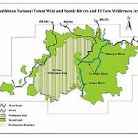
40.5 km2,
El Toro Wilderness area has a special protected status, researchers should note when they will be entering and performing research in the area as extra permitting maybe required from the USDA USFS.
Sabana Field Station
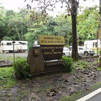
10.26 km2,
Encompasses Sabana Field Station and Sabana watershed. Visit the Sabana Field Research Station Website Here.
Sabana Field Station - Meteorology - Hourly (2001-2009)
9 components •
Sabana Field Station •
Climatology / Meteorology •
Gozalez, Grizelle
Sabana Field Station - Meteorology - Daily (2001-2010)
2 components •
Sabana Field Station •
Climatology / Meteorology •
Grizelle, Gonzalez; IITF
Sabana Field Station - Meteorology (2009-2016)
3 components •
Sabana Field Station •
Climatology / Meteorology •
Gonzalez, Grizelle; IITF
Sabana, Bisley - Meteorology - ceilometer and meteorological data (2000-2016)
2 components •
Bisley, Sabana Field Station •
Climatology / Meteorology •
Grizelle Gonzalez
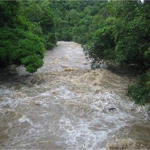
Rio Blanco
3.26338502 km2, 0-1043 m elevation, 3080 mm/yr
Large Instrumented river drains the majority of the south side of the Luquillo Mountains, underline with a granodirite bedrock. Sandy river bed with large boulders. Instrumentation includes multiple gagued streams, lysimeter fields, climate stations, water chemistry sampling as well as other event based and field campaign sampling.
Icacos/Blanco watersheds - Groundwater Chemistry, Groundwater Depth (2014-2016)
7 components •
Rio Blanco •
Hydrology, Water Chemistry •
McDowell, William H.; Brereton, Rich
National - Climate, Flux Tower, Streamflow / Discharge - CUAHSI WDC web services (1968-2015)
7 components •
Boulder Creek Watershed, Christina River Basin, Jemez River Basin, Santa Catalina Mountains, El Verde Field Station, Northeastern Puerto Rico and the Luquillo Mountains, Rio Blanco, Rio Mameyes, Susquehanna Shale Hills Critical Zone Observatory, Providence Creek Headwater Catchments (1660 - 2115 m elevation), Wolverton Basin (2230 - 2700 m elevation), Other instrumented sites •
Climatology / Meteorology, Hydrology, Soil Science / Pedology •
Boulder Creek Critical Zone Observatory; Catalina-Jemez Critical Zone Observatory; Luquillo Critical Zone Observatory; Shale Hills Critical Zone Observatory; Southern Sierra Critical Zone Observatory; Christina River Basin Critical Zone Observatory
National - Stream Water Chemistry - Cations, Anions, Metals (1982-2015)
1 components •
Bisley, Betasso, East Peak, Marshall Gulch (High-Elevation), Providence Creek Subcatchment P301, Providence Creek Subcatchment P303, Providence Creek Subcatchment P304, Eel River Watershed, Puente Roto, Rio Blanco, Rio Icacos, Susquehanna Shale Hills Critical Zone Observatory •
Biogeochemistry, Biology / Ecology, Hydrology, Water Chemistry •
Hyojin, Kim; Bishop, Jim; Dietrich, William; Fung, Inez; McDowell, William H.; Brantley, Susan L.; Hoagland, Beth; Sullivan, Pamela L.; Cain, Molly; Neal, Andrew; Fisher, Jessica; Russo, Tess; Niwot Ridge LTER; Liu, Fengjing; Chorover, Jon; Troch, Peter; McIntosh, Jennifer; Brooks, Paul; Abramson, Nate; Heidbuechel, Ingo; Amistadi, Mary Key; Alexander Pedron, Shawn; Chorover, Jon; Troch, Peter; Corley, Timothy; Zapata-Rios, Xavier; Losleben, Mark; Condon, Katherine
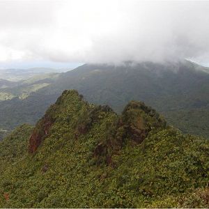
East Peak
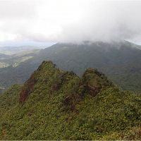
-1028 m elevation,
East Peak or Pico Del Este stands at 1030 meters in elevation and is dominated by Elfin Cloud forest the peak is almost continuously cloud shrouded.
East Peak - Meteorology (2002-2016)
5 components •
East Peak •
Climatology / Meteorology •
Scatena, F.N.; Holwerda, F.
East Peak - Groundwater Depth, Groundwater Temperatures - EP1 and LGW2B wells (2014-2016)
2 components •
East Peak •
Hydrology, Geochemistry / Mineralogy •
Hyojin Kim; Scott Hynek
National - Stream Water Chemistry - Cations, Anions, Metals (1982-2015)
1 components •
Bisley, Betasso, East Peak, Marshall Gulch (High-Elevation), Providence Creek Subcatchment P301, Providence Creek Subcatchment P303, Providence Creek Subcatchment P304, Eel River Watershed, Puente Roto, Rio Blanco, Rio Icacos, Susquehanna Shale Hills Critical Zone Observatory •
Biogeochemistry, Biology / Ecology, Hydrology, Water Chemistry •
Hyojin, Kim; Bishop, Jim; Dietrich, William; Fung, Inez; McDowell, William H.; Brantley, Susan L.; Hoagland, Beth; Sullivan, Pamela L.; Cain, Molly; Neal, Andrew; Fisher, Jessica; Russo, Tess; Niwot Ridge LTER; Liu, Fengjing; Chorover, Jon; Troch, Peter; McIntosh, Jennifer; Brooks, Paul; Abramson, Nate; Heidbuechel, Ingo; Amistadi, Mary Key; Alexander Pedron, Shawn; Chorover, Jon; Troch, Peter; Corley, Timothy; Zapata-Rios, Xavier; Losleben, Mark; Condon, Katherine
Puerto Rico - Stable Isotopes - Stable Isotope (δ18O and δ2H) Data (1994-2013)
8 components •
Northeastern Puerto Rico and the Luquillo Mountains, Rio Icacos, East Peak, Rio Mameyes •
Hydrology, Water Chemistry, Climatology / Meteorology •
Martha A. Scholl; Angel Torres-Sanchez; Manuel Rosario-Torres
Rio Blanco nr Florida
USGS stream gage location.
Lago Icacos
Data available for reservoir level, discharge and precipitation.
Rio Icacos
618-775 m elevation,
Instrumented river on the south side of the Luquillo Mountains, underline with a granodirite bedrock.
Bisley and Icacos - Geology, Regolith Survey - Regolith weathering (2015)
1 components •
Bisley, Rio Icacos •
Geochemistry / Mineralogy, Hydrology •
Buss,Heather L.;Chapela Lara, Maria; Moore, Oliver W.; Kurtz, Andrew C.; Schulz, Marjorie S.; White, Art F.
Bisley and Icacos - Geology, Regolith Survey - trace and rare earth elements (2018)
2 components •
Bisley, Rio Icacos •
Geochemistry / Mineralogy •
Chapela Lara, Maria; Buss, Heather L.; Pett-Ridge, Julie C.
Icacos and Quebrada Sonadora - Streamflow / Discharge, Stream Suspended Sediment, Electrical Conductivity - Hysteresis Analysis (2016-2017)
2 components •
Rio Icacos, Quebrada Sonadora •
Water Chemistry, Hydrology •
Wymore, Adam S.; Leon,Miguel C.; Shanley, James B.; McDowell, William H
National - Stream Water Chemistry - Cations, Anions, Metals (1982-2015)
1 components •
Bisley, Betasso, East Peak, Marshall Gulch (High-Elevation), Providence Creek Subcatchment P301, Providence Creek Subcatchment P303, Providence Creek Subcatchment P304, Eel River Watershed, Puente Roto, Rio Blanco, Rio Icacos, Susquehanna Shale Hills Critical Zone Observatory •
Biogeochemistry, Biology / Ecology, Hydrology, Water Chemistry •
Hyojin, Kim; Bishop, Jim; Dietrich, William; Fung, Inez; McDowell, William H.; Brantley, Susan L.; Hoagland, Beth; Sullivan, Pamela L.; Cain, Molly; Neal, Andrew; Fisher, Jessica; Russo, Tess; Niwot Ridge LTER; Liu, Fengjing; Chorover, Jon; Troch, Peter; McIntosh, Jennifer; Brooks, Paul; Abramson, Nate; Heidbuechel, Ingo; Amistadi, Mary Key; Alexander Pedron, Shawn; Chorover, Jon; Troch, Peter; Corley, Timothy; Zapata-Rios, Xavier; Losleben, Mark; Condon, Katherine
Puerto Rico - Stable Isotopes - Stable Isotope (δ18O and δ2H) Data (1994-2013)
8 components •
Northeastern Puerto Rico and the Luquillo Mountains, Rio Icacos, East Peak, Rio Mameyes •
Hydrology, Water Chemistry, Climatology / Meteorology •
Martha A. Scholl; Angel Torres-Sanchez; Manuel Rosario-Torres
Rio Mameyes and Rio Icacos - Stream Suspended Sediment, Streamflow / Discharge, Precipitation - riverine particulate organic matter export (1991-2015)
8 components •
Rio Mameyes, Rio Icacos •
Biogeochemistry, Hydrology, Climatology / Meteorology •
Clark, Kathryn E.; Stallard, Robert F.; Stallard, Martha A.; Plante, Alain F.; Plante, Sheila F.; Plante, Grizelle; McDowell, William H.
Rio Mameyes and Rio Icacos - Stream Suspended Sediment, Streamflow / Discharge, Stream Water Chemistry (2015)
3 components •
Rio Mameyes, Rio Icacos •
Hydrology, Water Chemistry, Biogeochemistry, Geochemistry / Mineralogy •
Clark, Kathryn E.; McDowell, William H.; Shanley, James; Perdrial, Nicolas; Scholl, Martha
Rio Mameyes
17.8191 km2,
The Rio Mameyes flows in a northerly direction and has outstanding scenic, biological, recreation and historic values. The Rio Mameyes watershed covers 6.88 square miles within the forest, or 10.4% of the forest. Water quality is optimum within the study area of the upper segment, since the entire corridor is located in the Baño de Oro Natural Area and no development exist. Due to steep slopes, no significant flood plains occur. There are approximately 73 acres of riparian wetlands along the Rio Mameyes designated segments.
Bisley, Mameyes - Stream Water Chemistry (1986-2012)
2 components •
Bisley, Rio Mameyes •
Water Chemistry •
Argerich, A.; Johnson, S.L.; Sebestyen, S.D.; Rhoades, C.C.; Greathouse, E.; Wohlgemuth, P.M.; Scatena, F.N.; McDowell, W.H.; Likens, G.E.; Knoepp, J.D.; Jones, J.B.; Ice, G.G.; Campbell, J.L.; Amatya, D.M.; Adams, M.B.
Mameyes and Bisley - Sediment Transport - Grain size and shape analysis (2013)
1 components •
Rio Mameyes, Bisley •
Geomorphology •
Litwin Miller, Kimberly; Szabo, Timea; Jerolmack, Douglas; Domokos, Gabor
Mameyes Watershed - Sediment Transport (2010-2012)
1 components •
Rio Mameyes •
Geomorphology •
Phillips, C.B.
National - Climate, Flux Tower, Streamflow / Discharge - CUAHSI WDC web services (1968-2015)
7 components •
Boulder Creek Watershed, Christina River Basin, Jemez River Basin, Santa Catalina Mountains, El Verde Field Station, Northeastern Puerto Rico and the Luquillo Mountains, Rio Blanco, Rio Mameyes, Susquehanna Shale Hills Critical Zone Observatory, Providence Creek Headwater Catchments (1660 - 2115 m elevation), Wolverton Basin (2230 - 2700 m elevation), Other instrumented sites •
Climatology / Meteorology, Hydrology, Soil Science / Pedology •
Boulder Creek Critical Zone Observatory; Catalina-Jemez Critical Zone Observatory; Luquillo Critical Zone Observatory; Shale Hills Critical Zone Observatory; Southern Sierra Critical Zone Observatory; Christina River Basin Critical Zone Observatory
Puerto Rico - Precipitation, Reservoir Height, Streamflow / Discharge - Schoolyard Data Jam (1990-2016)
6 components •
Rio Mameyes, Northeastern Puerto Rico and the Luquillo Mountains •
Hydrology, Soil Science / Pedology, Outreach / Education Research •
USGS; USDA USFS; Whendee Silver; Miguel Leon
Puerto Rico - Stable Isotopes - Stable Isotope (δ18O and δ2H) Data (1994-2013)
8 components •
Northeastern Puerto Rico and the Luquillo Mountains, Rio Icacos, East Peak, Rio Mameyes •
Hydrology, Water Chemistry, Climatology / Meteorology •
Martha A. Scholl; Angel Torres-Sanchez; Manuel Rosario-Torres
Rio Mameyes and Rio Icacos - Stream Suspended Sediment, Streamflow / Discharge, Precipitation - riverine particulate organic matter export (1991-2015)
8 components •
Rio Mameyes, Rio Icacos •
Biogeochemistry, Hydrology, Climatology / Meteorology •
Clark, Kathryn E.; Stallard, Robert F.; Stallard, Martha A.; Plante, Alain F.; Plante, Sheila F.; Plante, Grizelle; McDowell, William H.
Rio Mameyes and Rio Icacos - Stream Suspended Sediment, Streamflow / Discharge, Stream Water Chemistry (2015)
3 components •
Rio Mameyes, Rio Icacos •
Hydrology, Water Chemistry, Biogeochemistry, Geochemistry / Mineralogy •
Clark, Kathryn E.; McDowell, William H.; Shanley, James; Perdrial, Nicolas; Scholl, Martha
Bisley
265-460 m elevation,
The Bisley field area has been the site of numerous studies since the early 80's. It features mutliple gaged streams, soil and vegetation plots, ground water monitoring, and two weather stations.
Bisley - Streamflow / Discharge (1987-2013)
18 components •
Bisley •
Hydrology •
Gonzalez, Grizelle; IITF
Bisley - Overland Water Chemistry, Nutrient Fluxes, Rainfall Chemistry, Throughfall Chemistry - Includes Weekly Rainfall flux (1988-2002)
2 components •
Bisley •
Water Chemistry •
Scatena, F.N.; IITF; Heartsil-Scalley
Bisley - Overland Water Chemistry, Nutrient Fluxes, Throughfall Chemistry, Rainfall Chemistry - Including weekly bulk rain chemistry (1988-2007)
1 components •
Bisley •
Water Chemistry •
Scatena, F.N.; IITF; Heartsil-Scalley
Bisley - Precipitation - Throughfall (1988-2015)
2 components •
Bisley •
Hydrology •
Carlos Estrada Ruiz
Bisley - Meteorology - Monthly Averages (1993-2010)
1 components •
Bisley •
Climatology / Meteorology •
Scatena, F.N.; IITF
Bisley - Meteorology (1993-2016)
6 components •
Bisley •
Climatology / Meteorology •
Grizelle Gonzalez; IITF
Bisley - Meteorology, Ozone (2008-2013)
3 components •
Bisley •
Climatology / Meteorology •
Gonzalez, Grizelle; IITF
Bisley - Nutrient Fluxes, Stable Isotopes - Mg concentrations and isotopic signatures (2009-2011)
1 components •
Bisley •
Biogeochemistry •
Buss, Heather L.; Pogge von Strandmann, Philip A.E.; Chapela Lara, Maria ; Schuessler, Jan A.; Moore, Oliver W.
Bisley - Soil Biogeochemistry - landscape-scale soil biogeochemistry and enzymes (2012)
1 components •
Bisley •
Biogeochemistry •
Hall, Steven
Bisley - Soil Microbes, Soil Biogeochemistry - Iron redox, Soil Microbiome (2012-2017)
1 components •
Bisley •
Biogeochemistry, Biology / Ecology •
Wilmoth, Jared Lee ; Moran, Mary Ann; Thompson, Aaron
Bisley - Soil Redox Potential - Redox cycling (2018)
2 components •
Bisley •
Biogeochemistry, Soil Science / Pedology •
Chen, Chunmei; Christof Meile; Jared Wilmoth; Diego Barcellos; Aaron Thompson
Bisley and Guaba Ridge - Soil Biogeochemistry - trace metal mobilization, redox (2017)
1 components •
Bisley •
Biogeochemistry, Soil Science / Pedology •
King, E.K.; Thompson, A.; Pett-Ridge, J.C.
Bisley and Icacos - Geology, Regolith Survey - Regolith weathering (2015)
1 components •
Bisley, Rio Icacos •
Geochemistry / Mineralogy, Hydrology •
Buss,Heather L.;Chapela Lara, Maria; Moore, Oliver W.; Kurtz, Andrew C.; Schulz, Marjorie S.; White, Art F.
Bisley and Icacos - Geology, Regolith Survey - trace and rare earth elements (2018)
2 components •
Bisley, Rio Icacos •
Geochemistry / Mineralogy •
Chapela Lara, Maria; Buss, Heather L.; Pett-Ridge, Julie C.
Bisley, Mameyes - Stream Water Chemistry (1986-2012)
2 components •
Bisley, Rio Mameyes •
Water Chemistry •
Argerich, A.; Johnson, S.L.; Sebestyen, S.D.; Rhoades, C.C.; Greathouse, E.; Wohlgemuth, P.M.; Scatena, F.N.; McDowell, W.H.; Likens, G.E.; Knoepp, J.D.; Jones, J.B.; Ice, G.G.; Campbell, J.L.; Amatya, D.M.; Adams, M.B.
Mameyes and Bisley - Sediment Transport - Grain size and shape analysis (2013)
1 components •
Rio Mameyes, Bisley •
Geomorphology •
Litwin Miller, Kimberly; Szabo, Timea; Jerolmack, Douglas; Domokos, Gabor
National - Stream Water Chemistry - Cations, Anions, Metals (1982-2015)
1 components •
Bisley, Betasso, East Peak, Marshall Gulch (High-Elevation), Providence Creek Subcatchment P301, Providence Creek Subcatchment P303, Providence Creek Subcatchment P304, Eel River Watershed, Puente Roto, Rio Blanco, Rio Icacos, Susquehanna Shale Hills Critical Zone Observatory •
Biogeochemistry, Biology / Ecology, Hydrology, Water Chemistry •
Hyojin, Kim; Bishop, Jim; Dietrich, William; Fung, Inez; McDowell, William H.; Brantley, Susan L.; Hoagland, Beth; Sullivan, Pamela L.; Cain, Molly; Neal, Andrew; Fisher, Jessica; Russo, Tess; Niwot Ridge LTER; Liu, Fengjing; Chorover, Jon; Troch, Peter; McIntosh, Jennifer; Brooks, Paul; Abramson, Nate; Heidbuechel, Ingo; Amistadi, Mary Key; Alexander Pedron, Shawn; Chorover, Jon; Troch, Peter; Corley, Timothy; Zapata-Rios, Xavier; Losleben, Mark; Condon, Katherine
Northeastern Puerto Rico and the Luquillo Mountain - Soil Survey (2011-2012)
11 components •
Northeastern Puerto Rico and the Luquillo Mountains, Bisley •
Biogeochemistry, Geochemistry / Mineralogy •
Johnson, A.J.; Xing, Hao
Sabana, Bisley - Meteorology - ceilometer and meteorological data (2000-2016)
2 components •
Bisley, Sabana Field Station •
Climatology / Meteorology •
Grizelle Gonzalez
Shale Hills, Boulder, Luquillo, JRB-SCM, Calhoun - Soil Geochemistry (2001-2013)
1 components •
Susquehanna Shale Hills Critical Zone Observatory, Bisley, Boulder Creek Watershed, Northeastern Puerto Rico and the Luquillo Mountains, Santa Catalina Mountains •
Geochemistry / Mineralogy, Biogeochemistry •
Niu, Xianzeng; Williams, Jennifer; Brantley, Susan L.; Miller, Doug; Bills, Brian
Puente Roto
17.8191 km2,
USGS stream gauge station measuring gauge height and discharge. Additional event based sampling continues for sediment abrasion and suspended sediments.
National - Stream Water Chemistry - Cations, Anions, Metals (1982-2015)
1 components •
Bisley, Betasso, East Peak, Marshall Gulch (High-Elevation), Providence Creek Subcatchment P301, Providence Creek Subcatchment P303, Providence Creek Subcatchment P304, Eel River Watershed, Puente Roto, Rio Blanco, Rio Icacos, Susquehanna Shale Hills Critical Zone Observatory •
Biogeochemistry, Biology / Ecology, Hydrology, Water Chemistry •
Hyojin, Kim; Bishop, Jim; Dietrich, William; Fung, Inez; McDowell, William H.; Brantley, Susan L.; Hoagland, Beth; Sullivan, Pamela L.; Cain, Molly; Neal, Andrew; Fisher, Jessica; Russo, Tess; Niwot Ridge LTER; Liu, Fengjing; Chorover, Jon; Troch, Peter; McIntosh, Jennifer; Brooks, Paul; Abramson, Nate; Heidbuechel, Ingo; Amistadi, Mary Key; Alexander Pedron, Shawn; Chorover, Jon; Troch, Peter; Corley, Timothy; Zapata-Rios, Xavier; Losleben, Mark; Condon, Katherine
-
Data Use Policy
DRAFT v.0.4.0
1. Use our data freely. All CZO Data Products* except those labelled Private** are released to the public and may be freely copied, distributed, edited, remixed, and built upon under the condition that you give acknowledgement as described below. Non-CZO data products — like those produced by USGS or NOAA — have their own use policies, which should be followed.
2. Give proper citation and acknowledgement. Publications, models and data products that make use of these datasets must include proper citation and acknowledgement. Most importantly, provide a citation in a similar way as a journal article (i.e. author, title, year of publication, name of CZO “publisher”, edition or version, and URL or DOI access information. See http://www.datacite.org/whycitedata). Also include at least a brief acknowledgement such as: “Data were provided by the NSF-supported Southern Sierra Critical Zone Observatory” (replace with the appropriate observatory name).
3. Let us know how you will use the data. The dataset creators would appreciate hearing of any plans to use the dataset. Consider consultation or collaboration with dataset creators.
*CZO Data Products. Defined as a data collected with any monetary or logistical support from a CZO.
**Private. Most private data will be released to the public within 1-2 years, with some exceptionally challenging datasets up to 4 years. To inquire about potential earlier use, please contact us.
Explore Further
