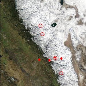
Dataset Listings
These dataset listings are out of date and have been archived.
See the updated listings on HydroShare.org >
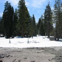
San Joaquin Experimental Range (210-520 m elevation)
The San Joaquin Experimental Range (SJER) research site is in the oak woodland foothills of the southern Sierra Nevada.
Flux Tower Transect, SJER - Flux Tower, Meteorology (2009-2018)
10 components •
San Joaquin Experimental Range (210-520 m elevation) •
Biology / Ecology, Climatology / Meteorology •
Mike Goulden; Anne Kelly
National - Flux Tower - AmeriFlux Network data (2007-2018)
14 components •
Boulder Creek Watershed, Jemez River Basin, Reynolds Creek Experimental Watershed, Susquehanna Shale Hills Critical Zone Observatory, San Joaquin Experimental Range (210-520 m elevation), Soaproot Saddle (1000-1500 m elevation), Short Hair (2670 m elevation) •
Climatology / Meteorology •
Boulder Creek Critical Zone Observatory; Catalina-Jemez Critical Zone Observatory; Reynolds Creek Critical Zone Observatory; Shale Hills Critical Zone Observatory; Southern Sierra Critical Zone Observatory
Soaproot Saddle (1000-1500 m elevation)
The Soaproot Saddle site is located within Ponderosa Pine forest at 1100 meters in elevation within the Sierra National Forest.
Flux Tower Transect, Soaproot Saddle - Flux Tower, Meteorology (2009-2018)
10 components •
Soaproot Saddle (1000-1500 m elevation) •
Biology / Ecology, Climatology / Meteorology •
Mike Goulden; Anne Kelly
National - Flux Tower - AmeriFlux Network data (2007-2018)
14 components •
Boulder Creek Watershed, Jemez River Basin, Reynolds Creek Experimental Watershed, Susquehanna Shale Hills Critical Zone Observatory, San Joaquin Experimental Range (210-520 m elevation), Soaproot Saddle (1000-1500 m elevation), Short Hair (2670 m elevation) •
Climatology / Meteorology •
Boulder Creek Critical Zone Observatory; Catalina-Jemez Critical Zone Observatory; Reynolds Creek Critical Zone Observatory; Shale Hills Critical Zone Observatory; Southern Sierra Critical Zone Observatory
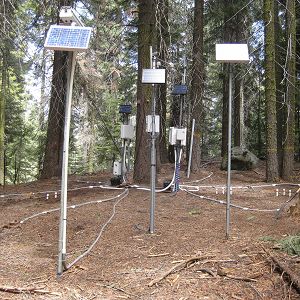
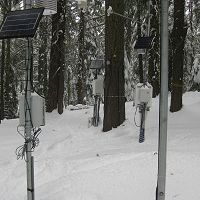
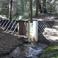
Providence Creek Headwater Catchments (1660 - 2115 m elevation)
4.6 km2,
The most intensively studied research area of the Southern Sierra Critical Zone Observatory is the Providence Creek headwaters area, located along a tributary to the North Fork of the Kings River in the Sierra National Forest. Most of the long-term observations by SSCZO are located at this site. The P300 area includes forested hillslopes, some glacial erratics and areas of exposed bedrock, multiple meadows, and creeks draining the catchment.
Critical Zone Tree 2 - Soil Moisture, Soil Temperature, Electrical Conductivity, Matric Potential, Sap Flow (2010-2012)
11 components •
Providence Creek Headwater Catchments (1660 - 2115 m elevation) •
Hydrology, Biology / Ecology •
Peter Hartsough; Jan Hopmans
Met Stations, Providence, Lower - Meteorology (2002-2011)
19 components •
Providence Creek Headwater Catchments (1660 - 2115 m elevation) •
Climatology / Meteorology •
Carolyn Husaker
National - Climate, Flux Tower, Streamflow / Discharge - CUAHSI WDC web services (1968-2015)
7 components •
Boulder Creek Watershed, Christina River Basin, Jemez River Basin, Santa Catalina Mountains, El Verde Field Station, Northeastern Puerto Rico and the Luquillo Mountains, Rio Blanco, Rio Mameyes, Susquehanna Shale Hills Critical Zone Observatory, Providence Creek Headwater Catchments (1660 - 2115 m elevation), Wolverton Basin (2230 - 2700 m elevation), Other instrumented sites •
Climatology / Meteorology, Hydrology, Soil Science / Pedology •
Boulder Creek Critical Zone Observatory; Catalina-Jemez Critical Zone Observatory; Luquillo Critical Zone Observatory; Shale Hills Critical Zone Observatory; Southern Sierra Critical Zone Observatory; Christina River Basin Critical Zone Observatory
National - Streamflow / Discharge - USGS and USDA Data Resources (1985-2017)
22 components •
Boulder Creek Watershed, Santa Catalina Mountains, Jemez River Basin, Reynolds Creek Experimental Watershed, Susquehanna Shale Hills Critical Zone Observatory, Northeastern Puerto Rico and the Luquillo Mountains, Clear Creek Watershed, Sangamon River Basin, Calhoun Critical Zone Observatory, Providence Creek Headwater Catchments (1660 - 2115 m elevation) •
Hydrology •
USGS National Water Information System
National - LiDAR, Land Cover, GIS/Map Data - OpenTopography (2010-2017)
18 components •
Boulder Creek Watershed, Eel River Watershed, Jemez River Basin, Reynolds Creek Experimental Watershed, Susquehanna Shale Hills Critical Zone Observatory, Northeastern Puerto Rico and the Luquillo Mountains, Sangamon River Basin, Clear Creek Watershed, Calhoun Critical Zone Observatory, Providence Creek Headwater Catchments (1660 - 2115 m elevation) •
Geomorphology, GIS / Remote Sensing, Hydrology, Biology / Ecology •
National Center for Airborne Laser Mapping; Boulder Creek Critical Zone Observatory; Calhoun Critical Zone Observatory; University of Arizona; University of California Merced; Valles Caldera National Preserve; Bandelier National Monument; National Park Service; Jemez River Basin and Santa Catalina Mountains Critical Zone Observatory; Luquillo Critical Zone Observatory; Reynolds Creek CZO; Eel River CZO; Shale Hills CZO
Providence - Streamflow / Discharge (2003-2010)
22 components •
Providence Creek Headwater Catchments (1660 - 2115 m elevation) •
Hydrology •
Carolyn Hunsaker
Providence, Lower Met, North aspect - Soil Moisture, Soil Temperature, Snow Depth, Air Temperature (2008-2018)
31 components •
Providence Creek Headwater Catchments (1660 - 2115 m elevation) •
Hydrology, Climatology / Meteorology •
Roger Bales; Matthew Meadows; Erin Stacy; Xiande Meng
Providence, Lower Met, South aspect - Soil Moisture, Soil Temperature, Snow Depth, Air Temperature (2008-2018)
31 components •
Providence Creek Headwater Catchments (1660 - 2115 m elevation) •
Hydrology, Climatology / Meteorology •
Roger Bales; Matthew Meadows; Erin Stacy; Xiande Meng
Providence, Upper Met, Flat aspect - Soil Moisture, Soil Temperature, Snow Depth, Air Temperature (2008-2018)
33 components •
Providence Creek Headwater Catchments (1660 - 2115 m elevation) •
Hydrology, Climatology / Meteorology •
Roger Bales; Matthew Meadows; Erin Stacy; Xiande Meng
Southern Sierra Nevada - LiDAR, Digital Elevation Model (DEM), Snow Survey - Snow-on, Snow-off Flyover (2010)
2 components •
Providence Creek Headwater Catchments (1660 - 2115 m elevation), Wolverton Basin (2230 - 2700 m elevation), Other instrumented sites •
GIS / Remote Sensing, Hydrology •
Qinghua Guo; Roger Bales; National Center for Airborne Laser Mapping
Spatial Data - GIS/Map Data (2003-2011)
11 components •
Wolverton Basin (2230 - 2700 m elevation), Providence Creek Headwater Catchments (1660 - 2115 m elevation), Other instrumented sites •
GIS / Remote Sensing •
Meadows, M.; Stuemky, M.
Spatial Data - GIS/Map Data (2013-2018)
9 components •
Providence Creek Headwater Catchments (1660 - 2115 m elevation) •
GIS / Remote Sensing •
Stacy, E.
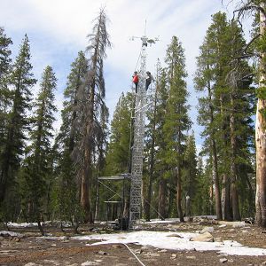
Providence Creek Subcatchment P301
0.992 km2, 1790-2117 m elevation,
The P301 subcatchment of Providence is the most intensely studied site out of our CZO's field areas. Active instruments include the P301 eddy covariance flux tower, critical zone tree, and transect of water-balance sensors.
Flux Tower Transect, P301 - Flux Tower, Meteorology (2007-2018)
12 components •
Providence Creek Subcatchment P301 •
Climatology / Meteorology, Biology / Ecology •
Mike Goulden; Anne Kelly
National - Stream Water Chemistry - Cations, Anions, Metals (1982-2015)
1 components •
Bisley, Betasso, East Peak, Marshall Gulch (High-Elevation), Providence Creek Subcatchment P301, Providence Creek Subcatchment P303, Providence Creek Subcatchment P304, Eel River Watershed, Puente Roto, Rio Blanco, Rio Icacos, Susquehanna Shale Hills Critical Zone Observatory •
Biogeochemistry, Biology / Ecology, Hydrology, Water Chemistry •
Hyojin, Kim; Bishop, Jim; Dietrich, William; Fung, Inez; McDowell, William H.; Brantley, Susan L.; Hoagland, Beth; Sullivan, Pamela L.; Cain, Molly; Neal, Andrew; Fisher, Jessica; Russo, Tess; Niwot Ridge LTER; Liu, Fengjing; Chorover, Jon; Troch, Peter; McIntosh, Jennifer; Brooks, Paul; Abramson, Nate; Heidbuechel, Ingo; Amistadi, Mary Key; Alexander Pedron, Shawn; Chorover, Jon; Troch, Peter; Corley, Timothy; Zapata-Rios, Xavier; Losleben, Mark; Condon, Katherine
P301 Water Balance Transect - Soil Moisture, Soil Temperature, Snow Depth (2011-2018)
16 components •
Providence Creek Subcatchment P301 •
Hydrology •
Roger Bales; Steven Glaser
Providence Creek Subcatchment P303
1.323 km2, 1731-2025 m elevation,
The P303 subcatchment contains a number of sensors and instruments, but the primary ones are the upper elevation meteorological station and the water balance instrument clusters, located at about 1985 m in elevation at the eastern edge of the watershed.
Met Stations, Providence, Upper - Meteorology (2002-2011)
19 components •
Providence Creek Subcatchment P303 •
Climatology / Meteorology •
Carolyn Hunsaker
National - Stream Water Chemistry - Cations, Anions, Metals (1982-2015)
1 components •
Bisley, Betasso, East Peak, Marshall Gulch (High-Elevation), Providence Creek Subcatchment P301, Providence Creek Subcatchment P303, Providence Creek Subcatchment P304, Eel River Watershed, Puente Roto, Rio Blanco, Rio Icacos, Susquehanna Shale Hills Critical Zone Observatory •
Biogeochemistry, Biology / Ecology, Hydrology, Water Chemistry •
Hyojin, Kim; Bishop, Jim; Dietrich, William; Fung, Inez; McDowell, William H.; Brantley, Susan L.; Hoagland, Beth; Sullivan, Pamela L.; Cain, Molly; Neal, Andrew; Fisher, Jessica; Russo, Tess; Niwot Ridge LTER; Liu, Fengjing; Chorover, Jon; Troch, Peter; McIntosh, Jennifer; Brooks, Paul; Abramson, Nate; Heidbuechel, Ingo; Amistadi, Mary Key; Alexander Pedron, Shawn; Chorover, Jon; Troch, Peter; Corley, Timothy; Zapata-Rios, Xavier; Losleben, Mark; Condon, Katherine
Providence, Upper Met - Rainfall Chemistry, Meteorology - NADP (2008-2010)
4 components •
Providence Creek Subcatchment P303 •
Climatology / Meteorology •
National Atmospheric Deposition Program
Providence, Upper Met, North aspect - Soil Moisture, Soil Temperature, Snow Depth, Air Temperature (2008-2018)
31 components •
Providence Creek Subcatchment P303 •
Hydrology, Climatology / Meteorology •
Roger Bales; Matthew Meadows; Erin Stacy; Xiande Meng
Providence, Upper Met, South aspect - Soil Moisture, Soil Temperature, Snow Depth, Air Temperature (2008-2018)
31 components •
Providence Creek Subcatchment P303 •
Hydrology, Climatology / Meteorology •
Roger Bales; Matthew Meadows; Erin Stacy; Xiande Meng
Providence Creek Subcatchment P304
0.487 km2, 1768-1983 m elevation,
The P304 subcatchment has a stream gauging station similar to those located within the other instrumented Providence Creek catchments. As with the other catchments, several micromet sensors are installed within P304.
National - Stream Water Chemistry - Cations, Anions, Metals (1982-2015)
1 components •
Bisley, Betasso, East Peak, Marshall Gulch (High-Elevation), Providence Creek Subcatchment P301, Providence Creek Subcatchment P303, Providence Creek Subcatchment P304, Eel River Watershed, Puente Roto, Rio Blanco, Rio Icacos, Susquehanna Shale Hills Critical Zone Observatory •
Biogeochemistry, Biology / Ecology, Hydrology, Water Chemistry •
Hyojin, Kim; Bishop, Jim; Dietrich, William; Fung, Inez; McDowell, William H.; Brantley, Susan L.; Hoagland, Beth; Sullivan, Pamela L.; Cain, Molly; Neal, Andrew; Fisher, Jessica; Russo, Tess; Niwot Ridge LTER; Liu, Fengjing; Chorover, Jon; Troch, Peter; McIntosh, Jennifer; Brooks, Paul; Abramson, Nate; Heidbuechel, Ingo; Amistadi, Mary Key; Alexander Pedron, Shawn; Chorover, Jon; Troch, Peter; Corley, Timothy; Zapata-Rios, Xavier; Losleben, Mark; Condon, Katherine
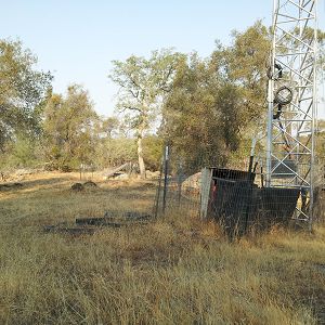
Short Hair (2670 m elevation)
The Short Hair field area is in the subalpine belt of the Sierra Nevada, located in the Sierra National Forest near Courtright Reservoir.
Flux Tower Transect, Short Hair Creek - Flux Tower, Meteorology (2009-2018)
12 components •
Short Hair (2670 m elevation) •
Climatology / Meteorology, Biology / Ecology •
Mike Goulden; Anne Kelly
National - Flux Tower - AmeriFlux Network data (2007-2018)
14 components •
Boulder Creek Watershed, Jemez River Basin, Reynolds Creek Experimental Watershed, Susquehanna Shale Hills Critical Zone Observatory, San Joaquin Experimental Range (210-520 m elevation), Soaproot Saddle (1000-1500 m elevation), Short Hair (2670 m elevation) •
Climatology / Meteorology •
Boulder Creek Critical Zone Observatory; Catalina-Jemez Critical Zone Observatory; Reynolds Creek Critical Zone Observatory; Shale Hills Critical Zone Observatory; Southern Sierra Critical Zone Observatory
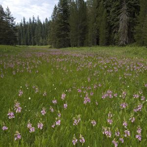
Wolverton Basin (2230 - 2700 m elevation)
8 km2,
Wolverton Basin site in Sequoia National Park comprises meadows and forested mountain slopes.
Met Stations, SEKI Panther - Meteorology (2006-2017)
18 components •
Wolverton Basin (2230 - 2700 m elevation) •
Climatology / Meteorology •
Peter Kirchner; Roger Bales; Erin Stacy; Xiande Meng
Met Stations, Wolverton - Meteorology (2006-2017)
13 components •
Wolverton Basin (2230 - 2700 m elevation) •
Climatology / Meteorology •
Peter Kirchner; Roger Bales; Erin Stacy; Xiande Meng
National - Climate, Flux Tower, Streamflow / Discharge - CUAHSI WDC web services (1968-2015)
7 components •
Boulder Creek Watershed, Christina River Basin, Jemez River Basin, Santa Catalina Mountains, El Verde Field Station, Northeastern Puerto Rico and the Luquillo Mountains, Rio Blanco, Rio Mameyes, Susquehanna Shale Hills Critical Zone Observatory, Providence Creek Headwater Catchments (1660 - 2115 m elevation), Wolverton Basin (2230 - 2700 m elevation), Other instrumented sites •
Climatology / Meteorology, Hydrology, Soil Science / Pedology •
Boulder Creek Critical Zone Observatory; Catalina-Jemez Critical Zone Observatory; Luquillo Critical Zone Observatory; Shale Hills Critical Zone Observatory; Southern Sierra Critical Zone Observatory; Christina River Basin Critical Zone Observatory
Southern Sierra Nevada - LiDAR, Digital Elevation Model (DEM), Snow Survey - Snow-on, Snow-off Flyover (2010)
2 components •
Providence Creek Headwater Catchments (1660 - 2115 m elevation), Wolverton Basin (2230 - 2700 m elevation), Other instrumented sites •
GIS / Remote Sensing, Hydrology •
Qinghua Guo; Roger Bales; National Center for Airborne Laser Mapping
Spatial Data - GIS/Map Data (2003-2011)
11 components •
Wolverton Basin (2230 - 2700 m elevation), Providence Creek Headwater Catchments (1660 - 2115 m elevation), Other instrumented sites •
GIS / Remote Sensing •
Meadows, M.; Stuemky, M.
Wolverton - Snow Depth (2007-2011)
12 components •
Wolverton Basin (2230 - 2700 m elevation) •
Hydrology, Climatology / Meteorology •
Peter Kirchner; Roger Bales
Wolverton - Sap Flow (2007-2015)
22 components •
Wolverton Basin (2230 - 2700 m elevation) •
Biology / Ecology, Hydrology •
Peter Kirchner; Roger Bales
Wolverton - Soil Moisture, Soil Temperature, Matric Potential, Solar Radiation (2007-2017)
12 components •
Wolverton Basin (2230 - 2700 m elevation) •
Hydrology •
Peter Kirchner; Roger Bales; Erin Stacy; Xiande Meng
Other instrumented sites
Other instrumented sites have been established in the Southern Sierra Nevada and are suitable for comparative research, including: Kings River Experimental Watersheds, Sierra Nevada Adaptive Management Project, and the American River Hydrologic Observatory.
KREW, Bull Creek - Streamflow / Discharge (2003-2010)
20 components •
Other instrumented sites •
Hydrology •
Carolyn Hunsaker
Met Stations, KREW, Bull Creek, Lower - Meteorology (2003-2011)
17 components •
Other instrumented sites •
Climatology / Meteorology •
Carolyn Husaker
Met Stations, KREW, Bull Creek, Upper - Meteorology (2003-2011)
16 components •
Other instrumented sites •
Climatology / Meteorology •
Carolyn Hunsaker
National - Climate, Flux Tower, Streamflow / Discharge - CUAHSI WDC web services (1968-2015)
7 components •
Boulder Creek Watershed, Christina River Basin, Jemez River Basin, Santa Catalina Mountains, El Verde Field Station, Northeastern Puerto Rico and the Luquillo Mountains, Rio Blanco, Rio Mameyes, Susquehanna Shale Hills Critical Zone Observatory, Providence Creek Headwater Catchments (1660 - 2115 m elevation), Wolverton Basin (2230 - 2700 m elevation), Other instrumented sites •
Climatology / Meteorology, Hydrology, Soil Science / Pedology •
Boulder Creek Critical Zone Observatory; Catalina-Jemez Critical Zone Observatory; Luquillo Critical Zone Observatory; Shale Hills Critical Zone Observatory; Southern Sierra Critical Zone Observatory; Christina River Basin Critical Zone Observatory
Southern Sierra Nevada - LiDAR, Digital Elevation Model (DEM), Snow Survey - Snow-on, Snow-off Flyover (2010)
2 components •
Providence Creek Headwater Catchments (1660 - 2115 m elevation), Wolverton Basin (2230 - 2700 m elevation), Other instrumented sites •
GIS / Remote Sensing, Hydrology •
Qinghua Guo; Roger Bales; National Center for Airborne Laser Mapping
Spatial Data - GIS/Map Data (2003-2011)
11 components •
Wolverton Basin (2230 - 2700 m elevation), Providence Creek Headwater Catchments (1660 - 2115 m elevation), Other instrumented sites •
GIS / Remote Sensing •
Meadows, M.; Stuemky, M.
-
Data Use Policy
DRAFT v.0.4.0
1. Use our data freely. All CZO Data Products* except those labelled Private** are released to the public and may be freely copied, distributed, edited, remixed, and built upon under the condition that you give acknowledgement as described below. Non-CZO data products — like those produced by USGS or NOAA — have their own use policies, which should be followed.
2. Give proper citation and acknowledgement. Publications, models and data products that make use of these datasets must include proper citation and acknowledgement. Most importantly, provide a citation in a similar way as a journal article (i.e. author, title, year of publication, name of CZO “publisher”, edition or version, and URL or DOI access information. See http://www.datacite.org/whycitedata). Also include at least a brief acknowledgement such as: “Data were provided by the NSF-supported Southern Sierra Critical Zone Observatory” (replace with the appropriate observatory name).
3. Let us know how you will use the data. The dataset creators would appreciate hearing of any plans to use the dataset. Consider consultation or collaboration with dataset creators.
*CZO Data Products. Defined as a data collected with any monetary or logistical support from a CZO.
**Private. Most private data will be released to the public within 1-2 years, with some exceptionally challenging datasets up to 4 years. To inquire about potential earlier use, please contact us.
Explore Further
