Dataset Listings
These dataset listings are out of date and have been archived.
See the updated listings on HydroShare.org >
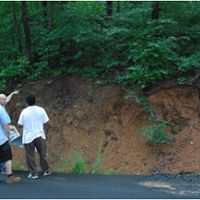
Susquehanna Shale Hills Critical Zone Observatory
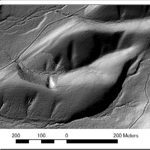
0.08 km2, 256-310 m elevation, 9.5 °C, 1050 mm/yr
Our interdisciplinary team works collaboratively in one observatory to advance methods for characterizing regolith, to provide a theoretical basis for predicting the distribution and properties of regolith, and to theoretically and experimentally study the impacts of regolith on fluid pathways, flow rates, and residence times.
Garner Run - Electrical Conductivity, Soil Temperature (2018)
1 components •
Susquehanna Shale Hills Critical Zone Observatory •
Geochemistry / Mineralogy, Soil Science / Pedology •
David Eissenstat; Jon Duncan; Qicheng Tang
Garner Run and Shale Hills - Soil Gas, Soil Moisture (2015-2016)
1 components •
Susquehanna Shale Hills Critical Zone Observatory •
Geophysics, Geochemistry / Mineralogy •
Jason Kaye; Lillian Hill
National - Climate, Flux Tower, Streamflow / Discharge - CUAHSI WDC web services (1968-2015)
7 components •
Boulder Creek Watershed, Christina River Basin, Jemez River Basin, Santa Catalina Mountains, El Verde Field Station, Northeastern Puerto Rico and the Luquillo Mountains, Rio Blanco, Rio Mameyes, Susquehanna Shale Hills Critical Zone Observatory, Providence Creek Headwater Catchments (1660 - 2115 m elevation), Wolverton Basin (2230 - 2700 m elevation), Other instrumented sites •
Climatology / Meteorology, Hydrology, Soil Science / Pedology •
Boulder Creek Critical Zone Observatory; Catalina-Jemez Critical Zone Observatory; Luquillo Critical Zone Observatory; Shale Hills Critical Zone Observatory; Southern Sierra Critical Zone Observatory; Christina River Basin Critical Zone Observatory
National - Stream Water Chemistry - Cations, Anions, Metals (1982-2015)
1 components •
Bisley, Betasso, East Peak, Marshall Gulch (High-Elevation), Providence Creek Subcatchment P301, Providence Creek Subcatchment P303, Providence Creek Subcatchment P304, Eel River Watershed, Puente Roto, Rio Blanco, Rio Icacos, Susquehanna Shale Hills Critical Zone Observatory •
Biogeochemistry, Biology / Ecology, Hydrology, Water Chemistry •
Hyojin, Kim; Bishop, Jim; Dietrich, William; Fung, Inez; McDowell, William H.; Brantley, Susan L.; Hoagland, Beth; Sullivan, Pamela L.; Cain, Molly; Neal, Andrew; Fisher, Jessica; Russo, Tess; Niwot Ridge LTER; Liu, Fengjing; Chorover, Jon; Troch, Peter; McIntosh, Jennifer; Brooks, Paul; Abramson, Nate; Heidbuechel, Ingo; Amistadi, Mary Key; Alexander Pedron, Shawn; Chorover, Jon; Troch, Peter; Corley, Timothy; Zapata-Rios, Xavier; Losleben, Mark; Condon, Katherine
National - Streamflow / Discharge - USGS and USDA Data Resources (1985-2017)
22 components •
Boulder Creek Watershed, Santa Catalina Mountains, Jemez River Basin, Reynolds Creek Experimental Watershed, Susquehanna Shale Hills Critical Zone Observatory, Northeastern Puerto Rico and the Luquillo Mountains, Clear Creek Watershed, Sangamon River Basin, Calhoun Critical Zone Observatory, Providence Creek Headwater Catchments (1660 - 2115 m elevation) •
Hydrology •
USGS National Water Information System
National - Flux Tower - AmeriFlux Network data (2007-2018)
14 components •
Boulder Creek Watershed, Jemez River Basin, Reynolds Creek Experimental Watershed, Susquehanna Shale Hills Critical Zone Observatory, San Joaquin Experimental Range (210-520 m elevation), Soaproot Saddle (1000-1500 m elevation), Short Hair (2670 m elevation) •
Climatology / Meteorology •
Boulder Creek Critical Zone Observatory; Catalina-Jemez Critical Zone Observatory; Reynolds Creek Critical Zone Observatory; Shale Hills Critical Zone Observatory; Southern Sierra Critical Zone Observatory
National - LiDAR, Land Cover, GIS/Map Data - OpenTopography (2010-2017)
18 components •
Boulder Creek Watershed, Eel River Watershed, Jemez River Basin, Reynolds Creek Experimental Watershed, Susquehanna Shale Hills Critical Zone Observatory, Northeastern Puerto Rico and the Luquillo Mountains, Sangamon River Basin, Clear Creek Watershed, Calhoun Critical Zone Observatory, Providence Creek Headwater Catchments (1660 - 2115 m elevation) •
Geomorphology, GIS / Remote Sensing, Hydrology, Biology / Ecology •
National Center for Airborne Laser Mapping; Boulder Creek Critical Zone Observatory; Calhoun Critical Zone Observatory; University of Arizona; University of California Merced; Valles Caldera National Preserve; Bandelier National Monument; National Park Service; Jemez River Basin and Santa Catalina Mountains Critical Zone Observatory; Luquillo Critical Zone Observatory; Reynolds Creek CZO; Eel River CZO; Shale Hills CZO
National - Air Temperature, Flux Tower, Meteorology - NADP and NOAA or other weather stations (2017)
8 components •
Boulder Creek Watershed, Calhoun Critical Zone Observatory, Jemez River Basin, Susquehanna Shale Hills Critical Zone Observatory •
Climatology / Meteorology •
NADP; NOAA; others
Shale Hills - Groundwater Depth, Streamflow / Discharge - Watershed Reanalysis (1979-2010)
1 components •
Susquehanna Shale Hills Critical Zone Observatory •
Hydrology •
Duffy, Christopher J.
Shale Hills - Stream Water Chemistry (2006-2010)
5 components •
Susquehanna Shale Hills Critical Zone Observatory •
Biogeochemistry, Water Chemistry, Hydrology •
Brantley, Susan L.; Duffy, Christopher, J.
Shale Hills - Soil Porewater Chemistry (2006-2011)
6 components •
Susquehanna Shale Hills Critical Zone Observatory •
Biogeochemistry, Water Chemistry, Hydrology •
Brantley, Susan L.; Duffy, Christopher J.
Shale Hills - Streamflow / Discharge - Shale Hills Stream Flow / Discharge Data (2006-2012)
8 components •
Susquehanna Shale Hills Critical Zone Observatory •
Hydrology •
Duffy, Christopher J.
Shale Hills - Precipitation (2006-2013)
2 components •
Susquehanna Shale Hills Critical Zone Observatory •
Climatology / Meteorology, Hydrology •
Duffy, Christopher J.
Shale Hills - Soil Moisture, Hydropedologic Properties (2006-2015)
1 components •
Susquehanna Shale Hills Critical Zone Observatory •
Hydrology, Soil Science / Pedology, Biology / Ecology •
Naithani, Kusum; Baldwin, Doug
Shale Hills - Hydropedologic Properties, Matric Potential - 229 Probes (2007-2010)
4 components •
Susquehanna Shale Hills Critical Zone Observatory •
Soil Science / Pedology •
Lin, Henry
Shale Hills - Hydropedologic Properties, Air Temperature (2007-2014)
1 components •
Susquehanna Shale Hills Critical Zone Observatory •
Soil Science / Pedology •
Lin, Henry
Shale Hills - Hydropedologic Properties, Matric Potential - 253 Probes (2007-2014)
1 components •
Susquehanna Shale Hills Critical Zone Observatory •
Soil Science / Pedology •
Lin, Henry
Shale Hills - Hydropedologic Properties, Matric Potential - MPS Probes (2007-2014)
1 components •
Susquehanna Shale Hills Critical Zone Observatory •
Soil Science / Pedology •
Lin, Henry
Shale Hills - Hydropedologic Properties, Precipitation (2007-2014)
1 components •
Susquehanna Shale Hills Critical Zone Observatory •
Soil Science / Pedology, Climatology / Meteorology •
Lin, Henry
Shale Hills - Hydropedologic Properties, Soil Moisture (2007-2014)
1 components •
Susquehanna Shale Hills Critical Zone Observatory •
Soil Science / Pedology •
Lin, Henry
Shale Hills - Hydropedologic Properties, Soil Temperature (2007-2014)
1 components •
Susquehanna Shale Hills Critical Zone Observatory •
Soil Science / Pedology •
Lin, Henry
Shale Hills - Hydropedologic Properties - Water Table (2007-2014)
1 components •
Susquehanna Shale Hills Critical Zone Observatory •
Soil Science / Pedology •
Lin, Henry
Shale Hills - Ground Penetrating Radar (GPR), Geology, GIS/Map Data - GPR Bedrock Elevation GIS Data (2008)
1 components •
Susquehanna Shale Hills Critical Zone Observatory •
GIS / Remote Sensing •
Lin, Henry
Shale Hills - Ground Penetrating Radar (GPR) (2008-2009)
1 components •
Susquehanna Shale Hills Critical Zone Observatory •
Soil Science / Pedology •
Lin, Henry
Shale Hills - Groundwater Chemistry (2008-2010)
3 components •
Susquehanna Shale Hills Critical Zone Observatory •
Water Chemistry, Hydrology •
Brantley, Susan L.; Duffy, Christopher J.
Shale Hills - Stable Isotopes, Groundwater Chemistry (2008-2011)
7 components •
Susquehanna Shale Hills Critical Zone Observatory •
Water Chemistry, Hydrology •
Duffy, Christopher J.; Thomas, Evan M.
Shale Hills - Stable Isotopes, Precipitation (2008-2011)
8 components •
Susquehanna Shale Hills Critical Zone Observatory •
Water Chemistry, Hydrology, Climatology / Meteorology •
Duffy, Christopher J.; Thomas, Evan
Shale Hills - Stable Isotopes, Soil Porewater Chemistry (2008-2011)
7 components •
Susquehanna Shale Hills Critical Zone Observatory •
Water Chemistry, Hydrology •
Duffy, Christopher J.; Thomas, Evan M.
Shale Hills - Stable Isotopes, Stream Water Chemistry (2008-2011)
7 components •
Susquehanna Shale Hills Critical Zone Observatory •
Water Chemistry, Hydrology •
Duffy, Christopher J.; Thomas, Evan M.
Shale Hills - Tree Growth & Physiology, Vegetation - Above-Ground Tree Biomass Data (2008-2012)
1 components •
Susquehanna Shale Hills Critical Zone Observatory •
Biology / Ecology •
Kaye, Margot; Smith, Lauren
Shale Hills - Vegetation - Tree Survey (2008-2012)
3 components •
Susquehanna Shale Hills Critical Zone Observatory •
Biology / Ecology •
Eissenstat, David M.; Kaye, Margot
Shale Hills - Soil Gas, Soil Porewater Chemistry - pCO2; CO2 Flux; N2O, NO3, NH4, DOC Concentrations (2008-2014)
11 components •
Susquehanna Shale Hills Critical Zone Observatory •
Geochemistry / Mineralogy •
Hasenmueller, Elizabeth A.; Kaye, Jason; Weitzman, Julie
Shale Hills - Streamflow / Discharge - Discharge Reanalysis (2008-2015)
1 components •
Susquehanna Shale Hills Critical Zone Observatory •
Hydrology, Modeling / Computational Science •
Shi, Yuning; Xiao, Dacheng
Shale Hills - Electrical Conductivity, Groundwater Chemistry - Solute Tracer Tests (2009)
1 components •
Susquehanna Shale Hills Critical Zone Observatory •
Geochemistry / Mineralogy, Water Chemistry, Hydrology •
Singha, Kamini
Shale Hills - Ecosystem model (2009-2010)
2 components •
Susquehanna Shale Hills Critical Zone Observatory •
Modeling / Computational Science, Climatology / Meteorology •
Ken Davis; Yuting He
Shale Hills - Groundwater Depth - Shale Hills Groundwater Depth Data (2009-2012)
4 components •
Susquehanna Shale Hills Critical Zone Observatory •
Hydrology •
Duffy, Christopher J.
Shale Hills - Soil Moisture - Shale Hills RTH Soil Moisture Data (2009-2012)
9 components •
Susquehanna Shale Hills Critical Zone Observatory •
Hydrology •
Duffy, Christopher J.
Shale Hills - Hydropedologic Properties, Electrical Conductivity (2009-2013)
1 components •
Susquehanna Shale Hills Critical Zone Observatory •
Soil Science / Pedology •
Lin, Henry
Shale Hills - Meteorology (2009-2013)
6 components •
Susquehanna Shale Hills Critical Zone Observatory •
Climatology / Meteorology •
Davis, Kenneth; Shi, Yuning
Shale Hills - Precipitation, Meteorology - LPM Disdrometer (2009-2014)
1 components •
Susquehanna Shale Hills Critical Zone Observatory •
Hydrology, Climatology / Meteorology •
Duffy, Chistopher; Yu, Xuan
Shale Hills - Sap Flow - Shale Hills Sap Flow Data (2009-2014)
13 components •
Susquehanna Shale Hills Critical Zone Observatory •
Biology / Ecology •
Eissenstat, David M.
Shale Hills - Vegetation, Stable Isotopes, Soil Water Chemistry (2009-2014)
2 components •
Susquehanna Shale Hills Critical Zone Observatory •
Biology / Ecology, Hydrology •
Gaines, Katie; Eissenstat, David M.
Shale Hills - Flux Tower (2009-2016)
1 components •
Susquehanna Shale Hills Critical Zone Observatory •
Climatology / Meteorology •
Davis, Kenneth
Shale Hills - Precipitation, Meteorology (2009-2016)
1 components •
Susquehanna Shale Hills Critical Zone Observatory •
Climatology / Meteorology, Hydrology •
Arthur, Dan K.
Shale Hills - Precipitation, Meteorology (2009-2016)
1 components •
Susquehanna Shale Hills Critical Zone Observatory •
Climatology / Meteorology, Hydrology •
Arthur, Dan K.
Shale Hills - Digital Elevation Model (DEM), GIS/Map Data, Land Cover, LiDAR, Soil Survey (2010)
16 components •
Susquehanna Shale Hills Critical Zone Observatory •
GIS / Remote Sensing •
Guo, Qinghua
Shale Hills - Geophysics (2010)
1 components •
Susquehanna Shale Hills Critical Zone Observatory •
Geophysics •
Singha, Kamini
Shale Hills - Geophysics - Gamma Ray Logs (2010)
1 components •
Susquehanna Shale Hills Critical Zone Observatory •
Geophysics •
Singha, Kamini
Shale Hills - GIS/Map Data - Control Points Survey (2010)
1 components •
Susquehanna Shale Hills Critical Zone Observatory •
GIS / Remote Sensing •
Duffy, Christopher J.
Shale Hills - GIS/Map Data - Ground Survey (2010)
1 components •
Susquehanna Shale Hills Critical Zone Observatory •
GIS / Remote Sensing •
Duffy, Christopher J.
Shale Hills - LiDAR - Terrestrial Laser Mapping (2010)
1 components •
Susquehanna Shale Hills Critical Zone Observatory •
Geomorphology, GIS / Remote Sensing •
Kirby, Eric; Slingerland, Rudy
Shale Hills - LiDAR, Vegetation (2010)
2 components •
Susquehanna Shale Hills Critical Zone Observatory •
Biology / Ecology, GIS / Remote Sensing •
Qinghua Guo
Shale Hills - Vegetation - Leaf Area Index (2010)
4 components •
Susquehanna Shale Hills Critical Zone Observatory •
Biology / Ecology •
Eissenstat, David M.
Shale Hills - Vegetation - Survey to Validate LiDAR (2010)
5 components •
Susquehanna Shale Hills Critical Zone Observatory •
Biology / Ecology •
Eissenstat, David M.
Shale Hills - Hydropedologic Properties - Imaginary Dielectric Constant (2010-2011)
1 components •
Susquehanna Shale Hills Critical Zone Observatory •
Soil Science / Pedology •
Lin, Henry
Shale Hills - Hydropedologic Properties - Real Dielectric Constant (2010-2011)
1 components •
Susquehanna Shale Hills Critical Zone Observatory •
Soil Science / Pedology •
Lin, Henry
Shale Hills - Vegetation - Litter & Dendroband Data (2011-2013)
1 components •
Susquehanna Shale Hills Critical Zone Observatory •
Biology / Ecology •
Kaye, Margot; Smith, Lauren
Shale Hills - Soil Moisture - COSMOS Probe (2011-2016)
3 components •
Susquehanna Shale Hills Critical Zone Observatory •
Geophysics, Hydrology •
Zreda, Marek; Shuttleworth, William J.
Shale Hills - Stream Ecology - Benthic Macroinvertebrate Survey (2012)
1 components •
Susquehanna Shale Hills Critical Zone Observatory •
Hydrology •
Susan Yetter
Shale Hills - Vegetation, Stable Isotopes (2012)
1 components •
Susquehanna Shale Hills Critical Zone Observatory •
Biology / Ecology, Hydrology •
Gaines, Katie; Eissenstat, David M.
Shale Hills - Geophysics, Seismic Refraction (2012-2013)
23 components •
Susquehanna Shale Hills Critical Zone Observatory •
Geomorphology, Geophysics •
Clarke, Brian
Shale Hills - Geology, Sediment Transport - Sieve Data - Shale Hills & Missed Grouse (2013)
1 components •
Susquehanna Shale Hills Critical Zone Observatory •
Hydrology, Soil Science / Pedology •
Toran, Laura
Shale Hills - Geology, Soil Water - Infiltrometer - Shale Hills & Missed Grouse (2013)
1 components •
Susquehanna Shale Hills Critical Zone Observatory •
Hydrology •
Toran, Laura
Shale Hills - GIS/Map Data - Geospatial Database (2013)
1 components •
Susquehanna Shale Hills Critical Zone Observatory •
GIS / Remote Sensing •
Neal, Andrew
Shale Hills - Hydropedologic Properties, Soil Moisture - Shale Hills Model Input Soil Parameters (2013)
1 components •
Susquehanna Shale Hills Critical Zone Observatory •
Hydrology, Modeling / Computational Science, Soil Science / Pedology •
Shi, Yuning
Shale Hills - Vegetation - Root Length Density (2013)
2 components •
Susquehanna Shale Hills Critical Zone Observatory •
Biology / Ecology •
Eissenstat, David M.
Shale Hills - Streamflow / Discharge, Stream Suspended Sediment (2013-2016)
1 components •
Susquehanna Shale Hills Critical Zone Observatory •
Hydrology •
Karwan, Diana L.
Shale Hills - Groundwater Depth, Groundwater Temperatures, Barometric Pressure, Groundwater Chemistry - Shale Hills Groundwater Depth and Groundwater Temp (2013-2019)
11 components •
Susquehanna Shale Hills Critical Zone Observatory •
Hydrology •
Brantley, Susan L.; Kim, Hyojin; Forsythe, Brandon
Shale Hills - Tree Growth & Physiology, GIS/Map Data - Tree Falls (2014)
1 components •
Susquehanna Shale Hills Critical Zone Observatory •
Geomorphology, Biology / Ecology •
White, Tim
Shale Hills - Solar Radiation (2014-2016)
1 components •
Susquehanna Shale Hills Critical Zone Observatory •
Climatology / Meteorology •
Davis, Kenneth J.
Shale Hills - Groundwater Chemistry, Stream Water Chemistry (2015)
1 components •
Susquehanna Shale Hills Critical Zone Observatory •
Geochemistry / Mineralogy, Water Chemistry •
Brantley, Susan L.; Kim, Hyojin
Shale Hills - Groundwater Chemistry, Stream Water Chemistry (2015)
1 components •
Susquehanna Shale Hills Critical Zone Observatory •
Geochemistry / Mineralogy, Water Chemistry •
Brantley, Susan L.; Kim, Hyojin
Shale Hills - Soil Geochemistry (2015)
1 components •
Susquehanna Shale Hills Critical Zone Observatory •
Geochemistry / Mineralogy •
Bern, Carleton
Shale Hills - Groundwater Temperatures, Stream Water Temperatures (2015-2016)
1 components •
Susquehanna Shale Hills Critical Zone Observatory •
Hydrology •
Russo, Tess; Kim, Hyojin
Shale Hills - Hydropedologic Properties - Real and Imaginary Dielectric Constants (2015-2016)
1 components •
Susquehanna Shale Hills Critical Zone Observatory •
Soil Science / Pedology •
Lin, Henry
Shale Hills - Stream Water Chemistry, Groundwater Chemistry (2015-2017)
3 components •
Susquehanna Shale Hills Critical Zone Observatory •
Geochemistry / Mineralogy •
Brantley, Susan L.
Shale Hills - Hydropedologic Properties, Soil Moisture, Soil Temperature (2015-2018)
4 components •
Susquehanna Shale Hills Critical Zone Observatory •
Soil Science / Pedology •
Lin, Henry
Shale Hills - Streamflow / Discharge, Groundwater Temperatures, Electrical Conductivity (2015-2018)
1 components •
Susquehanna Shale Hills Critical Zone Observatory •
Hydrology •
Brantley, Susan L.
Shale Hills - Streamflow / Discharge, Stream Water Temperatures, Electrical Conductivity (2015-2018)
1 components •
Susquehanna Shale Hills Critical Zone Observatory •
Hydrology •
Russo, Tess
Shale Hills - Sap Flow - Shale Hills Sap Flow Data (2016-2018)
1 components •
Susquehanna Shale Hills Critical Zone Observatory •
Biology / Ecology •
Eissenstat, David M.
Shale Hills - Electrical Conductivity, Soil Moisture, Soil Temperature (2018)
1 components •
Susquehanna Shale Hills Critical Zone Observatory •
Geochemistry / Mineralogy, Soil Science / Pedology •
David Eissenstat; Jon Duncan; Qicheng Tang
Shale Hills - Snow Depth (2018)
1 components •
Susquehanna Shale Hills Critical Zone Observatory •
Climatology / Meteorology, Hydrology •
Brantley, Susan L.; Forsythe, Brandon
Shale Hills, Boulder, Luquillo, JRB-SCM, Calhoun - Soil Geochemistry (2001-2013)
1 components •
Susquehanna Shale Hills Critical Zone Observatory, Bisley, Boulder Creek Watershed, Northeastern Puerto Rico and the Luquillo Mountains, Santa Catalina Mountains •
Geochemistry / Mineralogy, Biogeochemistry •
Niu, Xianzeng; Williams, Jennifer; Brantley, Susan L.; Miller, Doug; Bills, Brian
Shale Hills, Garner Run (Sandstone Forested) - Vegetation, Tree Growth & Physiology (2014)
2 components •
Garner Run - Sandstone Forested, Susquehanna Shale Hills Critical Zone Observatory •
Biology / Ecology •
Kaye, Margot
Shale Hills, Garner Run (Sandstone Forested) - Vegetation (2015)
1 components •
Garner Run - Sandstone Forested, Susquehanna Shale Hills Critical Zone Observatory •
Biology / Ecology •
Brubaker, Kristen
Shale Hills, Missed Grouse - Ground Penetrating Radar (GPR) (2013)
5 components •
Susquehanna Shale Hills Critical Zone Observatory •
Geophysics, Hydrology •
Toran, Laura
Shaver's Creek - Streamflow / Discharge, Stream Water Chemistry, Stream Water Temperatures - Stream Water Discharge and Chemistry (2013-2015)
1 components •
Susquehanna Shale Hills Critical Zone Observatory •
Hydrology, Water Chemistry •
Russo, Tess; Hoagland, Beth
Shaver's Creek - Streamflow / Discharge, Stream Water Temperatures, Air Temperature, Electrical Conductivity, Barometric Pressure (2013-2016)
1 components •
Susquehanna Shale Hills Critical Zone Observatory •
Hydrology •
Russo, Tess; Hoagland, Beth
Shaver's Creek - Groundwater Chemistry, Surface Water Chemistry (2014)
1 components •
Susquehanna Shale Hills Critical Zone Observatory •
Hydrology, Water Chemistry •
Herndon, Elizabeth
Shaver's Creek - Stream Water Chemistry - Stream Water Chemistry (2014)
2 components •
Susquehanna Shale Hills Critical Zone Observatory •
Hydrology, Water Chemistry •
Russo, Tess; Hoagland, Beth
Shaver's Creek Watershed - Tree Growth & Physiology - Root Distribution Data (2015)
1 components •
Garner Run - Sandstone Forested, Susquehanna Shale Hills Critical Zone Observatory •
Biology / Ecology •
Eissenstat, David M.
Shaver's Creek Watershed - Vegetation - Leaf Litter Collection Data (2015)
1 components •
Garner Run - Sandstone Forested, Susquehanna Shale Hills Critical Zone Observatory •
Biology / Ecology •
Eissenstat, David M.; Kaye, Margot
Cole Farm (Agricultural Site)
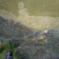
0.65 km2,
The Cole Farm catchment (0.65km2) is located ~ 4 km southwest of the Shale Hills site, draining orthogonally to a syncline axis of the Wills Creek Formation, a calcareous shale containing interbedded siltstone, sandstone, shaly limestone, and dolomite. Even though the farm adopted no-till practices in the 1970s, the axial channel of Cole Farm flows over a thick (>2.5 m) package of sediment in the valley floor. Soils range in texture from silty clay at the ridge top to sandy loam in the valley floor.
Cole Farm - Precipitation - Daily Precipitation (2017-2019)
2 components •
Cole Farm (Agricultural Site) •
Climatology / Meteorology, Hydrology •
Li, Li; Xiao, Dacheng
Cole Farm - Soil Moisture, Soil Temperature (2017-2019)
4 components •
Cole Farm (Agricultural Site) •
Hydrology, Soil Science / Pedology •
Eissenstat, David M.; Duncan, Jon; Tang, Qicheng
Cole Farm - Seismic Refraction, Geophysics (2018)
1 components •
Cole Farm (Agricultural Site) •
Geophysics, Geomorphology •
Hayes, Jorden
Cole Farm - Soil Moisture - COSMOS Probe (2018)
1 components •
Cole Farm (Agricultural Site) •
Soil Science / Pedology •
Li, Li; Xiao, Dacheng
Cole Farm (Agricultural Site) - Meteorology (2017-2018)
1 components •
Cole Farm (Agricultural Site) •
Climatology / Meteorology •
Kenneth J. Davis
Cole Farm (Agricultural Site) - Groundwater Depth, Groundwater Temperatures (2017-2019)
8 components •
Cole Farm (Agricultural Site) •
Hydrology •
Brantley, Susan L.; Forsythe, Brandon
Cole Farm (Agricultural Site) - Soil Moisture, Soil Temperature (2017-2019)
4 components •
Cole Farm (Agricultural Site) •
Hydrology, Soil Science / Pedology •
Eissenstat, David M.; Duncan, Jon; Tang, Qicheng
Cole Farm (Agricultural Site) - Solar Radiation (2018-2019)
1 components •
Cole Farm (Agricultural Site) •
Climatology / Meteorology •
Kenneth J. Davis
Cole Farm East Mid-Slope - Electrical Conductivity (2017-2018)
1 components •
Cole Farm (Agricultural Site) •
Geophysics, Soil Science / Pedology, Hydrology •
Brantley, Susan L.; Tang, Qicheng
Cole Farm Ridge Top - Electrical Conductivity (2017-2018)
1 components •
Cole Farm (Agricultural Site) •
Geophysics, Geology / Chronology •
Brantley, Susan L.; Gu, Xin
Cole Farm Valley Floor - Electrical Conductivity (2017-2018)
1 components •
Cole Farm (Agricultural Site) •
Geophysics, Geology / Chronology •
Brantley, Susan L.; Gu, Xin
Garner Run - Sandstone Forested
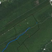
Garner Run Sandstone Forested site is situated on both sides of a segment of Garner Run, a tributary of Shavers Creek, on sandstone bedrock of slopes of Leading Ridge and Tussey Mountain in Huntingdon County, PA. (1.34km2), located ~ 3.5 km north of the Shale Hills site, is a headwater catchment with a small stream flowing parallel to a syncline fold axis of Tuscarora Formation, an erosionally resistant orthoquartzic sandstone with minor interbedded shale units. Surficial geology is largely controlled by periglacial alteration, such as slumps and solifluction lobes associated with thawing permafrost soils.
Garner Run - Vegetation (2014)
2 components •
Garner Run - Sandstone Forested •
Soil Science / Pedology •
Margot Kaye
Garner Run - Soil Geochemistry (2014-2016)
1 components •
Garner Run - Sandstone Forested •
Geochemistry / Mineralogy •
Brantley, Susan L.
Garner Run - Sap Flow - Garner Run Sap Flow Data (2016-2018)
1 components •
Garner Run - Sandstone Forested •
Biology / Ecology •
Eissenstat, David M.
Garner Run (Sandstone Forested) - Geophysics, Seismic Refraction, Geomorphology (2016-2017)
6 components •
Garner Run - Sandstone Forested •
Geophysics, Geomorphology •
Hayes, Jordan
Garner Run (Sandstone Forested) - Stream Water Temperatures - Fiber-Optic Distributed Temperature Sensor (2014)
1 components •
Garner Run - Sandstone Forested •
Hydrology •
Russo, Tess; Hoagland, Beth
Garner Run (Sandstone Forested) - Groundwater Chemistry (2014-2016)
1 components •
Garner Run - Sandstone Forested •
Hydrology, Geochemistry / Mineralogy •
Brantley, Susan L.
Garner Run (Sandstone Forested) - Hydropedologic Properties - Real and Imaginary Dielectric Constants (2014-2016)
1 components •
Garner Run - Sandstone Forested •
Soil Science / Pedology •
Lin, Henry
Garner Run (Sandstone Forested) - Soil Gas (2015)
1 components •
Garner Run - Sandstone Forested •
Geochemistry / Mineralogy, Soil Science / Pedology •
Kaye, Jason; Hill, Lillian
Garner Run (Sandstone Forested) - Groundwater Depth, Groundwater Temperatures (2015-2016)
1 components •
Garner Run - Sandstone Forested •
Hydrology •
Russo, Tess; Hoagland, Beth
Garner Run (Sandstone Forested) - Regolith Survey (2015-2016)
2 components •
Garner Run - Sandstone Forested •
GIS / Remote Sensing •
Roman DiBiase; Joanmarie Del Vecchio
Garner Run (Sandstone Forested) - Soil Moisture - COSMOS Probe (2015-2016)
2 components •
Garner Run - Sandstone Forested •
Soil Science / Pedology •
Li, Li; Xiao, Dacheng
Garner Run (Sandstone Forested) - Hydropedologic Properties, Soil Moisture, Soil Temperature (2015-2018)
4 components •
Garner Run - Sandstone Forested •
Soil Science / Pedology •
Lin, Henry; Brantley, Susan L.
Garner Run (Sandstone Forested) - Soil Gas - Gas Sample (O2 and CO2) (2015-2018)
2 components •
Garner Run - Sandstone Forested •
Geochemistry / Mineralogy, Soil Science / Pedology •
Jason Kaye; Caitlin Hodges; Ben Dillner
Garner Run (Sandstone Forested) - Groundwater Temperatures, Barometric Pressure, Groundwater Depth (2017-2019)
1 components •
Garner Run - Sandstone Forested •
Hydrology •
Tess Russo; Beth Hoagland
Garner Run (Sandstone Forested) - Precipitation - Precipitation (2018-2019)
6 components •
Garner Run - Sandstone Forested •
Climatology / Meteorology, Hydrology, Soil Science / Pedology •
Eissenstat, David M.; Duncan, Jon; Tang, Qicheng
Garner Run Outlet - Streamflow / Discharge, Air Temperature, Stream Water Temperatures (2014-2016)
1 components •
Garner Run - Sandstone Forested •
Hydrology •
Russo, Tess; Hoagland, Beth
National - Soil Gas - CO2 and O2 (2014-2017)
2 components •
Bigelow Site (High-Elevation), Jemez 2013 Burned ZOB, Jemez Unburned Site, Calhoun CZO Research Area 1, Garner Run - Sandstone Forested, Northeastern Puerto Rico and the Luquillo Mountains •
Biogeochemistry, Climatology / Meteorology, Soil Science / Pedology, Biology / Ecology •
Brecheisen, Zachary; Chorover, Jon; Kaye, Jason; Silver, Whendee; Abramson, Nate; Barron-Gafford, Greg; Condon, Katherine E.; Cook, Charles W.; Hill, Lillian; Losleben, Mark; Minor, Rebecca; O'Connell, Christine; Richter, Daniel deB.; Durcik, Matej
Shale Hills - Soil Gas - Soil Gas Sample (O2 and CO2) (2015-2018)
2 components •
Garner Run - Sandstone Forested •
Geochemistry / Mineralogy, Soil Science / Pedology •
Jason Kaye; Caitlin Hodges; Ben Dillner
Shale Hills, Garner Run (Sandstone Forested) - Vegetation, Tree Growth & Physiology (2014)
2 components •
Garner Run - Sandstone Forested, Susquehanna Shale Hills Critical Zone Observatory •
Biology / Ecology •
Kaye, Margot
Shale Hills, Garner Run (Sandstone Forested) - Vegetation (2015)
1 components •
Garner Run - Sandstone Forested, Susquehanna Shale Hills Critical Zone Observatory •
Biology / Ecology •
Brubaker, Kristen
Shaver's Creek Watershed - Tree Growth & Physiology - Root Distribution Data (2015)
1 components •
Garner Run - Sandstone Forested, Susquehanna Shale Hills Critical Zone Observatory •
Biology / Ecology •
Eissenstat, David M.
Shaver's Creek Watershed - Vegetation - Leaf Litter Collection Data (2015)
1 components •
Garner Run - Sandstone Forested, Susquehanna Shale Hills Critical Zone Observatory •
Biology / Ecology •
Eissenstat, David M.; Kaye, Margot
Shale Transect
![]()
7-24 °C, 1000-2500 mm/yr
Sites with constant parent lithology (Silurian Rose Hill Formation) used to study the effects of climate on regolith formation, soil geochemistry, formation and erosion. The sites are operated in collaboration between Penn State and six partner institutions.
Shale Transect - Meteorology, Air Temperature, Precipitation, Soil Moisture, Solar Radiation (2010-2014)
26 components •
Shale Transect •
Climatology / Meteorology, Hydrology •
Dere, Ashlee; White, Tim
Wales, UK
7.2 °C, 2500 mm/yr
The Wales transect site is located near Llanidloes, Wales, United Kingdom. The sampling site is within the Hafren Forest at an elevation of 1352 ft. The forest is a 4,000 ha area actively logged by the Forestry Commission and used for recreation. Historical uses include copper and lead mining and sheep grazing in some parts of the watershed. The source of the River Severn, which terminates near Bristol, UK, is found at the top of the watershed, not far from Pumlumon, the highest mountain in mid-Wales. The watershed has been extensively monitored by the Centre for Ecology and Hydrology for 40 years and is commonly referred to as Plynlimon. Sitka Spruce is the dominant vegetation and the underlying shale is called the Gwestyn Formation, which is equivalent to the Rose Hill Shale but has undergone some regional metamorphism. The climate is cold and very wet, with 60% of rain falling between October and March; air frost has been recorded in every month. Mean annual precipitation is 250 cm and mean annual temperature is 7.2 °C.
Colgate University NY
8.3 °C, 1000 mm/yr
The New York transect site is located near Paris, New York, in Oneida County, about thirty minutes from Colgate University. Private landowners have generously allowed use of their land for soil sampling and installation of a weather tower. The shale is part of the Clinton Group, which is equivalent to the Rose Hill Shale farther south in Pennsylvania. The site has thick forest cover and a perennial stream; elevation is 719 ft. Winters are harsh and cold and summers are moderate. Mean annual precipitation is 100 cm and mean annual temperature is 8.3 °C.
Juniata College PA
10 °C, 1070 mm/yr
Marcellus shale is well known as a natural gas play in the northeastern United States of America. A fracture density and geochemical study was conducted on Marcellus outcrops in central Pennsylvania to better understand physical and chemical weathering processes and relationships within the weathering profile of the Marcellus. The fracture density study served to provide quantitative data on the abundance of fractures in exposed Marcellus shale. As hypothesized, progressively higher fracture density values (FDV) were calculated closer to the soil profile. Understanding fracture densities and their associated depths can be used to explain why soil formation rates are faster. A study of this kind also has applications to natural gas extraction. The geochemical study was conducted to observe elemental depletion and movement within the soil profile. Lysimeters were installed to collect soil water in which major, trace elements, and Cu isotope compositions were measured. These concentrations and isotope ratios are important to understanding the extent of biogeochemical reactions.
Washington and Lee VA
13 °C, 1400 mm/yr
The Virginia transect site is located about 20 km from Lexington, VA, home of Washington and Lee University. The site is within the Goshen Wildlife Management Area, east of the Goshen Branch. The shale is Rose Hill Shale. The site has thick forest cover and is situated on a very flat ridgetop flanked by steep slopes, at an elevation of 2800 ft. Winters are cold and summers are warm. Mean annual precipitation is 140 cm and mean annual temperature is 13 °C.
Univ of Tennessee TN
14.2 °C, 1220 mm/yr
The Tennessee transect site is located in Big Ridge State Park, near Maynardville, TN, about 25 miles from the University of Tennessee campus in Knoxville. The 3,687 acre park surrounds the Norris Lake Reservoir. The sampling site is located on the tallest ridge, at an elevation of 1444 ft; the Smoky Mountains can be seen in the distance. The site is in the lower 10m of the Rose Hill Shale Formation, adjacent to the Tuscarora Sandstone Formation, which is exposed on the ridge. Winters are mild, with occasional snow, and summers are warm and humid. Mean annual precipitation is 122 cm and mean annual temperature is 14.2 °C. The site is located 36.27357 latitude and -83.91348 longitude.
Alabama A&M AL
15.6 °C, 1370 mm/yr
The Alabama transect site is located in Lake Guntersville State Park, near Lake Guntersville, AL, approximately 50 minutes from the Alabama A&M University campus. The site is on the Monsanto Tract of the park, which has not been developed for recreational purposes. The shale here is called the Red Rock Formation but is equivalent to the Rose Hill Shale in other parts of the transect. At an elevation of 758 ft., the site has thick forest cover and is adjacent to Lake Guntersville. Winters are very mild and summers are very hot and humid. Mean annual precipitation is 137 cm and mean annual temperature is 15.6 °C. The site is located at 34.42292 latitude and -86.20667 longitude.
U of Puerto Rico - Mayaguez
24.4 °C, 2100 mm/yr
The Puerto Rico transect site is located on private property off Rt. 111 between Juncal and Lares, Puerto Rico, about 30 miles northeast of the University of Puerto Rico, Mayaguez. The site is located on the San Sebastian formation, an Oligocene-age shale that is chemically similar to the Silurian-age Rose Hill Shale underlying other transect sites. Site elevation is 1,200 feet and vegetation is tropical, including numerous banana plants and palm trees. Winters are extremely mild and summers are hot and wet. Mean annual precipitation is 210 cm and mean annual temperature is 24.4 °C. The site is located at 18.30083 latitude and -66.90668 longitude.
-
Data Use Policy
DRAFT v.0.4.0
1. Use our data freely. All CZO Data Products* except those labelled Private** are released to the public and may be freely copied, distributed, edited, remixed, and built upon under the condition that you give acknowledgement as described below. Non-CZO data products — like those produced by USGS or NOAA — have their own use policies, which should be followed.
2. Give proper citation and acknowledgement. Publications, models and data products that make use of these datasets must include proper citation and acknowledgement. Most importantly, provide a citation in a similar way as a journal article (i.e. author, title, year of publication, name of CZO “publisher”, edition or version, and URL or DOI access information. See http://www.datacite.org/whycitedata). Also include at least a brief acknowledgement such as: “Data were provided by the NSF-supported Southern Sierra Critical Zone Observatory” (replace with the appropriate observatory name).
3. Let us know how you will use the data. The dataset creators would appreciate hearing of any plans to use the dataset. Consider consultation or collaboration with dataset creators.
*CZO Data Products. Defined as a data collected with any monetary or logistical support from a CZO.
**Private. Most private data will be released to the public within 1-2 years, with some exceptionally challenging datasets up to 4 years. To inquire about potential earlier use, please contact us.
Explore Further
