Dataset Listings
These dataset listings are out of date and have been archived.
See the updated listings on HydroShare.org >
Eel River Watershed
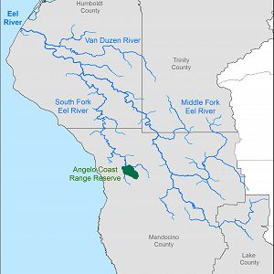
9540.0 km2, 0-2464 m elevation,
The Eel River Watershed (9,540 km2) is a steep mostly undammed Northern California coastal river eroding rapidly through mechanically weak rock with active uplift. Both watershed-climate-ocean productivity investigations and education & outreach have occurred here (supported by prior NSF funds and in collaboration with Friends of the Eel River and the Eel River Recovery Project).
Eel River and South Fork Eel River - LiDAR, Digital Elevation Model (DEM) (2009)
1 components •
Eel River Watershed •
GIS / Remote Sensing •
Jonathan Perkins; Noah Finnegan
Eel River to Rivendell - GIS/Map Data - Research and Watershed GIS Boundaries (2004-2015)
1 components •
Rivendell, Angelo Coast Range Reserve, Eel River Watershed •
GIS / Remote Sensing •
Collin Bode; USGS
National - Stream Water Chemistry - Cations, Anions, Metals (1982-2015)
1 components •
Bisley, Betasso, East Peak, Marshall Gulch (High-Elevation), Providence Creek Subcatchment P301, Providence Creek Subcatchment P303, Providence Creek Subcatchment P304, Eel River Watershed, Puente Roto, Rio Blanco, Rio Icacos, Susquehanna Shale Hills Critical Zone Observatory •
Biogeochemistry, Biology / Ecology, Hydrology, Water Chemistry •
Hyojin, Kim; Bishop, Jim; Dietrich, William; Fung, Inez; McDowell, William H.; Brantley, Susan L.; Hoagland, Beth; Sullivan, Pamela L.; Cain, Molly; Neal, Andrew; Fisher, Jessica; Russo, Tess; Niwot Ridge LTER; Liu, Fengjing; Chorover, Jon; Troch, Peter; McIntosh, Jennifer; Brooks, Paul; Abramson, Nate; Heidbuechel, Ingo; Amistadi, Mary Key; Alexander Pedron, Shawn; Chorover, Jon; Troch, Peter; Corley, Timothy; Zapata-Rios, Xavier; Losleben, Mark; Condon, Katherine
National - LiDAR, Land Cover, GIS/Map Data - OpenTopography (2010-2017)
18 components •
Boulder Creek Watershed, Eel River Watershed, Jemez River Basin, Reynolds Creek Experimental Watershed, Susquehanna Shale Hills Critical Zone Observatory, Northeastern Puerto Rico and the Luquillo Mountains, Sangamon River Basin, Clear Creek Watershed, Calhoun Critical Zone Observatory, Providence Creek Headwater Catchments (1660 - 2115 m elevation) •
Geomorphology, GIS / Remote Sensing, Hydrology, Biology / Ecology •
National Center for Airborne Laser Mapping; Boulder Creek Critical Zone Observatory; Calhoun Critical Zone Observatory; University of Arizona; University of California Merced; Valles Caldera National Preserve; Bandelier National Monument; National Park Service; Jemez River Basin and Santa Catalina Mountains Critical Zone Observatory; Luquillo Critical Zone Observatory; Reynolds Creek CZO; Eel River CZO; Shale Hills CZO
South Fork Eel River Headwaters - LiDAR, Digital Elevation Model (DEM) - Bare-earth elevation model and hillshade (2004)
1 components •
Angelo Coast Range Reserve, Eel River Watershed •
GIS / Remote Sensing •
Mary Power; Bill Dietrich; Collin Bode
Angelo Coast Range Reserve
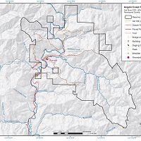
31 km2, 120-1260 m elevation, 10.1 °C,
The Heath & Marjorie Angelo Coast Range Reserve is a Berkeley-administered research reserve in the University of California Natural Reserve System. It covers 31 km2 of steep forested terrain, 5 km of the upper South Fork Eel River and entire watersheds of Elder Creek and several other tributaries. The Angelo Reserve has hosted > 25 years of prior NSF-funded field research and was the first collaborative field site for an NSF Science and Technology Center, the National Center for Earth Surface Dynamics (NCED) (2002-2012).
Angelo Coast Range Reserve - Precipitation, Rainfall Chemistry, Overland Water Chemistry, Stream Water Chemistry, Throughfall Chemistry, Groundwater Chemistry, Rock Moisture, Stable Isotopes - Stable isotope analysis of water samples (2014-2016)
1 components •
Angelo Coast Range Reserve •
Biogeochemistry, Water Chemistry •
Dawson, Todd E.; Wong, Christopher S.; Rempe, Daniella; Hahm, Jesse
Angelo Reserve - Meteorology - Weather Stations (4) (2007-2015)
4 components •
Angelo Coast Range Reserve •
Climatology / Meteorology •
Steel, Peter; Dietrich, William; Power, Mary; Bode, Collin; Stromberg, Mark; McCurdy, Greg
Angelo Reserve - Streamflow / Discharge - South Fork Eel River (2008-2015)
2 components •
Angelo Coast Range Reserve •
Hydrology •
Dietrich, William; Power, Mary; Bode, Collin; Steel, Peter
Eel River to Rivendell - GIS/Map Data - Research and Watershed GIS Boundaries (2004-2015)
1 components •
Rivendell, Angelo Coast Range Reserve, Eel River Watershed •
GIS / Remote Sensing •
Collin Bode; USGS
South Fork Eel River Headwaters - LiDAR, Digital Elevation Model (DEM) - Bare-earth elevation model and hillshade (2004)
1 components •
Angelo Coast Range Reserve, Eel River Watershed •
GIS / Remote Sensing •
Mary Power; Bill Dietrich; Collin Bode
Sagehorn-Russell Ranch
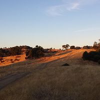
21 km2, 460-980 m elevation,
Sagehorn-Russell Ranch is a privately owned working cattle ranch in Mendocino, California. The owner has granted the Eel River Critical Zone Observatory permission to establish a weather station, several monitored wells, and to perform research on her property.
Rivendell - Tree Growth & Physiology - Tree growth measurements using piston dendrometers (2015-2016)
1 components •
Rivendell, Sagehorn-Russell Ranch •
Biology / Ecology •
Hahm, Jesse
Rivendell
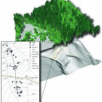
0.004 km2, 400-470 m elevation,
Rivendell is our critical zone laboratory where we can investigate in detail mechanisms controlling the currencies that then get released to the atmosphere and to the surrounding drainage channels. This proposed CZO leverages and builds upon the investment already made in Rivendell
Eel River to Rivendell - GIS/Map Data - Research and Watershed GIS Boundaries (2004-2015)
1 components •
Rivendell, Angelo Coast Range Reserve, Eel River Watershed •
GIS / Remote Sensing •
Collin Bode; USGS
Rivendell - Rainfall Chemistry, Stream Water Chemistry, Throughfall Chemistry, Groundwater Chemistry - Solute chemistry (2007-2015)
1 components •
Rivendell •
Water Chemistry •
Kim, Hyojin; Bishop, Jim; Dietrich, William; Fung, Inez
Rivendell - Groundwater Depth - Well water levels (12 wells) (2008-2015)
12 components •
Rivendell •
Hydrology •
Dietrich, William; Rempe, Daniella; Oshun, Jasper; Salve, Rohit
Rivendell - Rock Moisture, Soil Moisture - Soil and Rock Moisture TDR (2008-2015)
3 components •
Rivendell •
Geomorphology, Hydrology, Soil Science / Pedology •
Dietrich, William; Salve, Rohit; Rempe, Daniella; Oshun, Jasper
Rivendell - Stable Isotopes - Tree water, rain, stream, soil, & saprolite water (2010-2014)
1 components •
Rivendell •
Biogeochemistry, Biology / Ecology, Climatology / Meteorology, Geomorphology •
Oshun, Jasper; Dietrich, Bill; Dawson, Todd
Rivendell - Air Temperature - Air temperature and relative humidity measurements (2010-2016)
1 components •
Rivendell •
Climatology / Meteorology •
Link, Percy
Rivendell - Water Potential, Tree Growth & Physiology - Stem psychrometers (2014)
1 components •
Rivendell •
Biology / Ecology •
Todd, Dawson E.; Williams, Cameron; Wong, Christopher S.
Rivendell - Soil Moisture, Rock Moisture - Soil and rock moisture measured in well holes (2015-2016)
1 components •
Rivendell •
Geomorphology •
Rempe, Daniella
Rivendell - Tree Growth & Physiology - Tree growth measurements using piston dendrometers (2015-2016)
1 components •
Rivendell, Sagehorn-Russell Ranch •
Biology / Ecology •
Hahm, Jesse
-
Data Use Policy
DRAFT v.0.4.0
1. Use our data freely. All CZO Data Products* except those labelled Private** are released to the public and may be freely copied, distributed, edited, remixed, and built upon under the condition that you give acknowledgement as described below. Non-CZO data products — like those produced by USGS or NOAA — have their own use policies, which should be followed.
2. Give proper citation and acknowledgement. Publications, models and data products that make use of these datasets must include proper citation and acknowledgement. Most importantly, provide a citation in a similar way as a journal article (i.e. author, title, year of publication, name of CZO “publisher”, edition or version, and URL or DOI access information. See http://www.datacite.org/whycitedata). Also include at least a brief acknowledgement such as: “Data were provided by the NSF-supported Southern Sierra Critical Zone Observatory” (replace with the appropriate observatory name).
3. Let us know how you will use the data. The dataset creators would appreciate hearing of any plans to use the dataset. Consider consultation or collaboration with dataset creators.
*CZO Data Products. Defined as a data collected with any monetary or logistical support from a CZO.
**Private. Most private data will be released to the public within 1-2 years, with some exceptionally challenging datasets up to 4 years. To inquire about potential earlier use, please contact us.
Explore Further