Dataset Listings
These dataset listings are out of date and have been archived.
See the updated listings on HydroShare.org >
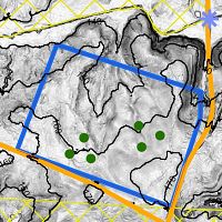
Calhoun Critical Zone Observatory
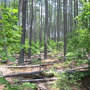
134-190 m elevation, 16 °C, 1250 mm/yr
The Calhoun Critical Zone Observatory is comprised of eight research areas in the Calhoun Experimental Forest and surrounding areas in the Sumter National Forest in upstate South Carolina, including the Holcombe's Branch watershed, experimental catchments, and space-for-time (paired hardwood-pine-cultivated field) plots. The areas were chosen primarily for their wealth of historical data giving researchers an ideal platform for testing hypotheses on how critical zones evolve in response to human forcings at the landscape scale.
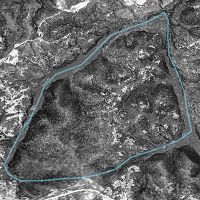
Calhoun Critical Zone Observatory - GIS/Map Data - Research Areas (2014-2018)
3 components •
Calhoun Critical Zone Observatory •
All Disciplines •
Brecheisen, Z.S.; Cook, Charles W.; Richter, Daniel deB.
Calhoun CZO - GIS/Map Data, LiDAR - Canopy Height (2014)
1 components •
Calhoun Critical Zone Observatory •
GIS / Remote Sensing, Biology / Ecology •
Brecheisen, Zachary S.
Enoree District, Sumter National Forest - GIS/Map Data - Land Grants, 1749-1851 (2018)
1 components •
Calhoun Critical Zone Observatory •
Social Science •
Coughlan, Michael R.; Nelson, Donald
National - Streamflow / Discharge - USGS and USDA Data Resources (1985-2017)
22 components •
Boulder Creek Watershed, Santa Catalina Mountains, Jemez River Basin, Reynolds Creek Experimental Watershed, Susquehanna Shale Hills Critical Zone Observatory, Northeastern Puerto Rico and the Luquillo Mountains, Clear Creek Watershed, Sangamon River Basin, Calhoun Critical Zone Observatory, Providence Creek Headwater Catchments (1660 - 2115 m elevation) •
Hydrology •
USGS National Water Information System
National - LiDAR, Land Cover, GIS/Map Data - OpenTopography (2010-2017)
18 components •
Boulder Creek Watershed, Eel River Watershed, Jemez River Basin, Reynolds Creek Experimental Watershed, Susquehanna Shale Hills Critical Zone Observatory, Northeastern Puerto Rico and the Luquillo Mountains, Sangamon River Basin, Clear Creek Watershed, Calhoun Critical Zone Observatory, Providence Creek Headwater Catchments (1660 - 2115 m elevation) •
Geomorphology, GIS / Remote Sensing, Hydrology, Biology / Ecology •
National Center for Airborne Laser Mapping; Boulder Creek Critical Zone Observatory; Calhoun Critical Zone Observatory; University of Arizona; University of California Merced; Valles Caldera National Preserve; Bandelier National Monument; National Park Service; Jemez River Basin and Santa Catalina Mountains Critical Zone Observatory; Luquillo Critical Zone Observatory; Reynolds Creek CZO; Eel River CZO; Shale Hills CZO
National - Air Temperature, Flux Tower, Meteorology - NADP and NOAA or other weather stations (2017)
8 components •
Boulder Creek Watershed, Calhoun Critical Zone Observatory, Jemez River Basin, Susquehanna Shale Hills Critical Zone Observatory •
Climatology / Meteorology •
NADP; NOAA; others
Calhoun CZO Research Area 8
0.77 km2,
Calhoun Research Area 8, the newest and easternmost of the 8 CCZO research areas, includes adjacent pine and hardwood stands.
Calhoun CZO - Soil Biogeochemistry (2015-2016)
1 components •
Calhoun CZO Research Area 1, Calhoun CZO Research Area 2, Calhoun CZO Research Area 7, Calhoun CZO Research Area 8 •
Biogeochemistry, Biology / Ecology, Soil Science / Pedology •
Sharon Billings; Christoph Lehmeier; Kyungjin Min; Samik Bagchi; Emma Hauser; Keelan Barger; Samantha Elledge; Rebecca Flournoy; Carl Heroneme; Hanna Rankin; Rena Stair
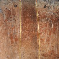
Calhoun CZO - Photographic Imagery, Soil Survey - Soil Pit Profiles (2016)
4 components •
Calhoun CZO Research Area 1, Calhoun CZO Research Area 2, Calhoun CZO Research Area 7, Calhoun CZO Research Area 8 •
Soil Science / Pedology •
Cook, Charles W.
Calhoun CZO - Soil Geochemistry (2016)
1 components •
Calhoun CZO Research Area 1, Calhoun CZO Research Area 2, Calhoun CZO Research Area 6, Calhoun CZO Research Area 7, Calhoun CZO Research Area 8 •
Geochemistry / Mineralogy •
Austin, Jason C.; Schroeder, Paul A.
Calhoun CZO Research Area 7
Calhoun Research Area 7, located south of the Enoree River, includes adjacent pine and hardwood stands. This is the southernmost of the 8 CCZO research areas.
Calhoun Critical Zone Observatory - Soil Moisture - Hydroprobe (2016-2018)
1 components •
Calhoun CZO Research Area 1, Calhoun CZO Research Area 4, Calhoun CZO Research Area 7 •
Hydrology, Biogeochemistry, Soil Science / Pedology •
Austin, Jason C.; Brecheisen, Zachary S.; Cook, Charles W.; Heine, Paul R.; Richter, Daniel deB.
Calhoun CZO - Soil Biogeochemistry (2015-2016)
1 components •
Calhoun CZO Research Area 1, Calhoun CZO Research Area 2, Calhoun CZO Research Area 7, Calhoun CZO Research Area 8 •
Biogeochemistry, Biology / Ecology, Soil Science / Pedology •
Sharon Billings; Christoph Lehmeier; Kyungjin Min; Samik Bagchi; Emma Hauser; Keelan Barger; Samantha Elledge; Rebecca Flournoy; Carl Heroneme; Hanna Rankin; Rena Stair
Calhoun CZO - Soil Texture (2015-2016)
1 components •
Calhoun CZO Research Area 1, Calhoun CZO Research Area 4, Calhoun CZO Research Area 7 •
Soil Science / Pedology •
Heine, Paul R
Calhoun CZO - Soil Porosity, Soil Invertebrates (2015-2017)
2 components •
Calhoun CZO Research Area 1, Calhoun CZO Research Area 4, Calhoun CZO Research Area 7 •
Soil Science / Pedology, Biology / Ecology •
Brecheisen, Zachary S..; Callaham, M.A.; Heine, P.R.; Cook, Charles W.; Richter, Daniel deB.
Calhoun CZO - Photographic Imagery, Soil Survey - Soil Pit Profiles (2016)
4 components •
Calhoun CZO Research Area 1, Calhoun CZO Research Area 2, Calhoun CZO Research Area 7, Calhoun CZO Research Area 8 •
Soil Science / Pedology •
Cook, Charles W.
Calhoun CZO - Soil Geochemistry (2016)
1 components •
Calhoun CZO Research Area 1, Calhoun CZO Research Area 2, Calhoun CZO Research Area 6, Calhoun CZO Research Area 7, Calhoun CZO Research Area 8 •
Geochemistry / Mineralogy •
Austin, Jason C.; Schroeder, Paul A.
Research areas 1, 4, 7 - Soil Gas (2015-2017)
2 components •
Calhoun CZO Research Area 1, Calhoun CZO Research Area 4, Calhoun CZO Research Area 7 •
Biogeochemistry, Soil Science / Pedology •
Brecheisen, Z. S.; Cook, Charles W.; Richter, Daniel deB.
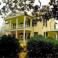
Calhoun CZO Research Area 6
0.30 km2,
Research Area 6 is centered on the historic Rose Hill Plantation, home of South Carolina's secessionist governor William Henry Gist (1807-1874).
Calhoun CZO - Soil Geochemistry (2016)
1 components •
Calhoun CZO Research Area 1, Calhoun CZO Research Area 2, Calhoun CZO Research Area 6, Calhoun CZO Research Area 7, Calhoun CZO Research Area 8 •
Geochemistry / Mineralogy •
Austin, Jason C.; Schroeder, Paul A.
Calhoun CZO Research Area 5
Calhoun Research Area 5, located at the corner of Old Buncombe and Sardis Roads, includes adjacent pine and hardwood stands.
Calhoun CZO - Vegetation - Litterfall (2014-2017)
1 components •
Calhoun CZO Research Area 1, Calhoun CZO Research Area 2, Calhoun CZO Research Area 3, Calhoun CZO Research Area 4, Calhoun CZO Research Area 5 •
Biology / Ecology •
Cook, Charles W.; O'Neill, K. P.; Richter, Daniel deB.
Calhoun CZO Research Area 3
6.5 km2, 108-195 m elevation, 16 °C, 1250 mm/yr
The largest of the research areas at the Calhoun, Research Area 3 encompasses the Holcombe's Branch watershed. This is the most intensely studied area in the CCZO for ecohydrology, geophysics, and soil organic carbon dynamics research.
Calhoun Critical Zone Observatory - Soil Moisture - Saturated Hydraulic Conductivity (Ksat) (2017)
2 components •
Calhoun CZO Research Area 2, Calhoun CZO Research Area 3 •
Soil Science / Pedology •
Ryland, Rachel; Markewitz, Daniel; Sutter, Lori
Calhoun CZO - Soil Survey - Soil Texture (2014-2015)
3 components •
Calhoun CZO Research Area 3, Calhoun CZO Research Area 4 •
Soil Science / Pedology •
Heine, Paul
Calhoun CZO - Streamflow / Discharge (2014-2017)
1 components •
Calhoun Experimental Forest and Eco-hydrology Experiments, Calhoun CZO Research Area 3 •
Hydrology •
Mallard, John McDevitt
Calhoun CZO - Vegetation - Litterfall (2014-2017)
1 components •
Calhoun CZO Research Area 1, Calhoun CZO Research Area 2, Calhoun CZO Research Area 3, Calhoun CZO Research Area 4, Calhoun CZO Research Area 5 •
Biology / Ecology •
Cook, Charles W.; O'Neill, K. P.; Richter, Daniel deB.
Calhoun CZO - Geomorphology - Gully Boundaries (2015)
1 components •
Calhoun CZO Research Area 3 •
Geomorphology, Hydrology •
Leonardo V. Noto; Yannis Dialynas; Satish Bastola
Calhoun CZO - Soil Texture - Argillic Horizon (2016-2017)
1 components •
Calhoun CZO Research Area 2, Calhoun CZO Research Area 3, Calhoun CZO Research Area 4 •
Soil Science / Pedology •
Ryland, Rachel C.
Calhoun CZO Research Area 2
.16 km2,
Research area 2 is located in the northwestern section of the Calhoun Experimental Forest off Bombing Range Road. It includes a small hardwood stand and an adjacent pine stand.
Calhoun Critical Zone Observatory - Soil Moisture - Saturated Hydraulic Conductivity (Ksat) (2017)
2 components •
Calhoun CZO Research Area 2, Calhoun CZO Research Area 3 •
Soil Science / Pedology •
Ryland, Rachel; Markewitz, Daniel; Sutter, Lori
Calhoun CZO - Vegetation - Litterfall (2014-2017)
1 components •
Calhoun CZO Research Area 1, Calhoun CZO Research Area 2, Calhoun CZO Research Area 3, Calhoun CZO Research Area 4, Calhoun CZO Research Area 5 •
Biology / Ecology •
Cook, Charles W.; O'Neill, K. P.; Richter, Daniel deB.
Calhoun CZO - Soil Biogeochemistry (2015-2016)
1 components •
Calhoun CZO Research Area 1, Calhoun CZO Research Area 2, Calhoun CZO Research Area 7, Calhoun CZO Research Area 8 •
Biogeochemistry, Biology / Ecology, Soil Science / Pedology •
Sharon Billings; Christoph Lehmeier; Kyungjin Min; Samik Bagchi; Emma Hauser; Keelan Barger; Samantha Elledge; Rebecca Flournoy; Carl Heroneme; Hanna Rankin; Rena Stair
Calhoun CZO - Photographic Imagery, Soil Survey - Soil Pit Profiles (2016)
4 components •
Calhoun CZO Research Area 1, Calhoun CZO Research Area 2, Calhoun CZO Research Area 7, Calhoun CZO Research Area 8 •
Soil Science / Pedology •
Cook, Charles W.
Calhoun CZO - Soil Geochemistry (2016)
1 components •
Calhoun CZO Research Area 1, Calhoun CZO Research Area 2, Calhoun CZO Research Area 6, Calhoun CZO Research Area 7, Calhoun CZO Research Area 8 •
Geochemistry / Mineralogy •
Austin, Jason C.; Schroeder, Paul A.
Calhoun CZO - Soil Texture - Argillic Horizon (2016-2017)
1 components •
Calhoun CZO Research Area 2, Calhoun CZO Research Area 3, Calhoun CZO Research Area 4 •
Soil Science / Pedology •
Ryland, Rachel C.
Calhoun CZO Research Area 4
0.42 km2,
One of four historic Calhoun experimental catchments, which were instrumented with precipitation and runoff gauges from the 1940s to 1960s. The catchment was severely eroded and gullied and has been reforested over the last half century. The archived hydrologic records and photographs have been stored in the Coweeta Hydrologic Laboratory data vault since 1962. Contemporary hydrologic responses of the catchments will be compared with the historical data.
Calhoun Critical Zone Observatory - Soil Moisture - Hydroprobe (2016-2018)
1 components •
Calhoun CZO Research Area 1, Calhoun CZO Research Area 4, Calhoun CZO Research Area 7 •
Hydrology, Biogeochemistry, Soil Science / Pedology •
Austin, Jason C.; Brecheisen, Zachary S.; Cook, Charles W.; Heine, Paul R.; Richter, Daniel deB.
Calhoun CZO - LiDAR - Hyperspectral and LiDAR Survey (2014)
1 components •
Calhoun CZO Research Area 1, Calhoun CZO Research Area 4, Calhoun Experimental Forest and Eco-hydrology Experiments, Calhoun Long-Term Soil-Ecosystem Plots and Reference Areas •
GIS / Remote Sensing •
National Center for Airborne Laser Mapping
Calhoun CZO - Vegetation - Leaf Area Index (2014)
1 components •
Calhoun CZO Research Area 1, Calhoun CZO Research Area 4, Calhoun Experimental Forest and Eco-hydrology Experiments •
Biology / Ecology •
Cook, Charles W.
Calhoun CZO - Soil Survey - Soil Texture (2014-2015)
3 components •
Calhoun CZO Research Area 3, Calhoun CZO Research Area 4 •
Soil Science / Pedology •
Heine, Paul
Calhoun CZO - Vegetation - Litterfall (2014-2017)
1 components •
Calhoun CZO Research Area 1, Calhoun CZO Research Area 2, Calhoun CZO Research Area 3, Calhoun CZO Research Area 4, Calhoun CZO Research Area 5 •
Biology / Ecology •
Cook, Charles W.; O'Neill, K. P.; Richter, Daniel deB.
Calhoun CZO - Soil Texture (2015-2016)
1 components •
Calhoun CZO Research Area 1, Calhoun CZO Research Area 4, Calhoun CZO Research Area 7 •
Soil Science / Pedology •
Heine, Paul R
Calhoun CZO - Soil Porosity, Soil Invertebrates (2015-2017)
2 components •
Calhoun CZO Research Area 1, Calhoun CZO Research Area 4, Calhoun CZO Research Area 7 •
Soil Science / Pedology, Biology / Ecology •
Brecheisen, Zachary S..; Callaham, M.A.; Heine, P.R.; Cook, Charles W.; Richter, Daniel deB.
Calhoun CZO - LiDAR - LiDAR Leaf-Off Survey (2016)
1 components •
Calhoun CZO Research Area 1, Calhoun CZO Research Area 4, Calhoun Experimental Forest and Eco-hydrology Experiments, Calhoun Long-Term Soil-Ecosystem Plots and Reference Areas •
GIS / Remote Sensing •
National Center for Airborne Laser Mapping
Calhoun CZO - Soil Texture - Argillic Horizon (2016-2017)
1 components •
Calhoun CZO Research Area 2, Calhoun CZO Research Area 3, Calhoun CZO Research Area 4 •
Soil Science / Pedology •
Ryland, Rachel C.
Research areas 1, 4, 7 - Soil Gas (2015-2017)
2 components •
Calhoun CZO Research Area 1, Calhoun CZO Research Area 4, Calhoun CZO Research Area 7 •
Biogeochemistry, Soil Science / Pedology •
Brecheisen, Z. S.; Cook, Charles W.; Richter, Daniel deB.
Calhoun CZO Research Area 1

0.40 km2, 180-190 m elevation, 16 °C, 1250 mm/yr
The largest of the research areas at the Calhoun, this includes three major subsections: (1) the Calhoun Long-Term Soil-Ecosystem Plots and Reference Areas, (2) the "tower site" (site of future flux tower and clearcut treatment), and (3) the "dove field", which to our knowledge has been continuously cultivated since at least the 1930s. Also included in Research Area 1 is a 70-m deep well in a cow pasture on private land adjacent to the long-term plots.
Calhoun 70-m deep well - Groundwater Depth, Electrical Conductivity (2014-2017)
2 components •
Calhoun CZO Research Area 1 •
Hydrology •
Mallard, John; McGlynn, Brian
Calhoun 70-m deep well - Soil Mineralogy, Soil Geochemistry, Photographic Imagery (2019)
4 components •
Calhoun CZO Research Area 1 •
Geochemistry / Mineralogy, Soil Science / Pedology •
Austin, Jason C.; Bacon, Allan R.; Richter, Daniel deB.; Schroeder, Paul A.
Calhoun Critical Zone Observatory - Soil Moisture - Hydroprobe (2016-2018)
1 components •
Calhoun CZO Research Area 1, Calhoun CZO Research Area 4, Calhoun CZO Research Area 7 •
Hydrology, Biogeochemistry, Soil Science / Pedology •
Austin, Jason C.; Brecheisen, Zachary S.; Cook, Charles W.; Heine, Paul R.; Richter, Daniel deB.
Calhoun CZO - LiDAR - Hyperspectral and LiDAR Survey (2014)
1 components •
Calhoun CZO Research Area 1, Calhoun CZO Research Area 4, Calhoun Experimental Forest and Eco-hydrology Experiments, Calhoun Long-Term Soil-Ecosystem Plots and Reference Areas •
GIS / Remote Sensing •
National Center for Airborne Laser Mapping
Calhoun CZO - Vegetation - Leaf Area Index (2014)
1 components •
Calhoun CZO Research Area 1, Calhoun CZO Research Area 4, Calhoun Experimental Forest and Eco-hydrology Experiments •
Biology / Ecology •
Cook, Charles W.
Calhoun CZO - Precipitation (2014-2017)
1 components •
Calhoun CZO Research Area 1 •
Climatology / Meteorology, Hydrology •
Mallard, John M.
Calhoun CZO - Vegetation - Litterfall (2014-2017)
1 components •
Calhoun CZO Research Area 1, Calhoun CZO Research Area 2, Calhoun CZO Research Area 3, Calhoun CZO Research Area 4, Calhoun CZO Research Area 5 •
Biology / Ecology •
Cook, Charles W.; O'Neill, K. P.; Richter, Daniel deB.
Calhoun CZO - Soil Biogeochemistry (2015-2016)
1 components •
Calhoun CZO Research Area 1, Calhoun CZO Research Area 2, Calhoun CZO Research Area 7, Calhoun CZO Research Area 8 •
Biogeochemistry, Biology / Ecology, Soil Science / Pedology •
Sharon Billings; Christoph Lehmeier; Kyungjin Min; Samik Bagchi; Emma Hauser; Keelan Barger; Samantha Elledge; Rebecca Flournoy; Carl Heroneme; Hanna Rankin; Rena Stair
Calhoun CZO - Soil Texture (2015-2016)
1 components •
Calhoun CZO Research Area 1, Calhoun CZO Research Area 4, Calhoun CZO Research Area 7 •
Soil Science / Pedology •
Heine, Paul R
Calhoun CZO - Soil Porosity, Soil Invertebrates (2015-2017)
2 components •
Calhoun CZO Research Area 1, Calhoun CZO Research Area 4, Calhoun CZO Research Area 7 •
Soil Science / Pedology, Biology / Ecology •
Brecheisen, Zachary S..; Callaham, M.A.; Heine, P.R.; Cook, Charles W.; Richter, Daniel deB.
Calhoun CZO - LiDAR - LiDAR Leaf-Off Survey (2016)
1 components •
Calhoun CZO Research Area 1, Calhoun CZO Research Area 4, Calhoun Experimental Forest and Eco-hydrology Experiments, Calhoun Long-Term Soil-Ecosystem Plots and Reference Areas •
GIS / Remote Sensing •
National Center for Airborne Laser Mapping
Calhoun CZO - Photographic Imagery, Soil Survey - Soil Pit Profiles (2016)
4 components •
Calhoun CZO Research Area 1, Calhoun CZO Research Area 2, Calhoun CZO Research Area 7, Calhoun CZO Research Area 8 •
Soil Science / Pedology •
Cook, Charles W.
Calhoun CZO - Soil Geochemistry (2016)
1 components •
Calhoun CZO Research Area 1, Calhoun CZO Research Area 2, Calhoun CZO Research Area 6, Calhoun CZO Research Area 7, Calhoun CZO Research Area 8 •
Geochemistry / Mineralogy •
Austin, Jason C.; Schroeder, Paul A.
Calhoun CZO Research Area 1 - Flux Tower - Young Pine Forest (2016-2017)
4 components •
Calhoun Long-Term Soil-Ecosystem Plots and Reference Areas, Calhoun CZO Research Area 1 •
Climatology / Meteorology •
Yao Tang; Jingfeng Wang
National - Soil Gas - CO2 and O2 (2014-2017)
2 components •
Bigelow Site (High-Elevation), Jemez 2013 Burned ZOB, Jemez Unburned Site, Calhoun CZO Research Area 1, Garner Run - Sandstone Forested, Northeastern Puerto Rico and the Luquillo Mountains •
Biogeochemistry, Climatology / Meteorology, Soil Science / Pedology, Biology / Ecology •
Brecheisen, Zachary; Chorover, Jon; Kaye, Jason; Silver, Whendee; Abramson, Nate; Barron-Gafford, Greg; Condon, Katherine E.; Cook, Charles W.; Hill, Lillian; Losleben, Mark; Minor, Rebecca; O'Connell, Christine; Richter, Daniel deB.; Durcik, Matej
R1 - Soil Biogeochemistry - Carbon isotopes (2016)
1 components •
Calhoun CZO Research Area 1 •
Soil Science / Pedology, Biogeochemistry •
Cherkinsky, Alexander
Research area 1 - Soil Gas, Soil Moisture, Soil Temperature (2016-2019)
1 components •
Calhoun CZO Research Area 1 •
Biogeochemistry, Soil Science / Pedology, Hydrology •
Brecheisen, Z. S.; Cook, Charles W.; Richter, Daniel deB.
Research areas 1, 4, 7 - Soil Gas (2015-2017)
2 components •
Calhoun CZO Research Area 1, Calhoun CZO Research Area 4, Calhoun CZO Research Area 7 •
Biogeochemistry, Soil Science / Pedology •
Brecheisen, Z. S.; Cook, Charles W.; Richter, Daniel deB.
Calhoun Pine Flux Tower
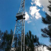
16 °C, 1250 mm/yr
In 2016 a 30 foot tall flux tower was installed in a young pine stand in research area 1. The heavily instrumented tower is complemented with gas well going down to 5-m below the soil surface.
Calhoun Long-Term Soil-Ecosystem Plots and Reference Areas
180-190 m elevation, 16 °C, 1250 mm/yr
The Calhoun LTSE has 16 permanent plots installed on the site of two former cotton fields planted to loblolly pine (P. taeda) in the winter of 1956-1957. From 1962 to present, the soil has been sampled to a depth of 60 cm approximately every 5 years. In 2007, 8 of the 16 plots were logged to initiate a new phase in the long-term experiment. Plot studies in the Calhoun CZO also include reference hardwoods, secondary pine, hay, and cultivated crops. Source: D. Richter, 2001.
Calhoun 70m deep well - Soil Geochemistry (2010)
1 components •
Calhoun Long-Term Soil-Ecosystem Plots and Reference Areas •
Soil Science / Pedology, Geochemistry / Mineralogy •
Bacon, Allan R; Richter, Daniel deB.; Bierman, Paul R.; Rood, Dylan H.
Calhoun CZO - LiDAR - Hyperspectral and LiDAR Survey (2014)
1 components •
Calhoun CZO Research Area 1, Calhoun CZO Research Area 4, Calhoun Experimental Forest and Eco-hydrology Experiments, Calhoun Long-Term Soil-Ecosystem Plots and Reference Areas •
GIS / Remote Sensing •
National Center for Airborne Laser Mapping
Calhoun CZO - Soil Mineralogy (2014-2015)
1 components •
Calhoun Long-Term Soil-Ecosystem Plots and Reference Areas •
Soil Science / Pedology •
Austin, Jason C.
Calhoun CZO - Vegetation - Tree Survey (2014-2017)
1 components •
Calhoun Experimental Forest and Eco-hydrology Experiments, Calhoun Long-Term Soil-Ecosystem Plots and Reference Areas •
Biology / Ecology •
Cook, Charles W.; Brecheisen, Z.; Richter, Daniel deB.
Calhoun CZO - LiDAR - LiDAR features for the Calhoun CZO forest plots (2015)
1 components •
Calhoun Experimental Forest and Eco-hydrology Experiments, Calhoun Long-Term Soil-Ecosystem Plots and Reference Areas •
GIS / Remote Sensing •
Majasalmi, Titta
Calhoun CZO - Soil Geochemistry - Mössbauer spectroscopy (2015)
1 components •
Calhoun Long-Term Soil-Ecosystem Plots and Reference Areas •
Biogeochemistry, Soil Science / Pedology •
Thompson, Aaron; Richter, Daniel deB.; Wilmoth, Jared; Barcellos, Diego
Calhoun CZO - Soil Geochemistry - Soil organic matter transformations (2015)
1 components •
Calhoun Long-Term Soil-Ecosystem Plots and Reference Areas •
Biogeochemistry, Biology / Ecology, Soil Science / Pedology •
Min, K.; Flournoy, R.; Heroneme, C.; Barger, K.; Lehmeier, C.A.; Heine, P.; Richter, Daniel deB.; Billings, S.A.
Calhoun CZO - LiDAR - LiDAR Leaf-Off Survey (2016)
1 components •
Calhoun CZO Research Area 1, Calhoun CZO Research Area 4, Calhoun Experimental Forest and Eco-hydrology Experiments, Calhoun Long-Term Soil-Ecosystem Plots and Reference Areas •
GIS / Remote Sensing •
National Center for Airborne Laser Mapping
Calhoun CZO Research Area 1 - Flux Tower - Young Pine Forest (2016-2017)
4 components •
Calhoun Long-Term Soil-Ecosystem Plots and Reference Areas, Calhoun CZO Research Area 1 •
Climatology / Meteorology •
Yao Tang; Jingfeng Wang
Calhoun Experimental Forest, SC - GIS/Map Data, Photographic Imagery - 1933 aerial imagery composite (1933)
2 components •
Calhoun Experimental Forest and Eco-hydrology Experiments, Calhoun Long-Term Soil-Ecosystem Plots and Reference Areas •
GIS / Remote Sensing •
Brecheisen, Zachary S.; Cook, Charles W.; Harmon, M.A.
Calhoun Long Term Soil Experiment - Soil Gas (1992-1996)
1 components •
Calhoun Long-Term Soil-Ecosystem Plots and Reference Areas •
Soil Science / Pedology, Biogeochemistry •
Markewitz, Daniel; Richter, Daniel deB.
Calhoun Long-Term Soil Experiment - Soil Water Chemistry (1991-1994)
1 components •
Calhoun Long-Term Soil-Ecosystem Plots and Reference Areas •
Soil Science / Pedology, Water Chemistry •
Markewitz, Daniel; Richter, Daniel deB.
Calhoun Long-Term Soil Experiment - Soil Moisture (1991-1995)
1 components •
Calhoun Long-Term Soil-Ecosystem Plots and Reference Areas •
Soil Science / Pedology, Hydrology •
Markewitz, D.; Richter, Daniel deB.
Calhoun Long-Term Soil Experiment - Soil Geochemistry - 70-m deep borehole (2010)
1 components •
Calhoun Long-Term Soil-Ecosystem Plots and Reference Areas •
Biogeochemistry, Geochemistry / Mineralogy, Soil Science / Pedology •
Bacon, A.R.; Richter, Daniel deB.
Calhoun Long-Term Soil Experiment - Soil Survey - Hydraulic Conductivity (2011)
1 components •
Calhoun Long-Term Soil-Ecosystem Plots and Reference Areas •
Soil Science / Pedology, Hydrology •
Brewington, M. Lance; Richter, Daniel deB.
Union County, SC - Land Use History - Agriculture Census (1950)
1 components •
Calhoun Long-Term Soil-Ecosystem Plots and Reference Areas •
Social Science •
Giesen, James C.
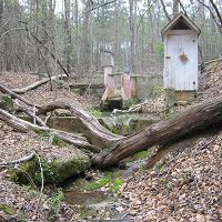
Calhoun Experimental Forest and Eco-hydrology Experiments
134-157 m elevation, 16 °C, 1250 mm/yr
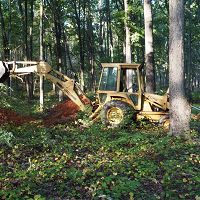
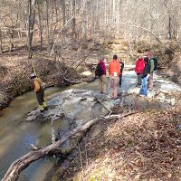
Three historic Calhoun experimental catchments are being re- and up-instrumented based on precipitation and runoff gauging from the 1940s to 1960s. The catchments were severely eroded and gullied and have been reforested over the last half century. The archived hydrologic records were stored in the Coweeta Hydrologic Laboratory data vault since 1962. Contemporary hydrologic responses of the catchments will be compared with those that are historic. The three experimental catchments reside within the much larger Holcombe's Branch, a tributary of the Tyger River. The Holcombe's Branch basin will be used to examine the erosion's interactions with soil carbon gains and losses.
Calhoun CZO - LiDAR - Hyperspectral and LiDAR Survey (2014)
1 components •
Calhoun CZO Research Area 1, Calhoun CZO Research Area 4, Calhoun Experimental Forest and Eco-hydrology Experiments, Calhoun Long-Term Soil-Ecosystem Plots and Reference Areas •
GIS / Remote Sensing •
National Center for Airborne Laser Mapping
Calhoun CZO - Vegetation - Leaf Area Index (2014)
1 components •
Calhoun CZO Research Area 1, Calhoun CZO Research Area 4, Calhoun Experimental Forest and Eco-hydrology Experiments •
Biology / Ecology •
Cook, Charles W.
Calhoun CZO - Streamflow / Discharge (2014-2017)
1 components •
Calhoun Experimental Forest and Eco-hydrology Experiments, Calhoun CZO Research Area 3 •
Hydrology •
Mallard, John McDevitt
Calhoun CZO - Vegetation - Tree Survey (2014-2017)
1 components •
Calhoun Experimental Forest and Eco-hydrology Experiments, Calhoun Long-Term Soil-Ecosystem Plots and Reference Areas •
Biology / Ecology •
Cook, Charles W.; Brecheisen, Z.; Richter, Daniel deB.
Calhoun CZO - Stream Water Chemistry (2014-2018)
2 components •
Calhoun Experimental Forest and Eco-hydrology Experiments •
Water Chemistry •
Foroughi, M.; Cook, Charles W.; Heine, P.; Richter, Daniel deB.
Calhoun CZO - LiDAR - LiDAR features for the Calhoun CZO forest plots (2015)
1 components •
Calhoun Experimental Forest and Eco-hydrology Experiments, Calhoun Long-Term Soil-Ecosystem Plots and Reference Areas •
GIS / Remote Sensing •
Majasalmi, Titta
Calhoun CZO - LiDAR - LiDAR Leaf-Off Survey (2016)
1 components •
Calhoun CZO Research Area 1, Calhoun CZO Research Area 4, Calhoun Experimental Forest and Eco-hydrology Experiments, Calhoun Long-Term Soil-Ecosystem Plots and Reference Areas •
GIS / Remote Sensing •
National Center for Airborne Laser Mapping
Calhoun Experimental Forest, SC - Land Use History, Photographic Imagery (1932-1987)
1 components •
Calhoun Experimental Forest and Eco-hydrology Experiments •
Outreach / Education Research, Social Science •
Nelson, Donald R.; O'Neill, Katherine P.; Coughlan, Michael R.; Lonneman, Michael C.; Meyers, Zachary; U.S. Department of Agriculture; Forest Service
Calhoun Experimental Forest, SC - GIS/Map Data, Photographic Imagery - 1933 aerial imagery composite (1933)
2 components •
Calhoun Experimental Forest and Eco-hydrology Experiments, Calhoun Long-Term Soil-Ecosystem Plots and Reference Areas •
GIS / Remote Sensing •
Brecheisen, Zachary S.; Cook, Charles W.; Harmon, M.A.
Calhoun Experimental Forest, SC - Streamflow / Discharge, Precipitation (1949-1962)
1 components •
Calhoun Experimental Forest and Eco-hydrology Experiments •
Hydrology, Climatology / Meteorology •
Jingfeng Wang; Yawen Shen; Sabina Shahnaz
Calhoun Experimental Watershed 4 - Soil Electrical Resistivity (2015)
1 components •
Calhoun Experimental Forest and Eco-hydrology Experiments •
Geophysics •
Daniel Markewitz
Calhoun Experimental Watershed 4 - Streamflow / Discharge, Electrical Conductivity (2015)
2 components •
Calhoun Experimental Forest and Eco-hydrology Experiments •
Hydrology •
Mallard, John; McGlynn, Brian
Calhoun Experimental Watersheds 2, 3, 4 - Soil Moisture, Soil Redox Potential (2014-2015)
1 components •
Calhoun Experimental Forest and Eco-hydrology Experiments •
Biogeochemistry, Soil Science / Pedology •
Caitlin Hodges; Daniel Markewitz; Aaron Thompson
Research area 3 - Groundwater Depth - 5 minute resolution (2014-2015)
1 components •
Calhoun Experimental Forest and Eco-hydrology Experiments •
Hydrology •
Mallard, John; McGlynn, Brian
-
Data Use Policy
DRAFT v.0.4.0
1. Use our data freely. All CZO Data Products* except those labelled Private** are released to the public and may be freely copied, distributed, edited, remixed, and built upon under the condition that you give acknowledgement as described below. Non-CZO data products — like those produced by USGS or NOAA — have their own use policies, which should be followed.
2. Give proper citation and acknowledgement. Publications, models and data products that make use of these datasets must include proper citation and acknowledgement. Most importantly, provide a citation in a similar way as a journal article (i.e. author, title, year of publication, name of CZO “publisher”, edition or version, and URL or DOI access information. See http://www.datacite.org/whycitedata). Also include at least a brief acknowledgement such as: “Data were provided by the NSF-supported Southern Sierra Critical Zone Observatory” (replace with the appropriate observatory name).
3. Let us know how you will use the data. The dataset creators would appreciate hearing of any plans to use the dataset. Consider consultation or collaboration with dataset creators.
*CZO Data Products. Defined as a data collected with any monetary or logistical support from a CZO.
**Private. Most private data will be released to the public within 1-2 years, with some exceptionally challenging datasets up to 4 years. To inquire about potential earlier use, please contact us.
Explore Further
