Bigelow Site (High-Elevation)
Bigelow site consist of the eddy covariance tower and zero order basin located south-east of the tower.
0.016 km2 Area
2532 - 2574 m Elev
9.2 °C Temp
609 mm Precip
Parent Field Area:
Santa Catalina Mountains ▲
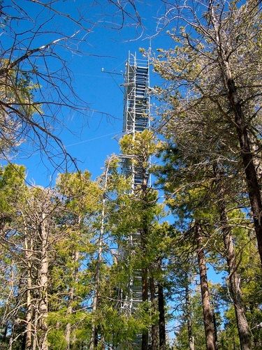
Mt. Bigelow eddy covariance tower.
Biome
coniferous forest
Land Use
forest land
-
Setting & Research
The Bigelow site is located on a sky island, (a type of continental terrain consisting of a sequence of valleys and mountains isolated by the surrounding desert floor), in the Santa Catalina Mountains of the Coronado National Forest, NE of Tucson, Arizona (32o 25’ 00” N, 110o 43’ 31” W). This is the second high-elevation site paired with the Marshall Gulch site which is situated 3.5 km WNW. The footprint of the tower encompasses a large footprint characterized by areas of topographically complex terrain. The site represents a secondary-growth subalpine mixed conifer forest composed predominantly of Ponderosa pine (Pinus ponderosa), Douglas fir (Pseudotsuga menziesii), Chihuahua pine (Pinus leiophylla) and Mexican pine (Pinus ayacahuite), with occasional Southwestern white pine (Pinus strobiformis Engelmann) and White fir (Abies concolor). Much of the woody regeneration in the sub-canopy is Douglas fir. The zero order basin (ZOB) is located on east slope down from the tower. The area of the ZOB is 0.016 km2, elevation ranges from 2532 m to 2574 m, and slope ranges from 0.3 degree to 27.6 degrees.
-
Overview Maps
Map Overlays
-
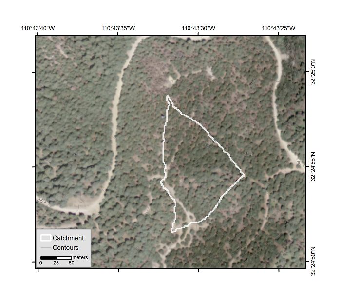
Bigelow tower satellite view.
-
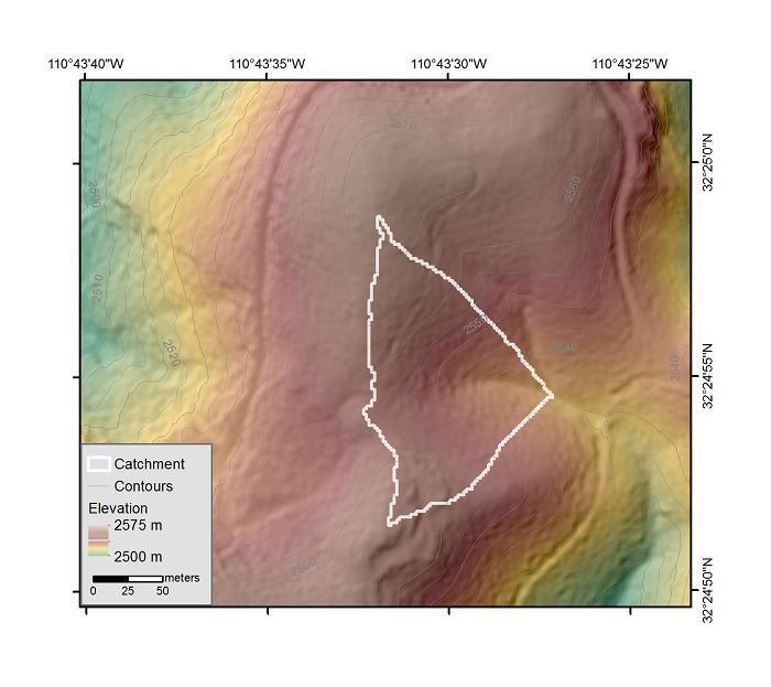
Bigelow tower elevation map.
-
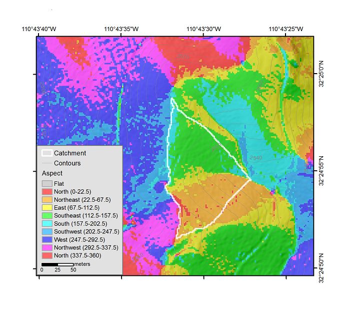
Bigelow tower aspect map.
-
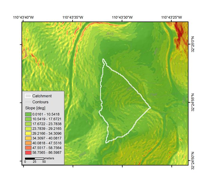
Bigelow tower slope map.
-
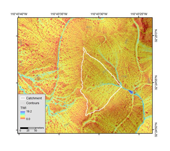
Bigelow tower topographic wetness index map.
-
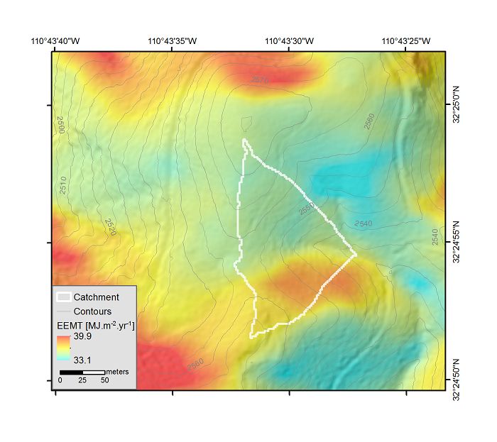
Bigelow tower environmental energy and mass transfer (EEMT) map.
-
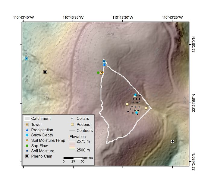
Bigelow tower instrumentation map.
-
-
Dynamic Map
To fully zoom into a small area, you may need to visit the "Map" button and uncheck "Terrain" view.
-
Data
Bigelow Site - Soil Gas - CO2 and O2 (2014-2019)
25 components • Bigelow Site (High-Elevation) • Climatology / Meteorology, Soil Science / Pedology, Biogeochemistry, Biology / Ecology • Jon Chorover; Greg Barron-Gafford; Rebecca Minor; Nate AbramsonBigelow Site - Soil Moisture, Soil Temperature, Electrical Conductivity, Water Potential (2014-2019)
25 components • Bigelow Site (High-Elevation) • Hydrology, Soil Science / Pedology • Jon Chorover; Greg Barron-Gafford; Rebecca Minor; Nate AbramsonBigelow Site - Streamflow / Discharge (2015-2019)
6 components • Bigelow Site (High-Elevation) • Hydrology • Peter Troch; Nate AbramsonBigelow Site - Soil Redox Potential (2015-2019)
6 components • Bigelow Site (High-Elevation) • Soil Science / Pedology, Geochemistry / Mineralogy • Jon Chorover; Greg Barron-Gafford; Nate AbramsonNational - Soil Gas - CO2 and O2 (2014-2017)
2 components • Bigelow Site (High-Elevation), Jemez 2013 Burned ZOB, Jemez Unburned Site, Calhoun CZO Research Area 1, Garner Run - Sandstone Forested, Northeastern Puerto Rico and the Luquillo Mountains • Biogeochemistry, Climatology / Meteorology, Soil Science / Pedology, Biology / Ecology • Brecheisen, Zachary; Chorover, Jon; Kaye, Jason; Silver, Whendee; Abramson, Nate; Barron-Gafford, Greg; Condon, Katherine E.; Cook, Charles W.; Hill, Lillian; Losleben, Mark; Minor, Rebecca; O'Connell, Christine; Richter, Daniel deB.; Durcik, Matej -
Photos
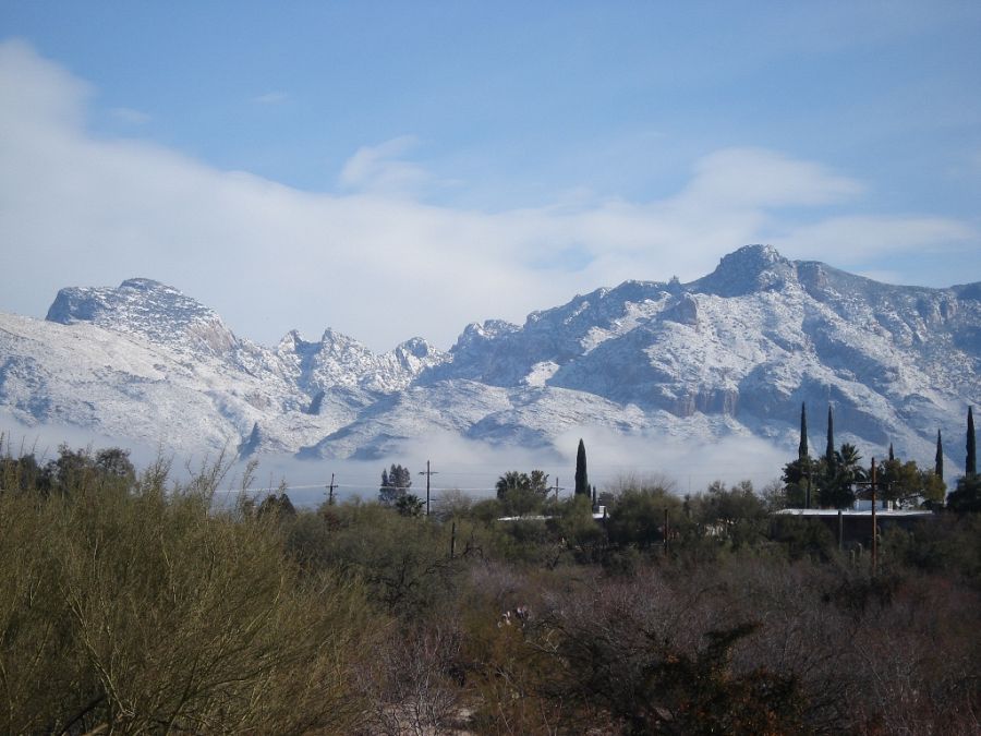
Catalina

Catalinas in winter

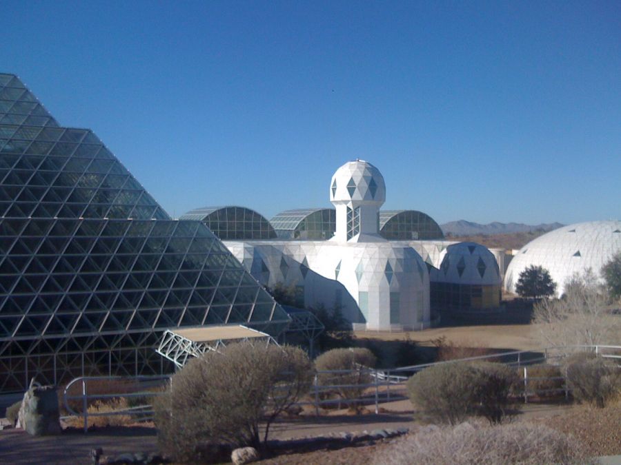
Biosphere 2

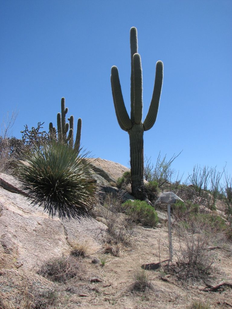
Desert site on the Catalina foodhills

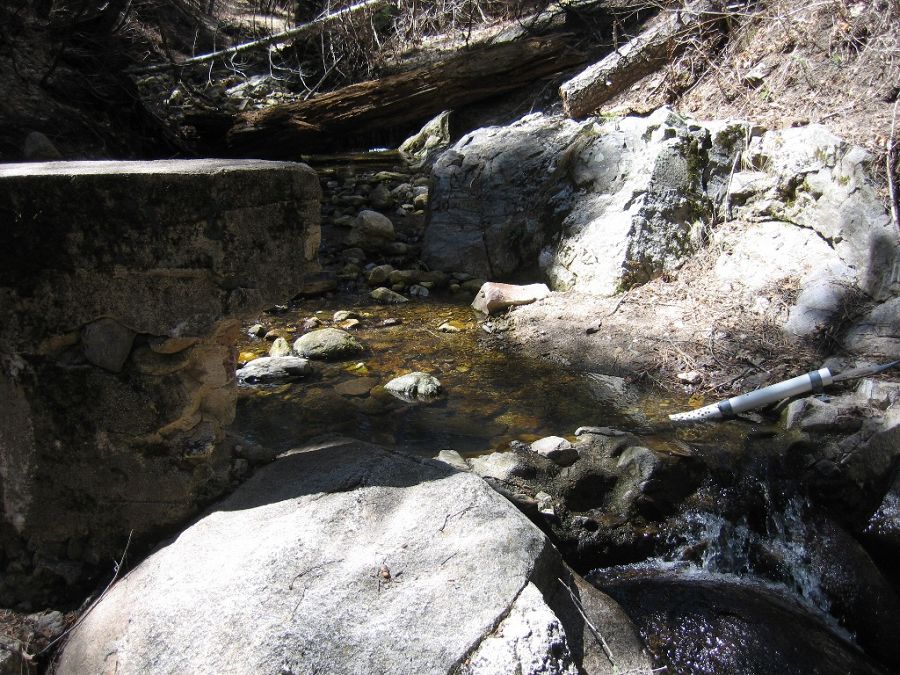
Marshall Gulch Weir
_76_76_80auto_s_c1.jpg)
Schist hillslope in the fall
Santa Catalina Mountains Photos
-
Partner Organizations
_900_675_80auto.jpg)


-
Ecosystems
- coniferous forest
The site represents a secondary-growth subalpine mixed conifer forest composed predominantly of Ponderosa pine (Pinus ponderosa), Douglas fir (Pseudotsuga menziesii), Chihuahua pine (Pinus leiophylla) and Mexican pine (Pinus ayacahuite), with occasional Southwestern white pine (Pinus strobiformis Engelmann) and White fir (Abies concolor). Much of the woody regeneration in the sub-canopy is Douglas fir.
Explore Further
