GIS, Remote Sensing & Geophysics
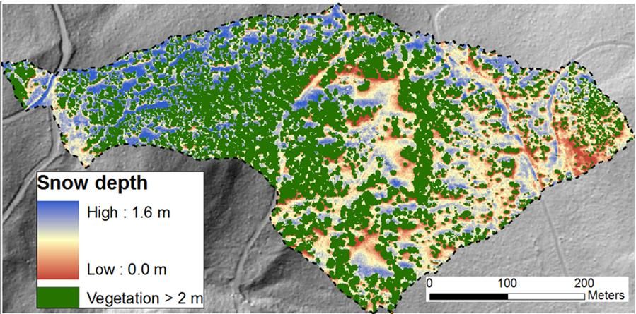
Spatial datasets are a key component of CZO research. Of particular utility are LiDAR results obtained from the NSF-funded CZO flights in 2010 that enable detailed mapping of surface features and the preparation of digital elevation maps, vegetation structures, and snowpack coverages.
Analysis of LiDAR data collected during periods of snow on (March 2010) and snow off (July 2010) enables determination of relations between vegetation structure, aspect and snow depth in the Jemez River Basin mixed conifer ZOB (Harpold et al.).
Geospatial Data
Digital geospatial datasets are used in the planning research activities modeling and computing new datasets. Collected geospatial datasets include elevation, climate, land cover, soil, and geology. Derived datasets include terrain characteristics such as slope, aspect, flow directions, flow accumulation, topographic index and boundaries. The third group of spatial data is measured GPS locations of experimental sites. Most of these datasets can be downloaded from the CZO Data website.

Remote Sensing Data
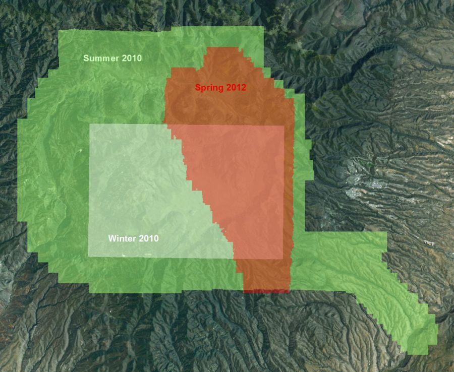
The Jemez River Basin has obtained three airborn LiDAR collections (winter 2010, summer 2010, and the most recent in spring 2012 which covers the 2011 Las Conchas fire). The southern part of the Catalina Mountains (only the Marshall Gulch catchment) is covered by 2007 LiDAR sponsored by Pima County. Complimentary to airborne LiDAR datasets, terrestrial laser scans (ground-based LiDAR) measurements are used to quantify landscape changes. Additionally, MODIS, Landsat and satellite photography were collected and used in mapping and various modeling activities.
- 2010 LiDAR Datasets can be downloaded from the OpenTopography website, and
- Derived LiDAR datasets (canopy height, intensity, snow depth) in the ArcGIS format can be downloaded from the CZO Data website.
Geospatial Modeling
Geospatial and remotely sensed data are used in the distributed hydrologic, environmental energy and mass transfer (EEMT), and soil thickness modeling. Some of the model results can be downloaded from the CZO Data website. See Models for more details about modeling.
Jemez LiDAR flights.
Explore Further
