GIS / Remote Sensing Tag
GIS / Remote Sensing is one of more than 16 discipline tags that we use to categorize and aggregate our interdisciplinary information within and across CZOs. Much of our information has been tagged with 2-3 disciplines.
-
Boulder People - GIS / Remote Sensing
3 People
.(JavaScript must be enabled to view this email address)
INSTAAR
GIS, remote sensing, web development, graphic design, scientific illustration
STAFF, Field Manager
.(JavaScript must be enabled to view this email address)
Geography, Meteorology.
INVESTIGATOR, PostDoc
Polar regions, aeolian processes and geomorphology, phosphorus cycling
-
Boulder Research Groups - GIS / Remote Sensing
-
Boulder Data - GIS / Remote Sensing
Betasso - Topographic Carbon Storage, GIS/Map Data, LiDAR, Land Cover (2010)
2 components • Betasso • GIS / Remote Sensing, Biology / Ecology, Geomorphology, Hydrology • Tyson Lee Swetnam; Paul Brooks; Holly Barnard; Adrian Harpold; Erika GalloBoulder Creek - GIS/Map Data - ArcGIS API BCCZO GIS (2010-2018)
1 components • Boulder Creek Watershed • GIS / Remote Sensing • Eric ParrishBoulder Creek - LiDAR - Point Cloud Data at OpenTopography.com (Snow off) (2010)
1 components • Boulder Creek Watershed • GIS / Remote Sensing • Suzanne Anderson; Eric ParrishBoulder Creek - LiDAR - Derived DEM from LIDAR (2010)
12 components • Boulder Creek Watershed • GIS / Remote Sensing • Eric Parrish; Suzanne AndersonComo Creek - Topographic Carbon Storage, GIS/Map Data, LiDAR, Land Cover (2010)
2 components • Boulder Creek Watershed • GIS / Remote Sensing, Biology / Ecology, Geomorphology, Hydrology • Tyson Lee Swetnam; Paul Brooks; Holly Barnard; Adrian Harpold; Erika GalloGordon Gulch - Topographic Carbon Storage, GIS/Map Data, LiDAR, Land Cover (2010)
2 components • Gordon Gulch • GIS / Remote Sensing, Biology / Ecology, Geomorphology, Hydrology • Tyson Lee Swetnam; Paul Brooks; Holly Barnard; Adrian Harpold; Erika GalloNational - LiDAR, Land Cover, GIS/Map Data - OpenTopography (2010-2017)
18 components • Boulder Creek Watershed, Eel River Watershed, Jemez River Basin, Reynolds Creek Experimental Watershed, Susquehanna Shale Hills Critical Zone Observatory, Northeastern Puerto Rico and the Luquillo Mountains, Sangamon River Basin, Clear Creek Watershed, Calhoun Critical Zone Observatory, Providence Creek Headwater Catchments (1660 - 2115 m elevation) • Geomorphology, GIS / Remote Sensing, Hydrology, Biology / Ecology • National Center for Airborne Laser Mapping; Boulder Creek Critical Zone Observatory; Calhoun Critical Zone Observatory; University of Arizona; University of California Merced; Valles Caldera National Preserve; Bandelier National Monument; National Park Service; Jemez River Basin and Santa Catalina Mountains Critical Zone Observatory; Luquillo Critical Zone Observatory; Reynolds Creek CZO; Eel River CZO; Shale Hills CZO -
Boulder Models - GIS / Remote Sensing
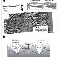
Landscape linkages
Hillslopes between rapidly downcutting streams steepen in the wake of propagating knickpoints
Hillslopes between rapidly downcutting streams steepen in the wake of propagating knickpoints.
-
Boulder Publications - GIS / Remote Sensing
2020
Chemistry of water, stream sediment, wildfire ash, soil, dust, and mine waste for Fourmile Creek Watershed, Colorado, 2010-2019. Murphy, S.F., McCleskey, R.B., D.A., Holloway, J.M., Writer, J.W., Martin, D.A., and Stricker, C.A. (2020): U.S. Geological Survey Data Releas
2020
Wildfire-driven changes in hydrology mobilize arsenic and metals from legacy mine waste. Murphy, S.F., McCleskey, R.B., Martin, D.A., Holloway, J.M., and Writer, J.W., (2020): Science of the Total Environment v. 743, 140635
2018
Solifluction Lobes on Niwot Ridge: Using Drones, Time-lapse Cameras, and Weather Data to Study Periglacial Features . Dylan Lanka (2018): Senior honors thesis, Physical Geography, University of Colorado.
2018
On the use of a snow aridity index to predict remotely sensed forest productivity in the presence of bark beetle disturbance . Knowles, JK, L. Lestak, N.P. Molotch (2018): Water Resources Research, 53: 4891-4906
2018
Which way do you lean? Using slope aspect variations to understand Critical Zone processes and feedbacks. Pelletier J. D., Barron‐Gafford G. A., Gutiérrez‐Jurado H., Hinckley E.‐L. S., Istanbulluoglu E., McGuire L. A., Niu G.‐Y., Poulos M. J., Rasmussen C., Richardson P., Swetnam T. L., and Tucker G. E. (2018): Earth Surface Processes and Landforms, 43(5): 1133–1154 Cross-CZO
2017
Topographically driven differences in energy and water constrain climatic control on forest carbon sequestration. Swetnam T.L., Brooks P.D., Barnard H.R., Harpold A.A., and Gallo E.L. (2017): Ecosphere 8(4): e01797 Cross-CZO
2015
Force of nature: A monumental flood gives CU-Boulder researchers a rare opportunity to study the effects of extreme weather on erosion. Anderson, R. S., Anderson, S., Anderson, S. P. (2015): Research and creative work 2014–15, PG.3-5
2015
Exhumation by debris flows in the 2013 Colorado Front Range storm. Anderson, S.W., Anderson, S. P., and Anderson, R. S. (2015): Geology, Geological Society of America
2015
Variation in Montane Forest Transpiration Dormancy and Seasonality Along an Elevation Gradient. Barnard, D., Barnard, H., and Molotch, N. (2015): H21C-1390 Ecohydrology in the Critical Zone I Posters, presented at 2015 Fall Meeting, AGU, San Francisco, CA, 14-18 Dec.
2015
Quantifying the effects of vegetation structure on snow accumulation and ablation in mixed-conifer forests. Broxton P. D., Harpold A. A., Biederman J. A., Troch P. A., Molotch N. P., and Brooks P. D. (2015): Ecohydrology 8(6): 1073-1094 Cross-CZO
2015
Aspect-dependent soil saturation and insight into debris-flow initiation during extreme rainfall in the Colorado Front Range. Ebel, B.A., Rengers, F. K., and Tucker, G.E. (2015): Geology 43 (8): 659-662
2015
Laser vision: lidar as a transformative tool to advance critical zone science. Harpold, A. A., Marshall, J. A., Lyon, S. W., Barnhart, T. B., Fisher, B. A., Donovan, M., Brubaker, K. M., Crosby, C. J., Glenn, N. F., Glennie, C. L., Kirchner, P. B., Lam, N., Mankoff, K. D., McCreight, J. L., Molotch, N. P., Musselman, K. N., Pelletier, J., Russo, T., Sangireddy, H., Sjöberg, Y., Swetnam, T., and West, N. (2015): Hydrol. Earth Syst. Sci., 19, 2881-2897 Cross-CZO National
2015
Interpreting climate-modulated processes of terrace development along Colorado Front Range using a landscape evolution model. Langston, A.L., G.E. Tucker, R.S. Anderson (2015): JGR-Earth Surface 120: 2121-2138
2015
Corrigendum: The role of precipitation type, intensity, and spatial distribution in source water quality after wildfire. Murphy SF, Writer JH, McCleskey RB, and Martin DA (2015): (2015 Environ. Res. Lett. 10 084007). Environmental Research Letters 11, 179504
2015
The role of precipitation type, intensity, and spatial distribution in source water quality after wildfire. Murphy, S. F., Writer, J. H., McCleskey, R. B., and Martin, D. A. (2015): Environ. Res. Lett. 10 084007
2015
Geophysical imaging reveals topographic stress control of bedrock weathering. St. Clair, J., S. Moon, W. S. Holbrook, J. T. Perron, C. S. Riebe, S. J. Martel, B. Carr, C. Harman, K. Singha, D. deB. Richter (2015): Science 350 (6260): 534-538 Cross-CZO National
2015
Topographic Control of Aboveground Carbon Pools Across an Environmental Gradient, Eastern Slope of the Rocky Mountains, Colorado. Swetnam T., Brooks P., Gallo E., Barnard H., Harpold A. (2015): Abstract H21C-1382 presented at 2015 Fall Meeting, AGU, San Francisco, CA, 14-18 Dec. Cross-CZO
2014
LiDAR-derived snowpack data sets from mixed conifer forests across the Western United States. Harpold, A.A., Q. Guo, N. Molotch, P. D. Brooks, R. Bales, J.C. Fernandez-Diaz, K.N. Musselman, and T.L. Swetnam, P. Kirchner, M. Meadows, J. Flanagan, R. Lucas (2014): Water Resources Research 50(3): 2749-2755 Cross-CZO
2014
Filling in the gaps: Inferring spatially distributed precipitation from gauge observations over complex terrain. Livneh, B., J. S. Deems, D. Schneider, J. Barsugli, and N. Molotch (2014): Water Resour. Res., 50, 8589–8610
2014
Snow cover depletion curves and snow water equivalent reconstruction: six decades of hydrologic remote sensing applications . Molotch, N.P., Durand, M.T., Guan, B., Margulis, S.A., and Davis, R.E. (2014): In Lakshmi, Venkataraman, ed., AGU Monograph on Remote Sensing of the Terrestrial Water Cycle, American Geophysical Union, p. 159-174, ISBN 978-1-118-87203-1
2014
Relationships between stream nitrate concentration and spatially distributed snowmelt in high-elevation catchments of the western US. Perrot, D., N. P. Molotch, M. W. Williams, S. M. Jepsen, and J. O. Sickman (2014): Water Resour. Res., 50, 8694–8713
2013
Critical zone evolution: Climate and exhumation in the Colorado Front Range. Anderson, S.P., Anderson, R.S., Tucker, G.E., and Dethier, D.P. (2013): In Abbot, L.D. and Hancock, G.S., eds., Classic Concepts and New Directions: Exploring 125 Years of GSA Discoveries in the Rocky Mountain Region: Geological Society of America, Field Guide 33, p. 1-18
2013
Changing mountain permafrost from the 1970s to today - comparing two examples from Niwot Ridge, Colorado Front Range, USA. Leopold, M., Volkel, J., Dethier, D. P., and Williams, M.W. (2013): Zeitschrift for Geomorphologie, Supplementary Issue
2013
Subsurface architecture of the Boulder Creek Critical Zone Observatory from electrical resistivity tomography. Leopold, M., Völkel, J., Huber, J., and Dethier, D. (2013): Earth Surface Processes and Landforms, 38, 1417–1431
2012
The shifting nature of vegetation controls on peak snowpack with varying slope and aspect. Biederman J.A., Harpold A.A., Brooks P.D., Broxton P.D., Litvak M.E. (2012): Abstract C33D-0685 presented at 2012 Fall Meeting, AGU, San Francisco, Calif., 3-7 Dec (Poster). Cross-CZO
2011
Snow measurement by GPS interferometric reflectometry: an evaluation at Niwot Ridge, Colorado. Gutmann, ED, Larson, KM, Williams, MW, Nievinski, FG., and Zavorotny, V. (2011): Hydrological Processes
2011
Reconstructing Pinedale (latest Pleistocene) ice in the Green Lakes Valley and adjacent areas, Colorado. Kantack, Keith McBride. (2011): Thesis submitted in partial fulfillment of the requirements for the Degree of Bachelor of Arts With Honors in Geosciences(Williams College)
2010
Twentieth-century changes in the thickness and extent of Arapahoe Glacier, Front Range, Colorado. Haugen, B.D., Scambos, T.A., Pfeffer, W.T., and Anderson, R.S. (2010): Arctic, Antarctic, and Alpine Research 42 (2): 198-209.
2010
Ecohydrological response to snowmelt dynamics from plot to regional scales. Molotch, N.P., Musselman, K.N., Trujillo, E., Brooks, P.D., McConnell, J. R., Williams, M.W. (2010): AGU Fall Meeting Abstract C14B-02. Cross-CZO
2010
The Distribution of Tors in Gordon Gulch, Front Range, Colorado . Trotta, James Richard. (2010): Thesis. Degree of Bachelor of Arts with Honors in Geosciences. Williams College 2010
-
Boulder News - GIS / Remote Sensing
2018

Noah Molotch on KGNU
08 Feb 2018 - The CZO's own Dr. Noah Molotch, director of CWEST, appeared on KGNU during a piece on snow depth and Snow Telemetry (SNOTEL). KGNU is an...
2016
Critical Zone Q&A with researcher Adrian Harpold
19 Oct 2016 - University of Nevada Reno's Adrian Harpold reflects on his past and present time researching at Critical Zone Observatories.
2015
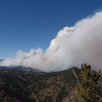
Sheila Murphy USGS press release “Storms after Wildfire Lead to Impaired Water Quality”
01 Oct 2015 - Fourmile Canyon fire September 2010, burned about 6,000 acres in Boulder County, CO. Storms after wildfire led to downstream water-quality impairment.
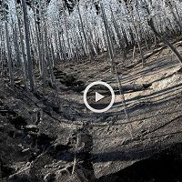
Animated LiDAR scan of a burned forest hillslope
01 May 2015 - This animated fly-through was generated from ground-based laser scanning data (a.k.a. LiDAR: LIght Detection And Ranging). The data were collected...
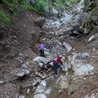
Colorado Public Radio - Colorado Matters features Suzanne & Robert Anderson
29 Apr 2015 - About Colorado Matters Colorado Public Radio's daily interview show Colorado Matters interviews Suzanne and Robert Anderson concerning...
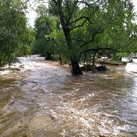
Geology paper about Boulder flood on release picked up by the press.
01 Apr 2015 - The Boulder Creek CZO and coauthors are highlighted in recent articles for their analysis of flooding and debris flows from the historic 2013...
2010
Boulder Creek CZO Online Tour
19 Aug 2010 - Boulder Creek CZO creates an online tour using Google earth and GIS technologies. ...
-
Explore Further


