Animated LiDAR scan of a burned forest hillslope
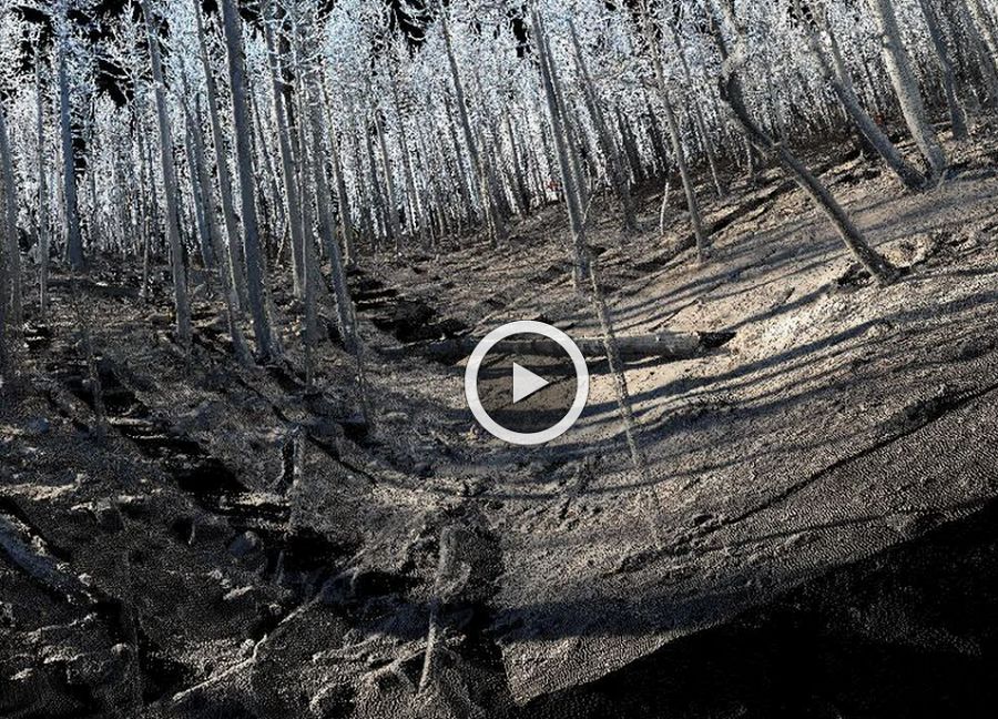
This animated fly-through was generated from ground-based laser scanning data (a.k.a. LiDAR: LIght Detection And Ranging). The data were collected and processed by Francis Rengers (formerly University of Colorado, now USGS Landslide Hazards Group) on a steep hillslope above Fourmile Creek, a large tributary to Boulder Creek. The area burned during the 2010 Fourmile Canyon wildfire. Five laser scans were acquired over a period of two years following the fire, in order to document patterns of erosion. (Source: F.K. Rengers, G.E. Tucker, J.A. Moody, and B. Ebel, Illuminating Wild re Erosion and Deposition Patterns with Repeat Terrestrial LiDAR, unpublished manuscript).
Rengers, F. 2014. The Influence of Transient Perturbations on Landscape Evolution: Exploring Gully Erosion and Post-Wildfire Erosion. Thesis. University of Colorado at Boulder. Boulder, CO.
Rengers, F., Tucker, G., Moody, J., and Ebel, B. Illuminating Wildfire Erosion and Deposition Patterns with Repeat Terrestrial LiDAR, Journal of Geophysical Research Earth Surface, in review.
News Category:
Publications
2012
The Geochemical Impact of Wildfire and Mining on the Fourmile Creek Watershed, Colorado . Beganskas, S. (2012): Submitted to the Department of Geology of Amherst College in partial fulfillment of the requirements for the degree of Bachelor of Arts with honors.
2012
Water chemistry of surface waters affected by the Fourmile Canyon wildfire, Colorado, 2010–2011. McCleskey, R.B., Writer, J.H., and Murphy, S.F., (2012): U.S. Geological Survey Open-File Report 2012–1104, 11 p
2012
Wildfire Effects on Source-Water Quality—Lessons from Fourmile Canyon Fire, Colorado, and Implications for Drinking-Water Treatment. Writer, J.H. and Murphy, S.F. (2012): U.S. Geological Survey Fact Sheet 2012–3095, 4 p.
Explore Further
