Sensors & Field Instruments
The Eel River CZO has instrumentation at the Angelo Reserve and our intensively monitored Rivendell site within the Reserve. We have 3 weather stations in meadows (400 m elevation), 1 station at Cahto Peak (1,400 m), and roughly 700 instruments at Rivendell. The South Fork Eel river has a stilling well with gauge and the USGS has a gauge on Elder Creek.
All environmental monitoring equipment is networked and data is pulled in realtime into an ODM compliant database.
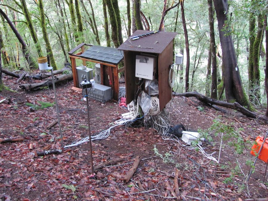
Rivendell monitoring site with well level, sap flow, soil moisture, and met data.
Sensors
Below is a poster of our monitoring infrastructure. This system started under the National Center for Earth-surface Dynamics (NCED), was dramatically expanded with the Keck Foundation HydroWatch Project, and is now part of the Eel River CZO (PDF of poster, 50MB).
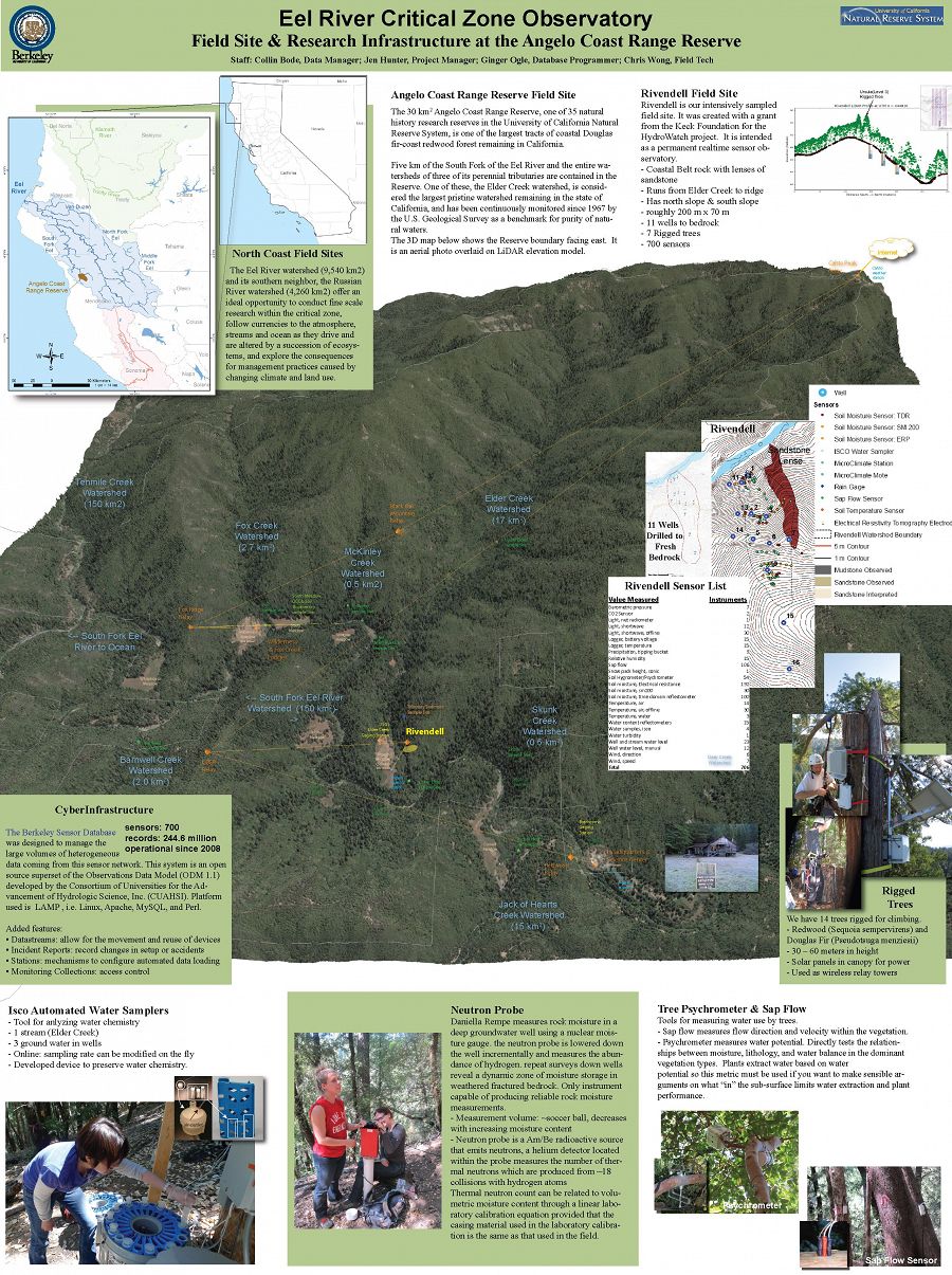
Sensor infrastructure at the Angelo Coast Range Reserve and subsite, Rivendell
Informatics & Cyberinfrastructure
The Eel River CZO adopted a modified version of the Consortium of Universities for the Advancement of Hydrologic Science, Inc.'s (CUAHSI) Hydrologic Information System (HIS). We migrated the Observations Data Model (ODM 1.1) to an open source LAMP platform and added methods to record information regarding data quality and events that affect sensors. Our Berkeley Sensor Database can by accessed using 'guest' login. It has been in operation since 2008 and has over 300 million records for 700 instruments at a 5 minute timestep. (PDF of poster, 50MB).
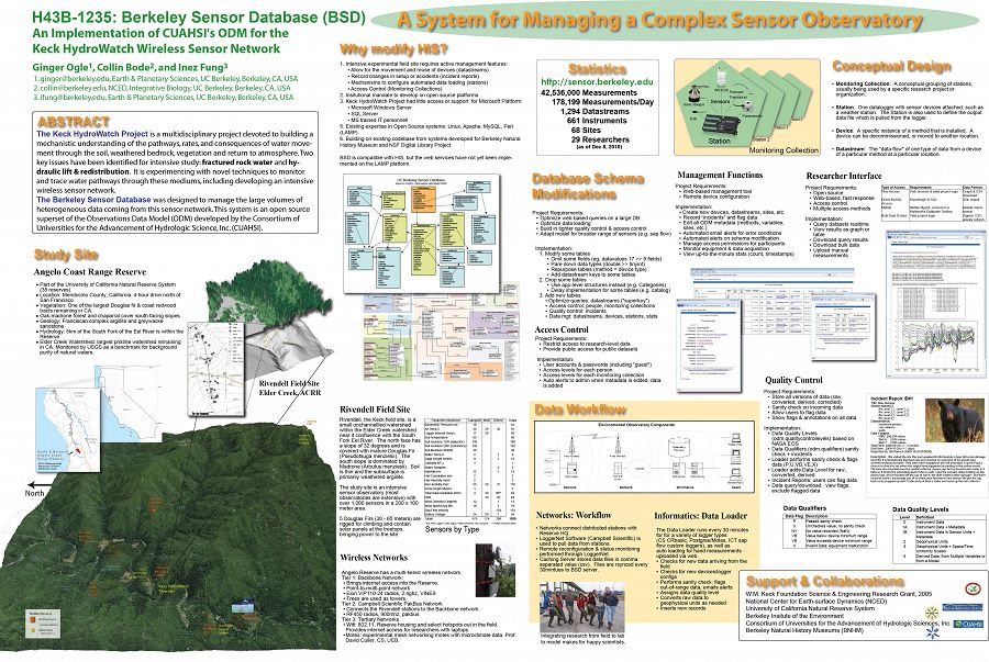
AGU 2010 Poster on the Sensor Database CyberInfrastructure
Vadose Zone Monitoring System (VMS)
At Rivendell, where the vadose zone extends to depths greater than 20 m, a vadose zone monitoring system was installed in 2015 with 10 “matrix” sampling ports spaced at 1.5 m intervals in the upper 16 m and 10 “fracture” sampling ports spaced at 1.75 m intervals in the upper 18 m. The VMS is a custom sleeve developed by Ofer Dahan and Sensoil Ltd. that houses samplers and sensors specially designed for complex unsaturated environments. The VMS sleeve was installed into an inclined borehole, drilled at 55 degrees, and accesses the unsaturated moisture that transits through the weathered and fractured rock above.
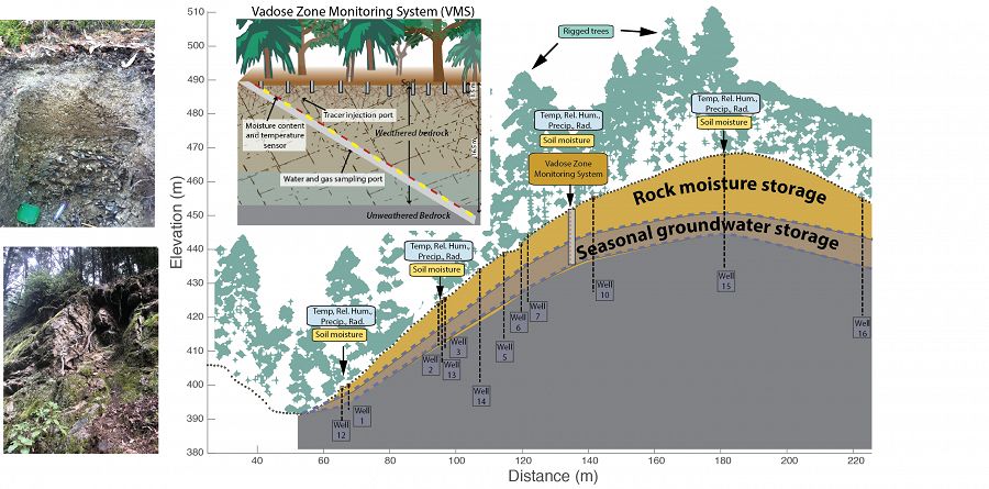
VMS cross section
Sensor infrastructure at the Angelo Coast Range Reserve and subsite, Rivendell
AGU 2010 Poster on the Sensor Database CyberInfrastructure
VMS cross section
Associated Files
Berkeley Sensor Database Poster, AGU 2010
(53 MB pdf)
AGU Conference Poster, 2010 on Berkeley Sensor Database, an implementation of CUAHSI's ODM for the Keck HydroWatch project. PDF 50MB.
Eel River Sensor Deployment Poster
(2 MB pdf)
Poster on CyberInfrastructure from CZO All Hands Meeting, Southern Sierra CZO 2014. PDF 2MB.
Explore Further
