GIS, Remote Sensing & Geophysics
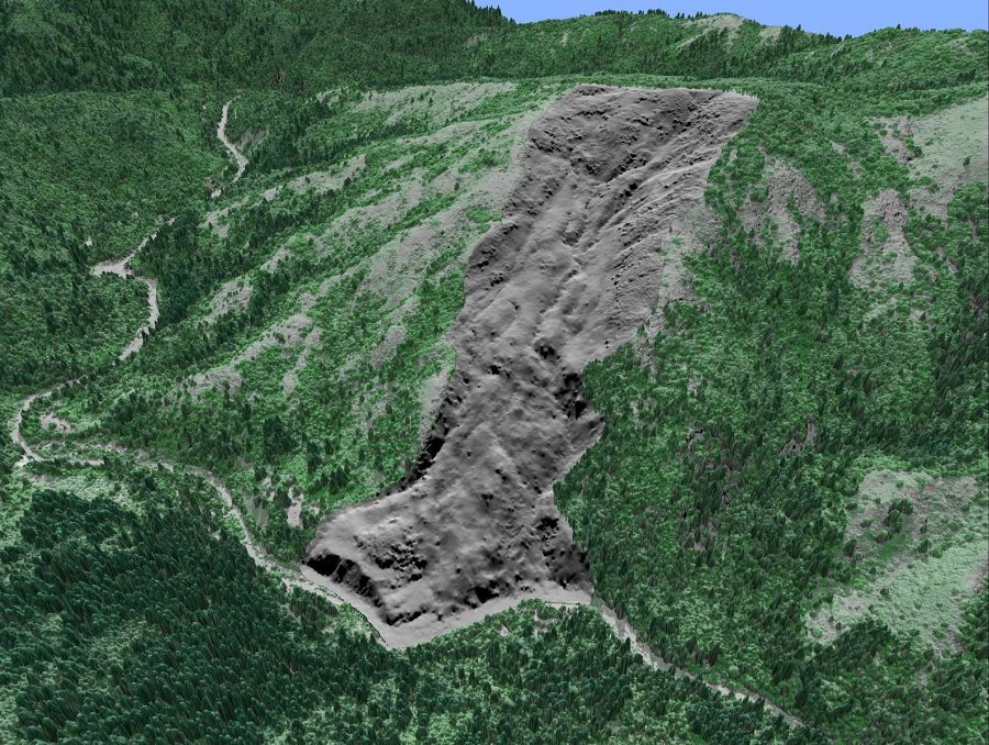
Rendered LiDAR image illustratingdeep seated landslide underneath vegetative cover. South Fork Eel River confluence with Tenmile Creek. Image: Collin Bode, 2010. LiDAR: 2004, NCALM.
Geospatial Data
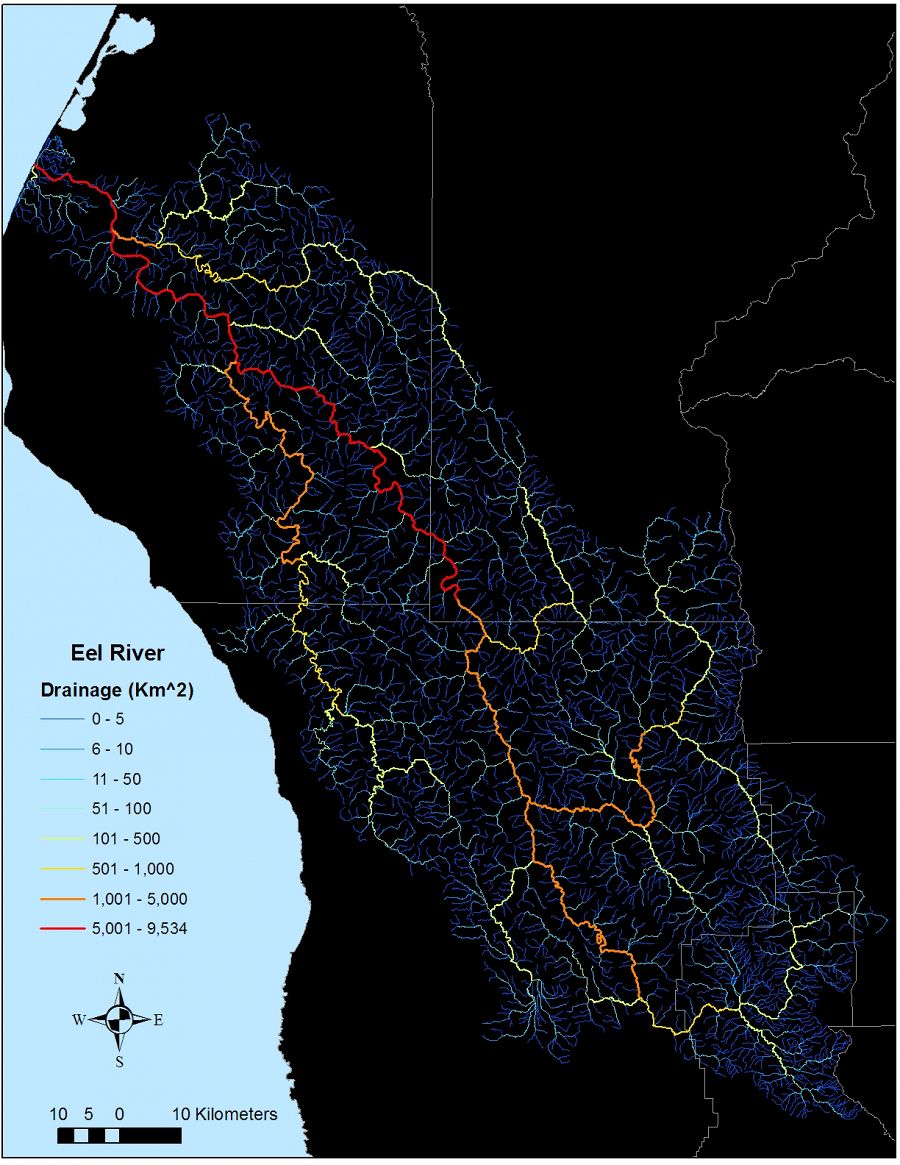
Eel River network colored by drainage area. NHD, 2010.
Remote Sensing: LiDAR
Our area is also the beneficiary of 2 prior LiDAR flights by the National Center for Airborn Laser Mapping (NCALM). These datasets are available on OpenTopography.org (2004, 2009). The 2004 dataset covers the headwaters of the South Fork Eel River down to the confluence of Tenmile Creek. This area covers the Angelo Reserve. It has a point density of 2.64 points/m2. The 2009 dataset is a narrow swath running down the mainstem of the South Fork Eel River to the confluence of the South Fork with Middle Fork. The 2009 has a point density of 9.64 points/m2. We have processed the 2004 dataset into all the standard bare-earth data products (1m DEM, hillshade, slope, aspect, flow direction, flow accumulation, and derived river channel).
Remote Sensing: EarthEngine
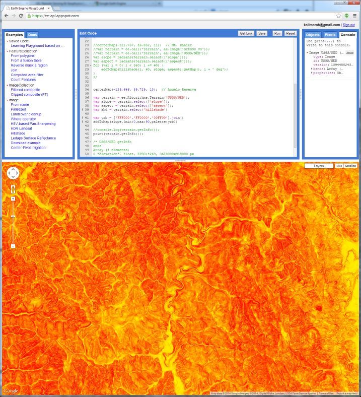
Google EarthEngine programming interface, showing javascript for displaying slope in two-color gradient. Feb, 2014.
Geophysics
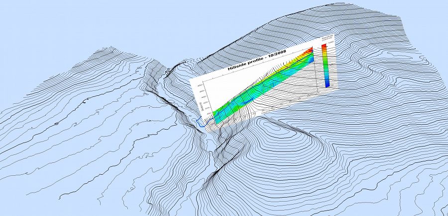
Electrical Resistive Tomography (ERT) performed by Daniella Rempe and Rohit Salve, 2008.
Eel River network colored by drainage area. NHD, 2010.
Electrical Resistive Tomography (ERT) performed by Daniella Rempe and Rohit Salve, 2008.
LiDAR derived Topographic map of the Angelo Reserve and surrounding area, combined with existing GIS of infrastructure.
Google EarthEngine programming interface, showing javascript for displaying slope in two-color gradient. Feb, 2014.
Explore Further
