GIS, Remote Sensing & Geophysics
Remote Sensing
The Christina River Basin CZO has partnered with National Science Foundation's National Center for Airborne Laser Mapping to provide detailed and accurate topographic data by Light Detection and Ranging (LiDAR) measurements. Read more »
Remote Sensing
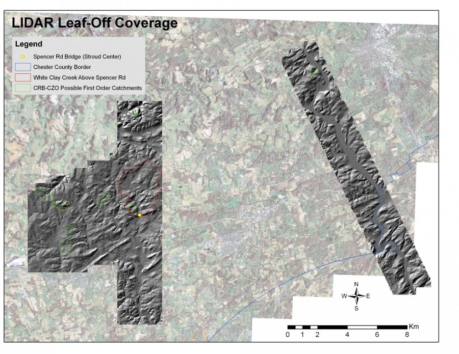
LIDAR leaf-off coverage
High-resolution LiDAR data (average first-return point density of 10 points m2 and 2-4 cm vertical accuracy) were obtained by NCALM for 121 km2 of the Christina River Basin Critical Zone Observatory (CRB-CZO) during both leaf-off (April 2010) and leaf-on (July 2010; see dataset CRB-10-Jul) periods.
Data acquisition, ground-truthing, vegetation surveys and processing were funded and coordinated by NSF Award EAR-0922307 (PI. Qinghua Guo) to collect similar data at all six CZOs for a variety of cross-site analyses, including calibration of algorithms to extract vegetation characteristics from the LIDAR point cloud data. The CRB-CZO is particularly interested in using this LIDAR dataset for high-resolution analyses of stream channel and floodplain geomorphology.

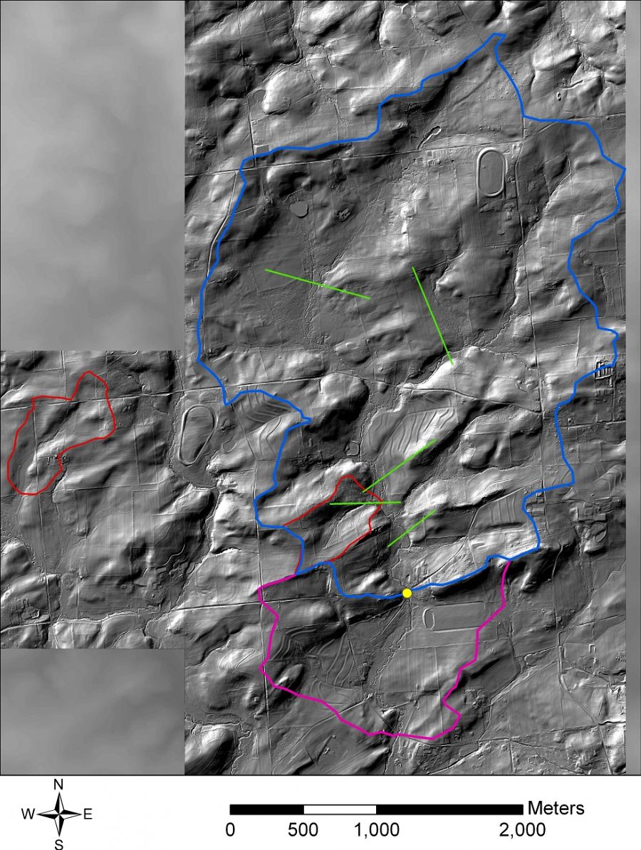
LIDAR leaf-off coverage (first returns hillshade)
Platform: Airborne LiDAR
Survey Date: 04/07/2010 - 04/08/2010
Survey Area: 133.0 km2
Shot Density: 13.94 pts/m2
Full datasets are available on the NSF OpenTopography Facility website.
LIDAR leaf-off coverage
LIDAR leaf-off coverage (first returns hillshade)
Explore Further
