Shale Hills CZO hosts Jorden Hayes for All-Hands 2016

16 May 2016
Jorden Hayes (Southern Sierra CZO) was an invited speaker and visitor to the Shale Hills CZO All-Hands meeting in May 2016
Invited guest Dr. Jorden Hayes, Assistant Professor of Earth Sciences at Dickinson College, joined this year’s Shale Hills All-Hands meeting to interact with students, faculty, and other CZO collaborators. Day one activities include a field trip to the CZO catenas in Shale Hills and Garner Run and the opening seminar presented by Hayes “Porosity production and distribution in the deep critical zone at the Southern Sierra Critical Zone Observatory, California and the Laramie Mountains, Wyoming.”
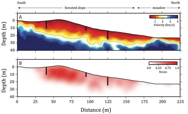
Traveltime tomography model of p-wave velocities (A) from a seismic refraction survey across a forested slope and meadow in the SSCZO (Holbrook et al., 2014). Maximum volumetric strain across the landscape (B) calculated from porosities inferred by seismic velocities (A). The contribution of chemical mass losses to the overall porosity is accounted for in this model; we assumed 22% average mass loss inferred from mass transfer coefficients. Push core locations shown as black lines in A & B.
In the Blair Wallis catchment of the Laramie Mountains, Wyoming, borehole measurements provide evidence that seismic velocities increase with depth primarily due to decreasing fracture density. Moreover, weathered zones, inferred from optical images, are concentrated along fracture planes. Our geophysical results suggest that topographic stresses in combination with regional tectonic stresses control the distribution of fractures. This observation is supported by borehole measurements, which show that fracture density not only decreases with depth but also is lower beneath valleys than ridges. Our analysis of fracture density incorporates not only the total number of fractures, but also fracture aperture.
In the Southern Sierra Critical Zone Observatory, California, geochemical measurements of borehole samples show that volumetric strain dominates over chemical mass losses in producing porosity in saprolite. Our results from cores show that porosity decreases with depth from 0.64 to 0.35 in the upper 11 meters of saprolite. Although rock physics models of seismic velocities correctly predict porosity variations, they cannot distinguish porosity produced by chemical mass loss from porosity produced by physical strain. To overcome this limitation, we quantified bulk density and immobile element concentrations in our samples of saprolite. We found that volumetric strain decreases with depth from 1.29 to 0.26. Conversely, the overall mass loss due to chemical weathering shows no trend with depth. Together these results suggest that the changes in porosity are due to physical rather than chemical processes. By quantifying the relative contributions of chemical mass loss and volumetric strain to the production of porosity, seismic velocities can be used to create maps of volumetric strain across the hillslope.
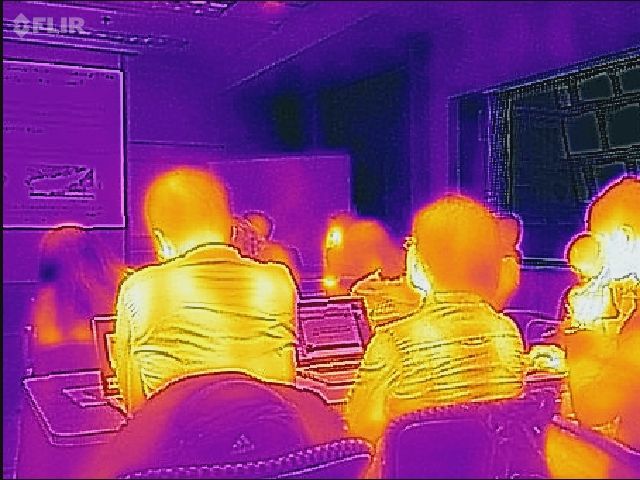
Thermal image of students listening to oral presetations. Courtesy of Jon Nyquist.
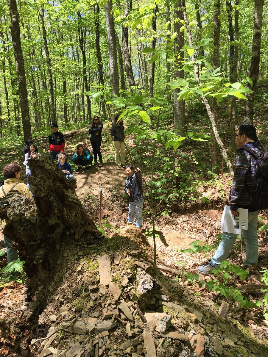
Henry Lin discusses soil processes and marcopore flow in the Shale Hills catena.
Traveltime tomography model of p-wave velocities (A) from a seismic refraction survey across a forested slope and meadow in the SSCZO (Holbrook et al., 2014). Maximum volumetric strain across the landscape (B) calculated from porosities inferred by seismic velocities (A). The contribution of chemical mass losses to the overall porosity is accounted for in this model; we assumed 22% average mass loss inferred from mass transfer coefficients. Push core locations shown as black lines in A & B.
Thermal image of students listening to oral presetations. Courtesy of Jon Nyquist.
Henry Lin discusses soil processes and marcopore flow in the Shale Hills catena.
News Category:
RESEARCH |
EDUCATION/OUTREACH
People Involved
CZO
-

National, Eel, Luquillo, Shale Hills, INVESTIGATOR, COLLABORATOR
-

Shale Hills, INVESTIGATOR
-

Shale Hills, INVESTIGATOR
-

Shale Hills, INVESTIGATOR
-

IML, Shale Hills, INVESTIGATOR
-

Shale Hills, INVESTIGATOR
-
Shale Hills, INVESTIGATOR
-

Shale Hills, INVESTIGATOR
-

Shale Hills, GRAD STUDENT
-

Shale Hills, GRAD STUDENT
-

Shale Hills, GRAD STUDENT
-

Shale Hills, GRAD STUDENT
-

Shale Hills, GRAD STUDENT
-

Shale Hills, GRAD STUDENT
-

Shale Hills, GRAD STUDENT
-

Luquillo, Shale Hills, INVESTIGATOR
-
Shale Hills, INVESTIGATOR
-

Shale Hills, GRAD STUDENT
-
Calhoun, Christina, Shale Hills, COLLABORATOR
-
Shale Hills, INVESTIGATOR, COLLABORATOR
-

Calhoun, Shale Hills, INVESTIGATOR, COLLABORATOR
-

Shale Hills, INVESTIGATOR, COLLABORATOR
-

Shale Hills, STAFF
-

Shale Hills, STAFF
-

Shale Hills, STAFF
-

Shale Hills, Sierra, INVESTIGATOR, COLLABORATOR
-

Shale Hills, GRAD STUDENT
-

Christina, Shale Hills, COLLABORATOR
Explore Further
