Sensors & Field Instruments
To assess such multi-scale dynamics, we combine mobile units of state-of-the-art sensors in the IML-CZO to characterize local processes at the event-scale. More permanent infrastructure, embedded and remote, is deployed hierarchically so that dynamics at each level are averaged or abstracted appropriately to feed into the dynamics at the next level up.
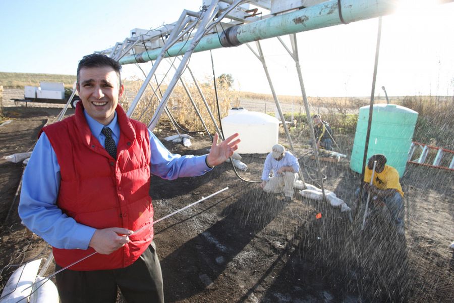
Thanos Papanicolaou (Co-PI, University of Tennessee-Knoxville) works with a rainmaking field apparatus in the Clear Creek watershed near Iowa City, Iowa, November 2011. Photo: Jim Heemstra.
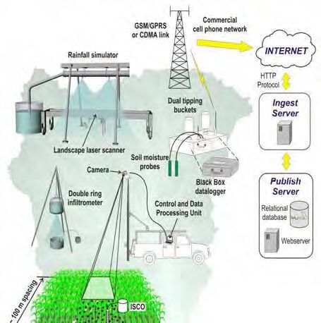
Conceptual model of an Experimental Farm with mobile sensor platform to support experiments at the activity centers.
Our multi-scale approach also employs ground-based platforms with low spatial and high temporal resolution (e.g., ground-based LiDAR). While the remote-sensing platform is optimal for large coverage, the embedded sensor network will be designed based on fewer high-density distributed sensing nodes. Lessons learned from other CZOs and other multi-scale network efforts have helped shape our embedded network.
The embedded sensor network is comprised of traditional continuous monitoring techniques (e.g., flow stage transducers) and innovative techniques, such as fiber optics for hydraulic conductivity and soil moisture measurements, RFIDs for sediment tracking, and Photo Electric Erosion Pins (PEEPs) for bank erosion. Due to high sensor maintenance costs, most of the innovative techniques are part of the mobile sensor platform, deployed to perform a select number of experiments in the network sites.
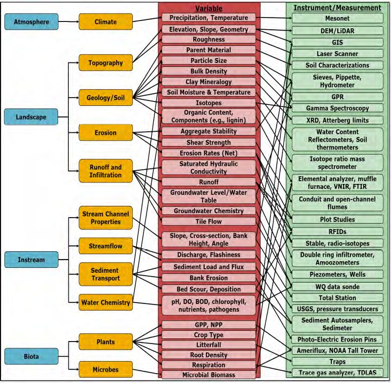
List of key state variables and the instrument/measurement techniques used in the IML-CZO.
Conceptual model of an Experimental Farm with mobile sensor platform to support experiments at the activity centers.
List of key state variables and the instrument/measurement techniques used in the IML-CZO.
Explore Further
