Sensors & Field Instruments
The Reynolds Creek CZO benefits from extensive instrumentation established and maintained by the USDA ARS NWRC. The CZO will also expand the current array of instrumentation. This network is critical because it forms the basis for understanding how the soil environment varies over time and space.
Current USDA-ARS instrumentation of RCEW
The existing scientific infrastructure is a key advantage for the RCEW site as a CZO. Most CZO sites require substantial funding to produce a hydro-meteorological network that is currently available at the RCEW. The existing, publically available hydroclimatic data are long-term and spatially extensive
Existing infrastructure at the Reynolds Creek Experimental Watershed
|
Parameter: |
Measured Value: |
# of Stations |
Years of Record: |
Data Interval: |
|||
|
|
|
1975 |
1996 |
2013 |
|
|
|
|
Precipitation
|
shielded gauge unshielded gauge |
53 53 |
17 17 |
28 26 |
1962-2013 1962-2013 |
Breakpoint (bp), 15 min |
|
|
Snow
|
snow course SWE snow pillow SWE snow depth |
8 1 |
8 1 |
8 2 32 |
1961-2013 1961-2013 1994-2013 |
bi-weekly 15 min 15 min |
|
|
Daily Climate (evap- summer only) |
Tmax and Tmin pan evaporation |
3 3 |
3 3 |
32 1 |
1964-2013 1974-2006 |
Daily Summer |
|
|
Weather
|
air temperature humidity solar radiation thermal radiation wind speed & direction barometric pressure heat flux surface & canopy temp |
3 3 3
3 3 |
5 5 5
4 3 |
38 36 32 5 32 6 8 3 |
1981-2013 1981-2013 1981-2013 1995-2013 1981-2013 1981-2013 2002-2013 2003-2013 |
15 min
|
|
|
Eddy Correlation |
H, LvE, H2O, C-flux, Rn (4 component) |
|
|
5 |
2002-2013 |
10 Hz & 30 min avg |
|
|
Sap Flux |
Heat dissipation |
|
|
12 |
2010-2011 |
Hourly |
|
|
Soil Lysimeter |
lysimeter water content |
4 |
|
|
1976-1991 |
Hourly |
|
|
Snowmelt lysimeter |
Water flux |
|
8 |
6 |
1982-2012 |
Hourly |
|
|
Soil Moisture, Neutron Probe |
soil water (various depths) |
18 |
14 |
35 |
1970-2013 |
bi-weekly |
|
|
Soil Moisture, Dielectric sensor |
% water (various depths) |
|
|
32 |
2000-2013 |
Hourly |
|
|
Soil Temperature |
soil temp (various depths) |
5 |
5 |
32 |
1981-2013 |
Hourly |
|
|
DTS Snow & Soil Temperature |
Distributed Temperature
|
|
|
2 km |
2010-2011 |
Hourly |
|
|
Ground Water |
GW head |
34 |
12 |
9 |
1968-2013 |
Hourly |
|
|
Discharge & Sediment
|
stream discharge suspended sediment |
13 3 |
8 3 |
10 9 |
1963-2013 1965-2013 |
bp,2 15 min event-based |
|
|
Stream Temperature |
Water temperature at the weir |
|
|
4 |
2000-2013 |
Hourly |
|
|
Vegetation |
Production, LAI and cover |
|
|
3 |
2009-2012 |
Semiannually |
|
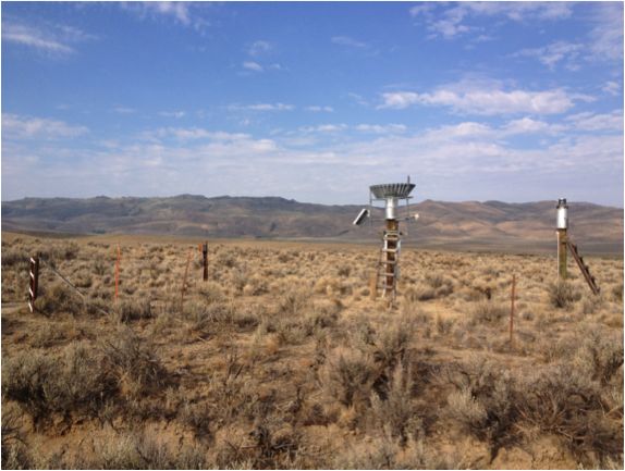
soil moisture and temperature probes installed by Mark Seyfried
Existing infrastructure at RCEW
Long-term hydrology data provides a strong backbone for the RC CZO
Long-term and spatially extensive climate data provides forcing data for RC CZO
long-term climate data provides the strong backbone to build a CZO
Explore Further
