ARCHIVED CONTENT: In December 2020, the CZO program was succeeded by the Critical Zone Collaborative Network (CZ Net)
×
CZ Science 3. Critical Zone architecture & evolution
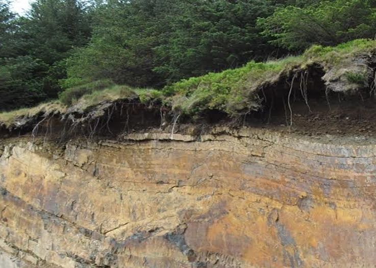
A Pennsylvania cliff, illustrating a cross section of the Critical Zone with trees, soil, and bedrock.
The goal of this module is a basic understanding of geologic processes and their relationship to Critical Zone processes and science. The focus is on the lithosphere's presence and role in CZ form and function. This module is part of a CZ Science course hosted by InTeGrate SERC.
Grades 15 -
16
Geology/Chronology • Geomorphology • GIS/RemoteSensing
Curriculum
Educational Objectives
By the end of this module students will be able to:
- Accurately recognize that tectonic processes of uplift and subsidence and the resulting landforms influence surficial processes of erosion, sediment transport and deposition, hill slope movement, and regolith production, and determine the architecture and evolution of the Critical Zone.
- Effectively summarize freely available online resources that provide information on geological mapping and aerial and other remotely sensed imagery that can be used in landscape assessment, and apply those resources to a site evaluation.
More on this module's objectives can be found here.
Audience
Higher Education
Observatory: National CZO
Author(s): Timothy White (Pennsylvania State University)

Contact(s):

Funding: National Science Foundation–funded SERC InTeGrate project
Related Resource(s):
- CZ Science 0. Undergrad course (7 modules)
- CZ Science 1. Critical Zone background
- CZ Science 2. Methods of Critical Zone Science
- CZ Science 4. Land-atmosphere exchange
- CZ Science 5. Water transfer through the Critical Zone
- CZ Science 6. Geochemistry & biogeochemistry
- CZ Science 7. Humans in the Critical Zone
Details for this Resource
The two units of Module 3 follow a similar structure of: background reading, class discussion, geomorphic resource demonstration and group exploration and reporting to facilitate student and teacher use.
-
Unit 3.1: Geology and Geomorphology (Two 75 min class sessions)
- Review the basic geologic processes that contribute to large-scale geomorphic features of the landscape.
-
Unit 3.2: Landforms and Remote Sensing (Two 75 min class sessions)
- Review characteristic geomorphic landscapes and the processes that form them.
Explore Further
