A Common Approach
Developing infrastructure and protocols that allow measurements to be directly compared across CZOs... and beyond.
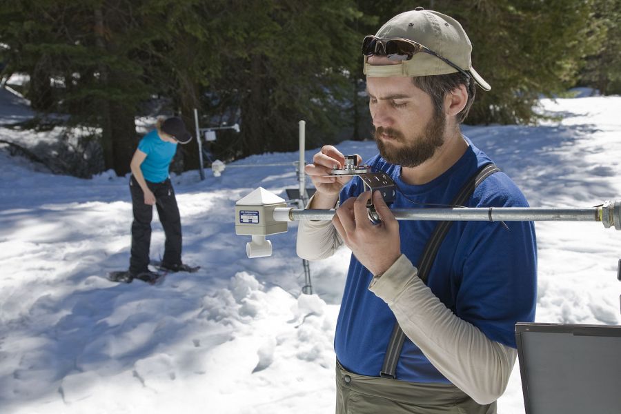
CZOs are building an infrastructure that enables measurement of Critical Zone evolution, structure, and processes. A key goal is to construct whole-watershed energy, water, carbon and other mass balances for a variety of environmental settings.
"Common Critical Zone Observatory Infrastructure and Measurements"
- View the PDF version (Version 05 May 2015, includes a detailed matrix of common measurements for all CZOs).
- See publication page (to view authorship)
Context
The Susquehanna-Shale Hills, Southern Sierra, and Boulder Creek CZOs were funded originally in 2007, with the Luquillo, Christina River Basin, and Jemez River Basin/Santa Catalina Mountains CZOs being funded in 2009. Four more CZOs were funded in 2013 and include the Reynolds Creek, Eel River, Calhoun Forest, and Intensively Managed Landscape CZOs. Find a summary of CZO site characteristics in the CZO Attributes Table (PDF).
Each CZO has its own unique sets of questions, hypotheses, and experimental designs. However, the CZO network of sites is being shaped by working groups, emergent common questions/hypotheses, X-CZO campaigns, activities or modeling, the national office, and, as discussed here, a suite of common measurements. These efforts seek to make the CZO network greater than the sum of its parts.
Conceptual framework and goals
The CZOs are sites where innovative techniques are being developed and tested for quantifying Critical Zone (CZ) processes and services. While each site develops its own novel approaches, all sites aim to make a set of comparable measurements across CZOs, as well as with other local, regional, and global monitoring efforts.
The goal of each site and the network is to develop fully the infrastructure and personnel needed to:
- resolve the evolution and formation of the CZ and its attributes;
- measure the properties and structure of the present-day CZ;
- construct mass and energy balances at multiple spatial scales and over event and continuous time scales that can be used for cross-site comparisons and characterizing the state of the CZ as it changes through space and time.
All CZOs seek to develop a common set of measurements to quantify:
1. CZ structure and evolution; including 3D spatial distribution and characterization of bedrock, soil, water, vegetation, and topography; regolith and drainage valley evolution; rates of soil production, differentiation, erosion, and deposition.
2. Event-based and continuous fluxes across CZ interfaces; including bedrock-soil; soil-atmosphere; soil- vegetation; vegetation-atmosphere; landscape surface-soil-water.
- Energy: Measurements of incoming and outgoing visible and infrared radiation, plus latent and sensible heat exchange.
- Water: Measurements of catchment-scale hydrologic cycle components and pathways, including precipitation (amount and type), evapotranspiration (ET) and its components, subsurface flows, and stream discharge.
- Solutes and Sediment: Measurements of gaseous, aqueous and solid constituent (e.g., carbon, metal(loid)s, nutrients) transport.
3. Changes in storage (i.e., budgets) of major CZ reservoirs at the catchment scale;
- Energy: Changes in the thermal state of the near-surface realm.
- Water: Changes in snowpack, soil water, surface- and ground-water storage.
- Solutes and Sediment: Changes in stocks of measured solute, sediment, and attached constituent concentrations of the major reservoirs in the CZ. Measurements are of sufficient detail that they can describe changes as a function of depth and watershed location.
CZO Common Measurements (not all measurements are feasible in all CZOs)
The CZO network uses both innovative instrumentation and campaign-style measurements to quantify the composition and fluxes of energy, water, and solutes and sediments at different spatial (e.g., plot to watershed) and temporal (event to millennial) scales across the land-atmosphere interface, through the vegetation and microbiota and in the regolith (soil, saprolite, and porous/fractured bedrock) and stream water. A representative set of measurements/approaches is discussed below.
1. Land-Atmosphere
- LiDAR datasets
- Eddy flux for momentum, heat, water vapor, CO2 exchanges
- Wind speed and direction (sensors)
- Solar radiation and temperature (sensors)
- Precipitation and through-fall (samplers)
- Wet and dry deposition (samplers)
2. Vegetation and associated microbiota
- Above- and below-ground vegetative and microbial biomass
- Relations between ET and species composition and structure
- Soil/plant respiration, net ecosystem exchange
3. Soil (vadose zone)
-
Solid phase (campaign sampling for spatial characterization)
- Texture and physical characterization
- Organic matter content
- Elemental composition and mineralogy
- Stable and radiogenic isotope composition
-
Fluid phase (sensors and samplers for time series)
- Soil moisture (sensors)
- Soil temperature (sensors)
- Soil solution chemistry (samplers)
- Soil gas chemistry (samplers/sensors)
- Rates of infiltration and groundwater flow
4. Saprolite and bedrock (saturated zone)
-
Solid phase (campaign sampling for spatial characterization)
- Texture and other physical and architectural traits
- Petrology and mineralogy
- Elemental composition and organic matter content
-
Fluid phase (sensors and samplers for time series)
- Potentiometric head and temperature (sensors)
- Groundwater chemistry (samplers/sensors)
- Gas chemistry (samplers/sensors)
5. Surface water
- Discrete and instantaneous discharge (flumes, weirs, stage sensors)
- Channel morphology
- Stream water chemistry, dissolved and suspended (samplers/sensors)
- Sediment and biota (samplers/sensors)
CZO Common Measurements Matrix
To view the matrix, see the last page of the PDF Version ("Common Critical Zone Observatory Infrastructure and Measurements").
Following the October 2013 meeting in Arlington, VA, CZO PIs contributed to the development of a “Common Measurements Matrix” that shows those measurements being conducted at the CZOs (see table on the following pages). The idea for this matrix originated from the CZO network Graduate Research Group.
In this matrix:
X indicates instrumentation is currently in place or sampling is occurring, owned and operated by the CZO; Y indicates instrumentation is currently in place, owned and operated by a partner of the CZO (see comments);
Z indicates that it is planned to be installed or implemented in the future by the CZO.
The original Excel file also includes comments in individual cells pertaining to specific issues flagged for a given CZO by the PI (e.g., identification of partners, etc.).
The matrix highlights the commonality of several types of measurements occurring at all CZOs, some of which are collected in collaboration with partnering agencies or projects.
This matrix remains under construction. Our goal is to have it be an active spreadsheet that links directly (by clicking on a given cell) to the infrastructure maps for a given CZO and shows the sensor, sampler and/or sample collection array that pertains to a given set of measurements. By doing so, the density or frequency of such measurements will be available to users in a hierarchical fashion.
Path Forward on Common Measurements
It is important to note that although there is strong correspondence in the targets of the measurements at the CZOs, the different CZOs are not using the same techniques in all cases. This represents an opportunity to share information on benefits and shortcomings of particular methods (e.g., techniques for soil moisture quantification, carbon flux, etc.).
Future cross-CZO efforts on Common Measurements will focus on sharing technology and experience to highlight the benefits/shortcomings of various measurement protocols being employed. In addition, the linkage of the CZO Common Measurements Matrix to CZO-specific data sets and maps will be established.
Common Measurements sub-groups are currently being developed to share methodologies and develop common protocols pertaining to laboratory-based analytical techniques. Potential subgroups include (i) physical separations, sample preparation, archiving and preservation; (ii) soil and aquatic microbiology; (iii) organic geochemistry; (iv) inorganic geochemistry; (v) hydrochemistry; and (iv) organic matter dynamics.
Folks interested in participating in one or more of these sub-groups should contact Jon Chorover, Dan Richter, or Tim Filley.
Explore Further
