Minnesota River Basin
The Minnesota River flows more than 335 miles from its source near the Minnesota-South Dakota border to its confluence with the Mississippi River at Minneapolis/St. Paul. It winds through diverse landscapes and drains nearly 20 percent of Minnesota (16,770 square miles total, 14,840 in Minnesota). Agriculture, primarily corn and soybean production, accounts for the majority of the basin’s land use. As the river enters the Twin Cities Metropolitan area, the basin is characterized by densely populated urban landscapes. The Minnesota River has been cited as one of the most polluted rivers in the state and the nation. In 2008, it was listed on American Rivers top 10 most endangered rivers in the United States. It is the focus of a major restoration effort by local, state, and federal agencies, as well as citizen and nonprofit groups.
44,000 km2 Area
210 - 294 m Elev
5 °C Temp
747 mm Precip
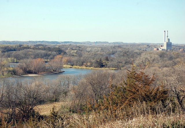
Minnesota River Valley near Granite Falls, Minn. Photo © jpellgen
Lithology
unconsolidated materials
Soil Order
Alfisol, Entisol, Inceptisol, Mollisol
Biome
grasslands, savanna
Land Use
agricultural land, urban or built-up land
-
Setting & Research
The Minnesota River Basin encompasses a wide range of hydrogeomorphic environments in the Upper Mississippi River Basin. The main stem of Minnesota River is an actively aggrading channel and many of its tributaries are among the most rapidly incising rivers in the world. Following retreat of the Wisconsin ice sheet, glacial Lake Agassiz catastrophically drained through the proto-Minnesota River valley, resulting in a nearly instantaneous, 70-m vertical incision of the main stem, which produced steep gradient knickpoints at the confluence of each tributary along the main stem. During the Holocene, the knickpoints have rapidly propagated 30 to 50 km up the tributary networks leaving tall bluffs and steep ravines at the interface with the otherwise flat uplands. These rapidly eroding banks, bluffs, and ravines are highly sensitive to changes in river discharge and significant contributors of sediment to the stream. Much of the watershed is characterized by low-relief, agricultural lands, with Mollisols being the primary soil type. The MRB has undergone extensive changes in land use from a forest-wetland-prairie system to row crop agriculture, which now covers nearly 80% of the basin. Annual precipitation varies from 55 cm in the northwestern portion of the basin to 81 cm in the southeastern parts, while annual runoff ranges from 5 cm in the west to 15 cm in the east. Significant increases in rainfall intensities and total storm amounts have been documented over the past 60 years, while storm durations have decreased. As a result of the increasing rainfall in conjunction with changing crop types and continued installation of tile drains, pervasive increases in streamflow have also been observed. These potentially significant changes in event-scale precipitation patterns strongly support the event-based approach of this project, focused on identifying specific activity centers.
-
Dynamic Map
To fully zoom into a small area, you may need to visit the "Map" button and uncheck "Terrain" view.
-
Data
No datasets for this field area have been entered yet
-
Partner Organizations


-
Geology
- unconsolidated materials
The 44,000-km2 Minnesota River Basin (MRB; Fig. 4) encompasses a wide range of hydrogeomorphic environments in the Upper Mississippi River Basin. The main stem of Minnesota River is an actively aggrading channel and many of its tributaries are among the most rapidly incising rivers in the world. Following retreat of the Wisconsin ice sheet, glacial Lake Agassiz catastrophically drained through the proto-Minnesota River valley resulting in a nearly instantaneous, 70-m vertical incision of the main stem, which produced steep gradient knickpoints at the confluence of each tributary along the main stem. During the Holocene, the knickpoints have rapidly propagated 30 to 50 km up the tributary networks leaving tall bluffs and steep ravines at the interface with the otherwise flat uplands. These rapidly eroding banks, bluffs, and ravines are highly sensitive to changes in river discharge and significant contributors of sediment to the stream.
-
Topography
210 - 294 m elevation (252 m mean)
The topography of the Minnesota River Basin varies from flat to gently undulating terrain. The relatively flat landscape of this watershed has experienced rapid geologic change over the past 12,000 years, as well as recent human modifications to the ecology, geomorphology, and hydrology of the area. Land use began to change around 1830, as wetlands were drained and the hardwood forest and long-grass prairie were converted to row crop agriculture. We are studying how natural and human-induced landscape change influence the movement of sediment and the water quantity and quality into the Minnesota River and Lake Pepin.
-
Climate
5 °C Mean Annual Temp 22 °C Mean Warmest Month -9 °C Mean Coldest Month 747 mm Mean Annual Precipitation The Minnesota River Basin has undergone extensive changes in land use from a forest-wetland-prairie system to row crop agriculture, which now covers nearly 80% of the basin. Annual precipitation varies from 55 cm in the northwestern portion of the basin to 81 cm in the southeastern parts, while annual runoff ranges from 5 cm in the west to 15 cm in the east. Significant increases in rainfall intensities and total storm amounts have been documented over the past 60 years, while storm durations have decreased. As a result of the increasing rainfall in conjunction with changing crop types and continued installation of tile drains, pervasive increases in streamflow have also been observed. These potentially significant changes in event-scale precipitation patterns strongly support the event-based approach of this project, focused on identifying specific activity centers.
-
Ecosystems
- grasslands
- savanna
Much of the watershed is characterized by low-relief, agricultural lands. The MRB has undergone extensive changes in land use from a forest-wetland-prairie system to row crop agriculture, which now covers nearly 80% of the basin.
-
Soil
- Alfisol
- Entisol
- Inceptisol
- Mollisol
Much of the watershed is characterized by low-relief, agricultural lands, with Mollisols being the primary soil type.
-
Human Impacts
- agricultural land
- urban or built-up land
The MRB has undergone extensive changes in land use from a forest-wetland-prairie system to row crop agriculture, which now covers nearly 80% of the basin.
Explore Further
