Dataset Listings
These dataset listings are out of date and have been archived.
See the updated listings on HydroShare.org >
Reynolds Creek Experimental Watershed
239 km2,
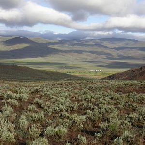
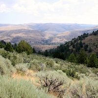
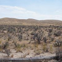
The Reynolds Creek CZO is located in the Reynolds Creek Experimental Watershed (RCEW) in the Owyhee Range in southwest Idaho. RCEW is 239 square km and encompasses a wide range of environments typical to the intermountain region of the western USA.
Johnston Draw - Climate, Meteorology, Hydropedologic Properties (2003-2014)
2 components •
Reynolds Creek Experimental Watershed •
Biology / Ecology, Climatology / Meteorology, Hydrology, Soil Science / Pedology •
Godsey, Sarah E.; Marks, Danny G.; Kormos, Patrick R.; Seyfried, Mark S.; Enslin, Clarissa L.; McNamara, James P.; Link, Timothy E.
Johnston Draw - Soil Biogeochemistry, Soil Survey, Topographic Carbon Storage - soil organic carbon, bulk density (2014-2016)
2 components •
Reynolds Creek Experimental Watershed •
Biogeochemistry, Soil Science / Pedology •
Patton, N.R.; Lohse, K.A.; Godsey, S.E.; Parsons, S.B.; Seyfried, M.S.
Johnston Draw - Soil Survey - Predicting Soil Thickness (2014-2016)
1 components •
Reynolds Creek Experimental Watershed •
Soil Science / Pedology •
Patton, N.R.; Lohse, K.A.; Godsey, S.E.; Seyfried, M.S.; Crosby, B.T.
National - Flux Tower - AmeriFlux Network data (2007-2018)
14 components •
Boulder Creek Watershed, Jemez River Basin, Reynolds Creek Experimental Watershed, Susquehanna Shale Hills Critical Zone Observatory, San Joaquin Experimental Range (210-520 m elevation), Soaproot Saddle (1000-1500 m elevation), Short Hair (2670 m elevation) •
Climatology / Meteorology •
Boulder Creek Critical Zone Observatory; Catalina-Jemez Critical Zone Observatory; Reynolds Creek Critical Zone Observatory; Shale Hills Critical Zone Observatory; Southern Sierra Critical Zone Observatory
National - LiDAR, Land Cover, GIS/Map Data - OpenTopography (2010-2017)
18 components •
Boulder Creek Watershed, Eel River Watershed, Jemez River Basin, Reynolds Creek Experimental Watershed, Susquehanna Shale Hills Critical Zone Observatory, Northeastern Puerto Rico and the Luquillo Mountains, Sangamon River Basin, Clear Creek Watershed, Calhoun Critical Zone Observatory, Providence Creek Headwater Catchments (1660 - 2115 m elevation) •
Geomorphology, GIS / Remote Sensing, Hydrology, Biology / Ecology •
National Center for Airborne Laser Mapping; Boulder Creek Critical Zone Observatory; Calhoun Critical Zone Observatory; University of Arizona; University of California Merced; Valles Caldera National Preserve; Bandelier National Monument; National Park Service; Jemez River Basin and Santa Catalina Mountains Critical Zone Observatory; Luquillo Critical Zone Observatory; Reynolds Creek CZO; Eel River CZO; Shale Hills CZO
Reynolds Creek - Geology, Soil Survey, Vegetation, GIS/Map Data (1960-1970)
7 components •
Reynolds Creek Experimental Watershed •
Biology / Ecology, Geology / Chronology, Soil Science / Pedology •
Gordon R. Stephenson
Reynolds Creek - Precipitation (1962-2014)
2 components •
Reynolds Creek Experimental Watershed •
Climatology / Meteorology •
USDA ARS Northwest Watershed Research Center
Reynolds Creek - Streamflow / Discharge (1963-2014)
1 components •
Reynolds Creek Experimental Watershed •
Climatology / Meteorology, Hydrology •
USDA ARS Northwest Watershed Research Center
Reynolds Creek - Soil Moisture (1977-2011)
1 components •
Reynolds Creek Experimental Watershed •
Biology / Ecology, Soil Science / Pedology •
Mark S. Seyfried; Gerald N. Flerchinger; Clatyon L. Hanson; Mark D. Murdock; Steven S. Van Vactor
Reynolds Creek - Soil Temperature (1977-2014)
1 components •
Reynolds Creek Experimental Watershed •
Biogeochemistry, Climatology / Meteorology, Soil Science / Pedology •
USDA ARS Northwest Watershed Research Center
Reynolds Creek - Meteorology - approximate date range (1981-2009)
1 components •
Reynolds Creek Experimental Watershed •
Climatology / Meteorology •
USDA-ARS Northwest Watershed Research Center
Reynolds Creek - Digital Elevation Model (DEM), Land Cover, LiDAR (2007)
1 components •
Reynolds Creek Experimental Watershed •
GIS / Remote Sensing •
Boise State University; Boise Aerospace Center Laboratory; Nancy Glenn
Reynolds Creek - LiDAR, Snow Depth - Snow-Depth (2009)
1 components •
Reynolds Creek Experimental Watershed •
GIS / Remote Sensing, Hydrology •
Boise State University; Boise Aerospace Center Laboratory; Nancy Glenn
Reynolds Creek - Land Cover, LiDAR, Vegetation - Biomass Estimate of Sagebrush (2012)
1 components •
Reynolds Creek Experimental Watershed •
Biology / Ecology, GIS / Remote Sensing, Modeling / Computational Science •
Li, Aihua; Glenn, Nancy F; Olsoy, Peter J; Mitchell, Jessica J; Shrestha, Rupesh
Reynolds Creek - GIS/Map Data (2014)
3 components •
Reynolds Creek Experimental Watershed •
All Disciplines •
USDA-ARS; Idaho State University; Boise State University
Reynolds Creek - Soil Biogeochemistry - Soil Organic Carbon (2014-2017)
1 components •
Reynolds Creek Experimental Watershed •
Biogeochemistry, Soil Science / Pedology •
Will, R.M.; Benner, S.; Glenn, N.F.; Pierce, J.; Lohse, K.A.; Patton, N.; Spaete, L.P.; Stanbery, C.
Reynolds Creek - Nutrient Fluxes, Climate, Flux Tower - Eddy Covariance (2014-2018)
1 components •
Reynolds Creek Experimental Watershed •
Climatology / Meteorology, Biogeochemistry •
Fellows, A.W.; Flerchinger, G.N.; Seyfried, M.S.; Lohse, K.A.
Reynolds Creek Experimental Watershed - Climate, GIS/Map Data - Temperature, Humidity, Precip Amount & Phase (1983-2014)
1 components •
Reynolds Creek Experimental Watershed •
Climatology / Meteorology •
P. Kormos; D. Marks; M. Seyfried; S. Havens; A. Hendrick; K. Lohse; M. Maserik; A. Flores
Reynolds Creek Experimental Watershed - LiDAR, Digital Elevation Model (DEM) - DEM (2014)
1 components •
Reynolds Creek Experimental Watershed •
GIS / Remote Sensing •
Nayani Ilangakoon; Nancy F. Glenn; Lucas P. Spaete; Hamid Dashti; Aihua Li
Reynolds Creek Experimental Watershed - Hydropedologic Properties, Soil Water, Soil Survey (2014-2018)
1 components •
Reynolds Creek Experimental Watershed •
Soil Science / Pedology •
Murdock, M.D.; Huber, D.P.; Seyfried, M.S.; Patton, N.R.; Lohse, K.A.
Reynolds Creek Experimental Watershed - Digital Elevation Model (DEM), GIS/Map Data, LiDAR (2015)
1 components •
Reynolds Creek Experimental Watershed •
GIS / Remote Sensing •
NCALM; Kathleen Lohse
Murphy Creek
1.29 km2,
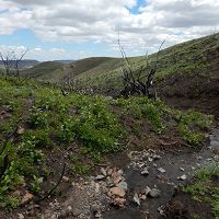
Murphy Creek was completely burned in the Soda Fire of August 2015, initiating a number of post-fire studies involving stream biogeochemistry, hillslope transport, and aeolian deposition.
Tollgate Weir
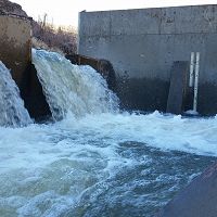
Tollgate Weir is the second largest installed on the Reynolds Creek watershed and has been collecting discharge and sediment data continuously since 1966.
Upper Sheep Creek
0.26 km2,
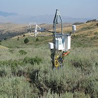
Upper Sheep Creek has, among other instrumentation, a Eddy Covariance Tower, and a grazing exclosure that has isolated a portion of this sub watershed from grazing impacts for decades.
Johnston Draw
1.83 km2,
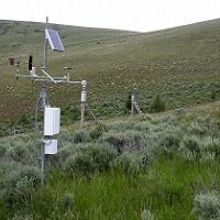
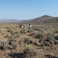
Johnston Draw sub watershed is extensively monitored, spanning the elevation and precipitation gradients associated with the rain-snow transition zone. Instrumentation there collects atmospheric, climatic, soil, and water chemistry measurements.
Mountain Big Sage
0.389 km2,
Under Construction
Lower Sheep Creek (Lower Sage)
0.131 km2,
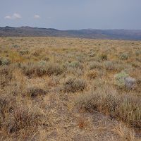
Lower Sheep Creek (Lower Sage) is an intermediate elevation CORE site within the watershed sensor network, and is characterized by light cattle grazing and low sagebrush.
Wyoming Big Sage
0.012 km2,
Under Construction
Flats
Under Constructions
-
Data Use Policy
DRAFT v.0.4.0
1. Use our data freely. All CZO Data Products* except those labelled Private** are released to the public and may be freely copied, distributed, edited, remixed, and built upon under the condition that you give acknowledgement as described below. Non-CZO data products — like those produced by USGS or NOAA — have their own use policies, which should be followed.
2. Give proper citation and acknowledgement. Publications, models and data products that make use of these datasets must include proper citation and acknowledgement. Most importantly, provide a citation in a similar way as a journal article (i.e. author, title, year of publication, name of CZO “publisher”, edition or version, and URL or DOI access information. See http://www.datacite.org/whycitedata). Also include at least a brief acknowledgement such as: “Data were provided by the NSF-supported Southern Sierra Critical Zone Observatory” (replace with the appropriate observatory name).
3. Let us know how you will use the data. The dataset creators would appreciate hearing of any plans to use the dataset. Consider consultation or collaboration with dataset creators.
*CZO Data Products. Defined as a data collected with any monetary or logistical support from a CZO.
**Private. Most private data will be released to the public within 1-2 years, with some exceptionally challenging datasets up to 4 years. To inquire about potential earlier use, please contact us.
Explore Further
