Engineering / Method Development Tag
Engineering / Method Development is one of more than 16 discipline tags that we use to categorize and aggregate our interdisciplinary information within and across CZOs. Much of our information has been tagged with 2-3 disciplines.
-
Sierra People - Engineering / Method Development
5 People
INVESTIGATOR, Lead-PI
.(JavaScript must be enabled to view this email address)
SNRI
UC Merced
Mountain hydrology and biogeochemistry, polar snow and ice, climate impacts and water resources
.(JavaScript must be enabled to view this email address)
UC Berkeley
Hydrology, wireless sensor networks, radios, cross-landscape telemetry and communication
COLLABORATOR
.(JavaScript must be enabled to view this email address)
UC Merced
Hydrology, Climatology, and Sustainability
COLLABORATOR
.(JavaScript must be enabled to view this email address)
UC Berkeley
sensor networks, systems engineering, sensor development, network optimization
GRAD STUDENT
.(JavaScript must be enabled to view this email address)
UC Merced
Surface and Mountain Hydrology, Water Resources, Watershed Modeling, Reservoir Routing Optimization
-
-
Sierra Data - Engineering / Method Development
No datasets with this discipline tag have been entered yet
-
-
Sierra Publications - Engineering / Method Development
2019 (In Press)
Deterministic Networking for the Industrial IoT: PhD Dissertation. Brun-Laguna, K. (2019): Thesis of the École Doctorale Informatique, Télécommunications et Électronique (Paris), Université Pierre et Marie Curie
2018
Spatially distributed water-balance and meteorological data from the rain-snow transition, southern Sierra Nevada, California. BALES, R., STACY, E., SAFEEQ, M., MENG, X., MEADOWS, M., OROZA, C., CONKLIN, M., GLASER, S., and WAGENBRENNER, J. (2018): Earth System Science Data, 10
2018
Spatially distributed water-balance and meteorological data from the Wolverton catchment, Sequoia National Park, California. BALES, R.C., STACY, E.M., MENG, X., CONKLIN, M.H., KIRCHNER, P.B., and ZHENG, Z (2018): Earth System Science Data, 10
2018
Southern Sierra Critical Zone Observatory and Kings River Experimental Watersheds: A Synthesis of Measurements, New Insights, and Future Directions. O'Geen, A.; Safeeq, M.; Wagenbrenner, J.; Stacy, E.; Hartsough, P.; Devine, S.; Tian, Z.; Ferrell, R.; Hopmans, J.W.; and Bales, R. (2018): Vadose Zone Journal, 17:180081
2018
Using research networks to create the comprehensive datasets needed to assess nutrient availability as a key determinant of terrestrial carbon cycling. Vicca, S.; Stocker, B.D.; Reed, S.; Wieder, W.R.; Bahn, M.; Fay, P.A.; Janssens, I.A.; Lambers, H.; Peñuelas, J.; Piao, S.; Rebel, K.T.; Sardans, J.; Sigurdsson, B.D.; Sundert, K.V.; Wang, Y.P.; Zaehle, S.; Ciais, P. (2018): Environmental Research Letters Cross-CZO National
2018
Canopy Effects on Snow Accumulation: Observations from Lidar, Canonical-View Photos, and Continuous Ground Measurements from Sensor Networks. Zheng, Z.; Ma, Q.; Qian, K.; Bales, R.C. (2018): Remote Sensing, 10, 1769
2017
Technical report: The design and evaluation of a basin-scale wireless sensor network for mountain hydrology. Zhang, Z.; Glaser, S.D.; Bales, R.C.; Conklin, M.; Rice, R.; Marks, D.G. (2017): Water Resources Research.
2015
Wetting and Drying Variability of the Shallow Subsurface Beneath a Snowpack in California’s Southern Sierra Nevada. Webb, R.W., Fassnacht, S.R., Gooseff, M.N. (2015): Vadose Zone Journal. 14 (8)
2013
Sensor placement strategies for SWE estimation in the American River basin. Welch, S., Kerkez, B., Bales, R., Glaser, S., Rittger, Rice, R. (2013): Water Resources Research, 49 (2)
2012
A cyber-infrastructure for the measurement and estimation of large-scale hydrologic processes. Kerkez, B. (2012): University of California, Berkeley
2012
Design and Performance of a Wireless Sensor Network for Catchment-scale Snow and Soil Moisture Measurements. Kerkez, B., Glaser, S.D., Bales, R.C., and Meadows, M.W. (2012): Water Resources Research, 48 (9), W09515
2012
Sampling design and optimal sensor placement strategies for basin-scale SWE estimation. Kerkez, B., Welch, S.C., Bales, R.C., Glaser, S.D., Rittger, K.E., and R. Rice (2012): Fall Meeting, American Geophysical Union, December 2012. Abstract C33C-0683.
2012
Connecting the snowpack to the internet of things: an IPv6 architecture for providing real-time measurements of hydrologic systems (Invited). Kerkez, B., Zhang, Z., Oroza, C., Glaser, S.D., and Bales, R.C. (2012): Fall meeting, American Geophysical Union, December 2012. Abstract C32B-07.
2012
Integrating soil water measurements from plot to catchment scale in a snow-dominated, mixed-conifer forest of the southern Sierra Nevada. Meadows, M.W., Hartsough, P.C., Bales, R.C., Hopmans, J.W., and Malazian, A.I. (2012): Fall Meeting, American Geophysical Union, December 2012. Abstract H31G-1198.
2012
Strategic sampling of microclimate, soil moisture and sapflux for improving ecohydrological model estimates in the California Sierra. Son, K., and Tague, C. (2012): Fall meeting, American Geophysical Union, December 2012. Abstract H31G-1208.
2011
Evaluation of MPS-1 soil water potential sensor. Malazian, A., Hartsough, P.C., Kamai, T., Campbell, C.S., Cobos, D.R. and Hopmans, J.W. (2011): J. of Hydrology. 402:126-134.
2011
Estimating Snow Water Equivalent over the American River in the Sierra Nevada Basin Using Wireless Sensor Networks. Welch, S.C., Kerkez, B., Glaser, S.D., Bales, R.C., Rice, R. (2011): Fall meeting, American Geophysical Union, December 2011. Abstract IN32A-07.
2010
Design and development of a wireless sensor network to monitor snow depth in multiple catchments in the American River basin, California: hardware selection and sensor placement techniques. Kerkez, B., Rice, R., Glaser, S.D., Bales, R.C., Saksa, P.C. (2010): Fall meeting, American Geophysical Union, December 2010. Abstract IN34A-07.
2009
The Science of Wireless Sensor Networks: Improving engineered systems through scientific analysis . Krekez, B., Meadows, M., Glaser, S.D., Bales, R.C. (2009): Fall meeting, American Geophysical Union, December 2009. 90(52). Abstract IN13C-03.
2009
Calibration and Testing of the MPS-1 Soil Matric Potential Sensor . Malaizan, A., Hartsough, P.C., Kamai, T., Cobos, D.R., Campbell, C.S., Hopmans, J.W. (2009): Fall meeting, American Geophysical Union, December 2009. 90(52). Abstract H31A-0740.
2008
Remote Environmental Monitoring of Hydrologic Biotic Interaction in a Mountain Environment. Hartsough, P., Malazian, A., Tuli, A., Kamai, T., Kizito, F., Bales, R., Broad, A., Hopmans, J. (2008): Fall meeting, American Geophysical Union, December 2008. 89(53). Abstract H51H-0974.
-
Sierra News - Engineering / Method Development
2018
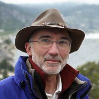
Watch Online: AGU 2017 Nye Lecture by Roger Bales
17 Jan 2018 - Dr. Roger Bales's Nye Lecture, "Making up for lost snow: lessons from a warming Sierra Nevada", is now available to watch online.
2017
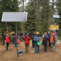
Visiting the Water Source: A Tour of the Kings River Headwaters
06 Nov 2017 - By Michelle Gilmore and Leigh Bernacchi Ever wonder how we know what we know about water? Twenty-five intrepid water and forest managers,...
2016
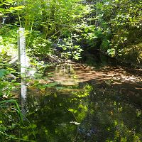
Pushing the Limits on Water Isotope Measurement: Lawrence Livermore and UC Merced
20 Dec 2016 - Lawrence Livermore and UC Merced researchers are tracking water through the critical zone using cutting-edge technology and new collection methods.
2015
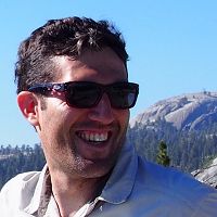
Critical Zone Profile - CARLOS OROZA (systems engineer, PhD student)
07 Sep 2015 - PhD Student, Systems Engineering, University of California Berkeley
2013
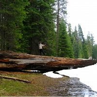
Smart sensors can measure pretty much anything
12 Aug 2013 - Network of iPhone-size devices keeps tabs on state water supply
Watershed-scale Experimental Design (KREW webinar)
19 Mar 2013 - Research Ecologist Carolyn Hunsaker presented a USFS Landscape Science webinar on the Kings River Experimental Watershed on March 19th. This hourly...
2011
California Researchers Expand ‘Intelligent Water Infrastructures Initiative’
07 Nov 2011 - In the Sierra Nevada, wireless sensor nodes are transmitting data indicating the amount of snow that has fallen or melted, as well as...
Video: Wireless snow measurement system featured in “Around California Part 1”
29 Apr 2011 - The wireless snow measurement system is discussed in a 3-minute long video segment, starting at 21:10. the video was created by the UC Berkeley...
-
Sierra Events - Engineering / Method Development
Southern Sierra Headwaters Tour
Presented by Southern Sierra Critical Zone Observatory, UC Water, & USDA Forest Service Pacific Southwest Research Station
Prather & Shaver Lake CA. REGISTRATION REQUIRED..CUAHSI Watershed Science Master Class
CUAHSI Watershed Science Master Class
Biosphere2, Oracle, Arizona.Depths of the Critical Zone
Drilling, Sampling, and Imaging the Depths of the Critical Zone: NSF Workshop
Denver, CO.
Explore Further
