California Researchers Expand ‘Intelligent Water Infrastructures Initiative’
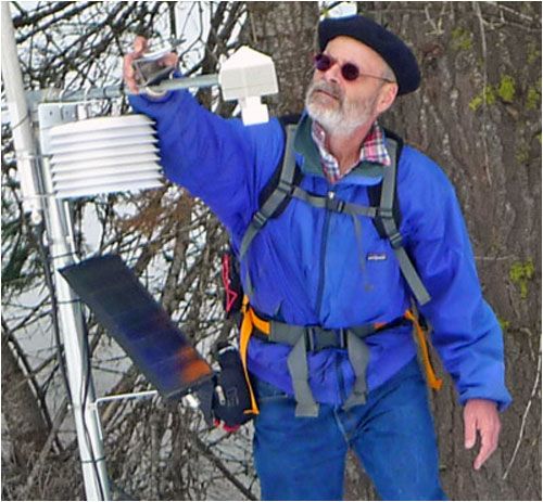
In the Sierra Nevada, wireless sensor nodes are transmitting data indicating the amount of snow that has fallen or melted, as well as soil-saturation levels. Ultimately, all of this information can be used to calculate the volume of water available to the tens of millions of residents and businesses located downstream. One step in achieving that goal is SierraNet—a program being run jointly by University of California (UC) researchers at the school system's Berkeley and Merced campuses. The first SierraNet project is taking place at the Kings River Experimental Watershed area, and is part of the Southern Sierra Nevada Critical Zone Observatory (CZO)—an environmental laboratory. The SierraNet projects are being led by Steven Glaser, a UC Berkeley professor of civil and environmental engineering, and Roger Bales, a UC Merced professor of engineering and the director of the Sierra Nevada Research Institute (SNRI). Glaser's team is now launching a much larger installation of wireless sensors, spread across the basin of the American River, with a $2 million grant from the National Science Foundation (NSF). The grant, awarded in September 2011, will be dispensed over the course of four years. READ MORE at the RFID Journal website
News Source:
READ MORE from RFID Journal >>
News Category:
RESEARCH |
INFRASTRUCTURE

Discipline Tags and CZOs
Climatology / Meteorology
Hydrology
Engineering / Method Development
Sierra
Explore Further
