Research Assistantships available to work with SSCZO
Up to four research assistantships are available for Fall 2014 for work in the Southern Sierra Critical Zone Observatory (SSCZO). Explore the rest of this site for background on the SSCZO. Available positions will cover research interest in the areas of mountain hydrology, ecosystem ecology and biogeochemistry, soil microbiology and organic matter processes, and geochemistry. Preference given to applicants interested inpursuing a Ph.D. Graduate students at UC Merced join an interdisciplinary graduate group. SSCZO faculty are members of the Environmental Systems (ES) graduate group (es.ucmerced.edu), and some are also members of the Quantitative and Systems Biology (QSB) graduate group (qsb.ucmerced.edu).
Please see graduatedivision.ucmerced.edu/academic‐studies for more information about graduate programs at UC Merced.
The Environmental Systems graduate program trains students to tackle the most challenging problems facing our planet – water, soil, climate, energy and resources. Through understanding the Earth as an integrated system of atmosphere, hydrosphere, lithosphere and biosphere that intersects human society, ES students are uniquely poised to address critical research needs of the environment and its sustainability. Graduates are prepared for careers in academia, research, government, and industry that integrate expertise from across engineering, natural sciences and social sciences.
Applicants are encouraged to communicate with SSCZO faculty, including Professors Roger Bales (rbales@ucmerced.edu), Martha Conklin (mconklin@ucmerced.edu), Stephen C. Hart (shart4@ucmerced.edu), Asmeret Asefaw Berhe (aaberhe@ucmerced.edu), or Marilyn Fogel (mfogel@ucmerced.edu); and collaborator Carolyn Hunsaker (chunsaker@fs.fed.us).
The application deadline for Fall semester 2014 enrollment is January 15th, 2014. For early consideration for admission and financial support to the Ph.D.program, apply by December 15th, 2013. Please visit the Graduate Division application page (graduatedivision.ucmerced.edu/prospective-students/how‐apply) to submit application materials.
Conceptual model of the SSCZO research, anchored by four sites in an elevation gradient in the Sierra Nevada.
News Source:
READ MORE from UC Merced >>
News Category:
OPPORTUNITIES
Files
SSCZO Research Assistantship call for applications 2013
(625 KB pdf)
Open call for applications, for student research positions starting Fall 2014.
Photos
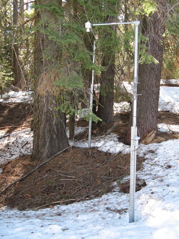
SSCZO - Instruments
Matt Meadows (Field Manager, UC Merced) checks on an instrument on the P301 flux tower.
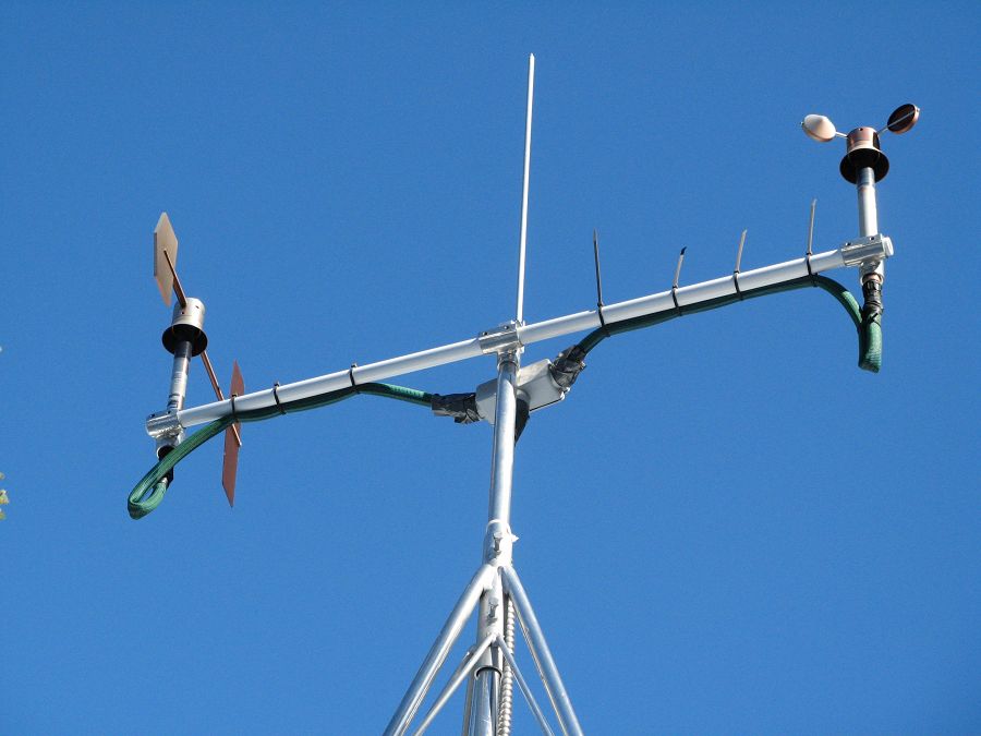
Anemometer measuring wind speed and direction.
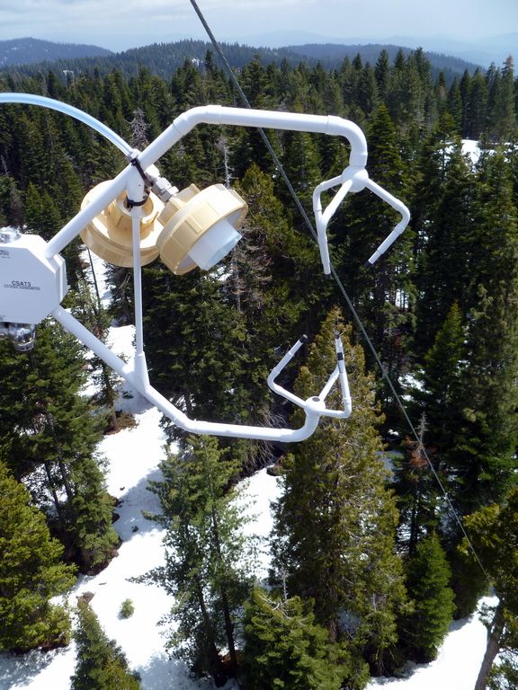
Ultrasonic anemometer on the P301 flux tower measures wind speed and direction in 3 dimensions. Data is connected to gas samples taken every quarter second at the filters on the left (beige circles).
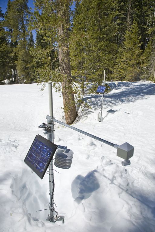
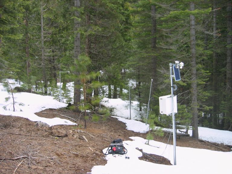
Instrument cluster featuring a relative humidity sensor, ultrasonic snow depth sensor, co-located soil moisture and temperature sensors at different depths, and a solar panel to power it all.
Instrument cluster at the P303 Upper Met site with ultrasonic snow depth sensor and co-located soil moisture and temperature sensors.
Instrument cluster at the P300 Lower Met site with ultrasonic snow depth sensor and co-located soil moisture and temperature sensors. The pole also psupports a solar panel, and an enclosure with a backup power supply and the data logger.
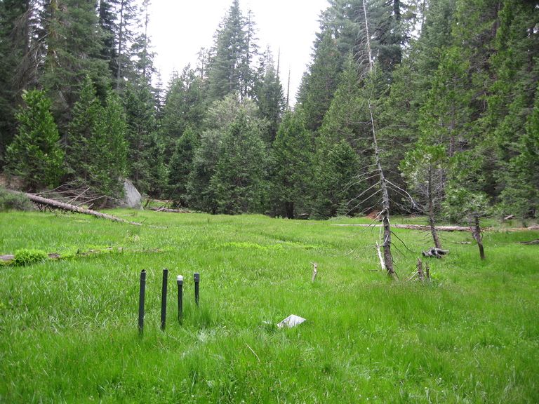
Instruments installed in the P301 meadows include wells and piezometers, at different locations to assess surface and groundwater flows.
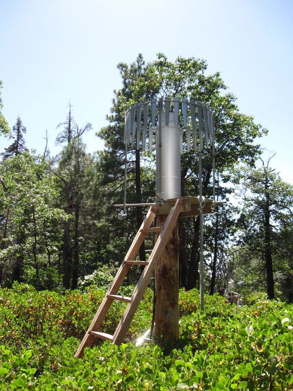
Several clusters of instruments measure the water balance. These clusters each contain soil moisture and temperature sensors, an air temperature sensor, relative humidity sensor, and an ultrasonic snow depth sensor.
These water balance instruments are clustered at two different elevations, with north, flat, and south facing aspects. Conditions are measured under canopy, at drip edge, and at open canopy. Water balance measurements are also made in the wireless sensor network that stretches along the P301 meadow.
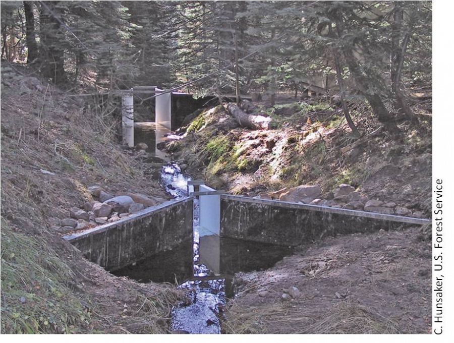
The eight subcatchments and two integrating catchments in the KREW project have flumes to measures discharge.
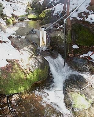
The large KREW flumes are complemented by small flumes for low flow.
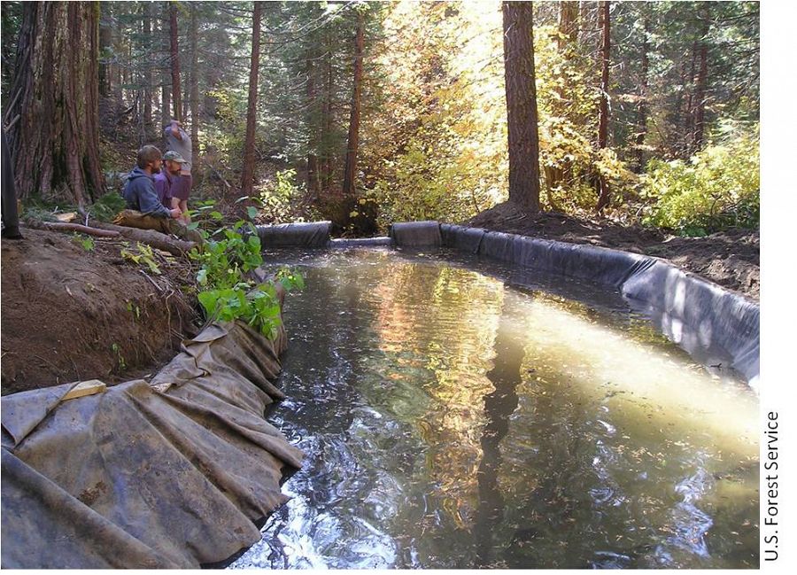
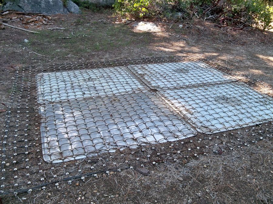
Each of those eight KREW subcatchments also has a plastic-lined settling basin to capture sediment.
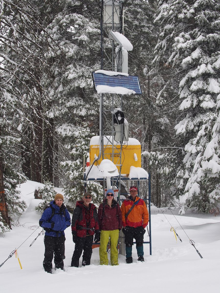
There are two meteorological stations in the Providence catchment - one at the lower elevation range and one near the crest. Each meteorological station has a rain gauge.
At the upper meteorological station, there is a snow pillow. This snow pillow tracks the weight of snow above it. Combined with the snow depth measurements, the two permit the calculation of amount of water in the snow pack.
Another view of the snow pillow.
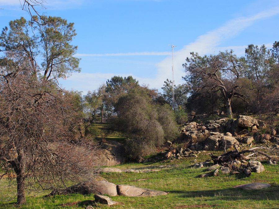
Hundreds of instruments and sensors have been deployed in the primary SSCZO research site of the Providence Creek watershed as well as in Wolverton basin. Additional SSCZO flux towers and instruments have also been installed at the San Joaquin Experimental Range, Soaproot Saddle, and Short Hair Creek.
Explore more photos of the intstuments and sensors used by SSCZO.
SSCZO - Flux Towers
At the San Joaquin Experimental Range (SJER), the SSCZO flux tower sits on a small rise in the oak-pine woodland. This is the lowest site of the flux-tower transect, with the tower installed at 405 m in elevation.
Fully erected, the SJER tower stands about 29 m tall (~95 ft).
However, the tower also telescopes down for maintenance.
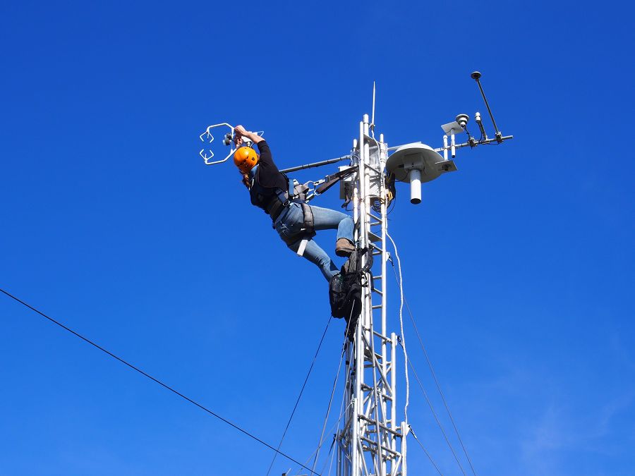
Erin Stacy (UC Merced) exchanges the filters on the gas intake.
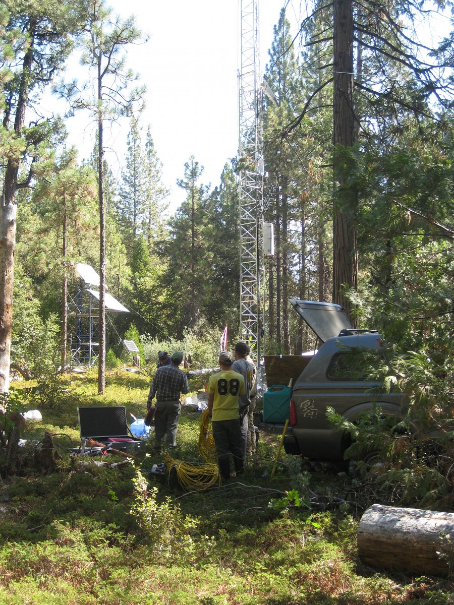
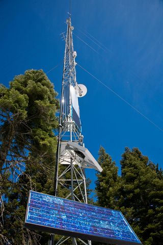
The flux tower at Soaproot Saddle stands in a small forest clearing. The tower, approximately 39 m tall (125-130 ft), is surrounded by a mix of Ponderosa pine and oak. Here the WyCEHG (Wyoming) sets out equipment to conduct geophysical surveys in the tower footprint.
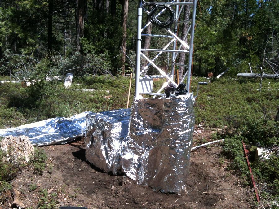
Defensive measures were taken for the Soaproot Saddle tower in advance of a prescribed burn. The Clarence Burn burned up to a nearby firebreak in January 2014, but did not burn the area immediately around the tower
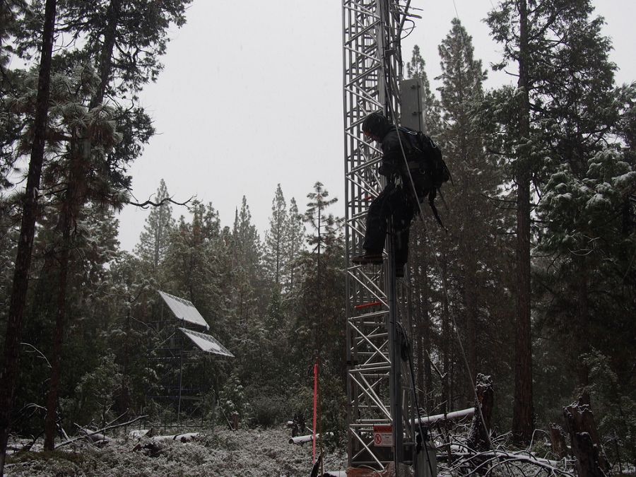
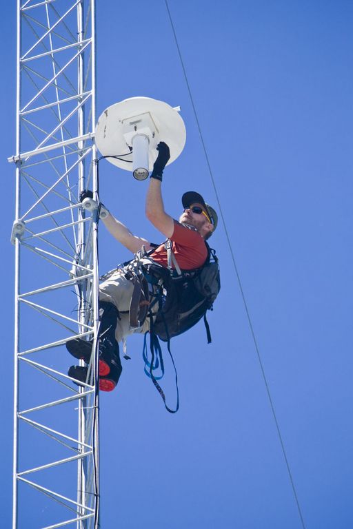
Matt Meadows (Field Manager, UC Merced) begins the climb for routine tower maintenance in a late January storm, 2014.
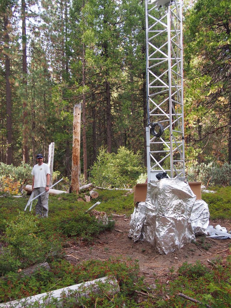
Pete Hartsough (collaborator, UC Davis) stands next to the Soaproot tower, September 2013, with core tubes in hand. A large drilling unit cored soil and saprolite to a depth of ~4 m on most attempts at this site.
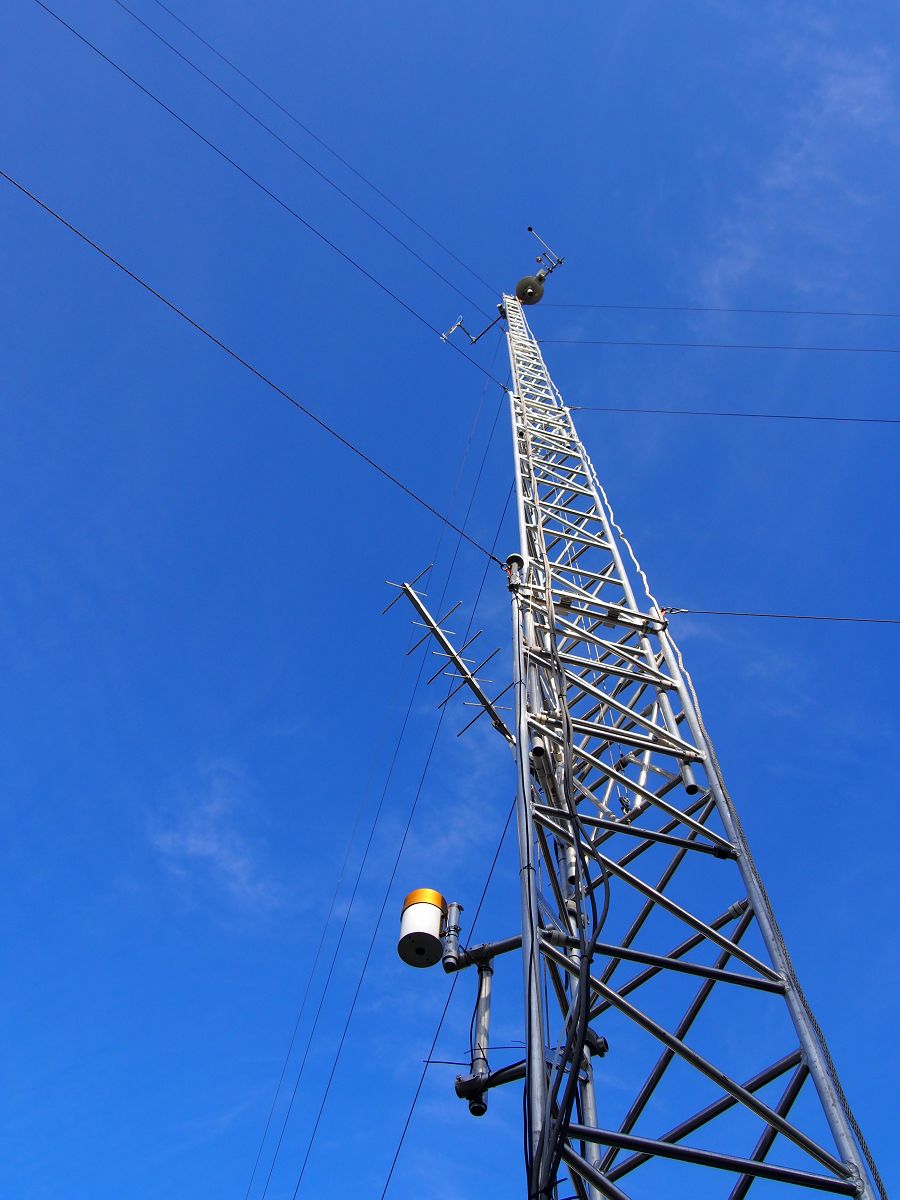
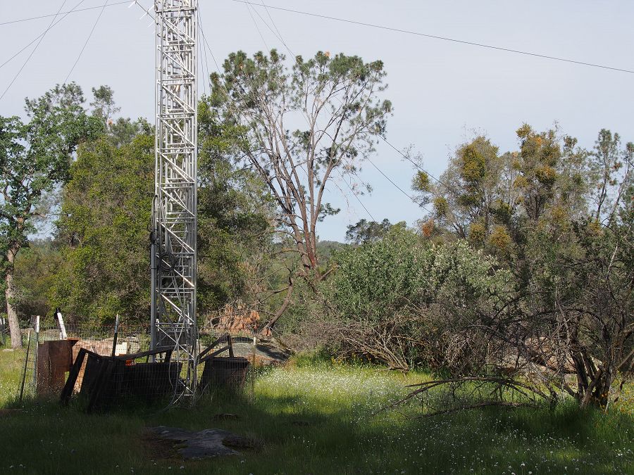
The P301 tower is the tallest of the four towers at 50 m (160 ft), plus a lightning rod. It stands near the top of the Providence catchments at 2015 m in elevation.
The P301 tower near the end of the 2014 winter.
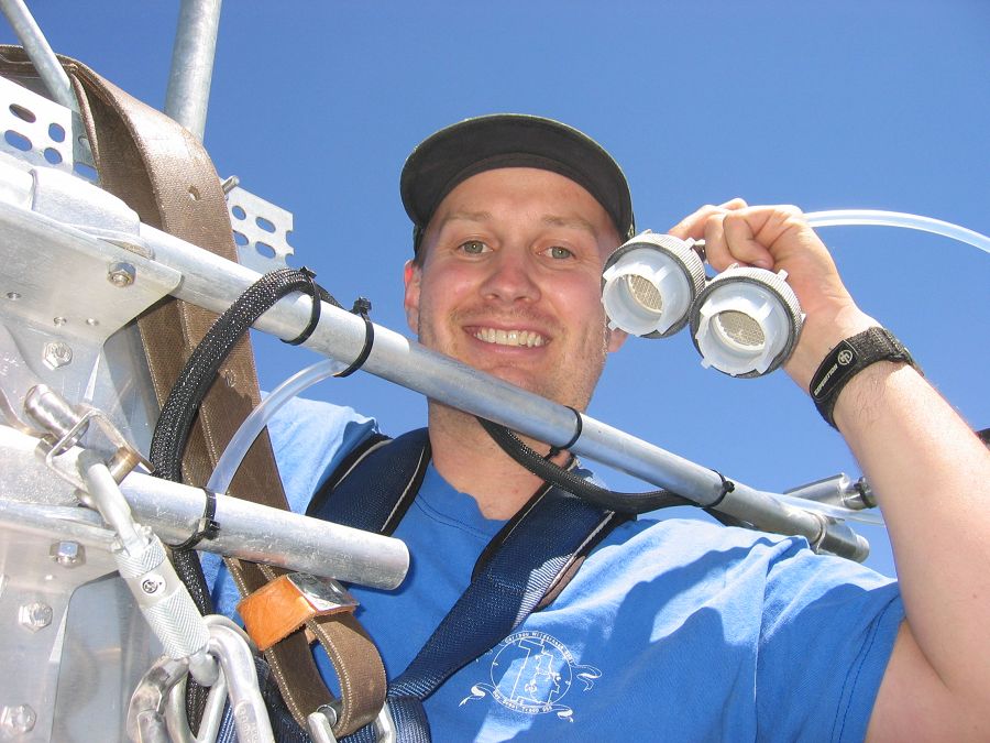
Matt Meadows (Field Manager, UC Merced) shows off the filter intakes at the top of the P301 tower.
An eddy covariance flux tower is located near the top of the P301 watershed. Instruments collect data on temperature, relative humidity, and fluxes of carbon dioxide and water vapor to determine the physiological responses of the site (for example, how photosynthesis increases with light) and summed over a year to determine the carbon balance of a site (how much carbon it is gaining or losing). Three other flux towers have been instrumented at different elevations with the Sierras including the San Joaquin River, Soaproot, and Short Hair Creek.
This west-east transect spans elevation gradient from 400 m to 2700 m. The change in elevation is accompanied by a slight increase in precipitation, but the main change is a shift from rain-dominated precipitation to snow-dominated precipitation. The climatic shift plays out in other ways as well. At lower elevations, high temperatures and low water availability limit evapotranspiration by vegetation. Meanwhile, forest activity (evapotranspiration) at higher elevations is limited by cold winter temperatures. There is a sweet spot at middle elevations of yera-round evapotranspiration and forest activity.
Photo galleries of each flux tower are available: San Joaquin Experimental Range; Soaproot Saddle; Providence subcatchment P301; and Short Hair Creek.
People Involved
CZO
-

Sierra, INVESTIGATOR
-
Sierra, INVESTIGATOR
-

Sierra, INVESTIGATOR
-
Sierra, INVESTIGATOR
Explore Further
