GIS / Remote Sensing Tag
GIS / Remote Sensing is one of more than 16 discipline tags that we use to categorize and aggregate our interdisciplinary information within and across CZOs. Much of our information has been tagged with 2-3 disciplines.
We may update this page later to combine content across all CZOs, rather than only content tagged with both this Discipline _and_ "national" czo.
-
National People - GIS / Remote Sensing
1 People
.(JavaScript must be enabled to view this email address)
Penn State
Science communication, outreach, geology, GIS
-
-
National Data - GIS / Remote Sensing
National - LiDAR, Land Cover, GIS/Map Data - OpenTopography (2010-2017)
18 components • Boulder Creek Watershed, Eel River Watershed, Jemez River Basin, Reynolds Creek Experimental Watershed, Susquehanna Shale Hills Critical Zone Observatory, Northeastern Puerto Rico and the Luquillo Mountains, Sangamon River Basin, Clear Creek Watershed, Calhoun Critical Zone Observatory, Providence Creek Headwater Catchments (1660 - 2115 m elevation) • Geomorphology, GIS / Remote Sensing, Hydrology, Biology / Ecology • National Center for Airborne Laser Mapping; Boulder Creek Critical Zone Observatory; Calhoun Critical Zone Observatory; University of Arizona; University of California Merced; Valles Caldera National Preserve; Bandelier National Monument; National Park Service; Jemez River Basin and Santa Catalina Mountains Critical Zone Observatory; Luquillo Critical Zone Observatory; Reynolds Creek CZO; Eel River CZO; Shale Hills CZO -
-
National Publications - GIS / Remote Sensing
2016 (In Press)
Diverging Sensitivity of Soil Water Stress To Changing Snowmelt Timing in the Western US . Harpold, A.A. (2016): Advances in Water Resources. 10.1016/j.advwatres.2016.03.017 National
2016
Influence of terrain aspect on water partitioning, vegetation structure, and vegetation greening in high elevation catchments in northern New Mexico. Zapata-Rios X., Brooks P.D., Troch P.A., McIntosh J. and Guo Q. (2016): Ecohydrology 9(5): 782-795 Cross-CZO National
2015
Laser vision: lidar as a transformative tool to advance critical zone science. Harpold, A. A., Marshall, J. A., Lyon, S. W., Barnhart, T. B., Fisher, B. A., Donovan, M., Brubaker, K. M., Crosby, C. J., Glenn, N. F., Glennie, C. L., Kirchner, P. B., Lam, N., Mankoff, K. D., McCreight, J. L., Molotch, N. P., Musselman, K. N., Pelletier, J., Russo, T., Sangireddy, H., Sjöberg, Y., Swetnam, T., and West, N. (2015): Hydrol. Earth Syst. Sci., 19, 2881-2897 Cross-CZO National
2015
Geophysical imaging reveals topographic stress control of bedrock weathering. St. Clair, J., S. Moon, W. S. Holbrook, J. T. Perron, C. S. Riebe, S. J. Martel, B. Carr, C. Harman, K. Singha, D. deB. Richter (2015): Science 350 (6260): 534-538 Cross-CZO National
2013
AGI LiDAR Handout. Harpold, A.A. and T.S. White (2013): AGI 2013 handout National
-
National News - GIS / Remote Sensing
2017
NSF Discovery: Can an ancient ocean shoreline set the stage for a tropical forest of today?
13 Jul 2017 - Researchers at NSF Critical Zone Observatory and Long-Term Ecological Research sites are finding out.
2016
Critical Zone Q&A with researcher Adrian Harpold
19 Oct 2016 - University of Nevada Reno's Adrian Harpold reflects on his past and present time researching at Critical Zone Observatories.
2015

Critical Zone Profile - ANDREW STUMPF (Quaternary geologist, senior investigator)
28 Nov 2015 - Associate Quaternary Geologist, Illinois State Geological Survey; Prairie Research Institute, University of Illinois, Urbana-Champaign

Critical Zone Profile - JANE WILLENBRING (geomorphologist, Assistant Professor)
15 Nov 2015 - Assistant Professor of Earth and Environmental Science, University of Pennsylvania
Colorado Public Radio - Colorado Matters features Suzanne & Robert Anderson
29 Apr 2015 - About Colorado Matters Colorado Public Radio's daily interview show Colorado Matters interviews Suzanne and Robert Anderson concerning...
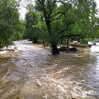
Geology paper about Boulder flood on release picked up by the press.
01 Apr 2015 - The Boulder Creek CZO and coauthors are highlighted in recent articles for their analysis of flooding and debris flows from the historic 2013...
Critical Zone Profile - XAVIER ZAPATA-RIOS (hydrologist, PhD student)
13 Mar 2015 - PhD Student, Hydrology and Water Resources, University of Arizona.
2014
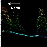
Community Workshop: The Next Generation of LiDAR Analysis for Critical Zone Research
27 Feb 2014 - A three-day workshop on LiDAR processing techniques will be held in Boulder, CO May 12th-14th, 2014 Early-career CZ researchers should apply to attend
2012
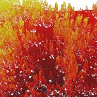
Jemez River LiDAR data available for download
30 Jul 2012 - Jemez River Basin LiDAR datasets (snow-on and snow-off) have been published on the OpenTopography website.
-
National Events - GIS / Remote Sensing
Environmental Field Methods Course in Idaho
Environmental Field Methods Course (3 credits) in Idaho-Learn Critical Zone Skills
Idaho State University, Pocatello, Idaho.CZOData cyber-seminar: Visualization Portal
CZO Data Visualization Portal Viz.CriticalZone.org - Emilio Mayorga
Online webinar.
Explore Further

