ARCHIVED CONTENT: In December 2020, the CZO program was succeeded by the Critical Zone Collaborative Network (CZ Net)
×
Jemez River LiDAR data available for download
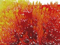
Example of LiDAR cloud data.
30 Jul 2012
Jemez River Basin LiDAR datasets (snow-on and snow-off) have been published on the OpenTopography website.
Jemez River Basin LiDAR datasets (snow-on and snow-off) have been published on the OpenTopography website.
News Category:
DATA
Explore Further


